
Cecil County is a county located in the U.S. state of Maryland at the northeastern corner of the state, bordering both Pennsylvania and Delaware. As of the 2020 census, the population was 103,725. The county seat is Elkton.

The Chesapeake & Delaware Canal is a 14-mile (22.5 km)-long, 450-foot (137.2 m)-wide and 35-foot (10.7 m)-deep ship canal that connects the Delaware River with the Chesapeake Bay in the states of Delaware and Maryland in the United States.
Claiborne is an unincorporated community in Talbot County, Maryland, United States. The village is located on the eastern shore of the Chesapeake Bay near the mouth of the Eastern Bay at 38°50′15″N76°16′40″W, and uses ZIP code 21624. The 2000 U.S. Census listed the population as 147 and the number of homes as 84, slightly down from its 1941 population of 156. Between 1890 and 1930, the village was a busy port for passenger and then automobile ferry service across the Chesapeake Bay, with numerous stores and motels/resorts, including Maple Hall and the Bellfonte Hotel. A post office was added in 1893 and the Protestant Episcopal Church of Claiborne was built in 1898. In 1912, an elementary school and Methodist Church were added. Before 1912, students attended school in nearby McDaniel. The town's first school consisted of the kitchen of the local railroad pavilion, used as a classroom. In 1913, the town became home to the Claiborne Fresh Air Association, Inc., which was formed for the purpose of providing 10 weeks of fresh air and summer vacation for children who had been exposed to tuberculosis. The role of Claiborne as a terminal for cross-Bay ferries was diminished in 1930 when the primary route shifted to Matapeake in Kent Island. It ended altogether in 1938 when the direct connection from Annapolis to Claiborne was terminated and only an auxiliary shuttle between Claiborne and Romancoke on Kent Island remained. This shuttle service ended in 1952, a few months after the opening of the Chesapeake Bay Bridge; thus ending all ferry service to Claiborne after more than six decades.

The Eastern Shore of Maryland is a part of the U.S. state of Maryland that lies mostly on the east side of the Chesapeake Bay. Nine counties are normally included in the region. The Eastern Shore is part of the larger Delmarva Peninsula that Maryland shares with Delaware and Virginia.
Old Point Comfort is a point of land located in the independent city of Hampton, Virginia. Previously known as Point Comfort, it lies at the extreme tip of the Virginia Peninsula at the mouth of Hampton Roads in the United States. It was renamed Old Point Comfort to differentiate it from New Point Comfort 21 miles (34 km) up the Chesapeake Bay. A group of enslaved Africans was brought to colonial Virginia at this point in 1619. Today the location is home to Continental Park and Fort Monroe National Monument.
The New Castle and Frenchtown Turnpike and Rail Road (NC&F) was opened in 1831, was the first railroad in Delaware and one of the first in the United States. About half of the route was abandoned in 1859; the rest became part of the Pennsylvania Railroad (PRR) route into the Delmarva Peninsula and is still used by Norfolk Southern Railway. The abandoned segment from Porter, Delaware, to Frenchtown, Maryland, the New Castle and Frenchtown Railroad Right-of-Way, was listed on the National Register of Historic Places in 1976.

The Philadelphia, Wilmington and Baltimore Railroad (PW&B) was an American railroad that operated independently from 1836 to 1881. Headquartered in Philadelphia, it was greatly enlarged in 1838 by the merger of four state-chartered railroads in three Mid-Atlantic states to create a single line between Philadelphia and Baltimore.
White Clay Creek Hundred is an unincorporated subdivision of New Castle County, Delaware. Hundreds were once used as a basis for representation in the Delaware General Assembly, and while their names still appear on all real estate transactions, they presently have no meaningful use or purpose except as a geographical point of reference.

The Elk River is a tidal tributary of the Chesapeake Bay on the Eastern Shore of Maryland and on the northern edge of the Delmarva Peninsula. It is about 15 miles (24 km) long. As the most northeastern extension of the Chesapeake Bay estuary, it has served as one entrance to the Chesapeake & Delaware Canal since the 19th century. The canal and river now serve as one boundary of the Elk Neck Peninsula. The river flows through Cecil County, Maryland, with its watershed extending into New Castle County, Delaware and Chester County, Pennsylvania. Elkton, the county seat of Cecil County, is located at its head. Its total watershed area is 143 square miles (370 km2), with 21 square miles (54 km2) of open water, so its watershed is 15% open water. It is south and east of the North East River, and north of the Sassafras River.

Maryland Route 279 is a state highway in the U.S. state of Maryland. Known for most of its length as Elkton Road, the highway runs 4.95 miles (7.97 km) from U.S. Route 40 and MD 7 west of Elkton northeast to the Delaware state line north of Elkton in northeastern Cecil County. At the state line, the highway continues as Delaware Route 279. MD 279 functions as a northern bypass of Elkton and is the primary highway to Newark, Delaware, from Maryland. The road has an interchange with Interstate 95 (I-95) northeast of Elkton. The state highway was originally constructed in the early 1910s. MD 279 was reconstructed and placed on a new course north of Elkton in the early 1960s. MD 279 bypassed the center of Elkton with an extension to US 40 in the late 1960s; the old alignment to downtown Elkton was designated MD 268.

Maryland Route 272 is a state highway in the U.S. state of Maryland. The state highway runs 20.67 miles (33.27 km) from Turkey Point within Elk Neck State Park north through North East to the Pennsylvania state line near Calvert, where the highway continues as Pennsylvania Route 272. MD 272 is the main north–south highway of central Cecil County, connecting the Elk Neck Peninsula between the North East River and Elk River with U.S. Route 40 and Interstate 95 (I-95) in North East, MD 273 in Calvert, and Rising Sun via MD 274. The section of MD 272 between North East and Bay View was paved by 1910. The remainder of the state highway north to Calvert and south to Elk Neck was completed in several sections in the 1930s. The first relocations of MD 272 occurred when both railroads near North East were bridged in the early 1940s and mid-1950s. Multiple relocations occurred in the late 1950s and early 1960s along the whole length of the highway to eliminate curves and tie the state highway into I-95. MD 272 reached its current extent when it was extended south into Elk Neck State Park in 1979.

The Mason-Dixon Trail is a 193-mile (311 km) hiking trail that begins at the Appalachian Trail in south-central Pennsylvania, continues through northeastern Maryland and northern Delaware, and re-enters Pennsylvania shortly before ending at Chadds Ford. It is named for the historic Mason–Dixon line, which it crosses twice. About one-third of the route follows roads through rural areas, but the rest is on traditional footpaths. The trail also traverses many tracts of private land, at which passage for hikers has been arranged with owners. This results in occasional relocations. The trail takes hikers through a variety or rural and semi-urban landscapes, with most of the route in Pennsylvania featuring farmlands and forested areas, and most of the route in Maryland and Delaware featuring historic sites and small towns.

The Queen Anne’s Railroad was a railroad that ran between Love Point, Maryland, and Lewes, Delaware, with connections to Baltimore via ferry across the Chesapeake Bay. The Queen Anne's Railroad company was formed in Maryland in 1894, and received legislative authorization from Delaware in February 1895. The railroad's original western terminus was in Queenstown, Maryland, and was moved via a 13-mile (21 km) extension to Love Point in 1902, which shortened the ferry trip to Baltimore.

Solomon Davies Warfield was an American railroad executive and banker. He is primarily remembered for extending the Seaboard Air Line Railway into South Florida in the 1920s and for connecting the east and west coasts of Florida by rail. To this day, Amtrak trains travel from Central Florida to South Florida on the route built by Warfield.

The Baltimore Steam Packet Company, nicknamed the Old Bay Line, was an American steamship line from 1840 to 1962 that provided overnight steamboat service on Chesapeake Bay, primarily between Baltimore, Maryland, and Norfolk, Virginia. Called a "packet" for the mail packets carried on government mail contracts, the term in the 19th century came to mean a steamer line operating on a regular, fixed daily schedule between two or more cities. When it closed in 1962 after 122 years of existence, it was the last surviving overnight steamship passenger service in the United States.

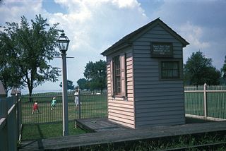
New Castle and Frenchtown Railroad Right-of-Way is a railroad right of way connecting Frenchtown, Cecil County, Maryland, and Porter, New Castle County, Delaware. The New Castle and Frenchtown Railroad originally crossed the Delmarva Peninsula from a wharf in New Castle to a wharf at Frenchtown on the Elk River in Maryland. This part of the right-of-way is abandoned for railroad purposes, although parts of it serve as county roads.

Old Baltimore Pike is a road in the U.S. state of Delaware. The road, known as New Castle County Road 26, runs from Maryland Route 281 (MD 281) at the Maryland state line south of Newark, Delaware, and continues east to Christiana, ending near Delaware Route 1 (DE 1). The road is paralleled by Interstate 95 to the north and U.S. Route 40 to the south. The Old Baltimore Pike was built before 1720 and connected Elkton, Maryland, to Christiana. It was a turnpike called the Elk and Christiana Turnpike between 1817 and 1838. In the past it served as a major connection between Philadelphia and Baltimore.
James Sewall (1778-1842) was a U.S. officer in the War of 1812, public servant, and early railroad executive.

The Delaware Railroad was the major railroad in the US state of Delaware, traversing almost the entire state north to south. It was planned in 1836 and built in the 1850s. It began in Porter and was extended south through Dover, Seaford and finally reached Delmar on the border of Maryland in 1859. Although operated independently, in 1857 it was leased by and under the financial control of the Philadelphia, Wilmington, and Baltimore Railroad. In 1891, it was extended north approximately 14 miles (23 km) with the purchase of existing track to New Castle and Wilmington. With this additional track, the total length was 95.2 miles (153.2 km).
Perch Creek is a 5.66 mi (9.11 km) long 2nd order tributary to the Elk River in Cecil County, Maryland.

