Marion is a city in and the county seat of Marion County, Ohio, United States. The municipality is located in north-central Ohio, approximately 50 miles (80 km) north of Columbus.

Hudson is a city in Summit County, Ohio, United States. The population was 22,262 at the 2010 census. It is a suburban community in the Akron metropolitan statistical area and the larger Cleveland–Akron–Canton Combined Statistical Area, the 17th-largest Combined Statistical Area in the United States.
The Mid-Atlantic, comprising the Middle Atlantic states or the Mid-Atlantic states, is a region of the United States generally located between New England and the South Atlantic portion of the Southeastern States. Its exact definition differs upon source, but the region usually includes New York, New Jersey, Pennsylvania, Delaware, Maryland, Washington, D.C., Virginia, and West Virginia. When discussing climate, Connecticut is sometimes included in the region, since its climate is closer to the Middle Atlantic states than the New England states. The Mid-Atlantic has played an important role in the development of American culture, commerce, trade, and industry.

USS Blackfin (SS-322), a Balao-class submarine, was a ship of the United States Navy named for the blackfin, a food fish of the Great Lakes.

American Corner is an unincorporated community in Caroline County, Maryland, United States. Its name is derived from either the patriotic spirit of the Revolutionary War or the Merriken family of the era. American Corner is home to Colonel Richardson High School and Colonel Richardson Middle School. On older maps, it is sometimes referred to as American Corners. There was formerly a post office, cannery, blacksmith, and a store located there, as seen on the 1875 and 1897 Maps of Caroline County, Maryland.

Claridon Township is one of the fifteen townships of Marion County, Ohio, United States. The 2010 census found 2,742 people in the township, 577 of whom lived in the village of Caledonia.
Marion Township is one of the fifteen townships of Marion County, Ohio, United States. The 2010 census found 44,749 people in the township, 36,837 of whom lived in the city of Marion.
The Newark Plank Road was a major artery between Hudson Waterfront at Paulus Hook and city of Newark further inland across the New Jersey Meadows. As its name suggests, a plank road was constructed of wooden planks laid side-to-side on a roadbed. Similar roads, the Bergen Point Plank Road, the Hackensack Plank Road and Paterson Plank Road, travelled to the locales for which they are named. The name is no longer used, the route having been absorbed into other streets and freeways.
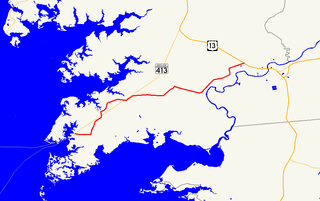
Maryland Route 667 is a state highway in the U.S. state of Maryland. The highway runs 17.61 miles (28.34 km) from Chesapeake Avenue in Crisfield east to U.S. Route 13 in West Pocomoke. MD 667 forms the old alignment of MD 413 from Crisfield to Hudson Corner in southern Somerset County. The highway has a curvaceously course through the villages of Hopewell and Marion Station while MD 413 passes them on a straight course. The portion of MD 667 between Hudson Corner and West Pocomoke serves the community of Rehobeth. This segment, which was built as Maryland Route 406, serves as a shortcut allowing traffic between Crisfield and Pocomoke City to avoid Westover at the junction of MD 413 and US 13. Portions of MD 667 are part of the Beach to Bay Indian Trail.

Hudson Generating Station was a power plant operated by PSEG Fossil LLC, a subsidiary of Public Service Enterprise Group (PSEG). It was located in Jersey City in Hudson County, New Jersey, United States. The site was in operation from 1906-2017, but as of 2011 only one unit was in operation at the facility – Unit 2, which ran primarily on coal to generate electricity and was also capable of burning natural gas as a secondary fuel. Unit 2 was also equipped with several back-end technology emission controls. The generating station was closed permanently by PSEG Power on June 1, 2017. The 241 acre site was sold to Chicago based Hilco Redevelopment Partners in January 2019, which plans to repurpose the site as a state-of-the-art industrial park serving growing warehouse-distribution business in region. https://www.njspotlight.com/stories/19/01/09/pseg-sells-defunct-coal-plants-in-jersey-city-and-hamilton-for-redevelopment/
Kingston is an unincorporated community in Somerset County, Maryland, United States. A small community at the head of navigation of the Big Annemessex River, it is located on Maryland Route 413 at the intersection of Kingston Lane. A very rural community far from any urban development, it is quite small in population, the land dominated by agricultural fields and tree farms.
Marion Station, also known as Marion, is an unincorporated community in Somerset County, Maryland, United States. It is located at the northern intersection of Maryland routes 413 and 667. After the arrival of the Pennsylvania Railroad arm known as the "Eastern Shore Railroad" toward Crisfield in 1866, Marion was locally hailed as the "strawberry capital of the world". After the trains stopped coming it went into decline, with some sources even hailing it as a ghost town.
Tulls Corner is an unincorporated community in Somerset County, Maryland, United States. Tulls Corner is located at the intersection of Tulls Corner Road and L. Q. Powell Road, south-southeast of Marion Station.

This is a list of the National Register of Historic Places listings in Center Township, Marion County, Indiana.
Reliance is an unincorporated community located on the border of the U.S. states of Maryland and Delaware. The Maryland side of the community has portions in Caroline and Dorchester counties, while the Delaware side is located within Sussex County. Reliance is along Delaware Route 20 and Maryland Route 392 at the junction with Maryland Route 577, west of Seaford. It was previously known as Johnson's Crossroads.

Saugerties is a town in Ulster County, New York, United States. The population was 19,482 at the 2010 census. The Town of Saugerties contains the Village of Saugerties in the northeast corner of Ulster County. Part of the town is inside Catskill Park.
Four Corners is a neighborhood located in Montgomery County, Maryland, United States. Many residents of the Four Corners neighborhood consider Four Corners to be a part of Silver Spring. The United States Census Bureau defines Four Corners as a distinct census-designated place (CDP). Prior to the 2010 U.S. Census, it was defined as a part of the Silver Spring CDP.

Waysons Corner is an unincorporated community in Anne Arundel County, Maryland, United States, 2.6 miles (4.2 km) east of Upper Marlboro. Waysons Corner is located at the junction of Maryland routes 4 and 408, where the former changes names to Pennsylvania Avenue.
The flags of the counties of the United States exhibit a wide variety of regional influences and local histories, as well as widely different styles and design principles. For example, some Floridian and Alabamian municipal flags feature a saltire, due to saltires being used on their states' flags. Some Maryland county flags feature the coat of arms of the Calvert family, as it is featured on the Maryland state flag, and due to the Calvert family's prominence in Maryland history. County flags were not always ubiquitous. Many counties went decades without a flag, until a certain event, such as a local sesquicentennial or the U.S. founding's bicentennial, spurred the creation of a flag. Frederick County, Maryland is one example, in 1976, it hosted a contest, asking the public to submit their designs to a commission. A panel then reviewed the five winning entries, choosing one to become the official county flag. Frederick County's example is typical of the flag adoption processes that many counties undertook with their flags. The 250th anniversary of Augusta County, Virginia's founding also spurred the creation of a flag, in 1988. Some flags, such as the flags of Montgomery County, Maryland, and Loudoun County, Virginia, were created by foreign entities, such as the College of Arms in the United Kingdom.