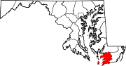
Somerset County is the southernmost county in the U.S. state of Maryland. As of the 2020 census, the population was 24,620, making it the second-least populous county in Maryland. The county seat is Princess Anne.

Crisfield is a city in Somerset County, Maryland, United States, located on the Tangier Sound, an arm of the Chesapeake Bay. The population was 2,515 at the 2020 census. It is included in the Salisbury, Maryland-Delaware Metropolitan Statistical Area. Crisfield has the distinction of being the southernmost incorporated city in Maryland.

U.S. Route 222 is a U.S. Highway that is a spur of US 22 in the states of Maryland and Pennsylvania. It runs for 95 miles (153 km) from US 1 in Conowingo, Maryland, north to Interstate 78 (I-78)/Pennsylvania Route 309 in Dorneyville, Pennsylvania. US 222 is almost entirely in Pennsylvania, and serves as the state's principal artery between the Lancaster and Reading areas and the Lehigh Valley.

U.S. Route 340 is a spur route of US 40, and runs from Greenville, Virginia, to Frederick, Maryland. In Virginia, it runs north–south, parallel and east of US 11, from US 11 north of Greenville via Waynesboro, Grottoes, Elkton, Luray, Front Royal, and Berryville to the West Virginia state line. A short separate piece crosses northern Loudoun County on its way from West Virginia to Maryland.
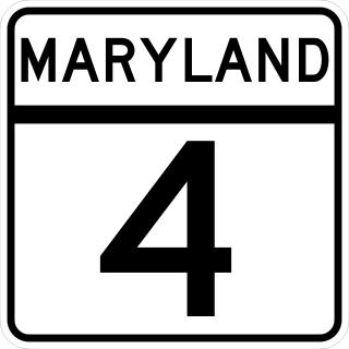
Maryland Route 4 is a state highway in the U.S. state of Maryland. The highway runs 64.85 miles (104.37 km) from MD 5 in Leonardtown north to Southern Avenue in Suitland at the District of Columbia boundary, beyond which the highway continues into Washington as Pennsylvania Avenue. MD 4 is a four- to six-lane highway that connects Washington and communities around Interstate 95 (I-95)/I-495 with southern Prince George's County with southwestern Anne Arundel County. The highway is the primary highway for the length of Calvert County, during most of which the route runs concurrently with MD 2. MD 4 also connects Calvert and St. Mary's counties via the Governor Thomas Johnson Bridge across the Patuxent River. The highway connects the Southern Maryland county seats of Leonardtown, Prince Frederick, and Upper Marlboro.

Maryland Route 213 (MD 213) is a 68.25-mile (109.84 km) state highway located on the Eastern Shore of Maryland in the United States. The route runs from MD 662 in Wye Mills, Queen Anne's County, north to the Pennsylvania border in Cecil County, where the road continues into that state as Pennsylvania Route 841 (PA 841). The route, which is a two-lane undivided highway most of its length, passes through mainly rural areas as well as the towns of Centreville, Chestertown, Galena, Cecilton, Chesapeake City, and Elkton. MD 213 intersects many routes including U.S. Route 50 (US 50) near Wye Mills, US 301 near Centreville, and US 40 in Elkton. It crosses over the Chesapeake & Delaware Canal in Chesapeake City on the Chesapeake City Bridge. MD 213 is designated by the state as the Chesapeake Country Scenic Byway between the southern terminus and Chesapeake City with the portion north of MD 18 in Centreville a National Scenic Byway. In addition, the route is also considered part of the Atlantic to Appalachians Scenic Byway between Chesapeake City and MD 273 in Fair Hill.
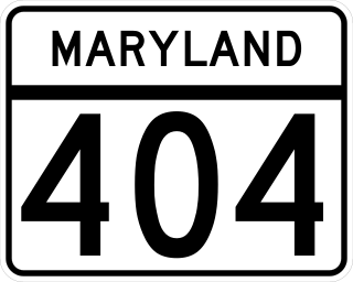
Maryland Route 404 (MD 404) is a major highway on Maryland's Eastern Shore in the United States. Signed east-west, it runs 24.61 miles (39.61 km) from MD 662 in Wye Mills on the border of Queen Anne's and Talbot counties, southeast to the Delaware state line in Caroline County, where the road continues as Delaware Route 404 (DE 404) to the Five Points intersection near Rehoboth Beach. The Maryland and Delaware state highways together cross the width of the Delmarva Peninsula and serve to connect the Baltimore–Washington Metropolitan Area by way of the Chesapeake Bay Bridge and U.S. Route 50 (US 50) with the Delaware Beaches. Along the way, MD 404 passes through mostly farmland and woodland as well as the towns of Queen Anne, Hillsboro, and Denton. The route is a four-lane divided highway between US 50 and east of Denton, with the remainder of the route a two-lane undivided road.

U.S. Route 50 is a major east–west route of the U.S. Highway system, stretching just over 3,000 miles (4,800 km) from West Sacramento, California, east to Ocean City, Maryland, on the Atlantic Ocean. In the U.S. state of Maryland, US 50 exists in two sections. The longer of these serves as a major route connecting Washington, D.C., with Ocean City; the latter is the eastern terminus of the highway. The other section passes through the southern end of Garrett County for less than 10 miles (16 km) as part of the Northwestern Turnpike, entering West Virginia at both ends. One notable section of US 50 is the dual-span Chesapeake Bay Bridge across the Chesapeake Bay, which links the Baltimore–Washington metropolitan area with the Eastern Shore region, allowing motorists to reach Ocean City and the Delaware Beaches.

U.S. Route 13 (US 13) is a United States Numbered Highway running from Fayetteville, North Carolina, north to Morrisville, Pennsylvania. In the U.S. state of Maryland, the route runs 42.48 miles (68.36 km) from the Virginia border south of Pocomoke City in Worcester County north to the Delaware border in Delmar, Wicomico County, where the route intersects Maryland Route 54 (MD 54)/Delaware Route 54 (DE 54), which runs along the state line. The majority of the route within Maryland is a four-lane divided highway that passes through rural areas of woodland and farmland. The route also runs through a few municipalities including Pocomoke City and Princess Anne and it bypasses Fruitland and Salisbury to the east on the Salisbury Bypass, which is a freeway. US 13 intersects many major roads including the southern terminus of US 113 in Pocomoke City, MD 413 in Westover, and MD 12 and US 50 where the route is on the Salisbury Bypass. The route shares a concurrency with US 50 along a portion of the Salisbury Bypass.

Maryland Route 361 is a state highway in the U.S. state of Maryland. Known as Fairmount Road, the state highway runs 5.62 miles (9.04 km) from the beginning of state maintenance in Upper Fairmount east to MD 413 in Westover. MD 361 provides access to the villages of Manokin and Upper Fairmount. The state highway was constructed from the Westover end beginning in 1926. MD 361 was completed west through Upper Fairmount in the early 1930s.
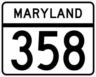
Maryland Route 358 is a state highway located in Somerset County in the U.S. state of Maryland. Known as Jacksonville Road, the state highway runs 1.13 miles (1.82 km) from MD 413 in Crisfield north to the end of state maintenance near Alfred J. Lawson Road. MD 358 connects Crisfield with Janes Island State Park and Crisfield Municipal Airport. MD 358 was constructed on the south side of Crisfield in the mid-1920s. What is now MD 358 north of MD 413 was originally MD 475, which was built in the early 1930s. MD 358 was extended north through Crisfield in the 1940s, taking over MD 475. The portion of MD 358 south of MD 413 was later returned to the city of Crisfield and Somerset County.
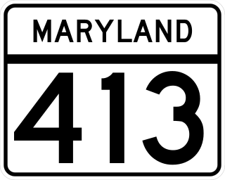
Maryland Route 413 is a 14.61-mile (23.51 km) state highway in Somerset County in the U.S. state of Maryland. The route runs from a dead end at Crisfield's city dock, which is located on the Tangier Sound, northeast to U.S. Route 13 in Westover. It is the main highway leading into Crisfield, and is known as Crisfield Highway for much of its length. The highway travels through mostly rural areas of farms and woods as well as the communities of Hopewell, Marion Station, and Kingston. It is a two-lane undivided road for most of its length; a portion of the road in Crisfield is a four-lane road that follows a one-way pair. MD 413 is part of two scenic routes: Chesapeake Country Scenic Byway and the Beach to Bay Indian Trail; both are Maryland Scenic Byways.

Maryland Route 380 is a state highway in the U.S. state of Maryland. The state highway runs 1.56 miles (2.51 km) from Ape Hole Road at Lawsonia north to Main Street at the city limit of Crisfield in southwestern Somerset County. MD 380, which is the southernmost state highway in Maryland, provides access to a suburban area south of Crisfield. The state highway was built in the mid-1930s.
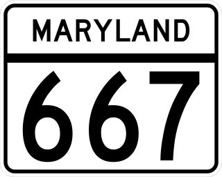
Maryland Route 667 is a state highway in the U.S. state of Maryland. The highway runs 17.61 miles (28.34 km) from Chesapeake Avenue in Crisfield east to U.S. Route 13 in West Pocomoke. MD 667 forms the old alignment of MD 413 from Crisfield to Hudson Corner in southern Somerset County. The highway has a curvaceously course through the villages of Hopewell and Marion Station while MD 413 passes them on a straight course. The portion of MD 667 between Hudson Corner and West Pocomoke serves the community of Rehobeth. This segment, which was built as Maryland Route 406, serves as a shortcut allowing traffic between Crisfield and Pocomoke City to avoid Westover at the junction of MD 413 and US 13. Portions of MD 667 are part of the Beach to Bay Indian Trail.
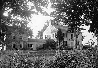
Kingston Hall is a historic home located at Kingston, Somerset County, Maryland. Located along the Big Annemessex River, it is a Georgian style dwelling of two stories plus an attic, three bays wide by two deep, connected by a one-story brick hyphen to a two-story-plus-loft brick kitchen wing. Also on the property is the brick, circular ice house. The interior of the house features corner fireplaces. Interior woodwork mouldings are in a transitional style, bridging late Georgian and Federal styles.

Marion Station, also known as Marion, is an unincorporated community in Somerset County, Maryland, United States. It is located at the northern intersection of Maryland routes 413 and 667. After the arrival of the Pennsylvania Railroad arm known as the "Eastern Shore Railroad" toward Crisfield in 1866, Marion was locally hailed as the "strawberry capital of the world". After the trains stopped coming it went into decline, with some sources even hailing it as a ghost town.
Westover is an unincorporated community in Somerset County, Maryland, United States. It is located on Maryland Route 413 near its terminus at U.S. Route 13. Owing to its central location in Somerset County, Westover is home to many important services and businesses.
Hopewell is an unincorporated community in Somerset County, Maryland, United States. It is located at the southern intersection of Maryland routes 413 and 667. St. Peter's Methodist Episcopal Church was listed on the National Register of Historic Places in 1990.
The Big Annemessex River is a 15.4-mile-long (24.8 km) tributary of the Chesapeake Bay on the Delmarva Peninsula. It rises in Kingston, Somerset County, Maryland, and flows roughly southwest about 6 miles (10 km) in a meandering pattern, then widens into an estuary and continues about 9 miles (14 km) to the bay, near Janes Island State Park. Tributaries include Annemessex Creek, Holland Creek, Hall Creek, Muddy Creek, Colbourn Creek, Jones Creek and Daugherty Creek.