Ivanhoe, Minnesota

Last updated
Ivanhoe
Ivanhoe MN 1.jpg
Downtown Ivanhoe
Lincoln County Minnesota Incorporated and Unincorporated areas Ivanhoe Highlighted.svg
Location of Ivanhoe
within Lincoln County, Minnesota
Coordinates: 44°27′55″N96°15′03″W / 44.46528°N 96.25083°W / 44.46528; -96.25083
Country United States
State Minnesota
County Lincoln
Area
[1]
  Total0.67 sq mi (1.74 km2)
  Land0.65 sq mi (1.68 km2)
  Water0.02 sq mi (0.06 km2)
Elevation
[2]
1,667 ft (508 m)
Population
 (2020)
  Total560
  Density862.87/sq mi (333.25/km2)
Time zone UTC-6 (Central (CST))
  Summer (DST) UTC-5 (CDT)
ZIP code
56142
Area code 507
FIPS code 27-31526 [3]
GNIS feature ID2395446 [2]
Website https://city-ivanhoe-mn.com

Ivanhoe is a city in Lincoln County, Minnesota, United States. The population was 559 at the 2010 census. [4] Since 1902 it has been the county seat of Lincoln County [5] and is now the least populous county seat in Minnesota.

Contents

History

Ivanhoe was platted in 1901. [6] It was named from the novel Ivanhoe by Sir Walter Scott. [6] A post office has been in operation at Ivanhoe since 1901. [7] Ivanhoe was named county seat in 1902. [8] Richard Mulder (1938-2022), physician and Minnesota state legislator, lived in Ivanhoe. [9]

Geography

According to the United States Census Bureau, the city has a total area of 0.90 square miles (2.33 km2), of which 0.88 square miles (2.28 km2) is land and 0.02 square miles (0.05 km2) is water. [10]

The Yellow Medicine River flows past Ivanhoe as an intermittent stream near its headwaters. [11] [12]

U.S. Highway 75 and Minnesota State Highway 19 are two of the main routes in the city.

Demographics

Historical population
CensusPop.Note
1910 484
1920 65535.3%
1930 556−15.1%
1940 6069.0%
1950 68212.5%
1960 7195.4%
1970 7382.6%
1980 7613.1%
1990 751−1.3%
2000 679−9.6%
2010 559−17.7%
2020 5600.2%
U.S. Decennial Census

Rather unusually for rural southwestern Minnesota, a high percentage of Ivanhoe's residents are of Polish ancestry. [13] [14]

2010 census

As of the census [15] of 2010, there were 559 people, 268 households, and 144 families residing in the city. The population density was 635.2 inhabitants per square mile (245.3/km2). There were 317 housing units at an average density of 360.2 per square mile (139.1/km2). The racial makeup of the city was 99.8% White and 0.2% from other races. Hispanic or Latino of any race were 0.4% of the population.

There were 268 households, of which 21.3% had children under the age of 18 living with them, 44.0% were married couples living together, 7.1% had a female householder with no husband present, 2.6% had a male householder with no wife present, and 46.3% were non-families. 42.9% of all households were made up of individuals, and 23.2% had someone living alone who was 65 years of age or older. The average household size was 1.99 and the average family size was 2.74.

The median age in the city was 49.5 years. 18.8% of residents were under the age of 18; 5.3% were between the ages of 18 and 24; 20.4% were from 25 to 44; 27.1% were from 45 to 64; and 28.3% were 65 years of age or older. The gender makeup of the city was 44.9% male and 55.1% female.

2000 census

As of the census [3] of 2000, there were 679 people, 310 households, and 172 families residing in the city. The population density was 745.2 inhabitants per square mile (287.7/km2). There were 341 housing units at an average density of 374.3 per square mile (144.5/km2). The racial make up of the city was 99.71% White. Hispanic or Latino of any race were 0.29% of the population.

There were 310 households, out of which 26.8% had children under the age of 18 living with them, 44.2% were married couples living together, 7.4% had a female householder with no husband present, and 44.2% were non-families. 41.0% of all households were made up of individuals, and 25.5% had someone living alone who was 65 years of age or older. The average household size was 2.05 and the average family size was 2.80.

In the city, the population was spread out, with 21.8% under the age of 18, 5.4% from 18 to 24, 22.5% from 25 to 44, 20.8% from 45 to 64, and 29.5% who were 65 years of age or older. The median age was 45 years. For every 100 females, there were 85.5 males. For every 100 females age 18 and over, there were 81.8 males.

The median income for a household in the city was $28,125, and the median income for a family was $40,491. Males had a median income of $27,946 versus $21,389 for females. The per capita income for the city was $17,775. About 4.6% of families and 8.6% of the population were below the poverty line, including 5.0% of those under age 18 and 21.8% of those age 65 or over.

Related Research Articles

<span class="mw-page-title-main">Correll, Minnesota</span> City in Minnesota, United States

Correll is a city in Big Stone County, Minnesota, United States. The population was 34 at the 2010 census. Correll was named for David N Correll, a railroad official who founded the city in 1881.

<span class="mw-page-title-main">Hanska, Minnesota</span> City in Minnesota, United States

Hanska is a city in Brown County, Minnesota, United States. The population was 402 at the 2010 census.

<span class="mw-page-title-main">Chickamaw Beach, Minnesota</span> City in Minnesota, United States

Chickamaw Beach is a city in Cass County, Minnesota, United States. The population was 114 at the 2010 census. It is part of the Brainerd Micropolitan Statistical Area.

<span class="mw-page-title-main">Stacy, Minnesota</span> City in Minnesota, United States

Stacy is a city in Chisago County, Minnesota, United States, along the Sunrise River. The population was 1,456 at the 2010 census.

<span class="mw-page-title-main">New Trier, Minnesota</span> City in Minnesota, United States

New Trier is a city in Dakota County, Minnesota, United States. The population was 112 at the 2010 census. Minnesota Highway 50 serves as a main route in the community.

<span class="mw-page-title-main">Miltona, Minnesota</span> City in Minnesota, United States

Miltona is a city in Douglas County, Minnesota, United States. The population was 431 at the 2020 census.

<span class="mw-page-title-main">Twin Lakes, Freeborn County, Minnesota</span> City in Minnesota, United States

Twin Lakes is a city in Freeborn County, Minnesota, United States, near Albert Lea. The population was 134 at the 2020 census.

<span class="mw-page-title-main">Nashwauk, Minnesota</span> City in Minnesota, United States

Nashwauk is a city in Itasca County, Minnesota, United States. The population was 983 at the 2010 census.

<span class="mw-page-title-main">Le Center, Minnesota</span> City in Minnesota, United States

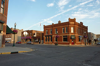
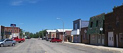
Le Center is a city in Le Sueur County, Minnesota, United States. The population was 2,517 at the 2020 census. It is the county seat of Le Sueur County. The Le Sueur County Courthouse and Jail are listed on the National Register of Historic Places.

<span class="mw-page-title-main">Sargeant, Minnesota</span> City in Minnesota, United States

Sargeant is a city in Sargeant Township, Mower County, Minnesota, United States. The population was 61 at the 2010 census.

<span class="mw-page-title-main">Deer Creek, Minnesota</span> City in Minnesota, United States

Deer Creek is a city in Otter Tail County, Minnesota, United States. The population was 330 at the 2020 census.

<span class="mw-page-title-main">St. Martin, Minnesota</span> City in Minnesota, United States

St. Martin or Saint Martin, Smartin to locals, is a city in Stearns County, Minnesota, United States. The population was 308 at the 2010 census. It is part of the St. Cloud Metropolitan Statistical Area.

<span class="mw-page-title-main">Hammond, Minnesota</span> City in Minnesota, United States

Hammond is a city in Wabasha County, Minnesota, United States. The population was 132 at the 2010 census.

<span class="mw-page-title-main">Dakota, Minnesota</span> City in Minnesota, United States

Dakota is a city in Winona County, Minnesota, United States. The population was 295 at the 2020 census.

<span class="mw-page-title-main">Minnesota City, Minnesota</span> City in Minnesota, United States

Minnesota City is a city in Winona County, Minnesota, United States. The population was 202 at the 2020 census.

<span class="mw-page-title-main">Silver Lake, Minnesota</span> City in Minnesota, United States

Silver Lake is a city in McLeod County, Minnesota, United States. The population was 866 at the 2020 census.

<span class="mw-page-title-main">Minnesota Lake, Minnesota</span> City in Minnesota, United States

Minnesota Lake is a city in Blue Earth and Faribault counties in the State of Minnesota. The population was 661 at the 2020 census. The bulk of the city is in Faribault County; a small part extends into Blue Earth County.

<span class="mw-page-title-main">Dennison, Minnesota</span> City in Minnesota, United States

Dennison is a city in Goodhue and Rice counties in the U.S. state of Minnesota. The population was 212 at the 2010 census. Most of Dennison is in Goodhue County, with only a small part that extends into Rice County.

<span class="mw-page-title-main">Jasper, Minnesota</span> City in Minnesota, United States

Jasper is a city in Pipestone and Rock counties in the State of Minnesota. The population was 633 at the 2010 census. Most of the city lies in Pipestone County, with only a small part of the city extending into Rock County.

<span class="mw-page-title-main">Minneiska, Minnesota</span> City in Minnesota, United States

Minneiska is a city in Wabasha and Winona counties in the U.S. state of Minnesota. The population was 111 at the 2010 census.

References

  1. "2020 U.S. Gazetteer Files". United States Census Bureau. Retrieved July 24, 2022.
  2. 1 2 U.S. Geological Survey Geographic Names Information System: Ivanhoe, Minnesota
  3. 1 2 "U.S. Census website". United States Census Bureau . Retrieved 2008-01-31.
  4. "2010 Census Redistricting Data (Public Law 94-171) Summary File". American FactFinder. United States Census Bureau . Retrieved 27 April 2011.[ dead link ]
  5. "Find a County". National Association of Counties. Archived from the original on 2011-05-31. Retrieved 2011-06-07.
  6. 1 2 Chicago and North Western Railway Company (1908). A History of the Origin of the Place Names Connected with the Chicago & North Western and Chicago, St. Paul, Minneapolis & Omaha Railways. p. 87.
  7. "Lincoln County". Jim Forte Postal History. Retrieved 18 July 2015.
  8. Upham, Warren (1920). Minnesota Geographic Names: Their Origin and Historic Significance. Minnesota Historical Society. p.  307.
  9. Minnesota Legislators Past & Present-Richard Mulder
  10. "US Gazetteer files 2010". United States Census Bureau. Archived from the original on 2012-07-02. Retrieved 2012-11-13.
  11. Waters, Thomas F. (2006). "The Southwest: Rivers of the Coteau des Prairies". The Streams and Rivers of Minnesota. Minneapolis: University of Minnesota Press. pp.  288–303. ISBN   0-8166-0960-8.
  12. Minnesota Atlas & Gazetteer. Yarmouth, Me.: DeLorme. 1994. p. 28. ISBN   0-89933-222-6.
  13. "The Demographic Statistical Atlas of the United States - Statistical Atlas".
  14. "Ivanhoe Times, August 4, 2011, Page 4".
  15. "U.S. Census website". United States Census Bureau . Retrieved 2012-11-13.