Walker, Minnesota

Last updated

Walker
City
Cass county MN 200 Walker IMG 1319.JPG
Photo: Erlend Bjørtvedt
Nickname: 
"The Big Place"
Cass County Minnesota Incorporated and Unincorporated areas Walker Highlighted.svg
Location of Walker
within Cass County and state of Minnesota
Coordinates: 47°05′59″N94°35′52″W / 47.09972°N 94.59778°W / 47.09972; -94.59778
CountryUnited States
State Minnesota
County Cass
Area
[1]
  Total2.81 sq mi (7.28 km2)
  Land2.81 sq mi (7.28 km2)
  Water0.00 sq mi (0.00 km2)
Elevation
[2]
1,352 ft (412 m)
Population
 (2020) [3]
  Total966
  Estimate 
(2022) [4]
987
  Density343.89/sq mi (132.76/km2)
Time zone UTC-6 (Central (CST))
  Summer (DST) UTC-5 (CDT)
ZIP code
56484
Area code 218
FIPS code 27-67792
GNIS feature ID2397174 [2]
Website walkermn.com

Walker is a city in Cass County, Minnesota, United States. The population was 966 at the 2020 census. [3] It is the county seat of Cass County. [5]

Contents

Walker is part of the Brainerd Micropolitan Statistical Area.

Minnesota State Highways 34, 200, and 371 are three of the main routes in the city.

History

Walker, 1901 Walker, Minnesota 1901.jpg
Walker, 1901

The area was inhabited for thousands of years by succeeding cultures of indigenous peoples. Before European settlement, the Ojibwe moved into the area from the Great Lakes, pushing out the historic Dakota peoples, such as the Assiniboine and Hidatsa. European American settlers followed the early fur traders and trappers, and encroached on Native American territories.

Following the construction of the railroad to the area, Patrick McGarry founded Walker in 1896. He named the settlement after the logging giant Thomas B. Walker, in hopes of luring construction of a sawmill. Walker instead chose to found and set up operations in nearby Akeley, because of his wife's moral objection to the bars and brothels in Walker, a rough frontier town. Walker developed with business, jobs and other services generated by four other logging companies.

Tourism later grew as a service industry. In the 20th century, people from urban areas came to more rural areas for recreation associated with lakes, fishing, hunting and water sports. The city reached its peak of population in 1950.

In 1907, Walker became the home of the Ah-Gwah-Ching Center, first constructed as a residential facility for tuberculosis (TB) patients, who at the time could be treated only with good nutrition and rest. [6] By 1927, it had 300 patients. The facility had its own farm and dairy herd, the patients and staff put on skits and produced a newspaper, and it had its own railroad depot at one time. During the Great Depression, it was a site for display of art produced by artists paid by the WPA, and it had the state's largest WPA art collection. In 1962, the facility was adapted as a state nursing home for psychiatric patients. The complex is listed on the National Register of Historic Places. [6] The building was closed in 2008.

Geography

Walker is on the southwest corner of Leech Lake, Minnesota's third-largest lake. According to the United States Census Bureau, the city has an area of 2.47 square miles (6.40 km2), all land. [7] Nearby cities and towns include Hackensack, Akeley, Whipholt, Laporte, Bemidji, and Onigum. Onigum is one of 11 communities that make up the Leech Lake Indian Reservation.

Climate

Walker has a humid continental climate (Köppen Dfb), with warm summers and cold, snowy winters.

Climate data for Walker, Minnesota, 1991–2020 normals, extremes 1908present
MonthJanFebMarAprMayJunJulAugSepOctNovDecYear
Record high °F (°C)52
(11)
59
(15)
83
(28)
94
(34)
93
(34)
98
(37)
103
(39)
103
(39)
97
(36)
89
(32)
72
(22)
60
(16)
103
(39)
Mean maximum °F (°C)41.2
(5.1)
45.0
(7.2)
56.8
(13.8)
72.9
(22.7)
83.4
(28.6)
88.2
(31.2)
89.3
(31.8)
88.0
(31.1)
82.0
(27.8)
75.1
(23.9)
56.0
(13.3)
42.8
(6.0)
91.5
(33.1)
Mean daily maximum °F (°C)19.3
(−7.1)
25.4
(−3.7)
37.8
(3.2)
52.0
(11.1)
66.0
(18.9)
74.6
(23.7)
79.0
(26.1)
76.7
(24.8)
68.0
(20.0)
53.3
(11.8)
37.2
(2.9)
24.8
(−4.0)
51.2
(10.6)
Daily mean °F (°C)10.0
(−12.2)
14.8
(−9.6)
27.7
(−2.4)
41.4
(5.2)
55.2
(12.9)
64.6
(18.1)
69.0
(20.6)
67.0
(19.4)
58.4
(14.7)
44.8
(7.1)
29.5
(−1.4)
16.5
(−8.6)
41.6
(5.3)
Mean daily minimum °F (°C)0.7
(−17.4)
4.2
(−15.4)
17.6
(−8.0)
30.9
(−0.6)
44.4
(6.9)
54.6
(12.6)
59.1
(15.1)
57.3
(14.1)
48.8
(9.3)
36.3
(2.4)
21.8
(−5.7)
8.2
(−13.2)
32.0
(0.0)
Mean minimum °F (°C)−24.0
(−31.1)
−21.0
(−29.4)
−8.3
(−22.4)
13.7
(−10.2)
31.7
(−0.2)
42.3
(5.7)
47.7
(8.7)
46.5
(8.1)
34.3
(1.3)
21.6
(−5.8)
3.2
(−16.0)
−17.4
(−27.4)
−28.4
(−33.6)
Record low °F (°C)−41
(−41)
−44
(−42)
−33
(−36)
−6
(−21)
18
(−8)
30
(−1)
40
(4)
32
(0)
22
(−6)
4
(−16)
−22
(−30)
−40
(−40)
−44
(−42)
Average precipitation inches (mm)0.75
(19)
0.74
(19)
1.18
(30)
2.18
(55)
3.32
(84)
4.29
(109)
4.11
(104)
3.21
(82)
3.37
(86)
2.75
(70)
1.26
(32)
0.82
(21)
27.98
(711)
Average snowfall inches (cm)10.5
(27)
6.6
(17)
8.1
(21)
1.1
(2.8)
0.0
(0.0)
0.0
(0.0)
0.0
(0.0)
0.0
(0.0)
0.0
(0.0)
0.2
(0.51)
7.9
(20)
7.6
(19)
42.0
(107)
Average precipitation days (≥ 0.01 in)6.16.15.87.110.911.210.28.710.69.37.16.799.8
Average snowy days (≥ 0.1 in)5.44.22.90.80.00.00.00.00.00.24.05.422.9
Source 1: NOAA (snow/snow days 1981–2010) [8] [9]
Source 2: National Weather Service [10]

Demographics

Historical population
CensusPop.Note
1900 500
1910 91783.4%
1920 785−14.4%
1930 618−21.3%
1940 93951.9%
1950 1,19226.9%
1960 1,180−1.0%
1970 1,073−9.1%
1980 970−9.6%
1990 950−2.1%
2000 1,06912.5%
2010 941−12.0%
2020 9662.7%
2022 (est.)987 [4] 2.2%
U.S. Decennial Census [11]
2020 Census [3]

2010 census

As of the census of 2010, there were 941 people, 452 households, and 205 families living in the city. The population density was 381.0 inhabitants per square mile (147.1/km2). There were 605 housing units at an average density of 244.9 per square mile (94.6/km2). The racial makeup of the city was 88.0% White, 7.2% Native American, 1.1% Asian, 0.5% from other races, and 3.2% from two or more races. Hispanic or Latino of any race were 1.3% of the population.

There were 452 households, of which 21.2% had children under the age of 18 living with them, 33.4% were married couples living together, 8.4% had a female householder with no husband present, 3.5% had a male householder with no wife present, and 54.6% were non-families. 48.0% of all households were made up of individuals, and 23.4% had someone living alone who was 65 years of age or older. The average household size was 1.93 and the average family size was 2.82.

The median age in the city was 49 years. 19.2% of residents were under the age of 18; 5% were between the ages of 18 and 24; 20.9% were from 25 to 44; 24.9% were from 45 to 64; and 30.1% were 65 years of age or older. The gender makeup of the city was 44.5% male and 55.5% female.

2000 census

As of the census of 2000, there were 1,069 people, 449 households, and 258 families living in the city. The population density was 734.3 inhabitants per square mile (283.5/km2). There were 517 housing units at an average density of 355.1 per square mile (137.1/km2). The racial makeup of the city was 88.59% White, 0.09% African American, 8.98% Native American, 0.28% Asian, 0.28% from other races, and 1.78% from two or more races. Hispanic or Latino of any race were 1.03% of the population.

There were 449 households, out of which 24.7% had children under the age of 18 living with them, 43.7% were married couples living together, 10.0% had a female householder with no husband present, and 42.5% were non-families. 39.0% of all households were made up of individuals, and 22.5% had someone living alone who was 65 years of age or older. The average household size was 2.16 and the average family size was 2.86.

In the city, the population was spread out, with 22.5% under the age of 18, 5.7% from 18 to 24, 26.1% from 25 to 44, 21.0% from 45 to 64, and 24.6% who were 65 years of age or older. The median age was 42 years. For every 100 females, there were 92.3 males. For every 100 females age 18 and over, there were 86.9 males.

The median income for a household in the city was $33,125, and the median income for a family was $44,063. Males had a median income of $31,324 versus $25,435 for females. The per capita income for the city was $17,079. About 8.0% of families and 12.4% of the population were below the poverty line, including 15.3% of those under age 18 and 14.7% of those age 65 or over.

Education

Walker Public Schools are part of the Walker-Hackensack-Akeley School District. Schools in the district include Walker-Hackensack-Akeley Elementary School and Walker-Hackensack-Akeley High School (WHA). Eric Pingrey is the Superintendent of Schools. [12] The Walker-Hackensack-Akeley district was formed by the 1990 consolidation of the Walker and Akeley districts. [13]

Walker is home to Walker-Hackensack-Akeley High School and Immanuel Lutheran School.

Transportation

Walker is served by the city-owned public-use Walker Airport ( FAA LID : Y49), located four miles north-west of the city. [14] Walker Airport contains one runway one designated 15/33 with a 3,220 x 75 ft (981 x 23 m) asphalt surface. [15]

For the 12-month period ending July 31, 2017, the airport had 9,200 aircraft operations, an average of 25.2 per day: 48.9% general aviation and 51.1% transient general aviation. [16] The airport housed 16 single-engine airplanes, 2 multi-engine airplanes, and 1 helicopter. [17]

Media

TV stations

Walker is part of the Minneapolis / Saint Paul television market.

ChannelCallsignAffiliationBrandingSubchannelsOwner
(Virtual)ChannelProgramming
12.1 KCCW
(WCCO Satellite)
CBS WCCO 412.2 Start TV CBS Corporation
21.1K21HX-D FOX Fox 921.2
21.3
21.4
FOX 9+
Movies!
Local
Leech Lake Television Corporation
24.1K21HX-D NBC KARE 1124.2
24.3
24.4
PBS (KAWE)
Weather
ABC (KSAX)
Leech Lake Television Corporation
35.1K35KH-D CW CW 2335.2
35.3
35.4
Court TV
MeTV
45TV
Leech Lake Television Corporation

Newspaper

The Pilot Independent / Co-Pilot Shopper

Radio stations

FM radio
AM radio

Notable people

Related Research Articles

<span class="mw-page-title-main">Hubbard County, Minnesota</span> County in Minnesota, United States

Hubbard County is a county in the northwestern part of the U.S. state of Minnesota. As of the 2020 census, the population was 21,344. Its county seat is Park Rapids.

<span class="mw-page-title-main">Cass County, Minnesota</span> County in Minnesota, United States

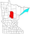
Cass County is a county in the central part of the U.S. state of Minnesota. As of the 2020 census, the population was 30,066. Its county seat is Walker. The county was formed in 1851, and was organized in 1897.

<span class="mw-page-title-main">Circle Pines, Minnesota</span> City in Minnesota, United States

Circle Pines is a city in Anoka County, Minnesota, United States. The population was 5,025 at the 2020 census.

<span class="mw-page-title-main">Moose Lake, Minnesota</span> City in Minnesota, United States

Moose Lake is a city in Carlton County, Minnesota, United States. The population was 2,789 at the 2020 census.

<span class="mw-page-title-main">Cass Lake, Minnesota</span> City in Minnesota, United States

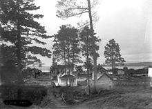
Cass Lake is a city in Cass County, Minnesota, United States, located within the boundaries of the Leech Lake Indian Reservation. It is surrounded by Pike Bay Township. Cass Lake had a population of 675 in the 2020 census. It is notable as the headquarters location of Minnesota Chippewa Tribe and Leech Lake Band of Ojibwe, as well as the Chippewa National Forest.

<span class="mw-page-title-main">Hackensack, Minnesota</span> City in Minnesota, United States

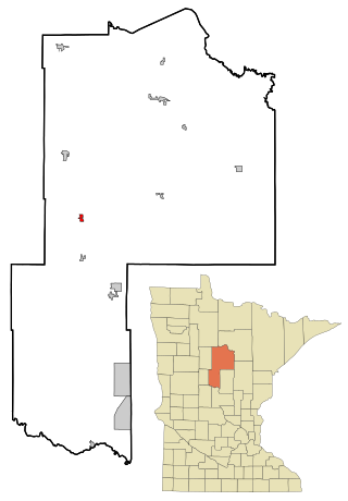
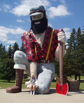
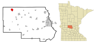
Hackensack is a city in Cass County, Minnesota, United States. The population was 313 at the 2010 census. It is part of the Brainerd Micropolitan Statistical Area.

Leech Lake Township is a township in Cass County, Minnesota, United States. The population was 384 at the 2000 census. This township took its name from Leech Lake.

<span class="mw-page-title-main">Jenkins, Minnesota</span> City in Minnesota, United States

Jenkins is a city in Crow Wing County, Minnesota, United States. The population was 430 at the 2010 census. It is part of the Brainerd Micropolitan Statistical Area.

<span class="mw-page-title-main">Akeley, Minnesota</span> City in Minnesota, United States

Akeley is a city in Hubbard County, Minnesota, United States. The population was 404 at the 2020 census.

<span class="mw-page-title-main">Isle, Minnesota</span> City in Minnesota, United States

Isle is a city in Mille Lacs County, Minnesota, United States. The population was 803 at the 2020 census, up from 751 in 2010.

<span class="mw-page-title-main">Milaca, Minnesota</span> City in Minnesota, United States

Milaca is a city and the county seat of Mille Lacs County, Minnesota. The population was 3,021 at the time of the 2020 census. It is situated on the Rum River.

<span class="mw-page-title-main">New Brighton, Minnesota</span> City in Minnesota, United States

New Brighton is a city in Ramsey County, Minnesota, United States. It is a suburb of the Twin Cities. The population was 23,454 at the 2020 census.

<span class="mw-page-title-main">Shoreview, Minnesota</span> City in Minnesota, United States

Shoreview is a city in Ramsey County, Minnesota, United States. The population was 26,921 at the time of the 2020 census. In 2008, Shoreview ranked fourth in a Family Circle list of best family towns.

<span class="mw-page-title-main">Vadnais Heights, Minnesota</span> City in Minnesota, United States

Vadnais Heights is a city in Ramsey County, Minnesota, United States. The population was 12,912 at the 2020 census.

<span class="mw-page-title-main">Lake Elmo, Minnesota</span> City in Minnesota, United States

Lake Elmo is a city in Washington County, Minnesota, United States. The population was 11,335 at the 2020 census. According to 2022 census estimates, the city is estimated to have a population of 13,449.

Gould Township is a township in Cass County, Minnesota, United States. The population was 249 as of the 2000 census. Gould Township was named for M. I. Gould, a lumberman and local landowner.

Shingobee Township is a township in Cass County, Minnesota, United States. The population was 1,745 as of the 2000 census. This township took its name from the Shingobee River.

<span class="mw-page-title-main">Sauk Centre, Minnesota</span> City in Minnesota, United States

Sauk Centre is a city in Stearns County, Minnesota, United States. The population was 4,555 at the 2020 census. Sauk Centre is part of the St. Cloud Metropolitan Statistical Area.

Bowstring Lake is an unorganized territory in Itasca County, Minnesota, United States. The population was 1,166 at the 2010 census.

<span class="mw-page-title-main">Brooten, Minnesota</span> City in Minnesota, United States

Brooten is a city in Stearns and Pope counties in the U.S. state of Minnesota, United States. The population was 626 as of the 2020 census. Almost the entire city is within Stearns County, with a small portion in Pope County.

References

  1. "2020 U.S. Gazetteer Files". United States Census Bureau. Retrieved July 24, 2022.
  2. 1 2 U.S. Geological Survey Geographic Names Information System: Walker, Minnesota
  3. 1 2 3 "Explore Census Data". United States Census Bureau . Retrieved November 15, 2023.
  4. 1 2 "City and Town Population Totals: 2020-2022". United States Census Bureau. November 15, 2023. Retrieved November 15, 2023.
  5. "Find a County". National Association of Counties. Retrieved June 7, 2011.
  6. 1 2 Andris Straumanis, "Ah-Gwa-Ching", Minnesota Public Radio, July 26, 2004. Retrieved March 8, 2012
  7. "US Gazetteer files 2010". United States Census Bureau. Archived from the original on January 12, 2012. Retrieved November 13, 2012.
  8. "U.S. Climate Normals Quick Access – Station: Walker, MN (19912020)". National Oceanic and Atmospheric Administration. Retrieved May 10, 2023.
  9. "U.S. Climate Normals Quick Access – Station: Walker, MN (19812010)". National Oceanic and Atmospheric Administration. Retrieved May 10, 2023.
  10. "NOAA Online Weather Data – NWS Duluth". National Weather Service. Retrieved May 10, 2023.
  11. "U.S. Decennial Census". Census.gov. Retrieved July 14, 2014.
  12. "Walker Hackensack Akeley Schools". Walker Hackensack Akeley Schools. Retrieved June 26, 2012.
  13. "School District Consolidations". Minnesota House of Representatives . Retrieved August 11, 2021.
  14. "AirNav: Y49 - Walker Municipal Airport". www.airnav.com. Retrieved July 18, 2023.
  15. "Y49/Walker Municipal General Airport Information". acukwik.com. Retrieved July 18, 2023.
  16. "Walker Municipal Airport - Y49 - Airport Guide". AirportGuide. Retrieved July 18, 2023.
  17. "Y49 - Walker Municipal Airport | SkyVector". skyvector.com. Retrieved July 18, 2023.
  18. Warfield, Baihly (July 8, 2020). "Northland man takes a swing at extreme mini golf competition". WDIO. Retrieved September 19, 2021.