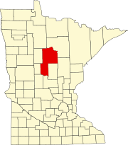
Boy Lake Township is a township in Cass County, Minnesota, United States. The population was 132 as of the 2000 census. This township took its name from Boy Lake.

Inguadona Township is a township in Cass County, Minnesota, United States. The population was 190 as of the 2000 census. Inguadona is a name probably derived from an unidentified Native American language.

Kego Township is a township in Cass County, Minnesota, United States. The population was 465 as of the 2000 census. Kego is a name derived from the Ojibwe language, meaning "fish".

Rogers Township is a township in Cass County, Minnesota, United States. The population was 43 as of the 2000 census. Rogers Township was named for William A. Rogers, an early settler.

Slater Township is a township in Cass County, Minnesota, United States. The population was 249 as of the 2000 census. Slater Township was named for David H. Slater, a farmer who settled there.

Thunder Lake Township is a township in Cass County, Minnesota, United States. The population was 262 as of the 2000 census. This township took its name from Thunder Lake.

Wabedo Township is a township in Cass County, Minnesota, United States. The population was 375 as of the 2000 census. This township took its name from Wabedo Lake.
Johnson Lake is a glacial lake in Elmore County, Idaho, United States.

Onigum is an unincorporated community in Shingobee Township, Cass County, Minnesota, United States, near Walker, along Cass County Road 13. The name Onigum means "portage" in the Ojibwe language.

Oshawa is an unincorporated community in Cass County, Minnesota, United States, near Backus. The community is located near the junction of Cass County Road 41 and State Highway 87. Oshawa is located within Bull Moose Township and Deerfield Township. The Badoura State Forest and the Foot Hills State Forest are both nearby.

Wabedo is an unincorporated community in Wabedo Township, Cass County, Minnesota, United States, near Longville. It is along Cass County Road 54 near the junction with County Road 120.

Tobique is an unincorporated community in Rogers Township, Cass County, Minnesota, United States, near Remer. It is situated along Tobique Road NE near Cass County Road 4.

Mae is an unincorporated community in Beulah Township, Cass County, Minnesota, United States, near Outing and Emily. It is located along Cass County Road 58, near Morrison Lake Road NE.

Leech Lake is an unincorporated community in Leech Lake Township, Cass County, Minnesota, United States. It is along State Highway 371 near 100th Street NW, Cass County Road 62. Nearby places include Walker, Laporte, and Steamboat Bay of Leech Lake.

Graff is an unincorporated community in Moose Lake Township, Cass County, Minnesota, United States, near Pine River and Pequot Lakes. It is along Cass County Road 24, 64th Street SW, near 51st Avenue SW.

Esterdy is an unincorporated community in Byron Township, Cass County, Minnesota, United States, near Motley and Staples. It is along 90th Street SW near 85th Avenue SW.

Ellis is an unincorporated community in Byron Township, Cass County, Minnesota, United States, near Motley. It is along 79th Avenue SW near 80th Street SW.

Casino is an unincorporated community in May Township, Cass County, Minnesota, United States, near Motley and Pillager. It is along 49th Avenue SW, near 104th Street SW.

Bridgeman is an unincorporated community in May Township, Cass County, Minnesota, United States, near Motley and Pillager. It is along 57th Avenue SW near 116th Street SW.

Brevik is an unincorporated community in Boy Lake Township, Cass County, Minnesota, United States, near Longville. It is along Cass County Road 39 near Liens Lane.


