Beulah Township, Cass County, Minnesota

Last updated

Beulah Township, Minnesota
USA Minnesota location map.svg
Red pog.svg
Beulah Township, Minnesota
Location within the state of Minnesota
Usa edcp location map.svg
Red pog.svg
Beulah Township, Minnesota
Beulah Township, Minnesota (the United States)
Coordinates: 46°51′4″N93°50′58″W / 46.85111°N 93.84944°W / 46.85111; -93.84944
Country United States
State Minnesota
County Cass
Area
  Total35.7 sq mi (92.5 km2)
  Land34.6 sq mi (89.7 km2)
  Water1.1 sq mi (2.8 km2)
Elevation
1,309 ft (399 m)
Population
 (2000)
  Total57
  Density1.6/sq mi (0.6/km2)
Time zone UTC-6 (Central (CST))
  Summer (DST) UTC-5 (CDT)
ZIP code
56662
Area code 218
FIPS code 27-05572 [1]
GNIS feature ID0663581 [2]

Beulah Township is a township in Cass County, Minnesota, United States. The population was 57 as of the 2000 census. [3] Beulah Township was named for Beulah Olds, a pioneer settler. [4]

Contents

Geography

According to the United States Census Bureau, the township has a total area of 35.7 square miles (92 km2), of which 34.7 square miles (90 km2) is land and 1.1 square miles (2.8 km2) (3.00%) is water.

Unincorporated communities

Lakes

Adjacent townships

Demographics

As of the census [1] of 2000, there were 57 people, 28 households, and 19 families residing in the township. The population density was 1.6 inhabitants per square mile (0.62/km2). There were 112 housing units at an average density of 3.2 per square mile (1.2/km2). The racial makeup of the township was 98.25% White, and 1.75% from two or more races.

There were 28 households, out of which 14.3% had children under the age of 18 living with them, 64.3% were married couples living together, and 28.6% were non-families. 28.6% of all households were made up of individuals, and 10.7% had someone living alone who was 65 years of age or older. The average household size was 2.04 and the average family size was 2.40.

In the township the population was spread out, with 10.5% under the age of 18, 7.0% from 25 to 44, 54.4% from 45 to 64, and 28.1% who were 65 years of age or older. The median age was 55 years. For every 100 females, there were 159.1 males. For every 100 females age 18 and over, there were 142.9 males.

The median income for a household in the township was $26,875, and the median income for a family was $25,000. Males had a median income of $51,250 versus $38,750 for females. The per capita income for the township was $16,613. There were 16.7% of families and 15.9% of the population living below the poverty line, including 75.0% of under eighteens and none of those over 64.

Related Research Articles

Hill Lake Township is a township in Aitkin County, Minnesota, United States. The population was 430 as of the 2010 census.

Macville Township is a township in Aitkin County, Minnesota, United States. The population was 206 at the 2010 census.

Kelliher Township is a township in Beltrami County, Minnesota, United States. The population was 150 as of the 2000 census.

<span class="mw-page-title-main">Taylor Township, Beltrami County, Minnesota</span> Township in Minnesota, United States

Taylor Township is a township in Beltrami County, Minnesota, United States. The population was 108 as of the 2000 census.

<span class="mw-page-title-main">Boy Lake Township, Cass County, Minnesota</span> Township in Minnesota, United States

Boy Lake Township is a township in Cass County, Minnesota, United States. The population was 132 as of the 2000 census. This township took its name from Boy Lake.

Bull Moose Township is a township in Cass County, Minnesota, United States. The population was 107 as of the 2000 census. This township was named after the Bull Moose Party.

<span class="mw-page-title-main">Crooked Lake Township, Cass County, Minnesota</span> Township in Minnesota, United States

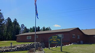
Crooked Lake Township is a township in Cass County, Minnesota, United States. The population was 498 as of the 2000 census. It is named after Roosevelt Lake, formerly known as Crooked Lake, a large lake located in this township. Crooked Lake is a translation from the Ojibwe Wewaagigamaag-zaaga'igan.

Remer Township is a township in Cass County, Minnesota, United States. The population was 183 as of the 2000 census. Remer Township was named for two brothers, E. N. and William P. Remer.

Smoky Hollow Township is a township in Cass County, Minnesota, United States. The population was 61 as of the 2000 census.

Thunder Lake Township is a township in Cass County, Minnesota, United States. The population was 262 as of the 2000 census. This township took its name from Thunder Lake.

Dead Lake Township is a township in Otter Tail County, Minnesota, United States. The population was 452 at the 2000 census.

Lake Johanna Township is a township in Pope County, Minnesota, United States. The population was 151 at the 2000 census.

Ault Township is a township in Saint Louis County, Minnesota, United States. The population was 109 at the 2010 census.

Colvin Township is a township in Saint Louis County, Minnesota, United States. The population was 317 at the 2010 census.

Cotton Township is a township in Saint Louis County, Minnesota, United States. The population was 445 at the 2010 census.

Ellsburg Township is a township in Saint Louis County, Minnesota, United States. The population was 219 at the 2010 census.

Fredenberg Township is a township in Saint Louis County, Minnesota, United States. The population was 1,337 at the 2010 census.

Lake Henry Township is a township in Stearns County, Minnesota, United States. The population was 278 at the 2010 census.

Maple Township is a township in Cass County, Minnesota, United States. The population was 291 as of the 2000 census. Maple Township was named from the groves of sugar maple trees within its borders.

Whiteface Reservoir is an unorganized territory in Saint Louis County, Minnesota, United States. The population was 292 at the 2000 census.

References

  1. 1 2 "U.S. Census website". United States Census Bureau . Retrieved January 31, 2008.
  2. "US Board on Geographic Names". United States Geological Survey. October 25, 2007. Retrieved January 31, 2008.
  3. "U.S. Census website" . Retrieved January 2, 2009.
  4. Upham, Warren (1920). Minnesota Geographic Names: Their Origin and Historic Significance. Minnesota Historical Society. p.  87.