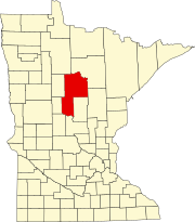
Shanty Town is an unincorporated community in Salem Township, Olmsted County, Minnesota, United States, near Byron. The community is located along Olmsted County Road 150 near 35th Street SW.

Smith Lake is an unincorporated community in Middleville Township, Wright County, Minnesota, United States. The community is located along Wright County Road 5 near 50th Street SW. Nearby places include Cokato and Howard Lake.

Oster is an unincorporated community in Carver and Wright Counties, Minnesota, United States.

Highland is an unincorporated community in Middleville Township, Wright County, Minnesota, United States. The community is located along Wright County Road 7 near 20th Street SW.

Onigum is an unincorporated community in Shingobee Township, Cass County, Minnesota, United States, near Walker along Cass County Road 13. The name Onigum means "across the bay" in the Ojibwe language.

Lemond is an unincorporated community in Lemond Township, Steele County, Minnesota, United States, near Owatonna and Ellendale. The community is located near the junction of Steele County Roads 4 and 7, and SW 89th Avenue.

Oshawa is an unincorporated community in Cass County, Minnesota, United States, near Backus. The community is located near the junction of Cass County Road 41 and State Highway 87. Oshawa is located within Bull Moose Township and Deerfield Township. The Badoura State Forest and the Foot Hills State Forest are both nearby.

Schley is an unincorporated community in Cass County, Minnesota, United States, within the Bowstring State Forest and the Chippewa National Forest. It is between Cass Lake and Bena along U.S. Highway 2 near Forest Road 2958.

Leader is an unincorporated community in Cass County, Minnesota, United States, near Motley. It is along Highway 64 near 76th Street SW.

Wabedo is an unincorporated community in Wabedo Township, Cass County, Minnesota, United States, near Longville. It is along Cass County Road 54 near the junction with County Road 120.

Tobique is an unincorporated community in Rogers Township, Cass County, Minnesota, United States, near Remer. It is along Tobique Road NE near Cass County Road 4.

Sylvan is an unincorporated community in Sylvan Township, Cass County, Minnesota, United States. It is located between Pillager and Baxter along State Highway 210 near 24th Avenue SW.

Mae is an unincorporated community in Beulah Township, Cass County, Minnesota, United States, near Outing and Emily. It is along Cass County Road 58 near Morrison Lake Road NE.

Leech Lake is an unincorporated community in Leech Lake Township, Cass County, Minnesota, United States. It is along State Highway 371 near 100th Street NW, Cass County Road 62. Nearby places include Walker, Laporte, and Steamboat Bay of Leech Lake.

Inguadona is an unincorporated community in Cass County, Minnesota, United States. It is near Longville and Remer along Cass County Road 7 near 28th Avenue NE. Inguadona is located within Inguadona Township and Trelipe Township.

Graff is an unincorporated community in Moose Lake Township, Cass County, Minnesota, United States, near Pine River and Pequot Lakes. It is along Cass County Road 24, 64th Street SW, near 51st Avenue SW.

Esterdy is an unincorporated community in Byron Township, Cass County, Minnesota, United States, near Motley and Staples. It is along 90th Street SW near 85th Avenue SW.

Casino is an unincorporated community in May Township, Cass County, Minnesota, United States, near Motley and Pillager. It is along 49th Avenue SW near 104th Street SW.

Bridgeman is an unincorporated community in May Township, Cass County, Minnesota, United States, near Motley and Pillager. It is along 57th Avenue SW near 116th Street SW.

Brevik is an unincorporated community in Boy Lake Township, Cass County, Minnesota, United States, near Longville. It is along Cass County Road 39 near Liens Lane.


