Grand Rapids is a city in Itasca County, Minnesota, United States. The population was 10,869 at the 2010 census. It is the county seat of Itasca County.

Embarrass is an unincorporated community in Embarrass Township, Saint Louis County, Minnesota, United States.

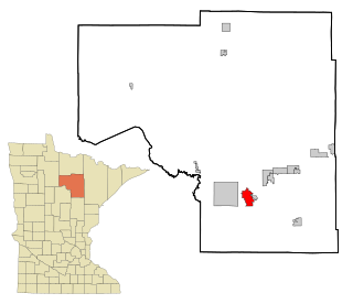
Togo is an unincorporated community in Carpenter Township, Itasca County, Minnesota, United States.
Celina is an unincorporated community in Saint Louis County, Minnesota, United States.
Burntside is an unincorporated community in Morse Township, Saint Louis County, Minnesota, United States.
Sturgeon is an unincorporated community in Sturgeon Township, Saint Louis County, Minnesota, United States.
Florenton is an unincorporated community in Wuori Township, Saint Louis County, Minnesota, United States; located near Britt.
Four Corners is an unincorporated community in Saint Louis County, Minnesota, United States; located 10 miles northwest of the city of Duluth at the junction of U.S. Highway 53 and Saint Louis County Road 13.
Robbin is an unincorporated community in Teien Township, Kittson County, Minnesota, United States.
Outing is an unincorporated community in Crooked Lake Township, Cass County, Minnesota, United States, near Emily. It is situated between North Roosevelt Lake, South Roosevelt Lake, and Lawrence Lake.
Holyoke is an unincorporated community in Holyoke Township, Carlton County, Minnesota, United States. It is located between Sandstone and Duluth.
Oxlip is an unincorporated community in Isanti County, Minnesota, United States. The community is located within Spencer Brook Township and Bradford Township.
Centerville is an unincorporated community in Wilson Township, Winona County, Minnesota, United States.
Wahlsten is an unincorporated community in Kugler Township, Saint Louis County, Minnesota, United States.
Alvwood is an unincorporated community in Alvwood Township, Itasca County, Minnesota, United States.
Wildwood is an unincorporated community in Koochiching County, Minnesota, United States; located within the Pine Island State Forest.
Dunbar is an unincorporated community in Good Hope Township, Itasca County, Minnesota, United States. The community is located northwest of Squaw Lake at the junction of Itasca County Roads 32 and 149. State Highway 46 is nearby.
Glendorado is an unincorporated community in Glendorado Township, Benton County, Minnesota, United States. The community is located near the junction of Benton County Roads 9 and 87, Glendorado Road. State Highway 95 is also in the immediate area. Nearby places include Foley, Princeton, and Santiago.
Duelm is an unincorporated community in St. George Township, Benton County, Minnesota, United States, near Foley. The community is located along Duelm Road near 110th Avenue. Stoney Brook flows through the community.
Oshawa is an unincorporated community in Cass County, Minnesota, United States, near Backus. The community is located near the junction of Cass County Road 41 and State Highway 87. Oshawa is located within Bull Moose Township and Deerfield Township. The Badoura State Forest and the Foot Hills State Forest are both nearby.


