Ladysmith, Wisconsin

Last updated

Ladysmith, Wisconsin
State Bank of Ladysmith Wisconsin.jpg
Rusk County Wisconsin Incorporated and Unincorporated areas Ladysmith Highlighted.svg
Location of Ladysmith in Rusk County, Wisconsin.
USA Wisconsin relief location map.svg
Red pog.svg
Ladysmith
Location in Wisconsin
Usa edcp relief location map.png
Red pog.svg
Ladysmith
Ladysmith (the United States)
Coordinates: 45°27′50″N91°6′0″W / 45.46389°N 91.10000°W / 45.46389; -91.10000
Country Flag of the United States.svg  United States
State Flag of Wisconsin.svg  Wisconsin
County Rusk
Government
  MayorRobert Grotzinger
Area
[1]
  Total4.59 sq mi (11.90 km2)
  Land4.22 sq mi (10.93 km2)
  Water0.38 sq mi (0.97 km2)
Elevation
[2]
1,145 ft (349 m)
Population
 (2020) [3]
  Total3,216
  Density762.1/sq mi (294.2/km2)
Time zone UTC-6 (Central (CST))
  Summer (DST) UTC-5 (CDT)
ZIP code
54848
Area code(s) 715 & 534
FIPS code 55-40850 [4]
GNIS feature ID1567715 [2]
Website www.cityofladysmithwi.com

Ladysmith is a city and the county seat of Rusk County, Wisconsin, United States. The population was 3,216 at the 2020 census. [3]

Contents

History

The Ojibwe who travelled the Flambeau River called the area that would become Ladysmith Gakaabikijiwanan ("of cliffed rapids").

The city was founded in 1885 at the intersection of the Minneapolis, St. Paul and Sault Ste. Marie Railroad (Soo Line) with the Flambeau River, initially named Flambeau Falls. Robert Corbett, a logging and lumbering entrepreneur who was a strong influence on the city in its early years, renamed it Corbett, then Warner in 1891. On July 1, 1900 he named it Ladysmith, after the bride of Charles R. Smith, head of Menasha Wooden Ware Co. [5] [6]

Flambeau Mine

Steely-blue chalcocite from the Flambeau Mine Chalcocite-181311.jpg
Steely-blue chalcocite from the Flambeau Mine

The Flambeau Copper Mine was operated by Kennecott from 1993 to 1997. This was a very rich volcanogenic massive sulfide ore deposit, so rich that the ore was shipped directly to the smelter.

Flambeau Mine has since been closed and the site reclaimed and planted. It now has walking trails. [7]

2002 tornado

On September 2, 2002, a tornado rated at F3 strength destroyed much of Ladysmith's downtown area. Overall damage was estimated at $20 million, but there were no fatalities. [8]

2020 Kenosha unrest shooting firearm purchase

On May 1, 2020, Dominick Black purchased a Smith and Wesson M&P 15 rifle at the Ace Hardware located in Ladysmith. This rifle would later be fired by 17-year-old Kyle Rittenhouse during unrest in Kenosha following the shooting of Jacob Blake. Black purchased the weapon using money given to him by Kyle Rittenhouse, and had an agreement that Kyle would take possession of the rifle when he turned 18. [9]

Geography

Ladysmith is located at 45°27′50″N91°6′0″W / 45.46389°N 91.10000°W / 45.46389; -91.10000 . According to the United States Census Bureau, the city has an area of 4.59 square miles (11.89 km2), of which 4.21 square miles (10.90 km2) is land and 0.38 square miles (0.98 km2) is water. [10]

U.S. Highway 8 and Wisconsin Highway 27 are the main routes in the community.

Ladysmith is along the Flambeau River.

Demographics

Historical population
CensusPop.Note
1910 2,352
1920 3,58152.3%
1930 3,493−2.5%
1940 3,6715.1%
1950 3,9246.9%
1960 3,584−8.7%
1970 3,6742.5%
1980 3,8264.1%
1990 3,9382.9%
2000 3,932−0.2%
2010 3,414−13.2%
2020 3,216−5.8%
U.S. Decennial Census [11]

2010 census

As of the census [12] of 2010, there were 3,414 people, 1,527 households, and 806 families living in the city. The population density was 810.9 inhabitants per square mile (313.1/km2). There were 1,667 housing units at an average density of 396.0 per square mile (152.9/km2). The racial makeup of the city was 96.3% White, 0.6% African American, 0.8% Native American, 0.6% Asian, 0.5% from other races, and 1.2% from two or more races. Hispanic or Latino of any race were 1.6% of the population.

There were 1,527 households, of which 26.1% had children under the age of 18 living with them, 37.1% were married couples living together, 10.7% had a female householder with no husband present, 5.0% had a male householder with no wife present, and 47.2% were non-families. 41.7% of all households were made up of individuals, and 20.2% had someone living alone who was 65 years of age or older. The average household size was 2.14 and the average family size was 2.86.

The median age in the city was 43.8 years. 22.3% of residents were under the age of 18; 7% were between the ages of 18 and 24; 21.9% were from 25 to 44; 25.7% were from 45 to 64; and 23% were 65 years of age or older. The gender makeup of the city was 45.6% male and 54.4% female.

2000 census

As of the census [4] of 2000, there were 3,932 people, 1,570 households, and 916 families living in the city. The population density was 1,008.9 people per square mile (389.3/km2). There were 1,660 housing units at an average density of 425.9 per square mile (164.3/km2). The racial makeup of the city was 96.31% White, 1.48% African American, 0.56% Native American, 0.48% Asian, 0.13% Pacific Islander, 0.10% from other races, and 0.94% from two or more races. Hispanic or Latino of any race were 0.76% of the population.

There were 1,570 households, out of which 28.2% had children under the age of 18 living with them, 43.4% were married couples living together, 11.0% had a female householder with no husband present, and 41.6% were non-families. 35.8% of all households were made up of individuals, and 19.2% had someone living alone who was 65 years of age or older. The average household size was 2.25 and the average family size was 2.92.

In the city, the population was spread out, with 22.8% under the age of 18, 13.4% from 18 to 24, 23.7% from 25 to 44, 18.7% from 45 to 64, and 21.4% who were 65 years of age or older. The median age was 37 years. For every 100 females there were 87.4 males. For every 100 females age 18 and over, there were 83.3 males.

The median income for a household in the city was $28,274, and the median income for a family was $40,526. Males had a median income of $26,725 versus $20,826 for females. The per capita income for the city was $15,499. About 7.2% of families and 12.2% of the population were below the poverty line, including 11.1% of those under age 18 and 11.0% of those age 65 or over.

Transportation

Rusk County Airport (KRCX) serves Ladysmith.

The Rusk County Transit Commission provides transportation within Rusk County.

Education

Ladysmith is served by the Ladysmith School District, which administers Ladysmith High School and Ladysmith Elementary School. Ladysmith is also home to private schools Our Lady of Sorrows, a Catholic grade school, and North Cedar Academy, a private college prep International boarding high school, providing "BluGold" study program, which allows students to earn up to 60 college credits within the high school.

Ladysmith was the home of Mount Senario College, which closed in 2002. In the 2006–07 school year, part of the former campus was operated as Concordia Preparatory School, a private Christian high school. That institution also faced financial problems and closed. Silver Lake College of Manitowoc, Wisconsin, began offering courses at Mount Senario, renamed Mount Senario Education Center, in September 2009. [13] Silver Lake itself closed in 2020, and North Cedar Academy now occupies Mount Senario's old campus, passed on its collaboration with the UW System and provides "BluGold" Guarantee Transfer Program.

Notable people

See also

Related Research Articles

<span class="mw-page-title-main">Rusk County, Wisconsin</span> County in Wisconsin, United States

Rusk County is a county in the U.S. state of Wisconsin. As of the 2020 census, the population was 14,188. Its county seat is Ladysmith. The Chippewa and Flambeau rivers and their tributaries flow through the county. The land ranges from corn/soybean farms and dairy farms to lakes rimmed with vacation homes to hiking trails through the Blue Hills.

<span class="mw-page-title-main">New London, Texas</span> City in Texas, United States

New London is a city in Rusk County, Texas, United States. The population was 958 at the 2020 census.

<span class="mw-page-title-main">Ferryville, Wisconsin</span> Village in Wisconsin, United States

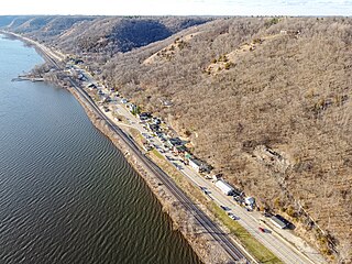
Ferryville is a village in Crawford County, Wisconsin, United States. The population was 176 at the 2010 census. It is located on Wisconsin Highway 35 along the Great River Road.

<span class="mw-page-title-main">Park Falls, Wisconsin</span> City in Wisconsin, United States

Park Falls is a city in Price County, Wisconsin, United States. The population was 2,462 at the 2010 census. Located in the woods of north central Wisconsin, primarily the Chequamegon National Forest, Park Falls is a small community divided by the North Fork of the Flambeau River, a popular destination for fishing, canoeing and whitewater rafting.

<span class="mw-page-title-main">Big Bend, Rusk County, Wisconsin</span> Town in Wisconsin, United States

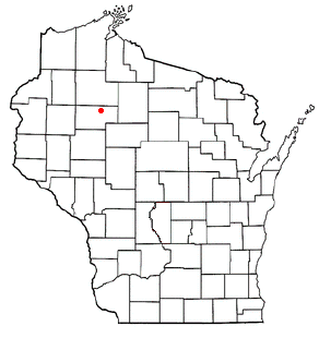
Big Bend is a town in Rusk County, Wisconsin, United States. The population was 402 at the 2000 census. The unincorporated community of Island Lake is located in the town.

<span class="mw-page-title-main">Big Falls, Rusk County, Wisconsin</span> Town in Wisconsin, United States

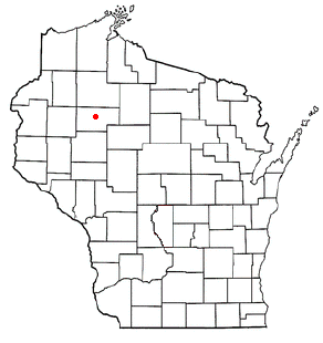
Big Falls is a town in Rusk County, Wisconsin, United States. The population was 107 at the 2000 census.

<span class="mw-page-title-main">Bruce, Wisconsin</span> Village in Wisconsin, United States

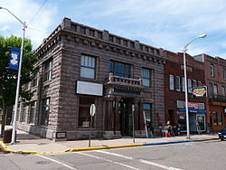
Bruce is a village in Rusk County, Wisconsin, United States. The population was 779 at the 2010 census. The village was founded in 1884 by the Sault Ste. Marie Land and Improvement Company. The land company was incorporated and led by the principal officers of the Minneapolis, Sault Ste. Marie and Atlantic Railway, which operated its ceremonial first train over its line to Bruce in November 1884. It was named for Alanson C. Bruce who operated a logging camp in the area.

<span class="mw-page-title-main">Cedar Rapids, Wisconsin</span> Town in Wisconsin, United States

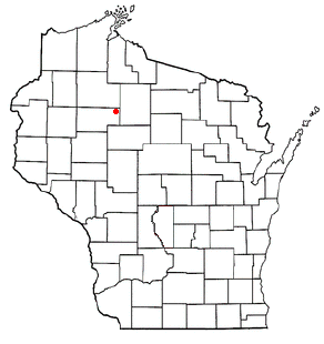
Cedar Rapids is a town in Rusk County, Wisconsin, United States. The population was 37 at the 2000 census.

<span class="mw-page-title-main">Dewey, Rusk County, Wisconsin</span> Town in Wisconsin, United States

Dewey is a town in Rusk County, Wisconsin, United States. As of the 2000 census, the town had a total population of 523.

<span class="mw-page-title-main">Flambeau, Rusk County, Wisconsin</span> Town in Wisconsin, United States

Flambeau is a town in Rusk County, Wisconsin, United States. The population was 1,067 at the 2000 census.

<span class="mw-page-title-main">Lawrence, Rusk County, Wisconsin</span> Town in Wisconsin, United States

Lawrence is a town in Rusk County in north-central Wisconsin, United States. The population was 240 at the 2000 census. The town is rural - all farmland or forest.

<span class="mw-page-title-main">South Fork, Wisconsin</span> Town in Wisconsin, United States

South Fork is a town in Rusk County, Wisconsin, United States. The population was 120 at the 2000 census. The unincorporated community of South Fork is located in the town.

<span class="mw-page-title-main">Weyerhaeuser, Wisconsin</span> Village in Wisconsin, United States

Weyerhaeuser is a village in Rusk County, Wisconsin, United States. The population was 238 at the 2010 census.

<span class="mw-page-title-main">Wilkinson, Wisconsin</span> Town in Wisconsin, United States

Wilkinson is a town in Rusk County, Wisconsin, United States. The population was 66 at the 2000 census.

Barron is a town in Barron County in the U.S. state of Wisconsin. The population was 873 at the 2010 census. The town surrounds the City of Barron.

<span class="mw-page-title-main">Chetek, Wisconsin</span> City in Wisconsin, United States

Chetek is a city in Barron County, Wisconsin, United States. The population was 2,221 at the 2010 census. The city is located partially within the Town of Chetek.

<span class="mw-page-title-main">Durand, Wisconsin</span> City in Wisconsin, United States

Durand is a city in and the county seat of Pepin County, Wisconsin, United States. Situated on the banks of the Chippewa River approximately 15 miles (24 km) from its confluence with the Mississippi River, the city borders the Town of Durand. The population was 1,854 at the 2020 census.

<span class="mw-page-title-main">Hawkins, Wisconsin</span> Village in Wisconsin, United States

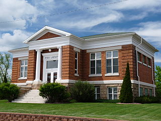
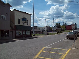
Hawkins is a village in Rusk County in north-central Wisconsin, United States. The population was 305 at the 2010 census. The village is located within the Town of Hawkins.

<span class="mw-page-title-main">Lac du Flambeau (CDP), Wisconsin</span> CDP in Wisconsin, United States

Lac du Flambeau is a census-designated place (CDP) in the town of Lac du Flambeau in Vilas County, Wisconsin, United States. The population was 1,845 at the 2020 census. Lac du Flambeau is the major community for the Lac du Flambeau Band of Lake Superior Chippewa tribe.

<span class="mw-page-title-main">Lac du Flambeau, Wisconsin</span> Town in Wisconsin, United States

The Town of Lac du Flambeau is located in Vilas County, Wisconsin, United States. The population was 3,004 at the 2000 census. The land base of the Lac du Flambeau Band of Lake Superior Chippewa is located within the town and also consists of a large portion of the town. The Lac du Flambeau census-designated place is located within the town. The unincorporated community of Marlands is also located in the town. Lac du Flambeau, situated around Flambeau Lake, is a year-round vacation destination.

References

  1. "2020 U.S. Gazetteer Files". United States Census Bureau. Retrieved March 21, 2024.
  2. 1 2 U.S. Geological Survey Geographic Names Information System: Ladysmith, Wisconsin
  3. 1 2 "Profile of General Population and Housing Characteristics: 2020 Demographic Profile Data (DP-1): Ladysmith city, Wisconsin". United States Census Bureau . Retrieved March 21, 2024.
  4. 1 2 "U.S. Census website". United States Census Bureau . Retrieved January 31, 2008.
  5. Rusk County Historical Society, ed. (1983). History of Rusk County, Wisconsin. Dallas, Texas: Taylor Publishing Company. p. 38. Retrieved August 19, 2015.
  6. Adams, Peter James (April 8, 1979). "Charles R. Smith House". NRHP Inventory-Nomination Form. US Dept. of the Interior. National Park Service. Retrieved August 8, 2015.
  7. Flambeau Mine at Mindat.org
  8. USA Today
  9. Vielmetti, Bruce (November 2, 2021). "Kyle Rittenhouse's friend Dominick Black testifies he bought the gun used in the killings in Kenosha". Milwaukee Journal Sentinel. Retrieved November 12, 2023. Black testified that shortly after he got an AR-15-style rifle, Rittenhouse expressed interest in one. During a trip to Black's family's hunting property in May 2020, Black agreed to buy a rifle for Rittenhouse, who was 17 and couldn't lawfully buy or possess one.
  10. "US Gazetteer files 2010". United States Census Bureau. Archived from the original on July 2, 2012. Retrieved November 18, 2012.
  11. "Census of Population and Housing". Census.gov. Retrieved June 4, 2015.
  12. "U.S. Census website". United States Census Bureau . Retrieved November 18, 2012.
  13. "Silver Lake College: Mount Senario Education Center's website". Archived from the original on March 2, 2009. Retrieved September 17, 2009.