Washburn, Wisconsin

Last updated

Washburn, Wisconsin
WashburnWI-054-050507.jpg
The main street (Bayfield Street / WIS 13) in downtown Washburn
Bayfield County Wisconsin Incorporated and Unincorporated areas Washburn Highlighted.svg
Location of Washburn in Bayfield County, Wisconsin.
Coordinates: 46°40′26″N90°53′52″W / 46.67389°N 90.89778°W / 46.67389; -90.89778
Country Flag of the United States.svg  United States
State Flag of Wisconsin.svg  Wisconsin
County Bayfield
Government
  Type Mayor–council
   Mayor Mary D. Motiff
Area
[1]
  Total3.92 sq mi (10.14 km2)
  Land3.91 sq mi (10.13 km2)
  Water0.00 sq mi (0.01 km2)
Elevation
[2]
692 ft (211 m)
Population
 (2020) [3]
  Total2,051
  Density524.2/sq mi (202.4/km2)
Time zone UTC-6 (Central (CST))
  Summer (DST) UTC-5 (CDT)
ZIP Code
54891
Area code(s) 715 & 534
FIPS code 55-83525 [4]
GNIS feature ID1576230 [2]
Website www.cityofwashburn.org

Washburn is a city and the county seat of Bayfield County, in the U.S. state of Wisconsin. The population was 2,051 at the 2020 census. [3] The city is just east of and adjacent to the Town of Washburn. It is in northern Wisconsin, on the shore of Lake Superior's Chequamegon Bay.

Contents

Wisconsin Highway 13 and County Highway C are the main routes in the community.

History

In 1659, the French explorers Radisson and Groseilliers touched here on their trip along the south shore of Lake Superior. In 1665 the Jesuit Claude-Jean Allouez established on the shore of the bay, a short distance south of the present city, the first French mission in Wisconsin. He named it "La Pointe du Saint Esprit," and in 1669 it was placed in charge of Father Jacques Marquette. The place was visited by Daniel Greysolon (Du Luth) in 1681–1682, and here in 1693 Pierre-Charles Le Sueur built a stockaded post. In 1718 a fort was erected and a French garrison placed in it. About 1820–1821 a trading post of the American Fur Company was established in the area. [5]

The city itself was founded in 1883, named for Cadwallader C. Washburn, Republican governor of Wisconsin from 1872 until 1874. [6] [7] It was chartered in 1904. [5]

Geography

Washburn is located at 46°40′26″N90°53′51″W / 46.67389°N 90.89750°W / 46.67389; -90.89750 (46.673989, -90.897674). [8]

According to the United States Census Bureau, the city has a total area of 6.17 square miles (15.98 km2), of which, 3.90 square miles (10.10 km2) is land and 2.27 square miles (5.88 km2) is water. [9]

Demographics

Historical population
CensusPop.Note
1890 3,039
1910 3,830
1920 3,707−3.2%
1930 2,238−39.6%
1940 2,3635.6%
1950 2,070−12.4%
1960 1,896−8.4%
1970 1,9573.2%
1980 2,0806.3%
1990 2,2859.9%
2000 2,280−0.2%
2010 2,117−7.1%
2020 2,051−3.1%
U.S. Decennial Census [10] [3]

2020 census

As of the census of 2020, [3] the population was 2,051. The population density was 524.2 inhabitants per square mile (202.4/km2). There were 1,059 housing units at an average density of 270.6 per square mile (104.5/km2). The racial makeup of the city was 85.9% White, 5.2% Native American, 0.6% Black or African American, 0.2% Asian, 1.3% from other races, and 6.8% from two or more races. Ethnically, the population was 2.9% Hispanic or Latino of any race.

2010 census

As of the census [11] of 2010, there were 2,117 people, 934 households, and 531 families living in the city. The population density was 542.8 inhabitants per square mile (209.6/km2). There were 1,070 housing units at an average density of 274.4 per square mile (105.9/km2). The racial makeup of the city was 88.4% White, 0.8% African American, 5.9% Native American, 0.3% Asian, 0.6% from other races, and 4.1% from two or more races. Hispanic or Latino of any race were 1.6% of the population.

There were 934 households, of which 26.8% had children under the age of 18 living with them, 42.5% were married couples living together, 9.9% had a female householder with no husband present, 4.5% had a male householder with no wife present, and 43.1% were non-families. 38.3% of all households were made up of individuals, and 16.9% had someone living alone who was 65 years of age or older. The average household size was 2.15 and the average family size was 2.82.

The median age in the city was 45.9 years. 21.6% of residents were under the age of 18; 6.3% were between the ages of 18 and 24; 21.1% were from 25 to 44; 32.2% were from 45 to 64; and 18.8% were 65 years of age or older. The gender makeup of the city was 48.7% male and 51.3% female.

2000 census

As of the census [4] of 2000, there were 2,280 people, 938 households, and 589 families living in the city. The population density was 581.5 people per square mile (224.6/km2). There were 1,004 housing units at an average density of 256.1 per square mile (98.9/km2). The racial makeup of the city was 92.06% White, 0.18% Black or African American, 5.61% Native American, 0.44% Asian, 0.35% from other races, and 1.36% from two or more races. Hispanic or Latino of any race were 0.66% of the population. 26.8% were of German, 14.2% Norwegian, 7.1% French, 7.1% Polish, 6.7% Irish, 5.6% English and 5.5% Swedish ancestry according to Census 2000.

There were 938 households, out of which 33.0% had children under the age of 18 living with them, 45.0% were married couples living together, 13.1% had a female householder with no husband present, and 37.2% were non-families. 33.2% of all households were made up of individuals, and 13.5% had someone living alone who was 65 years of age or older. The average household size was 2.33 and the average family size was 2.97.

In the city, the population was spread out, with 26.6% under the age of 18, 6.2% from 18 to 24, 25.8% from 25 to 44, 25.2% from 45 to 64, and 16.1% who were 65 years of age or older. The median age was 40 years. For every 100 females, there were 92.2 males. For every 100 females age 18 and over, there were 89.5 males.

The median income for a household in the city was $33,257, and the median income for a family was $40,781. Males had a median income of $31,875 versus $23,235 for females. The per capita income for the city was $15,331. About 7.5% of families and 10.3% of the population were below the poverty line, including 12.3% of those under age 18 and 6.4% of those age 65 or over.

Economy

Initially, the city's economy was based on lumbering, with sawmills lining the busy waterfront. It was also a popular summer resort, being especially well known for its boating and fishing. [5] In 1905, the DuPont company opened an explosives plant just outside town, providing an important source of employment as timber resources were growing scarce. The closing of the DuPont plant in 1971 was a severe blow to the local economy.

Currently, the city's economy focuses on the tourist industry and its position as county seat.

Transportation

Bus service is provided by Bay Area Rural Transit.

Government

Washburn uses a mayor–council form of government. As of March 2020, the current mayor of Washburn is Mary Motiff. [12] [13]

Presidential elections results
Presidential elections results [14]
Year Republican Democratic Third parties
2020 24.9% 32073.6%9441.5% 19
2016 27.0% 32965.2%7927.7% 94
2012 24.5% 29074.1%8781.4% 17
2008 26.0% 31172.6%8681.4% 17
2004 30.5% 38367.9%8541.6% 20
2000 31.4% 32759.6%6208.9% 93

Local media

Washburn receives three radio stations from Ashland; WATW, WBSZ and WJJH. Television stations come from the Duluth–Superior market; KDLH, KBJR, WDSE and WDIO.

Notable people

Images

Related Research Articles

<span class="mw-page-title-main">Washburn, North Dakota</span> City in North Dakota, United States

Washburn is a city in southern McLean County, North Dakota, United States. Located along the upper Missouri River, it is the county seat of McLean County. The population was 1,300 at the 2020 census.

<span class="mw-page-title-main">Greenwood, Wisconsin</span> City in Wisconsin, United States

Greenwood is a city in Clark County in the U.S. state of Wisconsin. The population was 1,026 at the 2010 census.

<span class="mw-page-title-main">Washburn, Clark County, Wisconsin</span> Town in Wisconsin, United States

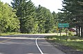
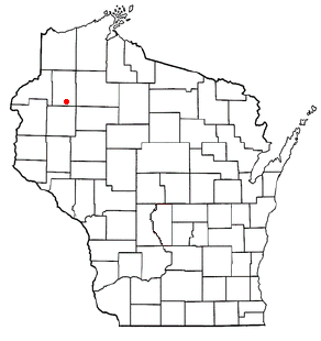
Washburn is a town in Clark County in the U.S. state of Wisconsin. The population was 304 at the 2000 census. The unincorporated community of Shortville is located in the town.

<span class="mw-page-title-main">Poynette, Wisconsin</span> Village in Wisconsin, United States

Poynette is a village in Columbia County, Wisconsin, United States. The population was 2,575 at the 2022 United States census. It is part of the Madison Metropolitan Statistical Area.

<span class="mw-page-title-main">Lancaster, Wisconsin</span> City in Wisconsin, United States

Lancaster is a city in and the county seat of Grant County, Wisconsin, United States. The population was 3,907 at the 2020 census.

<span class="mw-page-title-main">Markesan, Wisconsin</span> City in Wisconsin, United States

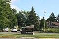
Markesan is a city in Green Lake County, Wisconsin, United States. The population was 1,476 at the 2010 census. The center of population of Wisconsin is located in Markesan.

<span class="mw-page-title-main">New Lisbon, Wisconsin</span> City in Wisconsin, United States

New Lisbon is a city in Juneau County, Wisconsin, United States. The population was 1,748 at the 2020 census.

<span class="mw-page-title-main">Amery, Wisconsin</span> City in Wisconsin, United States

Amery is a city in Polk County, Wisconsin, United States, along the Apple River. It is a part of Wisconsin's 7th congressional district. The population was 2,902 at the 2010 census. The city was named in honor of William Amery, a carpenter who held several local offices in the 1870s.

<span class="mw-page-title-main">Phillips, Wisconsin</span> City in Wisconsin, United States

Phillips is a city and the county seat of Price County, Wisconsin, United States. The population was 1,478 at the 2010 census.

<span class="mw-page-title-main">Galesville, Wisconsin</span> City in Wisconsin, United States

Galesville is a city in Trempealeau County, Wisconsin, United States. The population was 1,662 at the 2020 census. A dam on Beaver Creek is located at Galesville, forming Lake Marinuka north of the city. The mayor is Vince Howe.

<span class="mw-page-title-main">Osseo, Wisconsin</span> City in Wisconsin, United States

Osseo is a city located in Trempealeau County, Wisconsin, at the confluence of the North and South Forks of the Buffalo River. The population was 1,701 at the 2010 census.

<span class="mw-page-title-main">Westby, Wisconsin</span> City in Wisconsin, United States

Westby is a city in Vernon County, Wisconsin, United States. The population was 2,332 as of the 2020 census. The name "Westby" is a Norwegian name and literally translates to "Western city".

<span class="mw-page-title-main">Long Lake, Washburn County, Wisconsin</span> Town in Wisconsin, United States

Long Lake is a town in Washburn County, Wisconsin, United States. The population was 737 at the 2000 census. The unincorporated community of Nobleton is located in the town.

<span class="mw-page-title-main">Shell Lake, Wisconsin</span> City in Wisconsin, United States

Shell Lake is a city in Washburn County, Wisconsin, United States. The population was 1,347 at the 2010 census. It is the county seat of Washburn County.

Washburn is a town in Bayfield County, Wisconsin, United States. The population was 530 at the 2010 census. The City of Washburn is located just east of and adjacent to the town.

<span class="mw-page-title-main">Brillion, Wisconsin</span> City in Wisconsin, United States

Brillion is a city in Calumet County in the U.S. state of Wisconsin. The population was 3,538 as of 2024. The city is located within the Town of Brillion, though it is politically independent.

<span class="mw-page-title-main">Fairchild, Wisconsin</span> Village in Wisconsin, United States

Fairchild is a village in Eau Claire County, Wisconsin, United States. The population was 550 at the 2010 census. The village is located within the Town of Fairchild.

<span class="mw-page-title-main">Necedah, Wisconsin</span> Village in Wisconsin, United States

Necedah is a village in Juneau County, Wisconsin, United States. The population was 916 at the 2020 census. The village is located within the Town of Necedah.

Minong is a town in Washburn County, Wisconsin, United States. The population was 858 at the 2000 census. The Village of Minong is located within the town.

<span class="mw-page-title-main">Wautoma, Wisconsin</span> City in Wisconsin, United States

Wautoma is a city and the county seat of Waushara County, Wisconsin, United States. The population was 2,218 at the 2010 census.

References

  1. "2019 U.S. Gazetteer Files". United States Census Bureau. Retrieved August 7, 2020.
  2. 1 2 U.S. Geological Survey Geographic Names Information System: Washburn, Wisconsin
  3. 1 2 3 4 "2020 Decennial Census: Washburn city, Wisconsin". data.census.gov. U.S. Census Bureau. Retrieved July 15, 2022.
  4. 1 2 "U.S. Census website". United States Census Bureau . Retrieved January 31, 2008.
  5. 1 2 3 Wikisource-logo.svg One or more of the preceding sentences incorporates text from a publication now in the public domain :  Chisholm, Hugh, ed. (1911). "Washburn". Encyclopædia Britannica . Vol. 28 (11th ed.). Cambridge University Press. p. 344.
  6. "Washburn Wisconsin - History". Archived from the original on November 23, 2007. Retrieved November 11, 2007.
  7. Chicago and North Western Railway Company (1908). A History of the Origin of the Place Names Connected with the Chicago & North Western and Chicago, St. Paul, Minneapolis & Omaha Railways. p. 159.
  8. "US Gazetteer files: 2010, 2000, and 1990". United States Census Bureau. February 12, 2011. Retrieved April 23, 2011.
  9. "US Gazetteer files 2010". United States Census Bureau . Retrieved November 18, 2012.
  10. "Census of Population and Housing". Census.gov. Retrieved June 4, 2015.
  11. "U.S. Census website". United States Census Bureau . Retrieved November 18, 2012.
  12. "City of Washburn · City Council - City of Washburn". City of Washburn. Retrieved March 29, 2020.
  13. "Contact - City of Washburn". City of Washburn. Retrieved March 29, 2020.
  14. "Wisconsin election results". Lubar Center for Public Policy and Civic Education. Retrieved November 12, 2021.