Rhinelander, Wisconsin

Last updated

Rhinelander, Wisconsin
Rhinelander Wisconsin Downtown Looking East.jpg
Looking east at downtown Rhinelander with view of the Oneida County Courthouse dome
Oneida County Wisconsin Incorporated and Unincorporated areas Rhinelander Highlighted.svg
Location of Rhinelander in Oneida County, Wisconsin.
USA Wisconsin relief location map.svg
Red pog.svg
Rhinelander
Location of city in Wisconsin
Usa edcp relief location map.png
Red pog.svg
Rhinelander
Rhinelander (the United States)
Coordinates: 45°38′22″N89°24′44″W / 45.63944°N 89.41222°W / 45.63944; -89.41222
Country United States
State Flag of Wisconsin.svg  Wisconsin
County Oneida
Area
[1]
  Total8.68 sq mi (22.47 km2)
  Land8.42 sq mi (21.82 km2)
  Water0.25 sq mi (0.65 km2)
Elevation
[2]
1,549 ft (472 m)
Population
 (2020)
  Total8,285
  Density983.6/sq mi (379.8/km2)
Time zone UTC−6 (Central (CST))
  Summer (DST) UTC−5 (CDT)
Zip Code
54501
Area code(s) 715 & 534
FIPS code 55-67200 [3]
GNIS feature ID1572231 [2]
Website www.rhinelandercityhall.org

Rhinelander is a city in and the county seat of Oneida County, [4] Wisconsin, United States. The population was 8,285 at the 2020 census.

Contents

History

The area that eventually became the city of Rhinelander was originally called Pelican Rapids by early settlers, named for the stretch of rapids just above the convergence of the Wisconsin and Pelican Rivers. Around 1870, Anderson W. Brown of Stevens Point and Anson P. Vaughn traveled up the Wisconsin River to cruise timber for Brown's father, E. D. Brown. Upon arriving at the meeting point of the Wisconsin and Pelican Rivers at the site of John Curran's trading post, and seeing the high banks along the rapids and the excellent pine stands, Anderson Brown envisioned a mill town with a lumber mill powered by the waters of the Wisconsin River. Brown's vision did not come to fruition for some years, but after subsequent expeditions with others, including his brother and Rhinelander's first mayor, Webster Brown, the brothers managed to convince their father and uncle to purchase the land from the federal government and build a town. In its charter, the city was named Rhinelander after Frederic W. Rhinelander of New York, who was president of the Milwaukee, Lake Shore and Western Railway at the time. [5] This was part of a bid by the Brown brothers to induce the railroad to extend a spur to the location to further their lumbering business. Ultimately, after over 10 years of negotiations, the Brown family agreed to convey half their land holdings in the area to the railroad in exchange for a rail line to their future city. In 1882, the railroad line from present-day Monico to Rhinelander was completed, jump starting the development of Rhinelander as the commercial hub of the region. [6]

Geography

According to the United States Census Bureau, the city has a total area of 8.61 square miles (22.30 km2), of which, 8.34 square miles (21.60 km2) are land and 0.27 sq mi (0.70 km2) is covered by water. [7]

Climate

Rhinelander has a warm-summer humid continental climate (Köppen: Dfb). Because of its location, it is prone to Arctic cold snaps, and without the western Föhn winds its winter average is lower than other places in the US at 45 °N even at high elevations. Summers tend to be cooler with some degree of Lake Superior and Lake Michigan influence. Precipitation is still relatively distributed but not as much as other humid climates in the country. [8] [9]

Climate data for Rhinelander, Wisconsin (1991–2020 normals, extremes 1893–present)
MonthJanFebMarAprMayJunJulAugSepOctNovDecYear
Record high °F (°C)53
(12)
60
(16)
78
(26)
92
(33)
99
(37)
104
(40)
108
(42)
97
(36)
98
(37)
92
(33)
79
(26)
62
(17)
108
(42)
Mean daily maximum °F (°C)21.1
(−6.1)
26.0
(−3.3)
37.6
(3.1)
50.7
(10.4)
64.9
(18.3)
73.9
(23.3)
78.0
(25.6)
75.9
(24.4)
68.1
(20.1)
53.9
(12.2)
38.1
(3.4)
26.0
(−3.3)
51.2
(10.7)
Daily mean °F (°C)10.8
(−11.8)
13.9
(−10.1)
25.4
(−3.7)
38.7
(3.7)
52.6
(11.4)
62.1
(16.7)
66.3
(19.1)
64.3
(17.9)
56.3
(13.5)
43.3
(6.3)
29.4
(−1.4)
17.3
(−8.2)
40.0
(4.4)
Mean daily minimum °F (°C)0.4
(−17.6)
1.9
(−16.7)
13.2
(−10.4)
26.7
(−2.9)
40.3
(4.6)
50.3
(10.2)
54.5
(12.5)
52.6
(11.4)
44.6
(7.0)
32.8
(0.4)
20.7
(−6.3)
8.6
(−13.0)
28.9
(−1.7)
Record low °F (°C)−41
(−41)
−42
(−41)
−36
(−38)
−11
(−24)
18
(−8)
25
(−4)
31
(−1)
28
(−2)
21
(−6)
2
(−17)
−16
(−27)
−34
(−37)
−42
(−41)
Average precipitation inches (mm)1.22
(31)
1.16
(29)
1.80
(46)
2.97
(75)
3.77
(96)
4.52
(115)
4.39
(112)
3.50
(89)
4.12
(105)
3.38
(86)
1.95
(50)
1.58
(40)
34.36
(873)
Average snowfall inches (cm)12.0
(30)
12.3
(31)
7.5
(19)
7.4
(19)
0.1
(0.25)
0.0
(0.0)
0.0
(0.0)
0.0
(0.0)
0.0
(0.0)
1.1
(2.8)
7.0
(18)
14.8
(38)
62.2
(158)
Average precipitation days (≥ 0.01 in)10.57.98.610.813.112.711.310.711.412.810.210.9130.9
Average snowy days (≥ 0.1 in)9.16.84.32.40.10.00.00.00.00.74.78.636.7
Source: NOAA [10] [11]

Demographics

Historical population
CensusPop.Note
1890 2,658
1900 4,99888.0%
1910 5,63712.8%
1920 6,65418.0%
1930 8,01920.5%
1940 8,5016.0%
1950 8,7743.2%
1960 8,7900.2%
1970 8,218−6.5%
1980 7,873−4.2%
1990 7,427−5.7%
2000 7,7354.1%
2010 7,7980.8%
2020 8,2856.2%
U.S. Decennial Census [12] [13]

2020 census

As of the census of 2020, [14] the population was 8,285. The population density was 983.6 inhabitants per square mile (379.8/km2). There were 4,123 housing units at an average density of 489.5 per square mile (189.0/km2). The racial makeup of the city was 90.8% White, 1.6% Native American, 1.2% Black or African American, 0.8% Asian, 0.1% Pacific Islander, 0.8% from other races, and 4.7% from two or more races. Ethnically, the population was 2.5% Hispanic or Latino of any race.

2010 census

As of the census of 2010, [15] 7,798 people, 3,545 households, and 1,876 families resided in the city. The population density was 935.0 inhabitants per square mile (361.0/km2). The 3,981 housing units averaged 477.3 per square mile (184.3/km2). The racial makeup of the city was 95.2% White, 1.0% African American, 1.2% Native American, 0.7% Asian, 0.2% from other races, and 1.6% from two or more races. Hispanics or Latinos of any race were 1.3% of the population.

Of the 3,545 households, 26.9% had children under the age of 18 living with them, 34.6% were married couples living together, 13.5% had a female householder with no husband present, 4.9% had a male householder with no wife present, and 47.1% were not families. About 39.5% of all households were made up of individuals, and 17.1% had someone living alone who was 65 years of age or older. The average household size was 2.10 and the average family size was 2.79.

The median age in the city was 40 years; 21.2% of residents were under the age of 18; 9.5% were between the ages of 18 and 24; 25% were from 25 to 44; 25% were from 45 to 64; and 19.1% were 65 years of age or older. The gender makeup of the city was 47.0% male and 53.0% female.

2000 census

As of the census of 2000, [3] 7,735 people, 3,214 households, and 1,860 families resided in the city. The population density was 1,002.5 people per square mile (386.9/km2). The 3,430 housing units averaged 444.5 per square mile (171.5/km2). The racial makeup of the city was 96.83% White, 0.39% African American, 0.96% Native American, 0.32% Asian, 0.12% Pacific Islander, 0.23% from other races, and 1.15% from two or more races. Hispanics or Latinos of any race were 0.72% of the population.

Of the 3,214 households, 28.9% had children under the age of 18 living with them, 41.2% were married couples living together, 12.3% had a female householder with no husband present, and 42.1% were not families. About 36.3% of all households were made up of individuals, and 17.7% had someone living alone who was 65 years of age or older. The average household size was 2.23 and the average family size was 2.90.

In the city, the population was distributed as 23.4% under the age of 18, 8.3% from 18 to 24, 27.7% from 25 to 44, 20.1% from 45 to 64, and 20.5% who were 65 years of age or older. The median age was 39 years. For every 100 females, there were 84.1 males. For every 100 females age 18 and over, there were 80.3 males.

The median income for a household in the city was $29,622, and for a family was $37,629. Males had a median income of $29,750 versus $22,157 for females. The per capita income for the city was $16,047. About 9.4% of families and 12.2% of the population were below the poverty line, including 11.1% of those under age 18 and 9.3% of those age 65 or over.

Economy

Rhinelander is a commercial, industrial, and recreation hub for the Northwoods area of Wisconsin. Because of the forests, lakes, and trails in the area, it is both a summer and winter vacation destination. It has a paper mill and a hospital.

The Rhinelander area has numerous vacation destinations, offering fishing, boating, canoeing, kayaking, ATVing, mountain biking and hiking, hunting, golfing, cross country skiing and snowshoeing, snowmobiling, and bird watching. It also serves as a main shopping and lodging area for the Northwoods. A popular summer tourist destination is the Pioneer Park Historical Complex, which is open Memorial Day weekend through Labor Day weekend and features many interactive displays and spaces to explore Rhinelander's rich history, including the infamous hodag [16]

Arts and culture

A modern statue of the hodag on display in front of the Rhinelander Chamber of Commerce Hodag 002.jpg
A modern statue of the hodag on display in front of the Rhinelander Chamber of Commerce

Rhinelander is the home of the hodag, a folkloric green and white creature said to stalk the local woods. The hodag serves as mascot for the city and for Rhinelander High School and Northwoods Community Secondary School.

Museums

Parks and recreation

Golf

Government

Rhinelander is the county seat for Oneida County. Kristopher Hanus is the current mayor. [17]

Presidential elections results
Presidential elections results [18]
Year Republican Democratic Third parties
2020 45.8% 1,77551.8%2,0072.3% 91
2016 44.8% 1,50445.9%1,5409.2% 310
2012 36.8% 1,30361.5%2,1731.7% 60
2008 32.1% 1,24266.0%2,5541.9% 74
2004 42.4% 1,62256.3%2,1521.3% 49
2000 41.1% 1,36353.0%1,7575.9% 196

Education

Media

Rhinelander is home to NBC affiliate WJFW-TV. In addition to serving Rhinelander, WJFW-TV also serves the Wausau area. Conversely, Wausau's area stations, including CBS affiliate WSAW-TV and ABC affiliate WAOW, also serve Rhinelander. WXPR, a public radio station at 91.7 FM, is based in Rhinelander.

Infrastructure

Transportation

Major highways

US 8.svg
U.S. 8 runs eastbound to Crandon, Wisconsin. Westbound, US 8 routes to Prentice, Wisconsin.
WIS 17.svg
WIS 17 travels north to Eagle River, Wisconsin and south to Merrill, Wisconsin. This route is on the eastern side of Rhinelander.
WIS 47.svg
WIS 47 runs north to Woodruff, Wisconsin and runs south to Antigo, Wisconsin.

Airport

Rhinelander-Oneida County Airport (KRHI) serves Rhinelander and the surrounding Oneida County communities with both scheduled commercial jet service and general aviation services. Located two miles west of the city, the airport handles about 24,958 operations per year, with around 88% general aviation, 6% scheduled commercial air service, and 6% air taxi. The airport has a 6,800-ft concrete primary runway with approved ILS, GPS and VOR/DME approaches (runway 9-27) and a 5,201-ft asphalt crosswind runway with approved GPS approaches (runway 15-33). In addition, the Rhinelander VORTAC (RHI) navigational facility is located on the field. [21]

Notable people

Images

Related Research Articles

<span class="mw-page-title-main">Oneida County, Wisconsin</span> County in Wisconsin, United States

Oneida County is a county in the state of Wisconsin, United States. At the 2020 census, the population was 37,845. Its county seat is Rhinelander.

<span class="mw-page-title-main">Lincoln County, Wisconsin</span> County in Wisconsin, United States

Lincoln County is a county located in the U.S. state of Wisconsin. As of the 2020 census, the population was 28,415. Its county seat is Merrill. The county was created in 1875 and named after President Abraham Lincoln.

<span class="mw-page-title-main">Brown County, Wisconsin</span> County in Wisconsin, United States

Brown County is a county in the U.S. state of Wisconsin. As of the 2020 census, the population was 268,740, making it the fourth-most populous county in Wisconsin. The county seat is Green Bay. Brown County is part of the Green Bay, WI Metropolitan Statistical Area.

<span class="mw-page-title-main">De Pere, Wisconsin</span> City in Wisconsin, United States

De Pere is a city in Brown County, Wisconsin, United States. The population was 25,410 at the 2020 census. De Pere is part of the Green Bay Metropolitan Statistical Area.

<span class="mw-page-title-main">King, Lincoln County, Wisconsin</span> Town in Wisconsin, United States

King is a town in Lincoln County, Wisconsin, United States. The population was 855 at the 2010 census.

<span class="mw-page-title-main">Cassian, Wisconsin</span> Town in Wisconsin, United States

Cassian is a town in Oneida County, Wisconsin, United States. The population was 962 at the 2000 census. The unincorporated communities of Goodnow and Harshaw are located in the town.

<span class="mw-page-title-main">Hazelhurst, Wisconsin</span> Town in Wisconsin, United States

Hazelhurst is a town in Oneida County, Wisconsin, United States. The population was 1,258 at the 2018 census. The unincorporated community of Hazelhurst is located in the town.

<span class="mw-page-title-main">Lake Tomahawk, Wisconsin</span> Town in Wisconsin, United States

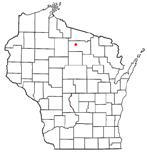
Lake Tomahawk is a town in Oneida County, Wisconsin, United States named for the adjacent freshwater lake of the same name. The population was 1,160 at the 2000 census. The census-designated place of Lake Tomahawk and the unincorporated community of Sunflower are located in the town.

<span class="mw-page-title-main">Little Rice, Wisconsin</span> Town in Wisconsin, United States

Little Rice is a town in Oneida County, Wisconsin, United States. The population was 314 at the 2000 census. The unincorporated community of McCord is located in the town.

<span class="mw-page-title-main">Lynne, Wisconsin</span> Town in Wisconsin, United States

Lynne is a town in Oneida County, Wisconsin, United States. The population was 210 at the 2000 census. The unincorporated communities of Clifford and Tripoli are located partially in the town.

<span class="mw-page-title-main">Monico, Wisconsin</span> Town in Wisconsin, United States

Monico is a town in Oneida County, Wisconsin, United States. The population was 260 at the 2020 census. The unincorporated community of Monico is located in the town.

<span class="mw-page-title-main">Newbold, Wisconsin</span> Town in Wisconsin, United States

Newbold is a town in Oneida County, Wisconsin, United States. The population was 2,710 at the 2000 census. Tom Doyle Lake and the unincorporated communities of McNaughton and Newbold are located in the town.

<span class="mw-page-title-main">Nokomis, Wisconsin</span> Town in Wisconsin, United States

Nokomis is a town in Oneida County, Wisconsin, United States. The population was 1,371 at the 2010 census.

<span class="mw-page-title-main">Pine Lake, Wisconsin</span> Town in Wisconsin, United States

Pine Lake is a town in Oneida County, Wisconsin. The population was 2,720 at the time of the 2000 census. The unincorporated community of Roosevelt is located in the town.

<span class="mw-page-title-main">Schoepke, Wisconsin</span> Town in Wisconsin, United States

Schoepke is a town in Oneida County, Wisconsin, United States. The population was 352 at the 2000 census. The unincorporated communities of Jennings, Lennox, Pelican Lake, and Pratt Junction are located in the town.

<span class="mw-page-title-main">Stella, Wisconsin</span> Town in Wisconsin, United States

Stella is a town in Oneida County, Wisconsin, United States. The population was 633 at the 2000 census. The unincorporated community of Starks is located within the town.

<span class="mw-page-title-main">Sugar Camp, Wisconsin</span> Town in Wisconsin, United States

Sugar Camp is a town in Oneida County, Wisconsin, United States. The population was 1,694 at the 2010 census. The unincorporated community of Sugar Camp is located in the town

Three Lakes is a town in Oneida County, Wisconsin, United States. The population was 2,131 at the 2010 census. The census-designated place of Three Lakes is located in the town. The unincorporated community of Clearwater Lake is also located in the town.

Woodruff is a town in Oneida County, Wisconsin, United States. The population was 2,055 at the 2010 census. The census-designated place of Woodruff is located in the town.

<span class="mw-page-title-main">Eagle River, Wisconsin</span> City in Wisconsin, United States

Eagle River is a city in Vilas County, Wisconsin, United States. The population was 1,628 at the 2020 census. It is the county seat of Vilas County. Because of the many lakes in the area, the city is a popular vacation and retirement destination. The area contains many condominiums, seasonal vacation homes, and hunting cabins.

References

  1. "2019 U.S. Gazetteer Files". United States Census Bureau. Retrieved August 7, 2020.
  2. 1 2 "US Board on Geographic Names". United States Geological Survey. October 25, 2007. Retrieved January 31, 2008.
  3. 1 2 "U.S. Census website". United States Census Bureau . Retrieved January 31, 2008.
  4. "Find a County". National Association of Counties. Retrieved June 7, 2011.
  5. Chicago and North Western Railway Company (1908). A History of the Origin of the Place Names Connected with the Chicago & North Western and Chicago, St. Paul, Minneapolis & Omaha Railways. p. 117.
  6. Olsen, T. V. (1983). Birth of a City. Rhinelander, Wisconsin: Pineview Publishing.
  7. "US Gazetteer files 2010". United States Census Bureau. Archived from the original on January 25, 2012. Retrieved November 18, 2012.
  8. "Rhinelander, Wisconsin Travel Weather Averages (Weatherbase)". Weatherbase. Retrieved August 7, 2019.
  9. "Solargis :: iMaps". solargis.info. Retrieved August 7, 2019.
  10. "NowData - NOAA Online Weather Data". National Oceanic and Atmospheric Administration. Retrieved June 13, 2021.
  11. "Station: Rhinelander, WI". U.S. Climate Normals 2020: U.S. Monthly Climate Normals (1991-2020). National Oceanic and Atmospheric Administration. Retrieved June 13, 2021.
  12. "Census of Population and Housing". Census.gov. Retrieved June 4, 2015.
  13. "United States Census Bureau QuickFacts". United States Census Bureau. Retrieved February 26, 2022.
  14. "2020 Decennial Census: Rhinelander city, Wisconsin". data.census.gov. U.S. Census Bureau. Retrieved July 1, 2022.
  15. "U.S. Census website". United States Census Bureau . Retrieved November 18, 2012.
  16. "Rhinelander and the Hodag", woodycrops.tennessee.edu, retrieved April 25, 2024
  17. "Mayor and City Council". Rhinelander City, Wisconsin. Retrieved June 14, 2022.
  18. "Wisconsin election results". Lubar Center for Public Policy and Civic Education. Retrieved November 12, 2021.
  19. "Zion Lutheran School".
  20. "Rhinelander School of the Arts". Liberty Grove Paper Arts. Retrieved June 14, 2022.
  21. "AirNAV - KRHI", AirNAV.com, accessed September 14, 2015.
  22. Doug Sterner. "MOH Citation for Deming Bronson". homeofheroes.com.
  23. "Nicolet College-Elizabeth Burmaster named new president of Nicolet College". Archived from the original on August 13, 2014. Retrieved May 9, 2013.
  24. "Darrell Einertson Statistics and History - Baseball-Reference.com". Baseball-Reference.com.
  25. Eau Claire Leader Telegram-obituaries-Rita Gross
  26. "Walt Kichefski". Pro-Football-Reference.com.
  27. Garcia, Ana (November 1, 2016). "-'VAMPCHICK' DISCUSSES DOUBLE MURDER FROM BEHIND BARS". Crime Watchers. Retrieved January 15, 2017.
  28. 'Wisconsin Blue Book 1933,' Biographical Sketch of Neil McEachin, pg. 234
  29. Lawrence Kestenbaum. "The Political Graveyard: Index to Politicians: Okeefer to Olchin". politicalgraveyard.com.
  30. "Richard J. Saykally". University of California-Berkeley. Retrieved April 16, 2018.