Medford, Wisconsin

Last updated

Medford, Wisconsin
City
Medford Wisconsin downtown.jpg
The Little Black River in foreground, then the old depot, then a bit of the downtown, and the Taylor County Courthouse at top middle.
Taylor County Wisconsin Incorporated and Unincorporated areas Medford Highlighted.svg
Location of Medford in Taylor County, Wisconsin.
USA Wisconsin relief location map.svg
Red pog.svg
Medford
Location in Wisconsin
Usa edcp relief location map.png
Red pog.svg
Medford
Medford (the United States)
Coordinates: 45°8′17″N90°20′43″W / 45.13806°N 90.34528°W / 45.13806; -90.34528
CountryUnited States
StateFlag of Wisconsin.svg  Wisconsin
County Taylor
Area
[1]
  Total4.52 sq mi (11.71 km2)
  Land4.49 sq mi (11.64 km2)
  Water0.03 sq mi (0.07 km2)
Population
 (2020) [2]
  Total4,349
  Density968.0/sq mi (373.7/km2)
Time zone UTC-6 (Central (CST))
  Summer (DST) UTC-5 (CDT)
ZIP codes
54451
Area code 715
FIPS code 55-50425
Website citymedfordwi.com

Medford is a city and county seat of Taylor County, in north-central Wisconsin, United States. The population was 4,349 at the 2020 census. [2] The city is located mostly within the boundaries of the Town of Medford.

Contents

History

Medford is located on historic Ojibwe forest land acquired by the United States in the 1837 Treaty of St. Peters. In 1864, the federal government authorized a grant of some 837,000 acres (1,308 sq mi; 3,390 km2) of this land to subsidize railway construction through the area. The Wisconsin Central Railroad Company, controlled by Boston financier Gardner Colby, obtained the land grant and constructed the railroad in the 1870s. [3] The railroad company and a local lumber milling company laid out the city of Medford in 1875 and sold lots for twenty-five dollars each. [4] The railroad named the new settlement after Medford, Massachusetts, the hometown of a railroad official. [5] Medford shipped over 1.5 million board feet of lumber by rail within a year of its establishment, [4] and the area was soon clear cut for farming. [6]

The Wisconsin Legislature organized Taylor County in 1875 and named Medford the county seat, leading to a dispute between the Wisconsin Central Railroad and the mill company over the location of the courthouse. The Taylor County Courthouse was ultimately constructed on land donated by the railroad company. [4] [7]

In the 1960s and 1970s, Medford hosted an annual Mink festival, celebrating the town's claim to be the "Mink capital of the world." Fur farms in the area make Taylor County a top mink producer in North America. During the COVID-19 pandemic, in 2020, thousands of mink died of the virus after having contracted it from human workers. [8]

Geography

Medford is located at 45°8′16″N90°20′42″W / 45.13778°N 90.34500°W / 45.13778; -90.34500 (45.137994, −90.345227). [9]

According to the United States Census Bureau, the city has a total area of 4.52 square miles (11.71 km2), of which, 4.49 square miles (11.63 km2) is land and 0.03 square miles (0.08 km2) is water. [10]

Climate

Climate data for Medford, Wisconsin, 1991–2020 normals, extremes 1893present
MonthJanFebMarAprMayJunJulAugSepOctNovDecYear
Record high °F (°C)52
(11)
60
(16)
78
(26)
89
(32)
101
(38)
103
(39)
104
(40)
100
(38)
99
(37)
89
(32)
73
(23)
60
(16)
104
(40)
Mean maximum °F (°C)37.8
(3.2)
44.1
(6.7)
59.1
(15.1)
74.7
(23.7)
82.9
(28.3)
87.3
(30.7)
88.5
(31.4)
87.9
(31.1)
83.7
(28.7)
74.6
(23.7)
57.4
(14.1)
42.7
(5.9)
90.7
(32.6)
Mean daily maximum °F (°C)20.6
(−6.3)
25.8
(−3.4)
38.1
(3.4)
52.3
(11.3)
65.8
(18.8)
74.8
(23.8)
78.8
(26.0)
77.0
(25.0)
69.2
(20.7)
54.8
(12.7)
38.7
(3.7)
25.9
(−3.4)
51.8
(11.0)
Daily mean °F (°C)11.4
(−11.4)
15.7
(−9.1)
28.0
(−2.2)
41.5
(5.3)
54.5
(12.5)
64.0
(17.8)
68.0
(20.0)
66.2
(19.0)
58.3
(14.6)
44.7
(7.1)
30.9
(−0.6)
18.1
(−7.7)
41.8
(5.4)
Mean daily minimum °F (°C)2.3
(−16.5)
5.6
(−14.7)
17.9
(−7.8)
30.6
(−0.8)
43.3
(6.3)
53.3
(11.8)
57.2
(14.0)
55.3
(12.9)
47.3
(8.5)
34.5
(1.4)
23.0
(−5.0)
10.3
(−12.1)
31.7
(−0.2)
Mean minimum °F (°C)−19.1
(−28.4)
−15.7
(−26.5)
−5.3
(−20.7)
16.0
(−8.9)
29.0
(−1.7)
39.1
(3.9)
46.4
(8.0)
43.6
(6.4)
31.7
(−0.2)
20.9
(−6.2)
5.0
(−15.0)
−11.6
(−24.2)
−23.0
(−30.6)
Record low °F (°C)−40
(−40)
−45
(−43)
−40
(−40)
−4
(−20)
16
(−9)
22
(−6)
34
(1)
30
(−1)
11
(−12)
2
(−17)
−19
(−28)
−31
(−35)
−45
(−43)
Average precipitation inches (mm)1.09
(28)
1.10
(28)
1.67
(42)
2.98
(76)
3.68
(93)
4.84
(123)
4.02
(102)
4.30
(109)
3.90
(99)
3.25
(83)
1.94
(49)
1.43
(36)
34.20
(869)
Average snowfall inches (cm)12.8
(33)
13.9
(35)
6.0
(15)
4.0
(10)
0.1
(0.25)
0.0
(0.0)
0.0
(0.0)
0.0
(0.0)
0.0
(0.0)
0.5
(1.3)
4.5
(11)
15.2
(39)
57.0
(145)
Average precipitation days (≥ 0.01 in)9.77.28.111.012.412.411.010.611.311.48.910.3124.3
Average snowy days (≥ 0.1 in)6.85.12.81.60.10.00.00.00.00.32.26.825.7
Source 1: NOAA [11]
Source 2: National Weather Service [12]

Demographics

Historical population
CensusPop.Note
1880 504
1890 1,193136.7%
1900 1,75847.4%
1910 1,8465.0%
1920 1,8811.9%
1930 1,9182.0%
1940 2,36123.1%
1950 2,79918.6%
1960 3,26016.5%
1970 3,4546.0%
1980 4,03516.8%
1990 4,2836.1%
2000 4,3501.6%
2010 4,326−0.6%
2020 4,3490.5%
U.S. Decennial Census [13]

2020 census

As of the census of 2020, [2] the population was 4,349. The population density was 968.0 inhabitants per square mile (373.7/km2). There were 2,163 housing units at an average density of 481.4 per square mile (185.9/km2). The racial makeup of the city was 92.3% White, 0.7% Asian, 0.7% Black or African American, 0.3% Native American, 2.1% from other races, and 4.0% from two or more races. Ethnically, the population was 4.6% Hispanic or Latino of any race.

2010 census

As of the census [14] of 2010, there were 4,326 people, 1,982 households, and 1,094 families residing in the city. The population density was 959.2 inhabitants per square mile (370.3/km2). There were 2,127 housing units at an average density of 471.6 per square mile (182.1/km2). The racial makeup of the city was 97.0% White, 0.5% African American, 0.4% Native American, 0.6% Asian, 0.2% from other races, and 1.4% from two or more races. Hispanic or Latino of any race were 1.2% of the population.

There were 1,982 households, of which 26.0% had children under the age of 18 living with them, 40.6% were married couples living together, 10.0% had a female householder with no husband present, 4.5% had a male householder with no wife present, and 44.8% were non-families. 39.4% of all households were made up of individuals, and 19.6% had someone living alone who was 65 years of age or older. The average household size was 2.10 and the average family size was 2.79.

The median age in the city was 43 years. 22.2% of residents were under the age of 18; 7.7% were between the ages of 18 and 24; 22.6% were from 25 to 44; 25.7% were from 45 to 64; and 21.7% were 65 years of age or older. The gender makeup of the city was 47.5% male and 52.5% female.

2000 census

As of the census [15] of 2000, there were 4,350 people. The population density was 1,243.9 people per square mile (479.9/km2). There were 2,034 housing units at an average density of 581.6 per square mile (224.4/km2). The racial makeup of the city was 98.69% White, 0.11% Black or African American, 0.18% Native American, 0.18% Asian, 0.02% from other races, and 0.80% from two or more races. 0.57% of the population were Hispanic or Latino of any race.

There were 1,947 households, out of which 27.2% had children under the age of 18 living with them, 45.9% were married couples living together, 9.0% had a female householder with no husband present, and 41.9% were non-families. 36.2% of all households were made up of individuals, and 16.8% had someone living alone who was 65 years of age or older. The average household size was 2.17 and the average family size was 2.86.

In the city, the population was spread out, with 23.2% under the age of 18, 8.6% from 18 to 24, 27.1% from 25 to 44, 19.2% from 45 to 64, and 21.9% who were 65 years of age or older. The median age was 39 years. For every 100 females, there were 91.0 males. For every 100 females age 18 and over, there were 86.6 males.

The median income for a household in the city was $35,278, and the median income for a family was $47,045. Males had a median income of $31,840 versus $23,955 for females. The per capita income for the city was $19,962. About 4.3% of families and 9.1% of the population were below the poverty line, including 12.9% of those under age 18 and 11.9% of those age 65 or over.

Government

City hall in Medford, Wisconsin in November 2013 Medford City Hall.JPG
City hall in Medford, Wisconsin in November 2013

Medford has a mayor-council form of government. The mayor is elected for a two-year term. Each of the four city districts is represented by an alderperson, with two elected to two-year terms in alternating years. [16]

Recreation

Medford City Park

Medford City Park, the city's principal community park, was established in 1890 and consists of 100 acres (0.40 km2). An extensive redevelopment program for the park was initiated in 1979. Equipment and facilities include an outdoor swimming pool, with dressing area and wading pool, playground equipment, four park shelters, two restroom facilities, one tennis court, four volleyball courts, one basketball court, two softball fields, a concession stand, nine recreation vehicle camping facilities, a skatepark, the "River Walk" which parallels the Black River for the majority of its way through the city, and picnic and barbecue areas along the walkway. The 19-acre (7.7 ha) Medford millpond has been periodically dredged of sedimentation in an effort to improve fish habitat in the pond. [17]

Grahl Park

Grahl Park consists of 7 acres (0.028 km2) and is designed as an integral part of a residential subdivision and has pedestrian access points to surrounding neighborhoods from the west, north, and east. It has a Little League baseball field, basketball court, restroom facilities, park shelter, and playground equipment. [18]

Pine Line Trail

The southern trailhead of Wisconsin's Pine Line Trail, lies within Medford. The Pine Line Trail is an unpaved, multi-use rail-trail extending just over 26 miles (42 km) to Prentice. [19]

Curling Club

The Medford Curling Club is located on the south side of the city. The Mixed National Championships were most recently held here in 2009. [20] There are four sheets of ice, a changing room, and a warming area inside.

Golf courses

The city has two golf courses, the Tee-Hi Golf Course and the Black River Golf Club.

Transportation

Major highways

WIS 13.svg
WIS 13 travels north to Prentice, Wisconsin and south to Stetsonville, Wisconsin.
WIS 64.svg
WIS 64 travels east to Merrill, Wisconsin and west to Gilman, Wisconsin.

Airport

Medford is served by the Taylor County Airport (KMDZ). It is located approximately three miles southeast of Medford. The airport handles approximately 7,000 operations per year, with roughly 93% general aviation and 7% air taxi. The airport has two asphalt runways; a 6,000-foot runway with approved GPS approaches (Runway 9–27) and a 4,435-foot crosswind runway, also with GPS approaches, (Runway 16–34). [21]

Media

WKEB / WIGM studios WKEB 99.3 WIGM 1490.jpg
WKEB / WIGM studios

AM radio

FM radio

Newspaper

Education

Primary

Secondary

Post-secondary

Health care

Aspirus Medford Hospital is a health care organization that operates a hospital, clinics, senior care facilities, and a skilled nursing care and rehabilitation facility in the Medford area. Featuring and extensive renovation done within the last 10 years, Memorial Health Center has been promoted to feature an Aspirus Heart and Vascular Institute.

Notable people

Images

Related Research Articles

<span class="mw-page-title-main">Taylor County, Wisconsin</span> County in Wisconsin, United States

Taylor County is a county in the U.S. state of Wisconsin. As of the 2020 census, the population was 19,913. Its county seat is Medford. It is mostly rural, lying roughly where corn and dairy farms to the south give way to forest and swamp to the north.

<span class="mw-page-title-main">Vienna, Wisconsin</span> Town in Wisconsin, United States

Vienna is a town in Dane County, Wisconsin, United States. The population was 1,666 at the 2020 census. The unincorporated community of Norway Grove is located in the town.

<span class="mw-page-title-main">Forest, Fond du Lac County, Wisconsin</span> Town in Wisconsin, United States

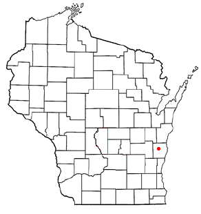
Forest is a town in Fond du Lac County, Wisconsin, United States. The population was 1,108 at the 2000 census. The unincorporated communities of Banner, Dotyville, and Graham Corners are located in the town.

<span class="mw-page-title-main">Brodhead, Wisconsin</span> City in Wisconsin, United States

Brodhead is a city in Green and Rock counties in the U.S. state of Wisconsin. The population was 3,274 at the 2020 census. In February 2000, the city annexed a portion of land from the Town of Spring Valley in Rock County.

<span class="mw-page-title-main">Markesan, Wisconsin</span> City in Wisconsin, United States

Markesan is a city in Green Lake County, Wisconsin, United States. The population was 1,476 at the 2010 census. The center of population of Wisconsin is located in Markesan.

<span class="mw-page-title-main">Ogema, Wisconsin</span> Town in Wisconsin, United States

Ogema is a town in Price County, Wisconsin, United States. The population was 882 at the 2000 census. The unincorporated community of Ogema is located in the town.

<span class="mw-page-title-main">Shawano, Wisconsin</span> City in Wisconsin, United States

Shawano is a city and the county seat of Shawano County, Wisconsin, United States. The population was 9,243 at the 2020 census.

<span class="mw-page-title-main">Chelsea, Wisconsin</span> Town in Wisconsin, United States

Chelsea is a town in Taylor County, Wisconsin, United States. The population was 113 at the 2010 census. The census-designated places of Chelsea and Whittlesey are located in the town.

<span class="mw-page-title-main">Hammel, Wisconsin</span> Town in Wisconsin, United States

Hammel is a town in Taylor County, Wisconsin, United States. The population was 735 at the 2000 census. The unincorporated community of Murat is located in the town.

<span class="mw-page-title-main">Bloomfield, Walworth County, Wisconsin</span> Town in Wisconsin, United States

Bloomfield is a town in Walworth County, Wisconsin, United States. The population was 1,778 at the 2020 census. The village of Bloomfield was formed from part of the town on December 20, 2011. The census-designated place of Lake Ivanhoe and unincorporated community of North Bloomfield are located in the town.

<span class="mw-page-title-main">Lyons, Wisconsin</span> Town in Wisconsin, United States

Lyons is a town in Walworth County, Wisconsin, United States. The population was 3,648 at the 2020 census. The unincorporated communities of Lyons and Springfield are located within the town.

<span class="mw-page-title-main">Abbotsford, Wisconsin</span> City in Wisconsin, United States

Abbotsford is a city in Clark (mostly) and Marathon counties in the U.S. state of Wisconsin. The population was 2,275 at the 2020 census. Of this, 1,665 were in Clark County, and 610 were in Marathon County. Abbotsford is nicknamed "Wisconsin's First City" due to its alphabetical place on a list of Wisconsin cities.

<span class="mw-page-title-main">Plymouth, Sheboygan County, Wisconsin</span> Town in Wisconsin, United States

Plymouth is a town in Sheboygan County, Wisconsin. The population was 3,115 at the time of the 2000 census. It is included in the Sheboygan, Wisconsin Metropolitan Statistical Area. The City of Plymouth is located within the town, but is politically independent. The unincorporated community of New Paris is also located in the town.

<span class="mw-page-title-main">Adams, Wisconsin</span> City in Wisconsin, United States

Adams is a city in Adams County in the U.S. state of Wisconsin. The population was 1,761 at the 2020 census. The city is located within the Town of Adams.

<span class="mw-page-title-main">Chilton (town), Wisconsin</span>

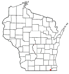
Chilton is a town in Calumet County in the U.S. state of Wisconsin. The population was 1,143 at the 2010 census. The City of Chilton is located partially within the town. The unincorporated community of Brant is located in the town.

<span class="mw-page-title-main">Beaver Dam, Wisconsin</span> City in Wisconsin, United States

Beaver Dam is a city in Dodge County, Wisconsin, United States, along Beaver Dam Lake and the Beaver Dam River. The population was 16,708 at the 2020 census, making it the largest city primarily located in Dodge County. It is the principal city of the Beaver Dam Micropolitan Statistical area which is included in the larger Milwaukee–Waukesha–Racine CSA. The city is adjacent to the Town of Beaver Dam.

<span class="mw-page-title-main">Milton, Wisconsin</span> City in Wisconsin, United States

Milton is a city in Rock County, Wisconsin, United States. The population was 5,716 at the 2020 census.

<span class="mw-page-title-main">Medford (town), Wisconsin</span> Town in Wisconsin, United States

Medford is a town in Taylor County, Wisconsin, United States. The population was 2,216 at the 2000 census. The City of Medford lies mostly within the town boundaries.

<span class="mw-page-title-main">Pewaukee, Wisconsin</span> City in Wisconsin, United States

Pewaukee is a city in Waukesha County, Wisconsin. The population was 15,914 at the 2020 census. The Village of Pewaukee, which was incorporated out of the town before it incorporated as a city, is surrounded by the city.

<span class="mw-page-title-main">Coloma, Wisconsin</span> Village in Wisconsin, United States

Coloma is a village in Waushara County, Wisconsin, United States. The population was 450 at the 2010 census. The village is located within the Town of Coloma. Coloma is home of the annual Coloma Chicken Chew, held at the end of June.

References

  1. "2019 U.S. Gazetteer Files". United States Census Bureau. Retrieved August 7, 2020.
  2. 1 2 3 "2020 Decennial Census: Medford city, Wisconsin". data.census.gov. U.S. Census Bureau. Retrieved August 1, 2022.
  3. Hudson, John C. (1997). "The Creation of Towns in Wisconsin". In Robert Clifford Ostergren; Thomas R. Vale (eds.). Wisconsin Land and Life. Madison : University of Wisconsin Press. pp. 209–210. ISBN   978-0-585-08113-7.
  4. 1 2 3 History of Northern Wisconsin. Chicago: Western Historical Company. 1881. pp. 1022–1025.
  5. Chicago and North Western Railway Company (1908). A History of the Origin of the Place Names Connected with the Chicago & North Western and Chicago, St. Paul, Minneapolis & Omaha Railways. p. 164.
  6. Boelter, Joseph M.; Stacy S. Eichner; Angela M. Elg; William D. Fiala; Richard M. Johannes (July 2005). "Soil Survey of Taylor County, Wisconsin" (PDF). U.S. Department of Agriculture, Natural Resources Conservation Service, and Forest Service. pp. 11–15. Retrieved August 1, 2022.
  7. Wisconsin Encyclopedia By Federal Writers' Project of the Works Progress Administration, Jennifer L. Herman page 402
  8. DeRosa, Claire; January 30, WisconsinWatch org (January 30, 2021). "Wisconsin's No. 1 mink farming industry now seen as a COVID-19 risk". WisconsinWatch.org. Retrieved January 9, 2022.{{cite web}}: CS1 maint: numeric names: authors list (link)
  9. "US Gazetteer files: 2010, 2000, and 1990". United States Census Bureau. February 12, 2011. Retrieved April 23, 2011.
  10. "2020 Gazetteer Files". census.gov. U.S. Census Bureau. Retrieved August 1, 2022.
  11. "U.S. Climate Normals Quick Access – Station: Medford, WI". National Oceanic and Atmospheric Administration. Retrieved March 5, 2023.
  12. "NOAA Online Weather Data – NWS La Crosse". National Weather Service. Retrieved March 5, 2023.
  13. "Census of Population and Housing". Census.gov. Retrieved June 4, 2015.
  14. "U.S. Census website". United States Census Bureau . Retrieved November 18, 2012.
  15. "U.S. Census website". United States Census Bureau . Retrieved January 31, 2008.
  16. Medford, Wisconsin
  17. "Medford, Wisconsin --". Archived from the original on October 27, 2010. Retrieved March 30, 2020.
  18. [ dead link ]
  19. "Pine Line / Price-Taylor Rail Trail".
  20. "Action gets underway in Wisconsin". United States Curling Association. March 17, 2009. Retrieved 2011-02-07.
  21. "AirNav: Airport Information".
  22. 'Wisconsin Blue Book 1931,' Biographical Sketch of John Gamper, pg. 242
  23. 'Wisconsin Blue Book 1919,' Biographical Sketch of L. W. Gibson, pg. 504
  24. 'Wisconsin Blue Book 1933,' Biographical Sketch of Anthony J. Opachen, pg. 258
  25. 'Wisconsin Blue Book 1885,' Biographical Sketch of John K. Parish, pg. 426
  26. "Tombstone Pizza co-founder Joseph Simek dies". Green Bay Press Gazette . February 21, 2013. Retrieved March 17, 2013.
  27. Uebelherr, Jay (February 20, 2013). "Joseph Simek was a founder of Tombstone Pizza". Milwaukee Journal Sentinel . Retrieved March 17, 2013.
  28. 'Wisconsin Blue Book 2011–2012,' Biographical Sketch of Scott Suder, pg. 65
  29. 'Wisconsin Blue Book 1891,' Biographical Sketch of Clinton Textor, pg. 594
  30. 'Wisconsin Blue Book 1913,' Biographical Sketch of Elias L. Urquhart, pg. 685