Lancaster, Wisconsin | |
---|---|
Nickname: City of the Dome | |
Coordinates: 42°50′55″N90°42′38″W / 42.84861°N 90.71056°W | |
Country | United States |
State | Wisconsin |
County | Grant |
Named for | Lancaster, Pennsylvania |
Area | |
• Total | 3.01 sq mi (7.80 km2) |
• Land | 3.01 sq mi (7.80 km2) |
• Water | 0.00 sq mi (0.00 km2) |
Elevation | 1,099 ft (335 m) |
Population | |
• Total | 3,907 |
• Density | 1,298.9/sq mi (501.5/km2) |
Time zone | UTC-6 (Central (CST)) |
• Summer (DST) | UTC-5 (CDT) |
ZIP Code | 53813 |
Area code | 608 |
FIPS code | 55-42250 [4] |
GNIS feature ID | 1567823 [2] |
Website | City of Lancaster official website |
Lancaster is a city in and the county seat of Grant County, Wisconsin, United States. [5] The population was 3,907 at the 2020 census. [3]
Lancaster originated as a planned community to serve as the county seat for Grant County. Anticipating the county's establishment in 1836, Major Glendower M. Price, a Cassville merchant and land speculator, purchased the site of Lancaster for its central location in the county. Major Price platted the town on a compass-aligned grid in 1837, reserving a large central square for the new county government. He was persuaded to name the city Lancaster by a relative who migrated from Lancaster, Pennsylvania. [6] Maj. Price and Daniel Banfill contracted to construct the first county courthouse, which stood on the square from 1838–1851. A second courthouse was constructed in 1852–1853 and enlarged in 1865. [7] The present, third courthouse was constructed on the site in 1902. [8]
Pleasant Ridge, one of the first African-American communities in Wisconsin, was founded just outside Lancaster by the Shepard family in 1849 and settled in the 1850s. Lancaster was the home of the first governor of Wisconsin, Nelson Dewey.
Lancaster is located at 42°50′55″N90°42′38″W / 42.848505°N 90.710430°W (42.848505, −90.710430). [9] Lancaster is located in the unglaciated "Driftless Area" of southwest Wisconsin whose topography is strikingly different from that of the rest of the state.
According to the United States Census Bureau, the city has a total area of 3.01 square miles (7.80 km2), all of it land. [10]
Climate data for Lancaster 4 WSW, Wisconsin (1991–2020 normals, extremes 1893–present) | |||||||||||||
---|---|---|---|---|---|---|---|---|---|---|---|---|---|
Month | Jan | Feb | Mar | Apr | May | Jun | Jul | Aug | Sep | Oct | Nov | Dec | Year |
Record high °F (°C) | 60 (16) | 71 (22) | 84 (29) | 95 (35) | 104 (40) | 100 (38) | 108 (42) | 103 (39) | 100 (38) | 94 (34) | 77 (25) | 68 (20) | 108 (42) |
Mean daily maximum °F (°C) | 25.3 (−3.7) | 29.9 (−1.2) | 42.9 (6.1) | 56.7 (13.7) | 68.3 (20.2) | 77.4 (25.2) | 80.9 (27.2) | 79.1 (26.2) | 72.2 (22.3) | 59.2 (15.1) | 43.8 (6.6) | 31.0 (−0.6) | 55.6 (13.1) |
Daily mean °F (°C) | 17.1 (−8.3) | 21.4 (−5.9) | 33.8 (1.0) | 46.6 (8.1) | 58.1 (14.5) | 67.8 (19.9) | 71.4 (21.9) | 69.5 (20.8) | 61.9 (16.6) | 49.2 (9.6) | 35.6 (2.0) | 23.5 (−4.7) | 46.3 (7.9) |
Mean daily minimum °F (°C) | 8.9 (−12.8) | 12.9 (−10.6) | 24.8 (−4.0) | 36.5 (2.5) | 47.9 (8.8) | 58.2 (14.6) | 61.8 (16.6) | 59.8 (15.4) | 51.6 (10.9) | 39.3 (4.1) | 27.5 (−2.5) | 16.0 (−8.9) | 37.1 (2.8) |
Record low °F (°C) | −31 (−35) | −31 (−35) | −22 (−30) | 6 (−14) | 23 (−5) | 35 (2) | 42 (6) | 34 (1) | 20 (−7) | 3 (−16) | −15 (−26) | −27 (−33) | −31 (−35) |
Average precipitation inches (mm) | 1.20 (30) | 1.29 (33) | 1.99 (51) | 3.80 (97) | 4.39 (112) | 5.93 (151) | 5.03 (128) | 3.86 (98) | 4.03 (102) | 2.90 (74) | 2.37 (60) | 1.70 (43) | 38.49 (978) |
Average snowfall inches (cm) | 10.0 (25) | 8.9 (23) | 4.9 (12) | 1.6 (4.1) | 0.2 (0.51) | 0.0 (0.0) | 0.0 (0.0) | 0.0 (0.0) | 0.0 (0.0) | 0.5 (1.3) | 2.6 (6.6) | 8.7 (22) | 37.4 (95) |
Average precipitation days (≥ 0.01 in) | 8.3 | 8.0 | 9.7 | 11.2 | 12.9 | 12.3 | 10.0 | 9.8 | 9.1 | 9.1 | 8.2 | 9.3 | 117.9 |
Average snowy days (≥ 0.1 in) | 6.1 | 5.9 | 3.5 | 1.2 | 0.1 | 0.0 | 0.0 | 0.0 | 0.0 | 0.3 | 1.9 | 5.8 | 24.8 |
Source: NOAA [11] [12] |
Census | Pop. | Note | %± |
---|---|---|---|
1880 | 1,069 | — | |
1890 | 1,543 | 44.3% | |
1900 | 2,403 | 55.7% | |
1910 | 2,329 | −3.1% | |
1920 | 2,485 | 6.7% | |
1930 | 2,432 | −2.1% | |
1940 | 2,963 | 21.8% | |
1950 | 3,266 | 10.2% | |
1960 | 3,703 | 13.4% | |
1970 | 3,756 | 1.4% | |
1980 | 4,076 | 8.5% | |
1990 | 4,192 | 2.8% | |
2000 | 4,070 | −2.9% | |
2010 | 3,868 | −5.0% | |
2020 | 3,907 | 1.0% | |
U.S. Decennial Census [13] |
As of the census of 2020, [3] the population was 3,907. The population density was 1,298.9 inhabitants per square mile (501.5/km2). There were 1,800 housing units at an average density of 598.4 per square mile (231.0/km2). The racial makeup of the city was 95.3% White, 0.8% Black or African American, 0.5% Asian, 0.5% from other races, and 2.8% from two or more races. Ethnically, the population was 1.4% Hispanic or Latino of any race.
As of the census [14] of 2010, there were 3,868 people, 1,659 households, and 1,037 families living in the city. The population density was 1,272.4 inhabitants per square mile (491.3/km2). There were 1,805 housing units at an average density of 593.8 per square mile (229.3/km2). The racial makeup of the city was 98.3% White, 0.5% African American, 0.2% Native American, 0.5% Asian, 0.3% from other races, and 0.3% from two or more races. Hispanic or Latino of any race were 0.8% of the population.
There were 1,659 households, of which 28.3% had children under the age of 18 living with them, 49.1% were married couples living together, 9.3% had a female householder with no husband present, 4.0% had a male householder with no wife present, and 37.5% were non-families. 32.4% of all households were made up of individuals, and 16.6% had someone living alone who was 65 years of age or older. The average household size was 2.27 and the average family size was 2.87.
The median age in the city was 41.2 years. 23.6% of residents were under the age of 18; 7.4% were between the ages of 18 and 24; 23.1% were from 25 to 44; 26.1% were from 45 to 64; and 19.8% were 65 years of age or older. The gender makeup of the city was 47.4% male and 52.6% female.
As of the census [4] of 2000, there were 4,070 people, 1,706 households, and 1,079 families living in the city. The population density was 1,441.1 people per square mile (557.2/km2). There were 1,799 housing units at an average density of 637.0 per square mile (246.3/km2). The racial makeup of the city was 99.24% White, 0.07% African American, 0.29% Asian, 0.10% from other races, and 0.29% from two or more races. Hispanic or Latino of any race were 0.42% of the population.
There were 1,706 households, out of which 28.3% had children under the age of 18 living with them, 52.8% were married couples living together, 8.0% had a female householder with no husband present, and 36.7% were non-families. 31.8% of all households were made up of individuals, and 18.1% had someone living alone who was 65 years of age or older. The average household size was 2.31 and the average family size was 2.93.
In the city, the population was spread out, with 23.5% under the age of 18, 9.0% from 18 to 24, 25.1% from 25 to 44, 21.9% from 45 to 64, and 20.5% who were 65 years of age or older. The median age was 40 years. For every 100 females, there were 89.3 males. For every 100 females age 18 and over, there were 87.0 males.
The median income for a household in the city was $32,723, and the median income for a family was $47,500. Males had a median income of $30,683 versus $22,331 for females. The per capita income for the city was $17,797. About 6.4% of families and 8.9% of the population were below the poverty line, including 8.9% of those under age 18 and 9.7% of those age 65 or over.
Lancaster Municipal Airport (73C) serves the city and surrounding communities.
Lancaster Community School District is the public school district for the community. The town also has a Catholic school.
Lancaster calls itself "The City of the Dome" after the octagonal glass and copper-clad dome of its courthouse, which was designed by Armand Koch and built in 1905. In the spandrels of the courthouse dome are four allegorical murals painted by Franz Edward Rohrbeck.
The Municipal Building (1922) is an example of Prairie School early modern architecture, which, like the courthouse, has been placed on the National Register of Historic Places.
The L. J. Arthur House, noted for its architecture, is also listed on the National Register.
The Lancaster Post Office contains a Depression-era mural, painted under the Works Progress Administration program in 1940.
The stone and wood Patrick and Margaret Kinney House in Lancaster was designed by Frank Lloyd Wright, one of 45 Wright structures in Wisconsin.
Somerset is a village in Perry County, Ohio, United States. The 2024 population estimate was 1,743 with 619 households. It is located 9.5 miles north of the county seat New Lexington and has a dedicated historical district. Saint Joseph Church, the oldest Catholic church in Ohio, is located just outside Somerset on State Route 383.
Friendship is a village in Adams County in the U.S. state of Wisconsin. It is the county seat of Adams County. The population was 725 at the 2010 census.
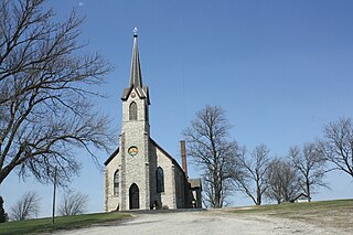
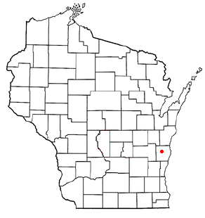
Charlestown is a town in Calumet County in the U.S. state of Wisconsin. The population was 775 at the 2010 census. The unincorporated community of Hayton is located in the town.
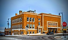
Juneau is a city in Dodge County, Wisconsin, United States. The population was 2,658 at the 2020 census. It is the county seat of Dodge County.
Mayville is a city in Dodge County, Wisconsin, United States, located along the Rock River and the Horicon Marsh. The population was 5,154 at the 2010 census.
Markesan is a city in Green Lake County, Wisconsin, United States. The population was 1,476 at the 2010 census. The center of population of Wisconsin is located in Markesan.
New Lisbon is a city in Juneau County, Wisconsin, United States. The population was 1,748 at the 2020 census.
Amery is a city in Polk County, Wisconsin, United States, along the Apple River. It is a part of Wisconsin's 7th congressional district. The population was 2,902 at the 2010 census. The city was named in honor of William Amery, a carpenter who held several local offices in the 1870s.
Phillips is a city and the county seat of Price County, Wisconsin, United States. The population was 1,478 at the 2010 census.
Richland Center is a city in Richland County, Wisconsin, United States that also serves as the county seat. The population was 5,114 at the 2020 census.
Shawano is a city in Shawano County, Wisconsin, United States. The population was 9,243 at the 2020 census. It is the county seat of Shawano County.
Galesville is a city in Trempealeau County, Wisconsin, United States. The population was 1,662 at the 2020 census. A dam on Beaver Creek is located at Galesville, forming Lake Marinuka north of the city. The mayor is Vince Howe.
Whitehall is a city in Trempealeau County, Wisconsin, United States, along the Trempealeau River. The population was 1,645 at the 2020 census. It is the county seat of Trempealeau County.
Westby is a city in Vernon County, Wisconsin, United States. The population was 2,332 as of the 2020 census. The name "Westby" is a Norwegian name and literally translates to "Western city".
Plymouth is a town in Sheboygan County, Wisconsin. The population was 3,115 at the time of the 2000 census. It is included in the Sheboygan, Wisconsin Metropolitan Statistical Area. The City of Plymouth is located within the town, but is politically independent. The unincorporated community of New Paris is also located in the town.
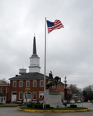
Chilton is a city in and county seat of Calumet County in the U.S. state of Wisconsin. The population was 3,720 as of 2024. The city is partially within the Town of Chilton.
Crandon is a city in Forest County, Wisconsin, United States; it is in the northeastern part of the state, about 100 miles (160 km) north of Green Bay. The population was 1,713 at the 2020 census. It is the county seat of Forest County and is the only incorporated community in the county. The city is located adjacent to the Town of Crandon.
Necedah is a village in Juneau County, Wisconsin, United States. The population was 916 at the 2020 census. The village is located within the Town of Necedah.
Merrill is a city in and the county seat of Lincoln County, Wisconsin, United States. It is located to the south of and adjacent to the Town of Merrill. The population was 9,347, according to the 2020 census. Merrill is part of the United States Census Bureau's Merrill MSA, which includes all of Lincoln County. Together with the Wausau MSA, which includes all of Marathon County, it forms the Wausau-Merrill CSA.
Wautoma is a city in Waushara County, Wisconsin, United States. The population was 2,218 at the 2010 census. Wautoma is the county seat of Waushara County.