Limestone County, Alabama

Last updated

Limestone County
Limestone County Courthouse, Athens, Alabama 01.jpg
Limestone County Courthouse in Athens
Map of Alabama highlighting Limestone County.svg
Location within the U.S. state of Alabama
Alabama in United States.svg
Alabama's location within the U.S.
Coordinates: 34°48′40″N86°59′03″W / 34.811111111111°N 86.984166666667°W / 34.811111111111; -86.984166666667
CountryFlag of the United States.svg United States
StateFlag of Alabama.svg  Alabama
FoundedFebruary 6 [1] , 1818 [1]
Named for Limestone Creek
Seat Athens
Largest city Huntsville [lower-alpha 1]
Government
  ChairmanCollin Daly [2]
Area
  Total607 sq mi (1,570 km2)
  Land560 sq mi (1,500 km2)
  Water47 sq mi (120 km2)  7.8%
Population
 (2020)
  Total103,570
  Estimate 
(2023)
114,654 Increase2.svg
  Density170/sq mi (66/km2)
Time zone UTC−6 (Central)
  Summer (DST) UTC−5 (CDT)
Congressional district 5th
Website limestonecounty-al.gov
  • County Number 44 on Alabama Licence Plates

Limestone County is a county of the U.S. state of Alabama. As of the 2020 census, the county's population was 103,570. [3] Its county seat is Athens. [4] The county is named after Limestone Creek. Limestone County is included in the Huntsville, AL Metropolitan Statistical Area.

Contents

History

Limestone County was established by the Alabama Territorial legislature on February 6, 1818. [1] On November 27, 1821, the Alabama State legislature passed an Act that altered the boundary of Limestone County to include the area east of the mouth of the Elk River with the Tennessee River. At the time, that area was a part of Lauderdale County. [5]

Historical marker on the northwest side of the courthouse Limestone County (Alabama) Historical Marker.jpg
Historical marker on the northwest side of the courthouse

Geography

According to the United States Census Bureau, the county has a total area of 607 square miles (1,570 km2), of which 560 square miles (1,500 km2) is land and 47 square miles (120 km2) (7.8%) is water. [6] It is the third smallest county in Alabama by land area.

River

Adjacent counties

National protected area

Demographics

Historical population
CensusPop.Note
1820 9,871
1830 14,80750.0%
1840 14,374−2.9%
1850 16,48314.7%
1860 15,306−7.1%
1870 15,017−1.9%
1880 21,60043.8%
1890 21,201−1.8%
1900 22,3875.6%
1910 26,88020.1%
1920 31,34116.6%
1930 36,62916.9%
1940 35,642−2.7%
1950 35,7660.3%
1960 36,5132.1%
1970 41,69914.2%
1980 46,00510.3%
1990 54,13517.7%
2000 65,67621.3%
2010 82,78226.0%
2020 103,57025.1%
2023 (est.)114,654 [7] 10.7%
U.S. Decennial Census [8]
1790–1960 [9] 1900–1990 [10]
1990–2000 [11] 2010–2020 [3]

2020 census

Limestone County, Alabama – Racial and Ethnic Composition
(NH = Non-Hispanic)
Note: the US Census treats Hispanic/Latino as an ethnic category. This table excludes Latinos from the racial categories and assigns them to a separate category. Hispanics/Latinos may be of any race.
Race / EthnicityPop 2000 [12] Pop 2010 [13] Pop 2020 [14] % 2000% 2010% 2020
White alone (NH)54,14265,11275,69282.44%78.65%73.08%
Black or African American alone (NH)8,70310,35013,17713.25%12.50%12.72%
Native American or Alaska Native alone (NH)2934874580.45%0.59%0.44%
Asian alone (NH)2289111,8570.35%1.10%1.79%
Pacific Islander alone (NH)1126700.02%0.03%0.07%
Some Other Race alone (NH)28833190.04%0.10%0.31%
Mixed Race/Multi-Racial (NH)5311,2224,7490.81%1.48%4.59%
Hispanic or Latino (any race)1,7404,5917,2482.65%5.55%7.00%
Total65,67682,782103,570100.00%100.00%100.00%

As of the 2020 United States census, there were 103,570 people, 32,020 households, and 23,919 families residing in the county.

2010 census

As of the 2010 census, [15] there were 82,782 people, 31,446 households, and 22,876 families living in the county. The population density was 57.1/km2 (148/sq mi). There were 34,977 housing units at an average density of 24.1/km2 (62/sq mi). The racial makeup of the county was 80.3% White, 12.6% Black or African American, 0.7% Native American, 1.1% Asian, 0.1% Pacific Islander, 3.5% from other races, and 1.8% from two or more races. 5.5% of the population were Hispanic or Latino of any race.

There were 31,446 households, 31.4% had children under the age of 18 living with them, 57.0% were married couples living together, 11.4% had a female householder with no husband present, and 27.3% were non-families. 23.7% of households were one person and 8.5% were one person aged 65 or older. The average household size was 2.54 and the average family size was 3.00.

The age distribution was 24.0% under the age of 18, 8.0% from 18 to 24, 28.1% from 25 to 44, 27.6% from 45 to 64, and 12.3% 65 or older. The median age was 38.4 years. For every 100 females, there were 102.5 males. For every 100 females age 18 and over, there were 107.0 males.

The median household income in the county was $46,682, and the median family income was $55,518. Males had a median income of $46,071 versus $31,609 for females. The per capita income for the county was $24,007. About 10.3% of families and 13.5% of the population were below the poverty line, including 17.5% of those under age 18 and 11.0% of those age 65 or over.

2000 census

As of the 2000 census, [16] there were 65,676 people, 24,688 households, and 18,219 families living in the county. The population density was 45/km2 (120/sq mi). There were 26,897 housing units at an average density of 18/km2 (47/sq ;mi). The racial makeup of the county was 78.79% White, 15.33% Black or African American, 0.46% Native American, 0.35% Asian, 0.02% Pacific Islander, 1.14% from other races, and 0.91% from two or more races. 2.65% of the population were Hispanic or Latino of any race.

According to the census of 2000, the largest ancestry groups in Limestone County were English 66.31%, Scots-Irish 15.12%, and African 13.33%

There were 24,688 households, 34.80% had children under the age of 18 living with them, 60.00% were married couples living together, 10.40% had a female householder with no husband present, and 26.20% were non-families. 23.40% of households were one person and 8.90% were one person aged 65 or older. The average household size was 2.55 and the average family size was 3.02.

The age distribution was 24.90% under the age of 18, 8.80% from 18 to 24, 32.10% from 25 to 44, 23.10% from 45 to 64, and 11.10% 65 or older. The median age was 36 years. For every 100 females, there were 103.10 males. For every 100 females age 18 and over, there were 101.80 males.

The median household income in the county was $37,405, and the median family income was $45,146. Males had a median income of $35,743 versus $23,389 for females. The per capita income for the county was $17,782. About 9.80% of families and 12.30% of the population were below the poverty line, including 16.20% of those under age 18 and 14.60% of those age 65 or over.

Government and politics

Limestone County comprises the Thirty-Ninth Judicial Circuit of Alabama. The Thirty-Ninth Judicial Circuit was created in the early 1980s when Limestone County broke away from Morgan County to form its own circuit.

The Thirty-Ninth Judicial Circuit has two circuit judges and two district judges. The two circuit judges are Judge Robert M. Baker and Judge B. Chadwick Wise. The two district judges are Judge Matthew R. Huggins and Judge R. Gray West.

The current District Attorney is Brian C.T. Jones.

The current Sheriff of Limestone County is Joshua McLaughlin. The term for sheriffs is four years, and there is no term limit. [17] [18]

Collin Daly (R) is the Chairman of the County Commission. [2]

Limestone County is reliably Republican at the presidential level. The last Democrat to win the county in a presidential election is Jimmy Carter, who won it by an absolute majority in 1980.

United States presidential election results for Limestone County, Alabama [19] [20]
Year Republican Democratic Third party
No.%No.%No.%
2020 34,64070.36%13,67227.77%9231.87%
2016 29,06772.14%9,46823.50%1,7594.37%
2012 25,29571.17%9,82927.66%4161.17%
2008 23,59870.33%9,53628.42%4171.24%
2004 19,70267.77%9,12631.39%2450.84%
2000 14,20460.10%8,99238.05%4381.85%
1996 10,86252.52%8,04538.90%1,7758.58%
1992 9,86245.66%8,08737.45%3,64816.89%
1988 9,08661.56%5,45536.96%2191.48%
1984 8,42360.12%5,41038.62%1771.26%
1980 4,57434.18%8,18061.12%6304.71%
1976 2,99724.98%8,80373.36%2001.67%
1972 6,18873.21%2,07924.60%1852.19%
1968 8708.39%8898.57%8,61683.05%
1964 2,37743.99%00.00%3,02756.01%
1960 99119.26%4,14780.59%80.16%
1956 58912.40%4,14587.26%160.34%
1952 54912.46%3,84487.24%130.30%
1948 1125.65%00.00%1,87094.35%
1944 1294.70%2,60594.93%100.36%
1940 953.12%2,94196.58%90.30%
1936 1083.61%2,86195.69%210.70%
1932 1073.85%2,66795.94%60.22%
1928 40719.42%1,68980.58%00.00%
1924 1368.40%1,41587.35%694.26%
1920 28513.48%1,81285.71%170.80%
1916 925.84%1,45092.12%322.03%
1912 907.38%1,01283.02%1179.60%
1908 23816.38%1,18881.76%271.86%
1904 18714.88%1,05383.77%171.35%
1900 1,15750.68%1,06346.56%632.76%
1896 1,52044.94%1,81253.58%501.48%
1892 180.54%1,44743.40%1,86956.06%
1888 1,18343.93%1,48955.29%210.78%
1884 1,45049.56%1,43048.87%461.57%
1880 1,62349.50%1,60048.80%561.71%
1876 1,34344.37%1,68455.63%00.00%
1872 89351.95%82648.05%00.00%
1868 35523.17%1,17776.83%00.00%
1860 00.00%32526.75%89073.25%
1856 00.00%79073.76%28126.24%
1852 22725.53%66274.47%00.00%
1848 37430.99%83369.01%00.00%
1844 32525.19%96574.81%00.00%
1840 35628.41%89771.59%00.00%
1836 31930.85%71569.15%00.00%
1832 00.00%912100.00%00.00%

Education

School districts include: [21]

Tertiary education:

Transportations

Major highways

Railways

Airport

Huntsville International Airport (HSV) is the nearest major commercial airport, 23 miles east. Nashville Airport (BNA) is approximately 104 miles north.

Recreation

GOLFING

FISHING

HUNTING

FESTIVALS

[25]

Points of interest

MUSEUMS

POINTS OF INTEREST

[25]

Communities

Historic buildings in Elkmont Historic buildings in Elkmont, Alabama LCCN2010640878.tif
Historic buildings in Elkmont

Cities

Towns

Unincorporated communities

See also

Notes

  1. Huntsville is technically the largest city but most inhabitants live outside Limestone County.

Related Research Articles

<span class="mw-page-title-main">Morgan County, Alabama</span> County in Alabama, United States

Morgan County is a county in the north-central part of the U.S. state of Alabama. As of the 2020 census, its population was 123,421. The county seat is Decatur. On June 14, 1821, it was renamed in honor of American Revolutionary War General Daniel Morgan of Virginia. It is a prohibition or dry county, although alcohol sales are allowed in the cities of Decatur, Hartselle, and Priceville. Morgan County is included in the Decatur, AL Metropolitan Statistical Area, which is also included in the Huntsville-Decatur-Albertville, AL Combined Statistical Area. It is a part of the North, Northwest, and North-Central regions of Alabama.

<span class="mw-page-title-main">Colbert County, Alabama</span> County in Alabama, United States

Colbert County is a county located in the northwestern part of the U.S. state of Alabama. As of the 2020 census the county's population was 57,227. The county seat is Tuscumbia. The largest city is Muscle Shoals.

<span class="mw-page-title-main">Lauderdale County, Alabama</span> County in Alabama, United States

Lauderdale County is a county located in the northwestern corner of the U.S. state of Alabama. At the 2020 census the population was 93,564. Its county seat is Florence. Its name is in honor of Colonel James Lauderdale, of Tennessee. Lauderdale is part of the Florence-Muscle Shoals, AL Metropolitan Statistical Area, also known as "The Shoals".

<span class="mw-page-title-main">Lawrence County, Alabama</span> County in Alabama, United States

Lawrence County is a county in the northern part of the U.S. state of Alabama. As of the 2020 census, the population was 33,073. The county seat is Moulton. The county was named after James Lawrence, a captain in the United States Navy from New Jersey.

<span class="mw-page-title-main">Madison County, Alabama</span> County in Alabama, United States

Madison County is located in the north central portion of the U.S. state of Alabama. As of the 2020 Census, the population was 388,153, making it the second-most populous county in Alabama. Its county seat is Huntsville. Since the mid-20th century it has become an area of defense and space research and industry.

<span class="mw-page-title-main">Marshall County, Alabama</span> County in Alabama, United States

Marshall County is a county of the state of Alabama, United States. As of the 2020 census the population was 97,612. Its county seat is Guntersville. A second courthouse is in Albertville. Its name is in honor of John Marshall, famous Chief Justice of the United States. Marshall County is a dry county, with the exception of the five cities of Albertville, Arab, Grant, Guntersville, and Boaz. Marshall County comprises the Albertville, AL Micropolitan Statistical Area, which is also included in the Huntsville-Decatur-Albertville, AL Combined Statistical Area.

<span class="mw-page-title-main">Lincoln County, Tennessee</span> County in Tennessee, United States

Lincoln County is a county located in the south central part of the U.S. state of Tennessee. As of the 2020 census, the population was 35,319. Its county seat and largest city is Fayetteville. The county is named for Major General Benjamin Lincoln, an officer in the American Revolutionary War.

<span class="mw-page-title-main">Rogersville, Alabama</span> Town in Alabama, United States

Rogersville is a town in Lauderdale County, Alabama, United States. As of the 2018 census, the population of the town is 1,231, up from 1,199 in 2000.

<span class="mw-page-title-main">Ardmore, Alabama</span> Town in Alabama, United States

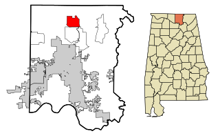
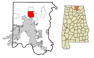
Ardmore is a town in Limestone County, Alabama, United States, and is included in the Huntsville-Decatur Metro Area. The population was 1,321 at the 2020 census, It borders its sister city Ardmore, Tennessee.

<span class="mw-page-title-main">Athens, Alabama</span> City in and county seat of Limestone County, Alabama

Athens is a city in and the county seat of Limestone County, in the U.S. state of Alabama; it is included in the Huntsville-Decatur-Albertville, AL Combined Statistical Area. As of the 2020 census, the population of the city is 25,406.

<span class="mw-page-title-main">Elkmont, Alabama</span> Town in Alabama, United States

Elkmont is a town in Limestone County, Alabama, United States, and is included in the Huntsville-Decatur Combined Statistical Area. As of the 2010 census, the population of the town was 434, down from its record high of 470 in 2000.

<span class="mw-page-title-main">Madison, Alabama</span> City in Alabama, United States

Madison is a city located primarily in Madison County, near the northern border of the U.S. state of Alabama. Madison extends west into neighboring Limestone County. The city is included in the Huntsville Metropolitan Area, the second-largest in the state, and is also included in the merged Huntsville-Decatur Combined Statistical Area. The population was 56,933 at the 2020 census. Madison is bordered by Huntsville on nearly all sides with some small unincorporated lands within Madison in Madison and Limestone counties.

<span class="mw-page-title-main">Gurley, Alabama</span> Town in Alabama, United States

Gurley is a town in Madison County, Alabama, United States, and is included in the Huntsville-Decatur Combined Statistical Area. As of the 2020 census, the population of the town was 816.

<span class="mw-page-title-main">Harvest, Alabama</span> Census-designated place in Alabama, United States

Harvest is an unincorporated community and census-designated place (CDP) in the northwestern part of Madison County, Alabama, United States, and is included in the Huntsville-Decatur Combined Statistical Area. According to the 2020 U.S. Census, the population of the community is 5,893.

<span class="mw-page-title-main">Hazel Green, Alabama</span> Census-designated place in Alabama, United States

Hazel Green is an unincorporated community and census-designated place (CDP) in Madison County, Alabama, United States, and is included in the Huntsville-Decatur Combined Statistical Area. As of the 2020 census, the population of the community was 4,105, up from 3,630 at the 2010 census.

<span class="mw-page-title-main">Meridianville, Alabama</span> Census-designated place in Alabama, United States

Meridianville is an unincorporated community and census-designated place (CDP) in Madison County, Alabama, United States, and is included in the Huntsville-Decatur Combined Statistical Area. As of the 2020 census, the population of the CDP was 8,209.

<span class="mw-page-title-main">New Market, Alabama</span> Census-designated place in Alabama, United States

New Market is an unincorporated community and census-designated place (CDP) in Madison County, Alabama, United States, and is included in the Huntsville-Decatur Combined Statistical Area. As of the 2020 census, the population of the CDP was 1,543. Although it was the first area settled in Madison County, the town has never been incorporated.

<span class="mw-page-title-main">Owens Cross Roads, Alabama</span> Town in Alabama, United States

Owens Cross Roads is a town in Madison County, Alabama, United States, and is included in the Huntsville-Decatur Combined Statistical Area. It was incorporated on October 9, 1967. The population was 2,594 at the 2020 census.

<span class="mw-page-title-main">Triana, Alabama</span> Town in Alabama, United States

Triana is a town in Madison County, Alabama, United States, and is included in the Huntsville-Decatur, AL Combined Statistical Area. The population was 2,890 at the 2020 census, and was estimated to be 3,961 in 2022.

<span class="mw-page-title-main">Ardmore, Tennessee</span> City in Tennessee, United States

Ardmore is a city in Giles and Lincoln counties, Tennessee, United States. The population was 1,217 at the 2020 census. Ardmore is the site of a Tennessee Department of Tourist Development Welcome Center. It borders its sister city, Ardmore, Alabama.

References

  1. 1 2 3 A digest of the laws of the State of Alabama: containing the statutes and resolutions in force at the end of the General Assembly in January, 1823. Published by Ginn & Curtis, J. & J. Harper, Printers, New-York, 1828. Title 10. Chapter XII. Page 85. An Act to establish the western and southern Boundaries of Madison County, and to establish the Counties of Limestone and Lauderdale--Passed February 6, 1818.
  2. 1 2 "Commission". Limestone County, Alabama. Retrieved July 7, 2017.
  3. 1 2 "State & County QuickFacts". United States Census Bureau. Retrieved September 12, 2023.
  4. "Find a County". National Association of Counties. Retrieved June 7, 2011.
  5. A digest of the laws of the State of Alabama: containing the statutes and resolutions in force at the end of the General Assembly in January, 1823. Published by Ginn & Curtis, J. & J. Harper, Printers, New-York, 1828. Title 10. Chapter XXXII. Page 99. An Act to alter and extend the Boundaries of Limestone CountyPassed November 27, 1821.
  6. "2010 Census Gazetteer Files". United States Census Bureau. August 22, 2012. Retrieved August 22, 2015.
  7. "Annual Estimates of the Resident Population for Counties: April 1, 2020 to July 1, 2023". United States Census Bureau. Retrieved March 27, 2024.
  8. "U.S. Decennial Census". United States Census Bureau. Retrieved August 22, 2015.
  9. "Historical Census Browser". University of Virginia Library. Retrieved August 22, 2015.
  10. Forstall, Richard L., ed. (March 24, 1995). "Population of Counties by Decennial Census: 1900 to 1990". United States Census Bureau. Retrieved August 22, 2015.
  11. "Census 2000 PHC-T-4. Ranking Tables for Counties: 1990 and 2000" (PDF). United States Census Bureau. April 2, 2001. Retrieved August 22, 2015.
  12. "P004 HISPANIC OR LATINO, AND NOT HISPANIC OR LATINO BY RACE – 2000: DEC Summary File 1 – Limestone County, Alabama". United States Census Bureau .
  13. "P2 HISPANIC OR LATINO, AND NOT HISPANIC OR LATINO BY RACE – 2010: DEC Redistricting Data (PL 94-171) – Limestone County, Alabama". United States Census Bureau .
  14. "P2 HISPANIC OR LATINO, AND NOT HISPANIC OR LATINO BY RACE - 2020: DEC Redistricting Data (PL 94-171) – Limestone County, Alabama". United States Census Bureau .
  15. "U.S. Census website". United States Census Bureau . Retrieved July 31, 2015.
  16. "U.S. Census website". United States Census Bureau . Retrieved May 14, 2011.
  17. "Mike Blakely, Alabama's longest serving sheriff, convicted at trial". August 2, 2021.
  18. "Limestone County Coroner Mike West assumes role as sheriff after Mike Blakely's conviction". August 3, 2021.
  19. "Dave Leip's Atlas of U.S. Presidential Elections" . Retrieved November 21, 2016.
  20. "Our Campaigns - U.S. President" . Retrieved January 22, 2021.
  21. "2020 CENSUS - SCHOOL DISTRICT REFERENCE MAP: Limestone County, AL" (PDF). United States Census Bureau . Retrieved August 1, 2022. - Text list
  22. 1 2 Alabama Railway Map Archived March 12, 2012, at the Wayback Machine . 2008. Alabama Department of Transportation. Accessed December 10, 2010.
  23. 1 2 2010 NRT designations Archived March 18, 2012, at the Wayback Machine . National Recreation Trails. June 2, 2010. U.S. Department of Interior. Accessed March 15, 2012.
  24. Richard Martin Trail National Recreation Trails Database. American Trails. Last Updated 06/09/2011.
  25. 1 2 3 "Athens-Limestone County Tourism". Visit Athens Alabama. Retrieved March 6, 2018.

34°48′40″N86°59′03″W / 34.81111°N 86.98417°W / 34.81111; -86.98417