Loch Lynn Heights, Maryland

Last updated

Loch Lynn Heights, Maryland
2021-08-07 14 41 18 View south along Maryland State Route 560 (Paul Street) at First Avenue in Loch Lynn Heights, Garrett County, Maryland.jpg
Entering Loch Lynn Heights on MD 560
Seal of Loch Lynn Heights, Maryland.png
Garrett County Maryland Incorporated and Unincorporated areas Loch Lynn Heights Highlighted.svg
Location of Loch Lynn Heights, Maryland
Coordinates: 39°23′30″N79°22′28″W / 39.39167°N 79.37444°W / 39.39167; -79.37444
Country United States
State Maryland
County Garrett
Incorporated 1896 [1]
Area
[2]
  Total0.32 sq mi (0.82 km2)
  Land0.32 sq mi (0.82 km2)
  Water0.00 sq mi (0.00 km2)
Elevation
[3]
2,464 ft (751 m)
Population
 (2020)
  Total493
  Density1,550.31/sq mi (598.40/km2)
Time zone UTC-5 (Eastern (EST))
  Summer (DST) UTC-4 (EDT)
ZIP code
21550 [4]
Area code(s) 301, 240
FIPS code 24-47525
GNIS feature ID2391272 [3]

Loch Lynn Heights is a town in Garrett County, Maryland, United States. The population was 493 at the 2020 census. [5]

Contents

Geography

According to the United States Census Bureau, the town has a total area of 0.32 square miles (0.83 km2), all land. [6]

1967 F3 tornado

On May 19, 1967, a tornado struck Loch Lynn Heights, causing one fatality and throwing a small frame house 100 yards. [7] It was rated F3. [8]

Demographics

Historical population
CensusPop.Note
1900 215
1910 2160.5%
1920 2243.7%
1930 198−11.6%
1940 33971.2%
1950 41522.4%
1960 47614.7%
1970 5076.5%
1980 503−0.8%
1990 461−8.3%
2000 4691.7%
2010 55217.7%
2020 493−10.7%
U.S. Decennial Census [9]

2010 census

As of the census [10] of 2010, there were 552 people, 203 households, and 157 families living in the town. The population density was 1,725.0 inhabitants per square mile (666.0/km2). There were 228 housing units at an average density of 712.5 per square mile (275.1/km2). The racial makeup of the town was 98.7% White, 0.2% African American, 0.2% from other races, and 0.9% from two or more races. Hispanic or Latino of any race were 0.4% of the population.

There were 203 households, of which 44.3% had children under the age of 18 living with them, 46.8% were married couples living together, 23.6% had a female householder with no husband present, 6.9% had a male householder with no wife present, and 22.7% were non-families. 19.2% of all households were made up of individuals, and 10.9% had someone living alone who was 65 years of age or older. The average household size was 2.72 and the average family size was 3.06.

The median age in the town was 32.8 years. 30.8% of residents were under the age of 18; 9.2% were between the ages of 18 and 24; 24.7% were from 25 to 44; 23.2% were from 45 to 64; and 12% were 65 years of age or older. The gender makeup of the town was 46.4% male and 53.6% female.

2000 census

As of the census [11] of 2000, there were 469 people, 181 households, and 135 families living in the town. The population density was 1,485.0 inhabitants per square mile (573.4/km2). There were 202 housing units at an average density of 639.6 per square mile (247.0/km2). The racial makeup of the town was 99.36% White, 0.43% Asian, and 0.21% from two or more races.

There were 181 households, out of which 36.5% had children under the age of 18 living with them, 59.1% were married couples living together, 11.6% had a female householder with no husband present, and 25.4% were non-families. 21.5% of all households were made up of individuals, and 9.9% had someone living alone who was 65 years of age or older. The average household size was 2.59 and the average family size was 3.00.

In the town, the population was spread out, with 28.6% under the age of 18, 7.7% from 18 to 24, 27.5% from 25 to 44, 22.0% from 45 to 64, and 14.3% who were 65 years of age or older. The median age was 36 years. For every 100 females, there were 93.0 males. For every 100 females age 18 and over, there were 81.1 males.

MD 560 southbound in Loch Lynn Heights 2021-08-07 14 43 35 View south along Maryland State Route 560 (Third Avenue) at Paul Street in Loch Lynn Heights, Garrett County, Maryland.jpg
MD 560 southbound in Loch Lynn Heights

The median income for a household in the town was $31,875, and the median income for a family was $34,375. Males had a median income of $21,563 versus $16,111 for females. The per capita income for the town was $12,369. About 14.7% of families and 16.2% of the population were below the poverty line, including 24.8% of those under age 18 and 11.2% of those age 65 or over.

Transportation

The main method of travel to and from Loch Lynn Heights at present is by road. The only state highway directly serving the town is Maryland Route 560, which head south to U.S. Route 50 in Gorman and north to Maryland Route 135 in Mountain Lake Park.

Related Research Articles

<span class="mw-page-title-main">Advance, Indiana</span> Town in Indiana, United States

Advance is a town in Jackson Township, Boone County, Indiana, United States. The population was 503 at the 2020 census.

<span class="mw-page-title-main">Kingsford Heights, Indiana</span> Town in Indiana, United States

Kingsford Heights is a town in Union Township, LaPorte County, Indiana, United States. The population was 1,335 at the 2020 census. It is included in the Michigan City, Indiana-La Porte, Indiana Metropolitan Statistical Area. Also known as "Victory City," the town was built by the United States government for workers that worked in the Kingsbury Ordnance Plant, an ammunitions plant that served the US during World War II and later the Korean War.

<span class="mw-page-title-main">Woodlawn Heights, Indiana</span> Town in Indiana, United States

Woodlawn Heights is a town in Anderson Township, Madison County, Indiana, United States. It is part of the Indianapolis–Carmel–Anderson metropolitan statistical area. The population was 91 at the 2020 census.

<span class="mw-page-title-main">Minden, Iowa</span> City in Iowa, United States

Minden is a city in Pottawattamie County, Iowa, United States. The population was 600 at the time of the 2020 census.

<span class="mw-page-title-main">Wayne, Maine</span> Town in the state of Maine, United States

Wayne is a town in Kennebec County, Maine, United States. Wayne is included in the Lewiston-Auburn, Maine metropolitan New England city and town area. The population was 1,129 at the 2020 census. The town was named after Revolutionary War General Anthony Wayne. During the summer, Wayne is home to Camp Androscoggin. A popular recreation spot in central Maine, Wayne is part of the Winthrop Lakes Region. The town is included in the Augusta, Maine micropolitan New England City and Town Area. and included in the Lewiston-Auburn, Maine metropolitan New England city and town area.

<span class="mw-page-title-main">Deer Park, Maryland</span> Town in Maryland, United States

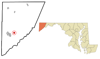
Deer Park is a town in Garrett County, Maryland, United States. The population was 399 at the 2010 census. It is part of the Pittsburgh Media Market.

<span class="mw-page-title-main">Kitzmiller, Maryland</span> Town in Maryland, United States

Kitzmiller is a town in Garrett County, Maryland, United States. The population was 321 at the 2010 census.

<span class="mw-page-title-main">Mountain Lake Park, Maryland</span> Town in Maryland, United States

Mountain Lake Park is a town in Garrett County, Maryland, United States. The population was 2,147 as of the 2020 census.

<span class="mw-page-title-main">Fairmount Heights, Maryland</span> Historic district in Maryland, United States

Fairmount Heights is a town in Prince George's County, Maryland, United States. Per the 2020 census, the population was 1,528. The town was formally incorporated in 1935, making the town the second oldest African-American-majority municipality in Prince George's County. The town is composed of six subdivisions: Fairmount Heights (1900), Waterford (1907), Mount Weissner (1909), North Fairmount Heights (1910), West Fairmount Heights (1911) and Sylvan Vista (1923).

<span class="mw-page-title-main">Hartland, Minnesota</span> City in Minnesota, United States

Hartland is a city in Freeborn County, Minnesota, United States. The population was 315 at the 2010 census.

<span class="mw-page-title-main">Wood Heights, Missouri</span> City in Missouri, United States

Wood Heights is a city in western Ray County, Missouri, and part of the Kansas City metropolitan area within the United States. The population was 757 at the 2020 census.

<span class="mw-page-title-main">Bennington, Nebraska</span> City in Douglas County, Nebraska, United States

Bennington is a city in Douglas County, Nebraska, United States. The population was 2,026 at the 2020 U.S. Census.

<span class="mw-page-title-main">Cardington, Ohio</span> Village in Ohio, United States

Cardington is a village in Morrow County, Ohio, United States. The population was 2,051 at the 2020 census. Mount Gilead, Ohio, the county seat, is located northeast of Cardington on U.S. Route 42.

<span class="mw-page-title-main">Clay Township, Lancaster County, Pennsylvania</span> Township in Pennsylvania, United States

Clay Township is a township in north central Lancaster County, Pennsylvania, United States. The population was 6,887 at the 2020 census.

<span class="mw-page-title-main">Salisbury, Pennsylvania</span> Borough in Pennsylvania, United States

Salisbury is a borough in Somerset County, Pennsylvania, United States. The population was 707 at the 2020 census. It is part of the Johnstown, Pennsylvania, Metropolitan Statistical Area.

<span class="mw-page-title-main">Woonsocket, South Dakota</span> City in South Dakota, United States

Woonsocket is a city in Sanborn County, South Dakota. The population was 631 at the 2020 census. It is the county seat of Sanborn County.

<span class="mw-page-title-main">Laguna Heights, Texas</span> Census-designated place in Texas, United States

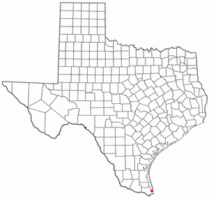
Laguna Heights is a census-designated place (CDP) in Cameron County, Texas, United States. The population was 3,488 at the 2010 census.

<span class="mw-page-title-main">Mitchell Heights, West Virginia</span> Town in West Virginia, United States

Mitchell Heights is a town in Logan County, West Virginia, United States. The population was 315 at the 2020 census. The town was named for an early farm on which it was established.

<span class="mw-page-title-main">Black Earth, Wisconsin</span> Village in Wisconsin, United States

Black Earth is a village in Dane County, Wisconsin, United States. The population was 1,338 at the 2010 census. The village is located within the Town of Black Earth. It is part of the Madison Metropolitan Statistical Area.

<span class="mw-page-title-main">Hazel Green, Wisconsin</span> Village in Wisconsin, United States

Hazel Green is a village in Grant and Lafayette counties in the U.S. state of Wisconsin. The population was 1,256 at the 2010 census. Of this, 1,243 were in Grant County, and only 13 were in Lafayette County. The village is located mostly within the Town of Hazel Green in Grant County; only a small portion extends into the Town of Benton in Lafayette County.

References

  1. "Loch Lynn Heights". Maryland Manual. Retrieved June 24, 2017.
  2. "2020 U.S. Gazetteer Files". United States Census Bureau. Retrieved April 26, 2022.
  3. 1 2 U.S. Geological Survey Geographic Names Information System: Loch Lynn Heights, Maryland
  4. "Loch Lynn Heights MD ZIP Code". zipdatamaps.com. 2023. Retrieved April 18, 2023.
  5. "Explore Census Data". data.census.gov. Retrieved January 25, 2023.
  6. "US Gazetteer files 2010". United States Census Bureau. Archived from the original on July 2, 2012. Retrieved January 25, 2013.
  7. "The Most 'Important' US Tornadoes by State". Archived from the original on March 4, 2016. Retrieved March 2, 2016.
  8. "Tornado History Project: Maps and Statistics". Archived from the original on January 17, 2018. Retrieved July 12, 2022.
  9. "Census of Population and Housing". Census.gov. Retrieved June 4, 2015.
  10. "U.S. Census website". United States Census Bureau . Retrieved January 25, 2013.
  11. "U.S. Census website". United States Census Bureau . Retrieved January 31, 2008.