
Ferndale is a census-designated place (CDP) in Anne Arundel County, Maryland, United States. At the 2010 census, the population was 16,746.

Jarrettsville is an unincorporated community and census-designated place (CDP) in Harford County, Maryland, United States. The population was 2,888 at the 2020 census.

Potomac is an unincorporated community and census-designated place in Montgomery County, Maryland, United States. As of the 2020 census, it had a population of 47,018. It is named after the nearby Potomac River. A part of the Washington metropolitan area, many Potomac residents work in nearby Washington, D.C., and Northern Virginia.
Bartonsville is an unincorporated community and census-designated place (CDP) in Frederick County, in the U.S. state of Maryland. As of the 2020 census it had a population of 2,753. Prior to 2010, the area was part of the Linganore-Bartonsville CDP.
McCoole is an unincorporated community and census-designated place (CDP) in Allegany County, Maryland, United States. As of the 2010 census it had a population of 511.
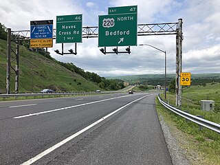
Potomac Park is an unincorporated subdivision and census-designated place (CDP) located on the North Branch Potomac River in Allegany County, Maryland, United States. As of the 2010 census, it had a population of 2,530. Potomac Park lies along U.S. Route 220 between Cresaptown and Cumberland. The CDP of Bowling Green is immediately to the north on Route 220.

Gormania is an unincorporated community along the North Branch Potomac River in Grant County, West Virginia. Gormania lies on the Northwestern Turnpike, which crosses the North Branch into Gorman, Maryland via Gormania Bridge. It is named for United States Senator from Maryland, Arthur P. Gorman.

Bloomington is an unincorporated community and census-designated place (CDP) locates in southeastern Garrett County, Maryland located at the confluence of the North Branch Potomac River and Savage River. It lies to the west of Luke on Maryland Route 135 and is bounded to the northwest by Savage River State Forest. As of the 2010 census the population of Bloomington was 305.
Pylesville is an unincorporated community and census-designated place (CDP) in Harford County, Maryland, United States. The population was 693 at the 2010 census. It is part of the Baltimore metropolitan area.The town was named after Brandon Pyles. Until 1958, this community was served by the Maryland and Pennsylvania Railroad at milepost 40.3.
Clarysville is an unincorporated community and census-designated place (CDP) in Allegany County, Maryland, United States. As of the 2010 census it had a population of 73.
Worton is an unincorporated community and census-designated place (CDP) in Kent County, Maryland, United States. As of the 2010 census it had a population of 249.
West Denton is an unincorporated community and census-designated place (CDP) in Caroline County, Maryland, United States. As of the 2010 census it had a population of 52.

Mapleville is an unincorporated community and census-designated place in eastern Washington County, Maryland, United States. Its population was 243 as of the 2020 census. It is officially a part of the Hagerstown Metropolitan Area.
Dawson is an unincorporated community and census-designated place (CDP) in Allegany County, Maryland, United States. As of the 2010 census it had a population of 103.
Detmold is an unincorporated community and census-designated place (CDP) in Allegany County, Maryland, United States. As of the 2010 census it had a population of 71.

Franklin is an unincorporated community and census-designated place (CDP) in Allegany County, Maryland, United States. As of the 2010 census it had a population of 290.
Pleasant Grove is a census-designated place (CDP) in Allegany County, Maryland, United States. As of the 2010 census it had a population of 353.
Gilmore is an unincorporated community and census-designated place (CDP) in Allegany County, Maryland, United States. As of the 2010 census it had a population of 127. It is part of the Cumberland, MD-WV Metropolitan Statistical Area.
National is an unincorporated community and census-designated place (CDP) in Allegany County, Maryland, United States. As of the 2010 census it had a population of 56.
Ocean is an unincorporated community and census-designated place (CDP) in Allegany County, Maryland, United States. As of the 2010 census it had a population of 32.


