Washington Township, Lehigh County, Pennsylvania

Last updated

Washington Township
Lehigh Gap Nature Center.jpg
Lehigh Gap Nature Center in Washington Township in 2011
Lehigh county - Washington.png
Location of Washington Township in Lehigh County, Pennsylvania
USA Pennsylvania location map.svg
Red pog.svg
Washington Township
Location of Washington Township in Pennsylvania
Usa edcp location map.svg
Red pog.svg
Washington Township
Location in the United States
Coordinates: 40°44′59″N75°37′30″W / 40.74972°N 75.62500°W / 40.74972; -75.62500
Country United States
State Pennsylvania
County Lehigh
Area
[1]
   Township 23.74 sq mi (61.48 km2)
  Land23.55 sq mi (61.01 km2)
  Water0.18 sq mi (0.48 km2)
Elevation
518 ft (158 m)
Population
 (2010) [2]
   Township 6,624
  Estimate 
(2016) [3]
6,761
  Density287.04/sq mi (110.83/km2)
   Metro
865,310 (US: 68th)
Time zone UTC-5 (EST)
  Summer (DST) UTC-4 (EDT)
ZIP codes
18065, 18078, 18079, 18080
Area code(s) 610
FIPS code 42-077-81280
Primary airport Lehigh Valley International Airport
Major hospital Lehigh Valley Hospital–Cedar Crest
School district Northern Lehigh
Website www.washingtonlehigh.com

Washington Township is a township in Lehigh County, Pennsylvania, United States. The population of Washington Township was 6,624 at the 2010 census. [2] It is a suburb of Allentown in the Lehigh Valley, which had a population of 861,899 and was the 68th-most populous metropolitan area in the U.S. as of the 2020 census.

Contents

History

Vigilant Fire Company Firemen's Monument, erected in 1909 in Washington Township, was added to the National Register of Historic Places in 2004. [4]

Geography

Washington Township is the northernmost in Lehigh County. According to the U.S. Census Bureau, the township has a total area of 23.7 square miles (61.5 km2), of which 23.6 square miles (61.0 km2) are land and 0.2 square miles (0.5 km2), or 0.74%, are water. [1] It is drained by the Lehigh River, which separates it from Northampton County to the east, and Blue Mountain separates it from Carbon County to the north.

The township includes nine villages: Best Station, Emerald, Friedens, Lehigh Furnace, Lehigh Gap, Neffs, Newhard, Newside, and Slatedale.

Adjacent municipalities

Climate

The township has a humid continental climate (Dfa/Dfb) and the hardiness zones are 6a and 6b. Average monthly temperatures range from 27.9 °F (−2.3 °C) in January to 72.3 °F (22.4 °C) in July. [5]

Demographics

Historical population
CensusPop.Note
2000 6,588
2010 6,6240.5%
2016 (est.)6,761 [3] 2.1%
U.S. Decennial Census [6]

As of the census [7] of 2000, there were 6,588 people, 2,512 households, and 1,929 families residing in the township. The population density was 278.4 inhabitants per square mile (107.5/km2). There were 2,594 housing units at an average density of 109.6 per square mile (42.3/km2). The racial makeup of the township was 98.71% White, 0.21% African American, 0.08% Native American, 0.41% Asian, 0.24% from other races, and 0.35% from two or more races. Hispanic or Latino of any race were 0.97% of the population.

There were 2,512 households, out of which 32.0% had children under the age of 18 living with them, 65.2% were married couples living together, 7.2% had a female householder with no husband present, and 23.2% were non-families. 18.0% of all households were made up of individuals, and 7.8% had someone living alone who was 65 years of age or older. The average household size was 2.62 and the average family size was 2.97.

In the township, the population was spread out, with 22.7% under the age of 18, 6.9% from 18 to 24, 31.4% from 25 to 44, 27.3% from 45 to 64, and 11.7% who were 65 years of age or older. The median age was 40 years. For every 100 females, there were 103.0 males. For every 100 females age 18 and over, there were 101.8 males. The median income for a household in the township was $50,587, and the median income for a family was $55,332. Males had a median income of $35,340 versus $26,967 for females. The per capita income for the township was $19,980. About 3.5% of families and 5.1% of the population were below the poverty line, including 3.0% of those under age 18 and 10.9% of those age 65 or over.

Education

The township is served by the Northern Lehigh School District. Students in grades nine through 12 attend Northern Lehigh High School in Slatington.

Transportation

I-476, the Northeast Extension of the Pennsylvania Turnpike South in Washington Township 2022-09-23 15 31 16 View south along Interstate 476 (Pennsylvania Turnpike Northeast Extension) from the overpass for Mountain Road in Washington Township, Lehigh County, Pennsylvania.jpg
I-476, the Northeast Extension of the Pennsylvania Turnpike South in Washington Township

As of 2010, there were 88.07 miles (141.73 km) of public roads in Washington Township, of which 6.00 miles (9.66 km) were maintained by the Pennsylvania Turnpike Commission (PTC), 19.25 miles (30.98 km) were maintained by the Pennsylvania Department of Transportation (PennDOT) and 62.82 miles (101.10 km) were maintained by the township. [8]

Interstate 476 follows the Pennsylvania Turnpike's Northeast Extension along a northwest-southeast alignment through Washington Township, entering the Lehigh Tunnel near the north edge of the township. However, the nearest interchange is in South Whitehall Township. Local access to the township is provided by Pennsylvania Route 873, which crosses north-to-south from Pennsylvania Route 248 in Lehigh Gap to PA Route 329 in Neffs and PA Route 309 in Schnecksville. An important east-to-west thoroughfare is Mountain Road, which proceeds west from PA 873 in Lehigh Gap to PA 309 north of New Tripoli. LANta serves the township with bus route 325.

Related Research Articles

<span class="mw-page-title-main">Hereford Township, Pennsylvania</span> Township in Pennsylvania, United States

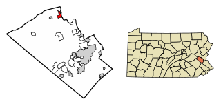
Hereford Township is a township in Berks County, Pennsylvania, United States. It is the easternmost municipality within Berks County. Its population was 2,969 at the 2020 census. It is in Upper Perkiomen School District.

<span class="mw-page-title-main">East Penn Township, Pennsylvania</span> Place in Pennsylvania, United States

East Penn Township is a rural township in the rough uplands terrain of the eastern Mahoning Hills area of Carbon County, Pennsylvania. It is part of Northeastern Pennsylvania.

<span class="mw-page-title-main">Kidder Township, Pennsylvania</span> Place in Pennsylvania, United States

Kidder Township is a township in Carbon County, Pennsylvania. It is part of Northeastern Pennsylvania. The population was 1,935 at the 2010 census, up from 1,185 at the 2000 census.

<span class="mw-page-title-main">Penn Forest Township, Pennsylvania</span> Place in Pennsylvania, United States

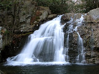
Penn Forest Township is a township in Carbon County, Pennsylvania. It is part of Northeastern Pennsylvania. The population was 9,581 at the 2010 census, up from 5,439 at the 2000 census.

<span class="mw-page-title-main">Heidelberg Township, Lehigh County, Pennsylvania</span> Township in Pennsylvania, United States

Heidelberg Township is a township in Lehigh County, Pennsylvania, United States. The population of Heidelberg Township was 3,416 at the 2010 census. It is a suburb of Allentown in the Lehigh Valley, which had a population of 861,899 and was the 68th-most populous metropolitan area in the U.S. as of the 2020 census.

<span class="mw-page-title-main">North Whitehall Township, Pennsylvania</span> Township in Pennsylvania, United States

North Whitehall Township is a township in Lehigh County, Pennsylvania, United States. The population of North Whitehall Township was 15,655 at the 2020 census. It is a suburb of Allentown in the Lehigh Valley, which had a population of 861,899 and was the 68th-most populous metropolitan area in the U.S. as of the 2020 census.

<span class="mw-page-title-main">Salisbury Township, Lehigh County, Pennsylvania</span> Township in Pennsylvania, United States

Salisbury Township is a township in Lehigh County, Pennsylvania, United States. The township's population was 13,621 at the 2020 census. The township borders Allentown, Pennsylvania's third-largest city, Bethlehem, and Emmaus, in the Lehigh Valley, which had a population of 861,899 and was the 68th-most populous metropolitan area in the U.S. as of the 2020 census.

<span class="mw-page-title-main">Schnecksville, Pennsylvania</span> Census-designated place in Pennsylvania, United States

Schnecksville is an unincorporated community and census-designated place (CDP) in North Whitehall Township in Lehigh County, Pennsylvania. The population of Schnecksville was 2,935 at the 2010 census.

<span class="mw-page-title-main">Slatington, Pennsylvania</span> Borough in Pennsylvania, United States

Slatington is a borough in Lehigh County, Pennsylvania, United States. As of the 2010 census, it had a population of 4,232. Slatington is located northwest of Allentown and Bethlehem. Slatington is part of the Lehigh Valley metropolitan area, which had a population of 861,899 and was the 68th-most populous metropolitan area in the U.S. as of the 2020 census.

<span class="mw-page-title-main">Upper Macungie Township, Pennsylvania</span> Township in Pennsylvania, United States

Upper Macungie Township is a township in Lehigh County, Pennsylvania, United States. The population of Upper Macungie Township was 26,377 as of the 2020 U.S. census, making it the fourth-fastest growing municipality of any category in Pennsylvania in terms of total population growth between 2010 and 2020.

<span class="mw-page-title-main">Upper Saucon Township, Pennsylvania</span> Township in Pennsylvania, United States

Upper Saucon Township is a township in Lehigh County, Pennsylvania, United States. It is part of the Lehigh Valley metropolitan area, which had a population of 861,899 and was the 68th-most populous metropolitan area in the U.S. as of the 2020 census. The township had a population of 16,973 as of the 2020 census.

<span class="mw-page-title-main">Upper Hanover Township, Pennsylvania</span> Township in Pennsylvania, United States

Upper Hanover Township is a township in Montgomery County, Pennsylvania, United States. The population was 6,464 at the 2010 census.

<span class="mw-page-title-main">Bushkill Township, Pennsylvania</span> Township in Pennsylvania, United States

Bushkill Township is a township in Northampton County, Pennsylvania, United States. Its population was 8,178 at the 2010 census. It is part of the Lehigh Valley metropolitan area, which had a population of 861,899 and was the 68th-most populous metropolitan area in the U.S. as of the 2020 census.

<span class="mw-page-title-main">Forks Township, Northampton County, Pennsylvania</span> Place in Pennsylvania, United States

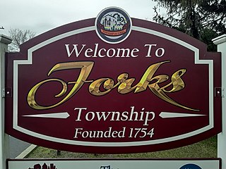
Forks Township is a township in Northampton County, Pennsylvania, United States. The population of Forks Township was 14,721 as of the 2010 census. It is part of the Lehigh Valley metropolitan area, which had a population of 861,899 and was the 68th-most populous metropolitan area in the U.S. as of the 2020 census. The township is home to the global headquarters of Crayola, founded in 1885, a global arts supply company and the world's leading manufacturer of crayons.

<span class="mw-page-title-main">Lehigh Township, Northampton County, Pennsylvania</span> Place in Pennsylvania, United States

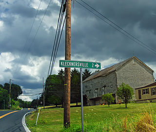
Lehigh Township is a township in Northampton County, Pennsylvania, United States. The population of Lehigh Township was 10,526 as of the 2010 census. It is part of the Lehigh Valley metropolitan area, which had a population of 861,899 and was the 68th-most populous metropolitan area in the U.S. as of the 2020 census.

<span class="mw-page-title-main">Moore Township, Pennsylvania</span> Place in Pennsylvania, United States

Moore Township is a township in Northampton County, Pennsylvania, United States. The population of Moore Township was 9,198 at the 2010 census. The township is located in the Lehigh Valley, which had a population of 861,899 and was the 68th-most populous metropolitan area in the U.S. as of the 2020 census.

<span class="mw-page-title-main">Upper Mount Bethel Township, Pennsylvania</span> Place in Pennsylvania, United States

Upper Mount Bethel Township is a township in Northampton County, Pennsylvania, United States. The population of Upper Mount Bethel Township was 6,706 at the 2010 census. The township is part of the Lehigh Valley metropolitan area, which had a population of 861,899 and was the 68th-most populous metropolitan area in the U.S. as of the 2020 census.

<span class="mw-page-title-main">Upper Nazareth Township, Pennsylvania</span> Place in Pennsylvania, United States

Upper Nazareth Township is a township in Northampton County, Pennsylvania, United States. It is part of the Lehigh Valley metropolitan area, which had a population of 861,899 and was the 68th-most populous metropolitan area in the U.S. as of the 2020 census. At the 2010 census, Upper Nazareth Township's population was 6,231.

<span class="mw-page-title-main">Walnutport, Pennsylvania</span> Place in Pennsylvania, United States

Walnutport is a borough in Northampton County, Pennsylvania. It was first incorporated in 1909. The population of Walnutport was 2,067 at the 2020 census.

<span class="mw-page-title-main">Washington Township, Northampton County, Pennsylvania</span> Township in Pennsylvania, United States

Washington Township is a township in Northampton County, Pennsylvania, United States. The population of Washington Township was 5,122 at the 2010 census. Washington Township is part of the Lehigh Valley metropolitan area, which had a population of 861,899 and was the 68th-most populous metropolitan area in the U.S. as of the 2020 census.

References

  1. 1 2 "2016 U.S. Gazetteer Files". United States Census Bureau. Retrieved August 14, 2017.
  2. 1 2 "Total Population: 2010 Census DEC Summary File 1 (P1), Washington township, Lehigh County, Pennsylvania". data.census.gov. U.S. Census Bureau. Retrieved October 22, 2020.
  3. 1 2 "Population and Housing Unit Estimates" . Retrieved June 9, 2017.
  4. "National Register Information System". National Register of Historic Places . National Park Service. July 9, 2010.
  5. Prism at Oregon State University
  6. "Census of Population and Housing". Census.gov. Retrieved June 4, 2016.
  7. "U.S. Census website". United States Census Bureau . Retrieved January 31, 2008.
  8. "Washington Township map" (PDF). PennDOT. Retrieved March 17, 2023.