Lower Saucon Township, Pennsylvania

Last updated

Lower Saucon Township
LUTZ-FRANKLIN SCHOOL.jpg
Lutz-Franklin School, built in 1880 in Lower Saucon Township, June 1970
Lower Saucon Seal.png
Map of Lower Saucon Township, Northampton County, Pennsylvania Highlighted.png
Lower Saucon Township in Northampton County Pennsylvania
Coordinates: 40°38′00″N75°16′59″W / 40.63333°N 75.28306°W / 40.63333; -75.28306
Country Flag of the United States.svg  United States
State Flag of Pennsylvania.svg  Pennsylvania
County Northampton
Area
[1]
  City24.51 sq mi (63.48 km2)
  Land24.27 sq mi (62.86 km2)
  Water0.24 sq mi (0.62 km2)
Elevation
417 ft (127 m)
Population
 (2010)
  City10,772
  Estimate 
(2016) [2]
10,813
  Density445.55/sq mi (172.02/km2)
   Metro
865,310 (US: 68th)
Time zone UTC-5 (EST)
  Summer (DST) UTC-4 (EDT)
ZIP Codes
18015 and 18055
Area code(s) 610
FIPS code 42-095-45104
Primary airport Lehigh Valley International Airport
Major hospital Lehigh Valley Hospital–Cedar Crest
School district Saucon Valley
Website www.lowersaucontownship.org

Lower Saucon Township is a township in Northampton County, Pennsylvania, United States. The township's population was 10,772 as of the 2010 census. The township is part of the Lehigh Valley metropolitan area, which had a population of 861,899 and was the 68th-most populous metropolitan area in the U.S. as of the 2020 census.

Contents

Lower Saucon Township is located 6 miles (9.7 km) east of Allentown, 58.9 miles (94.8 km) north of Philadelphia, and 83.6 miles (134.5 km) west of New York City. Addresses in nearby in township are either Hellertown or Bethlehem.

History

John Wagner Homestead, which is listed on the National Register of Historic Places, in Lower Saucon Township, August 2020 JOHN WAGNER AND FAMILY HOMESTEAD, NORTHAMPTON COUNTY, PA.jpg
John Wagner Homestead, which is listed on the National Register of Historic Places, in Lower Saucon Township, August 2020
Meadows Road Bridge crossing Saucon Creek in Lower Saucon Township, September 2020 NORTHAMPTON COUNTY BRIDGE NO. 15, NORTHAMPTON COUNTY, PA.jpg
Meadows Road Bridge crossing Saucon Creek in Lower Saucon Township, September 2020

17th century

Until the mid-17th century, Lenape Native American tribes hunted and inhabited the land of Lower Saucon Township. European traders first arrived in the area in the 17th century, and the Lenape peacefully traded with them with the exception of several periodic skirmishes. William Penn, who later founded the colonial-era Province of Pennsylvania, one of the initial Thirteen Colonies, was granted land on March 4, 1681, by King George III to repay a debt owed to Penn's father, a Royal Navy officer of the same name.

The land grant included what is now Lower Saucon Township. However, Penn soon realized that he needed to purchase the land from the Native Americans to maintain clear ownership. Penn advertised throughout Europe, offering 100-acre (0.40 km2) parcels of land for 40 shillings, subject to a rent of one shilling per annum forever.

18th century

In 1737, Penn's sons expanded their land holdings through the Walking Purchase to include most of the Lehigh Valley. Although the Lenape did not think this was a legitimate claim, they eventually moved out of the area, allowing Europeans to settle it. Sometime before 1737, Nathaniel Irish established a farm, built a grist and saw mill, and opened a land office for William Penn. He is considered the first European settler in Lower Saucon Township. His land is in present-day Shimersville. Irish was the first justice of the peace in the area, and the first King's Highway, from Philadelphia to the Lehigh Valley, built in 1737, led to his property. His son, also named Nathaniel Irish (1737-1816), built Nathaniel Irish House in Philadelphia.

Lower Saucon Township was chartered in 1743, when it was still a part of Bucks County. It was established in the rich farmland along Saucon Creek. The name Saucon comes from the native Unami language word sakunk, meaning “at the mouth of the creek.” [3] The township also included South Bethlehem until 1865 and Hellertown until 1872.

German immigrants, convinced by Penn's favorable description of the New World, settled Lower Saucon Township in large numbers, beginning in the 1730s. Some of the surnames of the early German settlers were Boehm, Wagner, Appel, Riegel, Brunner, Lerch, Laubach, Oberley, Heller, Shimer, and Lutz. These early settlers were hardworking, and their farms prospered. There were numerous mills built to provide sawed wood, flour, textiles, paper, and gunpowder. Other early industry included lime kilns and the extraction of zinc and iron ore.

During the Revolutionary War, many German farmers enlisted in the Continental Army to fight the British. At a time when the Continental Army's reserves were depleted, they offered to sell wheat and rye on credit. In 1777, soldiers of the Continental Army transporting the Liberty Bell to Allentown, passing through Lower Saucon and spending a night in Leithsville. The Marquis de Lafayette stopped at Wagner's Tavern in Hellertown on his way to Bethlehem during the Revolutionary War.

The first church, Lower Saucon Church, was established in 1734, soon after the early settlers' arrival. It was built by a German Reformed congregation on what is present-day Easton Road. There were ten schools in the township, established by local church congregations, before the Pennsylvania state legislature developed the state's public school system in 1834.

19th century

North Penn Railroad, connecting Philadelphia to Bethlehem, was completed in 1856. This 55-mile (89 km) line provided an impetus to building iron smelters in Bingen, Hellertown, and Iron Hill due to the township's wealth of iron ore and limestone. The railroad brought anthracite coal to this industry, transported pig iron to markets, and provided transportation for Lower Saucon Township's residents.

20th and 21st centuries

Lower Saucon Township was impacted by the late 20th century downturn and eventual closure and bankruptcy of Bethlehem Steel, which was the second-largest steel manufacturer in the world for most of the 20th century. Bethlehem Steel executives purchased farmland in Lower Saucon Townships and built large estates in the township, and the steel company became the largest employer in the Lehigh Valley region. It underwent a substantial reduction in manufacturing in 1982 and ultimately ceased manufacturing entirely in 1995, resulting in the termination of employment for many township residents.

Four locations in Lower Saucon Township have been named to the National Register of Historic Places: Ehrhart's Mill Historic District, Michael and Margaret Heller House, Lutz-Franklin School, and Northampton County Bridge No. 15. [4]

Geography

According to the U.S. Census Bureau, the township has a total area of 24.3 square miles (62.9 km2), of which 24.1 square miles (62.5 km2) is land and 0.2 square mile (0.4 km2) (0.62%) is water. The township is in the Delaware watershed and borders the Lehigh River to the north, which drains Lower Saucon, except for the Leithsville area in the extreme south, which is drained by Cooks Creek east into the Delaware River.

There are nine villages in the township: Bingen, Colesville, Leithsville, Lower Saucon, Redington, Seidersville, Steel City, Wassergass, and Wydnor.

Adjacent municipalities

Climate

Lower Saucon Township has a hot summer humid continental climate (Dfa) and the hardiness zone is 6b. Average temperatures in Wassergass range from 28.7 °F in January to 73.2 °F in July, while in Wydnor they average from 28.9 °F in January to 73.6 °F in July. [5]

Transportation

I-78 East in Lower Saucon Township 2022-09-27 11 13 21 View east along Interstate 78 from the overpass for Applebutter Road in Lower Saucon Township, Northampton County, Pennsylvania.jpg
I-78 East in Lower Saucon Township

As of 2021, there were 117.17 miles (188.57 km) of public roads in Lower Saucon Township, which 30.23 miles (48.65 km) are maintained by the Pennsylvania Department of Transportation (PennDOT) and 86.94 miles (139.92 km) were maintained by the township. [6]

Interstate 78 is the most prominent highway traversing Lower Saucon Township. It follows a southwest–northeast alignment through the middle of the township. However, the nearest interchanges serving local roads are all in neighboring municipalities. Pennsylvania Route 33 begins at I-78 in the far northeast corner of the township and heads northward. Pennsylvania Route 378 follows Philadelphia Pike along a north–south alignment across the western portion of the township. Finally, Pennsylvania Route 412 follows Leithsville Road along a northwest–southeast alignment across the southern portion of the township.

Demographics

Historical population
CensusPop.Note
2000 9,884
2010 10,7729.0%
2016 (est.)10,813 [2] 0.4%
U.S. Decennial Census [7]

As of the 2000 census, [8] there were 9,884 people, 3,735 households, and 2,890 families residing in the township. The population density was 409.4 inhabitants per square mile (158.1/km2). There were 3,915 housing units at an average density of 162.2 per square mile (62.6/km2). The racial makeup of the township was 96.73% white, 0.56% African American, 0.16% Native American, 1.20% Asian, 0.06% Pacific Islander, 0.69% from other races, and 0.60% from two or more races. Hispanic or Latino of any race were 2.56% of the population.

There were 3,735 households, out of which 32.4% had children under the age of 18 living with them, 68.6% were married couples living together, 5.8% had a female householder with no husband present, and 22.6% were non-families. 18.2% of all households were made up of individuals, and 7.6% had someone living alone who was 65 years of age or older. The average household size was 2.63 and the average family size was 3.00. In the township, the population was spread out, with 23.8% under the age of 18, 5.5% from 18 to 24, 27.9% from 25 to 44, 28.1% from 45 to 64, and 14.6% who were 65 years of age or older. The median age was 41 years. For every 100 females, there were 98.7 males. For every 100 females age 18 and over, there were 96.7 males. The median income for a household in the township was $59,964, and the median income for a family was $68,457. Males had a median income of $46,727 versus $30,256 for females. The per capita income for the township was $30,280. About 2.0% of families and 2.5% of the population were below the poverty line, including 2.9% of those under age 18 and 1.7% of those age 65 or over.

Education

Lower Saucon Township and Hellertown are served by the Saucon Valley School District. Students in grades nine through 12 attend Saucon Valley High School in Hellertown.

Related Research Articles

<span class="mw-page-title-main">Northampton County, Pennsylvania</span> County in Pennsylvania, United States

Northampton County is a county in the Commonwealth of Pennsylvania, United States. As of the 2020 census, the population was 312,951. Its county seat is Easton. The county was formed in 1752 from parts of Bucks County. Its namesake was the county of Northamptonshire in England, and the county seat of Easton was named for Easton Neston, a country house in Northamptonshire. The county is part of the Southeast Pennsylvania region of the state.

<span class="mw-page-title-main">Lehigh County, Pennsylvania</span> County in Pennsylvania, United States

Lehigh County is a county in the Commonwealth of Pennsylvania. As of the 2020 census, the county's population was 374,557. Its county seat is Allentown, the state's third-largest city after Philadelphia and Pittsburgh.

<span class="mw-page-title-main">Springfield Township, Bucks County, Pennsylvania</span> Township in Pennsylvania, United States

Springfield Township is a township in Bucks County, Pennsylvania, United States. The population was 5,035 at the 2010 census.

<span class="mw-page-title-main">Catasauqua, Pennsylvania</span> Borough in Pennsylvania, United States

Catasauqua, referred to colloquially as Catty, is a borough in Lehigh County, Pennsylvania, United States. Catasauqua's population was 6,518 at the 2020 census. It is a suburb of Allentown in the Lehigh Valley, which had a population of 861,899 and was the 68th-most populous metropolitan area in the U.S. as of the 2020 census.

<span class="mw-page-title-main">Coopersburg, Pennsylvania</span> Borough in Pennsylvania, United States

Coopersburg is a borough in Lehigh County, Pennsylvania, United States. The population of Coopersburg was 2,447 as of the 2020 census. It is a suburb of Allentown and is located 7 miles (11 km) miles southeast of Allentown, 40 miles (64 km) north of Philadelphia, and 76 miles (122 km) west of New York City.

<span class="mw-page-title-main">Lower Macungie Township, Pennsylvania</span> Township in Pennsylvania, United States

Lower Macungie Township is a township in Lehigh County, Pennsylvania, United States. The township's population was 31,964 as of the 2020 census, making it the second-largest population center in Lehigh County after Allentown and the third-largest population center in the Lehigh Valley metropolitan area after Allentown and Bethlehem.

<span class="mw-page-title-main">Lower Milford Township, Pennsylvania</span> Township in Pennsylvania, United States

Lower Milford Township is a township in Lehigh County, Pennsylvania, United States. The population of Lower Milford Township was 3,775 at the 2010 census. It is a suburb of Allentown in the Lehigh Valley region of eastern Pennsylvania.

<span class="mw-page-title-main">Salisbury Township, Lehigh County, Pennsylvania</span> Township in Pennsylvania, United States

Salisbury Township is a township in Lehigh County, Pennsylvania, United States. The township's population was 13,621 at the 2020 census. The township borders Allentown, Pennsylvania's third-largest city, Bethlehem, and Emmaus, in the Lehigh Valley, which had a population of 861,899 and was the 68th-most populous metropolitan area in the U.S. as of the 2020 census.

<span class="mw-page-title-main">South Whitehall Township, Pennsylvania</span> Township in Pennsylvania, United States

South Whitehall Township is a township in Lehigh County, Pennsylvania, United States. The township's population was 19,180 at the 2010 census. It is a suburb of Allentown and is part of the Lehigh Valley, which had a population of 861,899 and was the 68th-most populous metropolitan area in the U.S. as of the 2020 census.

<span class="mw-page-title-main">Upper Saucon Township, Pennsylvania</span> Township in Pennsylvania, United States

Upper Saucon Township is a township in Lehigh County, Pennsylvania, United States. It is part of the Lehigh Valley metropolitan area, which had a population of 861,899 and was the 68th-most populous metropolitan area in the U.S. as of the 2020 census. The township had a population of 16,973 as of the 2020 census.

<span class="mw-page-title-main">Whitehall Township, Pennsylvania</span> Township in Pennsylvania, United States

Whitehall Township is a township with home rule status in Lehigh County, Pennsylvania, United States. The township's population was 26,738 as of the 2010 census.

<span class="mw-page-title-main">Bethlehem Township, Pennsylvania</span> Place in Pennsylvania, United States

Bethlehem Township is a township in Northampton County, Pennsylvania, United States. The population of Bethlehem Township was 23,730 at the 2010 census. It is a suburb of Bethlehem and is part of the Lehigh Valley metropolitan statistical area, which had a population of 861,899 and was the 68th-most populous metropolitan area in the U.S. as of the 2020 census.

<span class="mw-page-title-main">Easton, Pennsylvania</span> City in Pennsylvania, United States

Easton is a city in, and the county seat of, Northampton County, Pennsylvania, United States. The city's population was 28,127 as of the 2020 census. Easton is located at the confluence of the Lehigh River, a 109-mile-long (175 km) river that joins the Delaware River in Easton and serves as the city's eastern geographic boundary with Phillipsburg, New Jersey.

<span class="mw-page-title-main">Forks Township, Northampton County, Pennsylvania</span> Place in Pennsylvania, United States

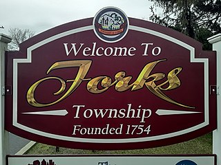
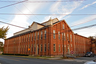
Forks Township is a township in Northampton County, Pennsylvania, United States. The population of Forks Township was 14,721 as of the 2010 census. It is part of the Lehigh Valley metropolitan area, which had a population of 861,899 and was the 68th-most populous metropolitan area in the U.S. as of the 2020 census. The township is home to the global headquarters of Crayola, founded in 1885, a global arts supply company and the world's leading manufacturer of crayons.

<span class="mw-page-title-main">Hellertown, Pennsylvania</span> Place in Pennsylvania, United States

Hellertown is a borough in Northampton County, Pennsylvania. Its population was 6,131 at the 2020 census. Hellertown is part of the Lehigh Valley metropolitan area, which had a population of 861,899 and was the 68th-most populous metropolitan area in the U.S. as of 2020.

<span class="mw-page-title-main">Bethlehem, Pennsylvania</span> City in Pennsylvania, United States

Bethlehem is a city in Northampton and Lehigh Counties in the Lehigh Valley region of eastern Pennsylvania, United States. As of the 2020 census, Bethlehem had a total population of 75,781, making it the second-largest city in the Lehigh Valley after Allentown and the seventh-largest city in the state. Among its total population as of 2020, 55,639 were in Northampton County and 19,343 were in Lehigh County. The city is located along the Lehigh River, a 109-mile-long (175 km) tributary of the Delaware River.

<span class="mw-page-title-main">Lehigh Valley</span> Metropolitan Statistical Area in the United States

The Lehigh Valley is a geographic and metropolitan region formed by the Lehigh River in Lehigh and Northampton counties in eastern Pennsylvania. It is a component valley of the Great Appalachian Valley bounded to its north by Blue Mountain, to its south by South Mountain, to its west by Lebanon Valley, and to its east by the Delaware River and Warren County, New Jersey. The Lehigh Valley is about 40 miles (64 km) long and 20 miles (32 km) wide. The Lehigh Valley's largest city is Allentown, the third-largest city in Pennsylvania and the county seat of Lehigh County, with a population of 125,845 residents as of the 2020 census.

<span class="mw-page-title-main">Pennsylvania Route 412</span> State highway in Pennsylvania, US

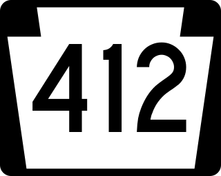
Pennsylvania Route 412 is a 17.75-mile-long (28.57 km) north–south state route located in Bucks and Northampton counties in southeastern Pennsylvania. Its southern terminus is at PA 611 in the Nockamixon Township community of Harrow. Its northern terminus is at PA 378 in Bethlehem.

Locust Valley was a village located in the southeastern corner of Lehigh County, Pennsylvania, United States. The village is located at the southern end of Upper Saucon Township. It is part of the Lehigh Valley, which has a population of 861,899 and is the 68th-most populous metropolitan area in the U.S. as of the 2020 census.

East Branch Saucon Creek is a tributary of Saucon Creek in Northampton County, Pennsylvania, in the United States. It is approximately 5.9 miles (9.5 km) long and flows through Lower Saucon Township and Bethlehem.

References

  1. "2016 U.S. Gazetteer Files". United States Census Bureau. Retrieved August 14, 2017.
  2. 1 2 "Population and Housing Unit Estimates" . Retrieved June 9, 2017.
  3. Sipe, Chester Hale (April 1, 1930). "The Principal Indian Towns of Western Pennsylvania". Western Pennsylvania Historical Magazine. 13 (2): 120. Retrieved October 19, 2023.
  4. "National Register Information System". National Register of Historic Places . National Park Service. July 9, 2010.
  5. Prism at Oregon State University
  6. "Lower Saucon Township map" (PDF). PennDOT. Retrieved March 16, 2023.
  7. "Census of Population and Housing". Census.gov. Retrieved June 4, 2016.
  8. "U.S. Census website". United States Census Bureau . Retrieved January 31, 2008.