Northampton County is a county in the Commonwealth of Pennsylvania, United States. As of the 2020 census, the population was 312,951. Its county seat is Easton. The county was formed in 1752 from parts of Bucks County. Its namesake was the county of Northamptonshire in England, and the county seat of Easton was named for the country house Easton Neston in Northamptonshire.

Bethel Park is a borough with home rule status in Allegheny County, Pennsylvania, United States. It is a suburb within the Pittsburgh metropolitan area, located approximately 7 miles (11 km) south of Pittsburgh. The population was 33,577 as of the 2020 census.
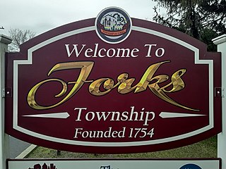
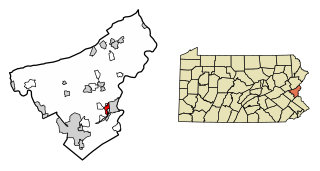
Forks Township is a township in Northampton County, Pennsylvania. The population of Forks Township was 14,721 as of the 2010 census. It is part of the Lehigh Valley metropolitan area, which had a population of 861,899 and was the 68th-most populous metropolitan area in the U.S. as of the 2020 census. The township is home to the global headquarters of Crayola, founded in 1885, a global arts supply company and the world's leading manufacturer of crayons.

Lower Mount Bethel Township is a township in Northampton County, Pennsylvania. The population of Lower Mount Bethel Township was 3,101 at the 2010 census. Lower Mount Bethel Township is part of the Lehigh Valley metropolitan area, which had a population of 861,899 and was the 68th-most populous metropolitan area in the U.S. as of the 2020 census.

Plainfield Township is a township in Northampton County, Pennsylvania. The population of Plainfield Township was 6,138 at the 2010 census. The township is part of the Lehigh Valley metropolitan area, which had a population of 861,899 and was the 68th-most populous metropolitan area in the U.S. as of the 2020 census.

Upper Mount Bethel Township is a township in Northampton County, Pennsylvania. The population of Upper Mount Bethel Township was 6,706 at the 2010 census. The township is part of the Lehigh Valley metropolitan area, which had a population of 861,899 and was the 68th-most populous metropolitan area in the U.S. as of the 2020 census.

Washington Township is a township in Northampton County, Pennsylvania. The population of Washington Township was 5,122 at the 2010 census. Washington Township is part of the Lehigh Valley metropolitan area, which had a population of 861,899 and was the 68th-most populous metropolitan area in the U.S. as of the 2020 census.
Wilson is a borough in Northampton County, Pennsylvania. The population was 8,259 at the 2020 census. Wilson is located adjacent to the city of Easton and is part of the Lehigh Valley metropolitan area, which had a population of 861,899 and was the 68th-most populous metropolitan area in the U.S. as of the 2020 census.

Pennsylvania Route 611 is a state highway in eastern Pennsylvania running 109.7 mi (176.5 km) from Interstate 95 (I-95) in the southern part of the city of Philadelphia north to I-380 in Coolbaugh Township in the Pocono Mountains. Through most of Philadelphia, PA 611 follows Broad Street, the main north-south street in the city. The route continues north through the northern suburbs of Philadelphia and serves Jenkintown, Willow Grove, and Doylestown, the latter of which it bypasses on a freeway. North of Doylestown, PA 611 heads through rural areas and runs along the west bank of the Delaware River to the city of Easton in the Lehigh Valley. The route continues back into rural land and passes through the Delaware Water Gap, at which point it enters the Pocono Mountains region. Here, PA 611 heads northwest through Stroudsburg and Mount Pocono toward its northern terminus.

Martins Creek is a 10.4-mile-long (16.7 km) tributary of the Delaware River in eastern Pennsylvania in the United States. In all, the main creek and its two branches drain an area of 46.7 square miles. Martins Creek joins the Delaware just south of the town of Martins Creek.

Pennsylvania Route 512 is a 26.1-mile-long (42.0 km) state route in Northampton County in the Lehigh Valley region in eastern Pennsylvania. The southern terminus is at U.S. Route 22 north of Bethlehem in Hanover Township. The northern terminus is at PA 611 in Upper Mount Bethel Township. The route heads north from US 22 to Bath, where it intersects PA 248. From here, PA 512 continues northeast and intersects PA 946 in Moorestown before it reaches an interchange with the PA 33 freeway in Wind Gap. The route heads east through the northern Northampton County boroughs of Wind Gap, Pen Argyl, Bangor, and East Bangor, intersecting PA 191 in Bangor. Past here, PA 512 continues east to PA 611.

Cementon is an unincorporated area and census-designated place (CDP) in Lehigh County, Pennsylvania. The town is in Whitehall Township, 7 miles (11 km) north of Allentown. As of the 2020 census, the population of Cementon was 1,657. Cementon is part of the Lehigh Valley metropolitan area, which had a population of 861,899 and was the 68th-most populous metropolitan area in the U.S. as of 2020. It uses the Whitehall Township ZIP Code of 18052.

The 138th Pennsylvania House of Representatives District is located in Southeastern Pennsylvania and has been represented since 2021 by Ann Flood.
Beersville, originally known as Falmers, is an exurban unincorporated village in southwestern Moore Township, Pennsylvania near the Lehigh Township line on Route 248. It is part of the Lehigh Valley metropolitan area, which had a population of 861,899 and which was thus the 68th-most populous metropolitan area in the U.S. as of the 2020 census.

Moorestown is an unincorporated community in Moore Township in Northampton County, Pennsylvania. It is part of the Lehigh Valley metropolitan area, which had a population of 861,899 and was the 68th-most populous metropolitan area in the U.S. as of the 2020 census.
Klecknersville is an unincorporated community in Moore Township in Northampton County, Pennsylvania. It is part of the Lehigh Valley metropolitan area, which had a population of 861,899 and was the 68th-most populous metropolitan area in the U.S. as of the 2020 census.

Berlinsville is an unincorporated community in Lehigh Township in Northampton County, Pennsylvania. It is part of the Lehigh Valley metropolitan area, which had a population of 861,899 and was the 68th-most populous metropolitan area in the U.S. as of the 2020 census.

Hanoverville is an unincorporated community in Northampton County, Pennsylvania. It is part of the Lehigh Valley metropolitan area, which had a population of 861,899 and was the 68th-most populous metropolitan area in the U.S. as of the 2020 census.
Balliettsville is an unincorporated community in North Whitehall Township in Lehigh County, Pennsylvania. It is part of the Lehigh Valley, which had a population of 861,899 and was the 68th-most populous metropolitan area in the U.S. as of the 2020 census.
Franks Corner is an unincorporated community located within East Allen Township in Northampton County, Pennsylvania. It is part of the Lehigh Valley metropolitan area, which had a population of 861,899 and was the 68th-most populous metropolitan area in the United States as of the 2020 census.