Borough of Roseto | |
---|---|
Location of Roseto in Pennsylvania | |
Coordinates: 40°52′50″N75°13′02″W / 40.88056°N 75.21722°W | |
Country | United States |
State | Pennsylvania |
County | Northampton |
Area | |
• City | 0.64 sq mi (1.64 km2) |
• Land | 0.63 sq mi (1.63 km2) |
• Water | 0.01 sq mi (0.02 km2) |
Elevation | 794 ft (242 m) |
Population | |
• City | 1,581 |
• Density | 2,513.51/sq mi (971.01/km2) |
• Metro | 865,310 (US: 68th) |
Time zone | UTC-5 (EST) |
• Summer (DST) | UTC-4 (EDT) |
ZIP Code | 18013 |
Area code(s) | 610 and 484 |
FIPS code | 42-66168 |
School district | Bangor Area School District |
Website | boroughroseto.com |
Roseto is a borough in Northampton County, Pennsylvania. The population of Roseto was 1,567 at the 2010 census. Roseto is part of the Lehigh Valley metropolitan area, which has a population of 861,899 and is the 68th most populated metropolitan area in the U.S. as of the 2020 census.
Roseto is known in the fields of sociology and cardiology for the Roseto effect, wherein the close-knit Italian American community exhibited half the national average rate of heart disease in the mid-20th century. This finding helped to establish that stress can contribute to heart disease. [3]
Roseto, meaning "Rose garden" in Italian, is named for the village of Roseto Valfortore. Neighboring communities were settled primarily by those of German, English, and Welsh descent. The first Italian immigrants from Roseto Valfortore, Italy arrived in 1882 to work in the local slate quarries. The Wind Gap and Delaware Railroad opened a line through the town in 1883. It was operated by the Central Railroad of New Jersey until 1905, after which it was merged into the Lehigh and New England Railroad, which abandoned the line in 1955. Roseto was incorporated as a borough in 1912. [4]
Roseto and its inhabitants were the scene of a study by folklorist Carla Bianco in the early 1970s. She compared Roseto to the mountain town where its name and most of its original settlers had come from, Roseto Valfortore in the Apulia region of southern Italy. [5] Bianco calculated that "95 percent of its present 1,600 inhabitants are still descendants of Roseto Valfortore". [6] A local doctor also noticed positive health rates in Roseto, leading to a study that identified the Roseto effect in public health. [7]
Roseto is located at 40°52′50″N75°13′2″W / 40.88056°N 75.21722°W (40.880576, -75.217345). [8] According to the U.S. Census Bureau, the borough has a total area of 0.6 square miles (1.6 km2), 0% of it being water.
As of 2017, there were 9.08 miles (14.61 km) of public roads in Roseto, of which 1.64 miles (2.64 km) were maintained by the Pennsylvania Department of Transportation (PennDOT) and 7.44 miles (11.97 km) were maintained by the borough. [9]
Pennsylvania Route 191 and Pennsylvania Route 512 are the numbered highways serving Roseto. PA 191 follows Roseto Avenue and First Street along a north-south alignment through the eastern part of the borough. PA 512 follows Blue Valley Drive along an east-west alignment along the southwestern edge of the borough.
Census | Pop. | Note | %± |
---|---|---|---|
1920 | 1,634 | — | |
1930 | 1,746 | 6.9% | |
1940 | 1,778 | 1.8% | |
1950 | 1,676 | −5.7% | |
1960 | 1,630 | −2.7% | |
1970 | 1,538 | −5.6% | |
1980 | 1,484 | −3.5% | |
1990 | 1,555 | 4.8% | |
2000 | 1,653 | 6.3% | |
2010 | 1,567 | −5.2% | |
2020 | 1,581 | 0.9% | |
Sources: [10] [11] [12] |
As of the 2000 census [11] , there were 1,653 people, 640 households, and 476 families residing in the borough. The population density was 2,634.5 inhabitants per square mile (1,017.2/km2). There were 670 housing units at an average density of 1,067.8 per square mile (412.3/km2). The racial makeup of the borough was 98.85% White, 0.36% Asian, 0.18% African American, 0.18% from other races, and 0.42% from two or more races. Hispanic or Latino of any race were 1.94% of the population.
There were 640 households, out of which 33.6% had children under the age of 18 living with them, 57.3% were married couples living together, 11.7% had a female householder with no husband present, and 25.6% were non-families. 22.2% of all households were made up of individuals, and 11.4% had someone living alone who was 65 years of age or older. The average household size was 2.58 and the average family size was 3.04.
In the borough, the population was spread out, with 25.2% under the age of 18, 7.1% from 18 to 24, 28.9% from 25 to 44, 19.2% from 45 to 64, and 19.5% who were 65 years of age or older. The median age was 38 years. For every 100 females there were 89.3 males. For every 100 females age 18 and over, there were 87.3 males. The median income for a household in the borough was $39,813, and the median income for a family was $45,833. Males had a median income of $36,563 versus $21,750 for females. The per capita income for the borough was $17,419. About 5.7% of families and 7.2% of the population were below the poverty line, including 9.4% of those under age 18 and 8.7% of those age 65 or over.
Roseto is served by Bangor Area School District. Students in grades nine through 12 attend Bangor Area High School in Bangor. Faith Christian School is also located in the borough.
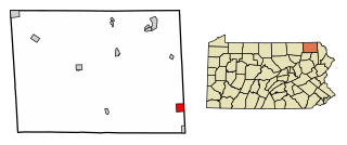
Rankin is a borough in Allegheny County, Pennsylvania, United States, 8 miles (13 km) south of Pittsburgh on the Monongahela River. The borough was named after Thomas Rankin, a local landowner. Early in the 20th century, Rankin specialized in manufacturing steel and wire goods. The population increased from 3,775 in 1900 to 7,470 in 1940, and has since declined to 1,896 as of the 2020 census.
West Kittanning is a borough in Armstrong County, Pennsylvania, United States. The population was 1,192 at the 2020 census.
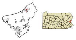
Bally is a borough in Berks County, Pennsylvania, United States. The population was 1,090 at the 2010 census.
Kenhorst is a borough in Berks County, Pennsylvania, United States. The population was 2,877 at the 2010 census.
Lyons is a borough that is located in Berks County, Pennsylvania, United States. The population was 478 at the time of the 2010 census.
Mount Penn is a borough in Berks County, Pennsylvania, United States. The population was 3,106 at the 2010 census. The borough shares a name with a 1,120-foot-high (340 m) mountain that rises to the north and overlooks the city of Reading. The peak is sometimes recognized as the southern end of the Reading Prong group of mountains.
Wyomissing Hills was a borough in Berks County, Pennsylvania that merged into Wyomissing in January, 2002. The population was 2,568 at the 2000 census.
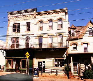
Taylor is a borough in Lackawanna County, Pennsylvania, United States, 3 miles (5 km) southwest of Scranton on the Lackawanna River. It was founded in 1790 by Cornelius Atherton. Silk manufacturing and coal mining were once practiced in the borough. Most of Taylor is built over abandoned mines. The Pennsylvania Turnpike Northeast Extension (I-476), accessible via the Keyser Avenue Interchange, passes through Taylor, going north to Clarks Summit and south to Philadelphia.
Ashley is a borough in Luzerne County, Pennsylvania, one mile (2 km) from Wilkes Barre. The population was 2,588 at the 2020 census.
Bear Creek Village is a borough in Luzerne County, Pennsylvania, United States. The population was 290 at the 2020 census.
Dupont is a borough in the Greater Pittston area of Luzerne County, Pennsylvania, United States. The population was 2,536 as of the 2020 census.
Jeddo is a borough in Luzerne County, Pennsylvania, United States. As of the 2020 census, the population was 109, making it the least populous borough in the county.
Larksville is a borough in Luzerne County, Pennsylvania, United States. It is 2 miles (3 km) west of Wilkes Barre on the Susquehanna River. The population was 4,216 as of the 2020 census.
Laurel Run is a borough that is located in Luzerne County, Pennsylvania, United States. The population was 560 at the time of the 2020 census.
Bangor, or West Bangor, to differentiate it from its immediate neighbor East Bangor, is a borough located in Northampton County, Pennsylvania, United States. It is located 32 miles (51 km) north of Allentown. It had a population of 5,187 as of the 2020 census.
East Bangor is a borough in Northampton County, Pennsylvania. The population of East Bangor was 1,124 as of the 2020 census. It is located in the Lehigh Valley metropolitan region, which had a population of 861,899 and was the 68th-most populous metropolitan area in the U.S. as of the 2020 census.
Portland is a borough in Northampton County, Pennsylvania. The population of Portland was 494 at the 2020 census. Portland is part of the Lehigh Valley metropolitan area, which had a population of 861,899 and was thus the 68th most populous metropolitan area in the U.S. as of the 2020 census.
Washington Township is a township in Northampton County, Pennsylvania. The population of Washington Township was 5,122 at the 2010 census. Washington Township is part of the Lehigh Valley metropolitan area, which had a population of 861,899 and was the 68th-most populous metropolitan area in the U.S. as of the 2020 census.
Union Dale is a borough in Susquehanna County, Pennsylvania, United States. The borough was incorporated in 1885. Union Dale's population was 267 at the 2010 census.
Factoryville is a borough in Wyoming County, Pennsylvania, United States. The population was 1,146 at the 2020 census.