Williams Township, Northampton County, Pennsylvania

Last updated

Williams Township
Township
Coffeetown Grist Mill 04.JPG
Coffeetown Grist Mill in William Township in September 2013
Williams Township Seal.png
Northampton county - Williams Township.png
Location of Williams Township in Northampton County, Pennsylvania
USA Pennsylvania location map.svg
Red pog.svg
Williams Township
Location of Williams Township in Pennsylvania
Usa edcp location map.svg
Red pog.svg
Williams Township
Williams Township (the United States)
Coordinates: 40°38′00″N75°13′59″W / 40.63333°N 75.23306°W / 40.63333; -75.23306
Country Flag of the United States.svg  United States
State Flag of Pennsylvania.svg  Pennsylvania
County Northampton
Area
[1]
  Township18.58 sq mi (48.12 km2)
  Land18.16 sq mi (47.02 km2)
  Water0.42 sq mi (1.09 km2)
Elevation
643 ft (196 m)
Population
 (2020)
  Township6,581
  Estimate 
(2016) [2]
6,071
  Density334.40/sq mi (129.11/km2)
   Metro
865,310 (US: 68th)
Time zone UTC-5 (EST)
  Summer (DST) UTC-4 (EDT)
Area code(s) 610
FIPS code 42-095-85256
Primary airport Lehigh Valley International Airport
Major hospital Lehigh Valley Hospital–Cedar Crest
School district Wilson Area
Website http://www.williamstwp.org

Williams Township is a township in Northampton County, Pennsylvania, United States. The township's population was 6,581 at the 2020 census. The township is part of the Lehigh Valley metropolitan area, which had a population of 861,899 and was the 68th-most populous metropolitan area in the U.S. as of the 2020 census.

Contents

History

The Williams Township Veterans Memorial Williams township war memorial in northampton county pa.JPG
The Williams Township Veterans Memorial
I-78 East in Williams Township 2022-09-27 11 32 35 View east along Interstate 78 from the overpass for Morgan Hill Road in Williams Township, Northampton County, Pennsylvania.jpg
I-78 East in Williams Township

The Bridge in Williams Township, Jacob Arndt House and Barn, Coffeetown Grist Mill, and Isaac Stout House, all in the township, are each listed on the National Register of Historic Places. [3] Another historic grist mill located in Williams Township is the Wottring Mill built in 1810 by William Wottring located on a road that is named in honor of William's mill on Wottrings Mill Road. Presently, it is an unregistered historic place that is privately owned.

Geography

According to the U.S. Census Bureau, Williams Township has a total area of 18.7 square miles (48.5 km2), of which 18.4 square miles (47.6 km2) is land and 0.3 square mile (0.9 km2) (1.76%) is water. It is drained by the Delaware River, which separates it on the east from New Jersey. Its villages include Coffeetown, Raubsville, and Stouts. Morgan Hill is a census-designated place in the northeastern part of the township.

Neighboring municipalities

Demographics

Historical population
CensusPop.Note
2000 4,470
2010 5,88431.6%
2016 (est.)6,071 [2] 3.2%
U.S. Decennial Census [4]

As of the 2000 census, [5] there were 4,470 people, 1,657 households, and 1,267 families residing in the township. The population density was 243.0 inhabitants per square mile (93.8/km2). There were 1,738 housing units at an average density of 94.5 per square mile (36.5/km2). The racial makeup of the township was 97.25% White, 0.81% African American, 0.04% Native American, 0.94% Asian, 0.02% Pacific Islander, 0.13% from other races, and 0.81% from two or more races. Hispanic or Latino of any race were 1.05% of the population.

There were 1,657 households, out of which 31.1% had children under the age of 18 living with them, 66.6% were married couples living together, 6.0% had a female householder with no husband present, and 23.5% were non-families. 18.4% of all households were made up of individuals, and 7.0% had someone living alone who was 65 years of age or older. The average household size was 2.70 and the average family size was 3.10.

In the township, the population was spread out, with 24.2% under the age of 18, 5.9% from 18 to 24, 28.1% from 25 to 44, 28.8% from 45 to 64, and 13.0% who were 65 years of age or older. The median age was 41 years. For every 100 females, there were 99.4 males. For every 100 females age 18 and over, there were 98.5 males.

The median income for a household in the township was $56,196, and the median income for a family was $66,488. Males had a median income of $44,545 versus $29,358 for females. The per capita income for the township was $27,249. About 1.7% of families and 2.7% of the population were below the poverty line, including 1.4% of those under age 18 and 2.2% of those age 65 or over.

Transportation

As of 2018, there were 75.22 miles (121.05 km) of public roads in Williams Township, of which 29.11 miles (46.85 km) were maintained by the Pennsylvania Department of Transportation (PennDOT) and 46.11 miles (74.21 km) were maintained by the township. [6]

Interstate 78 follows an east-to-west alignment in the northern part of Washington Township. I-78's Easton interchange is with Old Philadelphia Road/Morgan Hill Road in the township. The western end of the Interstate 78 Toll Bridge, which crosses the Delaware River to Phillipsburg, New Jersey, is located in Williams Township. Route 611 follows a north-south alignment along the Delaware River from Martins Creek via Easton to Kinternsville. It is connected to the I-78 interchange by Cedarville Road. Other notable local roads are Durham Road, Hellertown-Raubsville Road, and Island Park Road.

Education

The township is served by the Wilson Area School District. Students in grades K through 4 attend Williams Township Elementary School, 5 through 8 attend Wilson Area Intermediate School, and 9 through 12 attend Wilson Area High School in the district.

Related Research Articles

<span class="mw-page-title-main">Warren County, New Jersey</span> County in northwestern New Jersey, United States

Warren County is a county located in the U.S. state of New Jersey. According to the 2020 census, the county was the state's 19th-most populous county, with a population of 109,632, its highest decennial count ever and an increase of 940 (+0.9%) from the 2010 census count of 108,692, which in turn reflected an increase of 6,255 (+6.1%) from 102,437 counted at the 2000 census. The county is part of the North Jersey region of the state.

<span class="mw-page-title-main">Phillipsburg, New Jersey</span> Town in Warren County, New Jersey, US

Phillipsburg is a town located along the Delaware River that is the most populous municipality in Warren County, in the U.S. state of New Jersey. It is part of the Allentown-Bethlehem-Easton, PA-NJ metropolitan statistical area. As of the 2020 United States census, the town's population was 15,249, an increase of 299 (+2.0%) from the 2010 census count of 14,950, which in turn reflected a decline of 216 (−1.4%) from the 15,166 counted in the 2000 census.

<span class="mw-page-title-main">Pohatcong Township, New Jersey</span> Township in Warren County, New Jersey, US

Pohatcong Township is a township in Warren County, in the U.S. state of New Jersey. As of the 2020 United States census, the township's population was 3,241, a decrease of 98 (−2.9%) from the 2010 census count of 3,339, which in turn reflected a decline of 77 (−2.3%) from the 3,416 counted in the 2000 census.

<span class="mw-page-title-main">Bridgeton Township, Pennsylvania</span> Township in Pennsylvania, United States

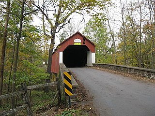
Bridgeton Township is a township in Bucks County, Pennsylvania, United States. The population was 1,277 at the 2010 census. The township was originally a part of adjacent Nockamixon Township, but a division was arranged and signed on May 24, 1890. This accord split an area of Nockamixon which ran west from the banks of the Delaware River to approximately one third the breadth of the original township. This smaller area was named "Bridgeton", since it was the site of Upper Black Eddy–Milford Bridge covered wooden truss bridge built in 1842, which connected the towns of Upper Black Eddy, Pennsylvania and Milford, New Jersey. The original covered bridge was replaced by a truss bridge in 1933.

<span class="mw-page-title-main">Doylestown Township, Pennsylvania</span> Township in Pennsylvania, United States

Doylestown Township is a township in Bucks County, Pennsylvania, United States. The population was 17,565 at the 2010 census. Adjacent to the county seat, the township hosts many county offices and the county correctional facility. Doylestown Central Park is a park in the township.

<span class="mw-page-title-main">Durham Township, Pennsylvania</span> Township in Pennsylvania, United States

Durham Township is a township in Bucks County, Pennsylvania, United States. The population was 1,144 at the 2010 census.

<span class="mw-page-title-main">Nockamixon Township, Pennsylvania</span> Township in Pennsylvania, United States

Nockamixon Township is a township in Bucks County, Pennsylvania, United States. The population was 3,441 at the 2010 census.

<span class="mw-page-title-main">Riegelsville, Pennsylvania</span> Borough in Pennsylvania, United States

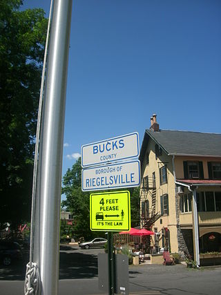
Riegelsville is a borough in Bucks County, Pennsylvania, United States. The population was 868 at the 2010 census. It is included in the Philadelphia–Wilmington–Camden metropolitan statistical area, despite being so closely connected to the Lehigh Valley.

<span class="mw-page-title-main">Springfield Township, Bucks County, Pennsylvania</span> Township in Pennsylvania, United States

Springfield Township is a township in Bucks County, Pennsylvania, United States. The population was 5,035 at the 2010 census.

<span class="mw-page-title-main">Tinicum Township, Bucks County, Pennsylvania</span> Township in Pennsylvania, United States

Tinicum Township is a township in Bucks County, Pennsylvania, United States. The population was 3,995 at the 2010 census.

<span class="mw-page-title-main">Warrington Township, Bucks County, Pennsylvania</span> Township in Pennsylvania, United States

Warrington Township is a township in Bucks County, Pennsylvania, United States. Warrington Township is a northern suburb of Philadelphia. The population was 25,639 at the 2020 census.

<span class="mw-page-title-main">Newlin Township, Pennsylvania</span> Township in Pennsylvania, United States

Newlin Township is a township in Chester County, Pennsylvania, United States. The population was 1,285 at the 2010 census.

<span class="mw-page-title-main">Easton, Pennsylvania</span> City in Pennsylvania, United States

Easton is a city in, and the county seat of, Northampton County, Pennsylvania, United States. The city's population was 28,127 as of the 2020 census. Easton is located at the confluence of the Lehigh River, a 109-mile-long (175 km) river that joins the Delaware River in Easton and serves as the city's eastern geographic boundary with Phillipsburg, New Jersey.

<span class="mw-page-title-main">Forks Township, Northampton County, Pennsylvania</span> Place in Pennsylvania, United States

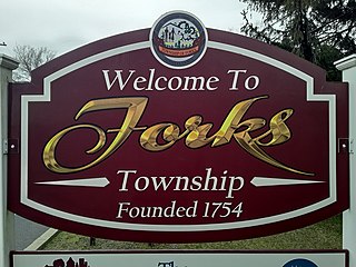
Forks Township is a township in Northampton County, Pennsylvania, United States. The population of Forks Township was 14,721 as of the 2010 census. It is part of the Lehigh Valley metropolitan area, which had a population of 861,899 and was the 68th-most populous metropolitan area in the U.S. as of the 2020 census. The township is home to the global headquarters of Crayola, founded in 1885, a global arts supply company and the world's leading manufacturer of crayons.

<span class="mw-page-title-main">Lower Mount Bethel Township, Pennsylvania</span> Place in Pennsylvania, United States

Lower Mount Bethel Township is a township in Northampton County, Pennsylvania, United States. The population of Lower Mount Bethel Township was 3,101 at the 2010 census. Lower Mount Bethel Township is part of the Lehigh Valley metropolitan area, which had a population of 861,899 and was the 68th-most populous metropolitan area in the U.S. as of the 2020 census.

<span class="mw-page-title-main">Lower Saucon Township, Pennsylvania</span> Place in Pennsylvania, United States

Lower Saucon Township is a township in Northampton County, Pennsylvania, United States. The township's population was 10,772 as of the 2010 census. The township is part of the Lehigh Valley metropolitan area, which had a population of 861,899 and was the 68th-most populous metropolitan area in the U.S. as of the 2020 census.

<span class="mw-page-title-main">Moore Township, Pennsylvania</span> Place in Pennsylvania, United States

Moore Township is a township in Northampton County, Pennsylvania, United States. The population of Moore Township was 9,198 at the 2010 census. The township is located in the Lehigh Valley, which had a population of 861,899 and was the 68th-most populous metropolitan area in the U.S. as of the 2020 census.

<span class="mw-page-title-main">Palmer Township, Pennsylvania</span> Second Class Township in Pennsylvania, United States

Palmer Township is a township in Northampton County, Pennsylvania, United States. The population of Palmer Township was 22,317 at the 2020 census. It is the eight-largest municipality in the Lehigh Valley metropolitan area, which had a population of 861,899 and was the 68th-most populous metropolitan area in the U.S. as of the 2020 census.

<span class="mw-page-title-main">Upper Mount Bethel Township, Pennsylvania</span> Place in Pennsylvania, United States

Upper Mount Bethel Township is a township in Northampton County, Pennsylvania, United States. The population of Upper Mount Bethel Township was 6,706 at the 2010 census. The township is part of the Lehigh Valley metropolitan area, which had a population of 861,899 and was the 68th-most populous metropolitan area in the U.S. as of the 2020 census.

<span class="mw-page-title-main">Coppock, Iowa</span> City in Iowa, United States

Coppock is a city in Henry, Jefferson, and Washington counties in the U.S. state of Iowa. The population was 36 at the 2020 census.

References

  1. "2016 U.S. Gazetteer Files". United States Census Bureau. Retrieved August 14, 2017.
  2. 1 2 "Population and Housing Unit Estimates" . Retrieved June 9, 2017.
  3. "National Register Information System". National Register of Historic Places . National Park Service. July 9, 2010.
  4. "Census of Population and Housing". Census.gov. Retrieved June 4, 2016.
  5. "U.S. Census website". United States Census Bureau . Retrieved January 31, 2008.
  6. "Williams Township map" (PDF). PennDOT. Retrieved March 16, 2023.