Middletown, Northampton County, Pennsylvania

Last updated

Middletown
USA Pennsylvania location map.svg
Red pog.svg
Middletown
Location of Middletown in Pennsylvania
Usa edcp location map.svg
Red pog.svg
Middletown
Middletown (the United States)
Coordinates: 40°38′45″N75°19′40″W / 40.64583°N 75.32778°W / 40.64583; -75.32778
Country Flag of the United States.svg  United States
State Flag of Pennsylvania.svg  Pennsylvania
County Northampton
Area
   Census-designated place 7 km2 (2.6 sq mi)
  Land7 km2 (2.6 sq mi)
  Water0 km2 (0.0 sq mi)
Elevation
84 m (276 ft)
Population
 (2010)
   Census-designated place 7,441
  Density1,100/km2 (2,900/sq mi)
   Metro
865,310 (US: 68th)
Time zone UTC-5 (EST)
  Summer (DST) UTC-4 (EDT)
Area code(s) 610

Middletown is a census-designated place (CDP) in Bethlehem Township in Northampton County, Pennsylvania, United States. The population of Middletown was 7,441 at the 2010 census. Middletown is part of the Lehigh Valley, which had a population of 861,899 and was the 68th-most populous metropolitan area in the U.S. as of the 2020 census.

Contents

Geography

Middletown is located at 40°38′45″N75°19′40″W / 40.64583°N 75.32778°W / 40.64583; -75.32778 (40.645898, -75.327822). [1] According to the U.S. Census Bureau, Middletown has a total area of 2.6 square miles (6.7 km2), all land.

Demographics

As of the 2000 census, [2] there were 7,378 people, 2,779 households, and 2,125 families residing in the CDP. The population density was 2,858.1 inhabitants per square mile (1,103.5/km2). There were 2,862 housing units at an average density of 1,108.7 per square mile (428.1/km2). The racial makeup of the CDP was 94.88% White, 2.07% African American, 0.05% Native American, 0.94% Asian, 1.11% from other races, and 0.95% from two or more races. Hispanic or Latino of any race were 4.31% of the population.

There were 2,779 households, out of which 32.4% had children under the age of 18 living with them, 66.5% were married couples living together, 7.6% had a female householder with no husband present, and 23.5% were non-families. 19.5% of all households were made up of individuals, and 9.1% had someone living alone who was 65 years of age or older. The average household size was 2.65 and the average family size was 3.05.

In Middletown, the population was spread out, with 23.9% under the age of 18, 5.7% from 18 to 24, 29.5% from 25 to 44, 27.1% from 45 to 64, and 13.8% who were 65 years of age or older. The median age was 40 years. For every 100 females, there were 96.1 males. For every 100 females age 18 and over, there were 95.7 males.

The median income for a household in the CDP was $53,785, and the median income for a family was $61,690. Males had a median income of $41,543 versus $29,048 for females. The per capita income for the CDP was $22,282. About 2.3% of families and 3.4% of the population were below the poverty line, including 3.6% of those under age 18 and 3.0% of those age 65 or over.

Education

The community is served by the Bethlehem Area School District.

Related Research Articles

<span class="mw-page-title-main">West Puente Valley, California</span> Census-designated place in California, United States

West Puente Valley is an unincorporated community and census-designated place in Los Angeles County, California, USA, northwest of La Puente. The population was 22,636 at the 2010 census, up from 22,589 at the 2000 census. The community is probably named for its location related to the city of La Puente.

<span class="mw-page-title-main">Cochituate, Massachusetts</span> Census-designated place in Massachusetts, United States

Cochituate is a census-designated place (CDP) in the town of Wayland in Middlesex County, Massachusetts, United States. The population was 6,927 at the 2020 census, out of 13,943 in the entire town of Wayland.

<span class="mw-page-title-main">Middletown, Michigan</span> Census-designated place & unincorporated community in Michigan, United States

Middletown is a census-designated place (CDP) in Shiawassee County in the U.S. state of Michigan. Middletown is located within Caledonia Township along M-71 between the cities of Corunna and Owosso. The CDP had a population of 825 at the 2020 census.

<span class="mw-page-title-main">Beckett, New Jersey</span> Populated place in Gloucester County, New Jersey, US

Beckett is an unincorporated community and census-designated place (CDP) within Logan Township, in Gloucester County, in the U.S. state of New Jersey. As of the 2010 United States Census, the CDP's population was 4,847.

<span class="mw-page-title-main">North Middletown, New Jersey</span> Populated place in Monmouth County, New Jersey, US

North Middletown is an unincorporated community and census-designated place (CDP) within Middletown Township, in Monmouth County, in the U.S. state of New Jersey. As of the 2010 United States Census, the CDP's population was 3,295.

<span class="mw-page-title-main">Beaverdam Lake–Salisbury Mills, New York</span> Former census-designated place in New York, United States

Beaverdam Lake-Salisbury Mills was a census-designated place (CDP) in Orange County, New York, United States. It encompassed a region in the corner of the towns of Blooming Grove, Cornwall, and New Windsor. As of the 2000 census, its population was 2,779. After the 2000 census, the area was counted as two separate CDPs: Beaver Dam Lake in the towns of Blooming Grove and New Windsor and Salisbury Mills in the towns of Blooming Grove and Cornwall. Beaverdam Lake is also the name of a lake next to the community.

Central Valley is a hamlet in Woodbury, New York, United States. The population was 1,857 at the 2000 census, at which time it was a census-designated place. It is part of the Poughkeepsie–Newburgh–Middletown, NY Metropolitan Statistical Area as well as the larger New York–Newark–Bridgeport, NY-NJ-CT-PA Combined Statistical Area.

<span class="mw-page-title-main">Bethlehem, Alexander County, North Carolina</span> Census-designated place in North Carolina, United States

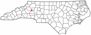
Bethlehem is a census-designated place (CDP) in Alexander County, North Carolina, United States. The population was 4,214 at the 2010 census. It is part of the Hickory–Lenoir–Morganton Metropolitan Statistical Area.

<span class="mw-page-title-main">South Middletown, Ohio</span> Former CDP in Ohio, United States

South Middletown is a former census-designated place (CDP) in Lemon Township, Butler County, Ohio, United States. The population was 264 at the 2000 census. The area of South Middletown is now within the city limits of Middletown.

<span class="mw-page-title-main">Fairview Lanes, Ohio</span> Unincorporated community and Census-designated place in Ohio, United States

Fairview Lanes is an unincorporated community in Perkins Township, Erie County, Ohio, United States. The area was delineated as a census-designated place (CDP) for the 2000 census, at which time its population was 1,015. The area was not a CDP for the 2010 census. It is part of the Sandusky, Ohio Metropolitan Statistical Area.

Reiffton is a census-designated place (CDP) in Exeter Township, Berks County, Pennsylvania, United States. The population was 4,178 at the 2010 census.

Spring Ridge is a census-designated place (CDP) in Spring Township, Berks County, Pennsylvania, United States. The population was 1,003 at the 2010 census.

<span class="mw-page-title-main">Lima, Pennsylvania</span> Census-designated place in Pennsylvania, United States

Lima is an unincorporated community and census-designated place (CDP) in Middletown Township, Delaware County, Pennsylvania, United States. The population was 2,735 at the 2010 census, down from 3,225 at the 2000 census.

<span class="mw-page-title-main">Brodheadsville, Pennsylvania</span> Census-designated place in Pennsylvania, United States

Brodheadsville is a census-designated place (CDP) in Monroe County, Pennsylvania, United States. The population was 1,700 at the 2020 census. The community is served by Pleasant Valley School District.

<span class="mw-page-title-main">Flourtown, Pennsylvania</span> Census-designated place in Pennsylvania, United States

Flourtown is a census-designated place (CDP) in Springfield Township, Montgomery County, Pennsylvania. Flourtown is adjacent to the neighborhoods of Erdenheim, Oreland, Whitemarsh, and Chestnut Hill. The population of Flourtown was 4,538 at the 2010 census. Its ZIP code is 19031.

Halfway House is a census-designated place (CDP) in Montgomery County, Pennsylvania, United States. The population was 3,273 at the 2020 census.

<span class="mw-page-title-main">Montgomeryville, Pennsylvania</span> Census-designated place in Pennsylvania, United States

Montgomeryville is a census-designated place (CDP) in Montgomery Township, Montgomery County, Pennsylvania, United States. The population was 12,624 at the 2010 census. According to a 2010 Forbes magazine/Yahoo.com survey, Montgomeryville ranks 5th in America's top 10 affordable suburbs. It is part of the North Penn Valley region that is centered on the borough of Lansdale.

<span class="mw-page-title-main">Spring House, Pennsylvania</span> Census-designated place in Pennsylvania, United States

Spring House is a census-designated place (CDP) in Lower Gwynedd Township, Montgomery County, Pennsylvania, United States. The population was 3,978 at the 2020 census.

<span class="mw-page-title-main">Harrison City, Pennsylvania</span> Census-designated place in Pennsylvania, United States

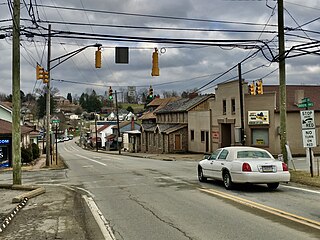
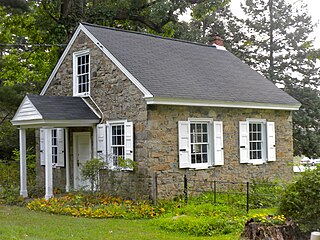
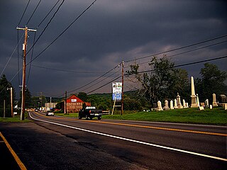
Harrison City is a census-designated place (CDP) in Westmoreland County, Pennsylvania, United States. The population was 174 at the 2020 census.

<span class="mw-page-title-main">Bethlehem Village, Connecticut</span> Census-designated place in Connecticut, United States

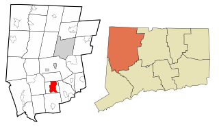
Bethlehem Village is a census-designated place (CDP) within the town of Bethlehem in Litchfield County, Connecticut, United States. The CDP includes the Bethlehem Green Historic District at the town center, as well as surrounding residential and rural land. As of the 2010 census, the CDP had a population of 2,021, out of a population of 3,607 for the entire town of Bethlehem.

References

  1. "US Gazetteer files: 2010, 2000, and 1990". United States Census Bureau. February 12, 2011. Retrieved April 23, 2011.
  2. "U.S. Census website". United States Census Bureau . Retrieved January 31, 2008.