Wilson, Pennsylvania

Last updated

Borough of Wilson
Wilson
Borough
Wilson Seal.png
Northampton County Pennsylvania Incorporated and Unincorporated areas Wilson Highlighted.svg
Location of Wilson in Northampton County, Pennsylvania (left) and of Northampton County in Pennsylvania (right)
USA Pennsylvania location map.svg
Red pog.svg
Wilson
Location of Wilson in Pennsylvania
Usa edcp location map.svg
Red pog.svg
Wilson
Wilson (the United States)
Coordinates: 40°41′05″N75°14′23″W / 40.68472°N 75.23972°W / 40.68472; -75.23972
Country Flag of the United States.svg  United States
State Flag of Pennsylvania.svg  Pennsylvania
County Northampton
Formed as a townshipFeb. 10, 1913 [1]
Incorporated as a boroughJuly 12, 1920 [2]
Named for Woodrow Wilson
Government
   Mayor Donald R Barrett, Jr.
Area
[3]
  Borough1.16 sq mi (3.00 km2)
  Land1.16 sq mi (2.99 km2)
  Water0.01 sq mi (0.01 km2)
Elevation
394 ft (120 m)
Population
 (2020) [4]
  Borough8,259
  Density7,150.65/sq mi (2,760.10/km2)
   Metro
865,310 (US: 68th)
Time zone UTC-5 (EST)
  Summer (DST) UTC-4 (EDT)
ZIP Code
18042
Area code(s) 610 and 484
FIPS code 42-85592
Primary airport Lehigh Valley International Airport
School district Wilson Area
Website Wilson Borough

Wilson is a borough in Northampton County, Pennsylvania. The population was 8,259 at the 2020 census. Wilson is located adjacent to the city of Easton and is part of the Lehigh Valley metropolitan area, which had a population of 861,899 and was the 68th-most populous metropolitan area in the U.S. as of the 2020 census.

Contents

Geography

There is more than one Wilson in Pennsylvania. This borough is in the far east of Pennsylvania, in Northampton County; there is a neighborhood named Wilson in Clairton, south of Pittsburgh in Allegheny County, and another in Clarion County. Wilson is located at 40°41′5″N75°14′23″W / 40.68472°N 75.23972°W / 40.68472; -75.23972 (40.684648, -75.239626). [5] According to the U.S. Census Bureau, the borough has a total area of 1.2 square miles (3.1 km2), of which 1.2 square miles (3.1 km2) is land and 0.80% is water.

History

Page 99 of a Wilson Township organizational meeting in 1914 Page 99 of Wilson Township Organizational Meeting 1914.jpg
Page 99 of a Wilson Township organizational meeting in 1914

Wilson Borough is named after former U.S. President Woodrow Wilson. First formed as a township on February 10, 1913 during the first half of 1920, a number of property owners solicited the courts to change the form of government from a township to that of a borough.

According to the 1920 book, History of the Northampton County (Pennsylvania) and the Grand Valley of Lehigh, by the American Historical Association, supervised and revised by William J. Heller, the township was consummated by the courts in 1914, but the court case of Palmer School District v. Wilson School District indicates the township's formation occurred on February 10, 1913. [1] [6]

There are two very early court cases soon after the creation of the new township in 1913. The first, Palmer School District v. Wilson School District, related to Wilson owing Palmer for a certain amount of indebtedness caused by the township's creation. The second, Township of Wilson v. Easton Transit Co. in 1916, related to Wilson officials suing the transit company for performing work without first obtaining necessary permissions. The township lost this case, but in an appeal to Supreme Court of Pennsylvania on May 22, 1917, then Pennsylvania Supreme Court Justice Walling ruled, "The assignments of error are overruled and the decree is affirmed at the cost of the appellant." [7]

Demographics

Historical population
CensusPop.Note
1920 5,196
1930 8,26559.1%
1940 8,217−0.6%
1950 8,159−0.7%
1960 8,4653.8%
1970 8,406−0.7%
1980 7,564−10.0%
1990 7,8303.5%
2000 7,682−1.9%
2010 7,8962.8%
2020 8,2594.6%
U.S. Decennial Census [8]

At the 2010 census, [9] there were 7,896 people living in the borough. The racial makeup of the borough was 84.1% White, 6.5% African American, 0.2% Native American, 2.1% Asian, 0.0% Pacific Islander, 3.0% from other races, and 4.1% from two or more races. Hispanic or Latino of any race were 10.6% of the population.

Transportation

US 22 East in Wilson 2022-09-28 10 46 29 View east along U.S. Route 22 (Lehigh Valley Thruway) from the pedestrian overpass between Pennsylvania State Route 248 (Northampton Street) and Wood Avenue in Wilson, Northampton County, Pennsylvania.jpg
US 22 East in Wilson

As of 2010, there were 19.96 miles (32.12 km) of public roads in Wilson, of which 5.08 miles (8.18 km) were maintained by the Pennsylvania Department of Transportation (PennDOT) and 14.88 miles (23.95 km) were maintained by the borough. [10]

U.S. Route 22 and Pennsylvania Route 248 are the numbered highways passing through Wilson. US 22 follows the Lehigh Valley Thruway along a southwest-northeast alignment along the western and northern edges of the borough, with an interchange with PA 248 located just west of the borough in Palmer Township. PA 248 follows Northampton Street along an east-west alignment through the center of the borough.

Education

The borough is served by the Wilson Area School District. Students in grades nine through 12 attend Wilson Area High School in the borough.

Related Research Articles

<span class="mw-page-title-main">Northampton County, Pennsylvania</span> County in Pennsylvania, United States

Northampton County is a county in the Commonwealth of Pennsylvania, United States. As of the 2020 census, the population was 312,951. Its county seat is Easton. The county was formed in 1752 from parts of Bucks County. Its namesake was the county of Northamptonshire in England, and the county seat of Easton was named for the country house Easton Neston in Northamptonshire.

<span class="mw-page-title-main">Lehigh County, Pennsylvania</span> County in Pennsylvania, United States

Lehigh County is a county in the Commonwealth of Pennsylvania. As of the 2020 census, the county's population was 374,557. Its county seat is Allentown, the state's third-largest city after Philadelphia and Pittsburgh.

<span class="mw-page-title-main">Carbon County, Pennsylvania</span> County in Pennsylvania, United States

Carbon County is a county in the Commonwealth of Pennsylvania. It is located in Northeastern Pennsylvania. As of the 2020 census, the population was 64,749. The county is also part of Pennsylvania's Coal Region and Northeastern Pennsylvania.

<span class="mw-page-title-main">Whitehall Township, Pennsylvania</span> Township in Pennsylvania, United States

Whitehall Township is a township with home rule status in Lehigh County, Pennsylvania. The township's population was 26,738 as of the 2010 census.

<span class="mw-page-title-main">Bath, Pennsylvania</span> Borough in Pennsylvania, United States

Bath is a borough in Northampton County, Pennsylvania. As of the 2020 census, Bath had a population of 2,808. It is part of the Lehigh Valley metropolitan area, which had a population of 861,899 and was the 68th-most populous metropolitan area in the U.S. as of the 2020 census.

<span class="mw-page-title-main">Bethlehem Township, Pennsylvania</span> Place in Pennsylvania, United States

Bethlehem Township is a township in Northampton County, Pennsylvania, United States. The population of Bethlehem Township was 23,730 at the 2010 census. It is a suburb of Bethlehem and is part of the Lehigh Valley metropolitan statistical area, which had a population of 861,899 and was the 68th-most populous metropolitan area in the U.S. as of the 2020 census.

<span class="mw-page-title-main">Chapman, Pennsylvania</span> Borough in Pennsylvania, United States

Chapman is a borough in Northampton County, Pennsylvania. The population of Chapman was 223 as of the 2020 census. Chapman is part of the Lehigh Valley metropolitan area, which had a population of 861,899 and was the 68th-most populous metropolitan area in the U.S. as of the 2020 census.

<span class="mw-page-title-main">East Allen Township, Northampton County, Pennsylvania</span> Place in Pennsylvania, United States

East Allen Township is a township in Northampton County, Pennsylvania. The population of East Allen Township was 4,903 at the 2010 census. East Allen is part of the Lehigh Valley metropolitan area, which had a population of 861,899 and was the 68th-most populous metropolitan area in the U.S. as of the 2020 census.

<span class="mw-page-title-main">Easton, Pennsylvania</span> City in Pennsylvania, United States

Easton is a city in, and the county seat of, Northampton County, Pennsylvania, United States. The city's population was 28,127 as of the 2020 census. Easton is located at the confluence of the Lehigh River, a 109-mile-long (175 km) river that joins the Delaware River in Easton and serves as the city's eastern geographic boundary with Phillipsburg, New Jersey.

<span class="mw-page-title-main">Forks Township, Northampton County, Pennsylvania</span> Place in Pennsylvania, United States

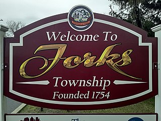
Forks Township is a township in Northampton County, Pennsylvania. The population of Forks Township was 14,721 as of the 2010 census. It is part of the Lehigh Valley metropolitan area, which had a population of 861,899 and was the 68th-most populous metropolitan area in the U.S. as of the 2020 census. The township is home to the global headquarters of Crayola, founded in 1885, a global arts supply company and the world's leading manufacturer of crayons.

<span class="mw-page-title-main">Glendon, Pennsylvania</span> Place in Pennsylvania, United States

Glendon is a borough in Northampton County, Pennsylvania. The population of Glendon was 373 at the 2020 census. Glendon is part of the Lehigh Valley metropolitan area, which had a population of 861,899 and was thus the 68th-most populous metropolitan area in the U.S. as of the 2020 census.

<span class="mw-page-title-main">Hellertown, Pennsylvania</span> Place in Pennsylvania, United States

Hellertown is a borough in Northampton County, Pennsylvania. Its population was 6,131 at the 2020 census. Hellertown is part of the Lehigh Valley metropolitan area, which had a population of 861,899 and was the 68th-most populous metropolitan area in the U.S. as of 2020.

<span class="mw-page-title-main">Lower Nazareth Township, Pennsylvania</span> Place in Pennsylvania, United States

Lower Nazareth Township is a township in Northampton County, Pennsylvania. The population of Lower Nazareth Township was 5,674 at the 2010 census. The township is located in the Lehigh Valley, which had a population of 861,899 and was the 68th-most populous metropolitan area in the U.S. as of the 2020 census.

<span class="mw-page-title-main">Moore Township, Northampton County, Pennsylvania</span> Place in Pennsylvania, United States

Moore Township is a township in Northampton County, Pennsylvania. The population of Moore Township was 9,198 at the 2010 census. The township is located in the Lehigh Valley, which had a population of 861,899 and was the 68th-most populous metropolitan area in the U.S. as of the 2020 census.

<span class="mw-page-title-main">Northampton, Pennsylvania</span> Borough in Pennsylvania, United States

Northampton is a borough in Northampton County, Pennsylvania. Its population was 10,395 as of the 2020 census. Northampton is located 7.8 miles (12.6 km) north of Allentown, 66.7 miles (107.3 km) northwest of Philadelphia, and 93.8 miles (151.0 km) west of New York City.

<span class="mw-page-title-main">Palmer Township, Pennsylvania</span> Place in Pennsylvania, United States

Palmer Township is a township in Northampton County, Pennsylvania. The population of Palmer Township was 20,691 at the 2010 census.

<span class="mw-page-title-main">Stockertown, Pennsylvania</span> Place in Pennsylvania, United States

Stockertown is a borough in Northampton County, Pennsylvania. The borough's population was 927 as of the 2010 census. It is part of the Lehigh Valley metropolitan area, which had a population of 861,899 and was the 68th most populous metropolitan area in the U.S. as of the 2010 census.

<span class="mw-page-title-main">Upper Nazareth Township, Pennsylvania</span> Place in Pennsylvania, United States

Upper Nazareth Township is a township in Northampton County, Pennsylvania. It is part of the Lehigh Valley metropolitan area, which had a population of 861,899 and was the 68th-most populous metropolitan area in the U.S. as of the 2020 census. At the 2010 census, the Upper Nazareth Township population was 6,231.

<span class="mw-page-title-main">Pennsylvania Route 248</span> State highway in Pennsylvania, US

Pennsylvania Route 248 is a 31.3 mi (50.4 km) long state highway in the eastern part of the U.S. state of Pennsylvania. The western terminus of the route is at U.S. Route 209 in Weissport East, a CDP in Franklin Township. The eastern terminus is at PA 611 in Easton. The route begins at US 209 in Carbon County and heads southeast parallel to the Lehigh River as a four-lane divided highway to Bowmanstown, where it becomes a freeway and heads through Palmerton. Upon crossing Lehigh Gap in Blue Mountain, PA 248 enters Northampton County and becomes a two-lane undivided highway that heads southeast through rural areas, serving Bath and Nazareth. From here, the route runs southeast through suburban areas to Wilson, where it turns east and follows city streets through Easton.

<span class="mw-page-title-main">Wilson Area School District</span> School district in Pennsylvania

Wilson Area School District is a public school district located in Northampton County, Pennsylvania in the Lehigh Valley region of eastern Pennsylvania. It serves the boroughs of Glendon, West Easton, and Wilson, and Williams Township.

References

  1. 1 2 Pennsylvania. Courts; Allinson, E.P.; Titus, H.C.; Monaghan, R.J.; Stork, T.B.; Page, H.W.; Bergen, M.V.; Bell, J.C.; Hanna, M.; American Bar Association (1916). The District Reports, Containing Cases Decided in the Various Judicial Districts of the State of Pennsylvania. V. 1–30: 1892–1921. Vol. 25. E. P. Allinson. p. 461. Retrieved November 15, 2014.
  2. "Local Name Origins: Wilson Borough (retyped and revised) | Easton, PA Patch". easton.patch.com. Retrieved November 15, 2014.
  3. "ArcGIS REST Services Directory". United States Census Bureau. Retrieved October 16, 2022.
  4. "Census Population API". United States Census Bureau. Retrieved October 12, 2022.
  5. "US Gazetteer files: 2010, 2000, and 1990". United States Census Bureau. February 12, 2011. Retrieved April 23, 2011.
  6. Heller, W.J.; American Historical Society (1920). History of Northampton County [Pennsylvania] and the Grand Valley of the Lehigh: Under Supervision and Revision of William J. Heller, Assisted by an Advisory Board of Editors... American historical society. p. 506. Retrieved November 15, 2014.
  7. Pennsylvania. Supreme Court (1918). Pennsylvania State Reports Containing Cases Decided by the Supreme Court of Pennsylvania. Vol. 258. West Publishing Company. p. 271. Retrieved November 15, 2014.
  8. "Census of Population and Housing". Census.gov. Retrieved June 4, 2016.
  9. "U.S. Census website". United States Census Bureau . Retrieved January 31, 2008.
  10. "Wilson Borough map" (PDF). PennDOT. Retrieved March 16, 2023.