Hellertown, Pennsylvania

Last updated

Hellertown, Pennsylvania
Detwiller Plaza (2602062075).jpg
Detwiller Plaza in Hellertown in June 2008
Hellertown Seal.jpg
Northampton County Pennsylvania Incorporated and Unincorporated areas Hellertown Highlighted.svg
Location of Hellertown in Northampton County, Pennsylvania (left) and of Northampton County in Pennsylvania (right)
USA Pennsylvania location map.svg
Red pog.svg
Hellertown
Location of Hellertown in Pennsylvania
Usa edcp location map.svg
Red pog.svg
Hellertown
Hellertown (the United States)
Coordinates: 40°35′03″N75°20′17″W / 40.58417°N 75.33806°W / 40.58417; -75.33806
Country United States
State Pennsylvania
County Northampton
Named for Christopher Heller
Government
   Mayor David J. Heintzelman (D) [1]
Area
  City1.32 sq mi (3.41 km2)
  Land1.31 sq mi (3.40 km2)
  Water0.00 sq mi (0.01 km2)
Elevation
322 ft (98 m)
Population
 (2020) [2]
  City6,132
  Density4,673.78/sq mi (1,805.07/km2)
   Metro
865,310 (US: 68th)
Time zone UTC-5 (EST)
  Summer (DST) UTC-4 (EDT)
Zip Code
18055
Area codes 610 and 484
FIPS code 42-33744
Primary airport Lehigh Valley International Airport
Major hospital Lehigh Valley Hospital–Cedar Crest
School district Saucon Valley
Website www.hellertownborough.org

Hellertown is a borough in Northampton County, Pennsylvania. Its population was 6,131 at the 2020 census. Hellertown is part of the Lehigh Valley metropolitan area, which had a population of 861,899 and was the 68th-most populous metropolitan area in the U.S. as of 2020.

Contents

Hellertown is home to Lost River Caverns, a natural limestone cavern.

Geography

Hellertown is located at 40°35′3″N75°20′17″W / 40.58417°N 75.33806°W / 40.58417; -75.33806 (40.584099, -75.338139). [3] According to the U.S. Census Bureau, the borough has a total area of 1.3 square miles (3.4 km2), all land.

History

Pre-settlement

The area of present-day Hellertown was inhabited by various American Indian groups and European settlers.[ citation needed ]

18th century

Hellertown was founded in 1742 by Christopher Heller and his brother Simon. The family were Palatines that left Rotterdam on September 5, 1738 and landed in Philadelphia. Christopher obtained the patent for his land September 8, 1742, and Simon received his patent October 14, 1746. Together they owned a 176 acre property at the southern foot of the Lehigh Mountain along the Saucon Creek and constructed the family plantation named "delay". [4]

19th century

In 1820, the town contained thirteen houses, eighteen families, three taverns, two stores, one grist-mill, and seventy-three inhabitants. The town specialized in the production of linseed oil. The first school in Hellertown was built in 1845 following the donation of a plot of land by resident John Reutzheimer. Prior to this all schooling was performed on a rotation basis in local homes. [5]

In the late 1840s, the town would shift from a small farming community to a burgeoning industrial center, with coal yards being built in 1848, and the Lower Saucon Ironworks opening in 1849. This growth was expedited in 1856 the North Pennsylvania Railroad was built through Hellertown and Rudolphus Kent, of Gwynedd, purchased a plot of land to build a rail station. The small wooden station would be demolished in favor of a larger stone one in 1868. In 1858, the town's first newspaper, The Hellertown Telegraph began publication, but would only last a year before shutting its doors. In 1866, a large iron foundry was constructed by the Lower Saucon Ironworks. It was joined by the Saucon Savings bank in 1871, and a steel foundry in 1872. A Planing mill was built in 1874 and a furniture factory and flour mill in 1875.

In 1870, the original school house built in 1845 was purchased and turned into an Evangelical Church, the first church in the town, prior to which all religious services where held on a rotational basis in people's houses. Since 1867, the town has had an Odd Fellows lodge, and they were joined in October 1869 by the second ever chapter of the Sons of Hermann.

In 1874, the first cemetery in the town was started, the Union Cemetery. In 1875, the town's second newspaper, The Saucon Advertiser was founded, but it would close in just a few months. That year Hellertown consisted of five stores, two hardware stores, one drug store, two carriage factories, one foundry, one grist-mill, one saw-mill, one planing-mill, two furnace stacks, three hotels, coal and lumber yard, furniture manufactory, a town hall, a bank, two churches, and a population of almost 1,000. [5]

Government and politics

In the 2016 Presidential election Donald Trump won the borough with 1,349 votes to 1,281 votes in favor of Hillary Clinton. [6] In the 2020 Presidential election Joe Biden won with 1,648 votes to Donald Trump's 1,572 votes. [7]

Legislators

Chief Burgess

Originally, like many other boroughs in Pennsylvania, Hellertown's highest executive was the Chief Burgess a largely ceremonial office selected by members of the borough council amongst themselves to serve a one year term that was often reserved for the more senior members of the council.

No.NameTermPartyNotes
1.Thomas R. LaubachTinsmith and stove dealer elected the first Chief Burgess. [8]
Milton HessBrother of Jeremiah. Local businessman. [8]
Jeremiah S. Hess Brother of Milton. Local businessman. [8]
A.J. HarrisOwner of the first Drug Store in the borough. [8]
George B. DeemerOwner of a stone quarry that most of the borough used to build structures. [8]
Charles J. WaidnerNorthampton County commissioner and veterinarian. [8]
James WagnerOwner of a gist mill. [8]
Morris J. Dimmick1925 - 1945Vice President of Guerber Engineering from 1930 to 1960. [9]

Mayors

No.NameTermPartyNotes
Howard Hess1946-1949Descendant of Thomas R. Laubach, Northampton county commissioner, restored and preserved the original borough jail. [10]
Emerson Mills1969-1981Served three terms until his defeat in 1981. [11]
Donald C. Zimpfer1985-1993DemocraticSpent eight years on the borough council before becoming mayor. [12] Defeated in the Democratic primaries. [11]
Ben Muschlitz1993-1997DemocraticLongtime borough councilmen, engaged in a corruption scandal at the end of his term. [13] Attempted to merge Hellertown and Lower Saucon Township. [14]
Richard Fluck1997-2017DemocraticSpent 28 years on the borough council, and 20 years as mayor. [15] [16]
David Heintzelman2017-presentDemocraticLocal funeral home owner and prominent local businessman. [17] [15]

Demographics

Historical population
CensusPop.Note
1880 605
1890 70817.0%
1900 7455.2%
1910 91522.8%
1920 3,008228.7%
1930 3,85128.0%
1940 4,0314.7%
1950 5,43534.8%
1960 6,71623.6%
1970 6,615−1.5%
1980 6,025−8.9%
1990 5,662−6.0%
2000 5,606−1.0%
2010 5,8985.2%
2020 6,1324.0%
Sources: [18] [19] [20] [2]

As of the census [19] of 2000, there were 5,606 people, 2,448 households, and 1,571 families residing in the borough. The population density was 4,180.8 inhabitants per square mile (1,614.2/km2). There were 2,570 housing units at an average density of 1,916.6 per square mile (740.0/km2). The racial makeup of the borough was 98.20% White, 0.30% African American, 0.07% Native American, 0.20% Asian, 0.68% from other races, and 0.55% from two or more races. Hispanic or Latino of any race were 2.48% of the population.

There were 2,448 households, out of which 24.7% had children under the age of 18 living with them, 51.2% were married couples living together, 10.3% had a female householder with no husband present, and 35.8% were non-families. 30.5% of all households were made up of individuals, and 17.2% had someone living alone who was 65 years of age or older. The average household size was 2.29 and the average family size was 2.85.

In the borough, the population was distributed, with 20.2% under the age of 18, 6.6% from 18 to 24, 29.0% from 25 to 44, 21.2% from 45 to 64, and 23.1% who were 65 years of age or older. The median age was 42 years. For every 100 females there were 89.3 males. For every 100 females age 18 and over, there were 86.2 males.

The median income for a household in the borough was $39,651, and the median income for a family was $49,604. Males had a median income of $37,935 versus $26,322 for females. The per capita income for the borough was $20,119. About 4.1% of families and 4.6% of the population were below the poverty line, including 6.5% of those under age 18 and 3.3% of those age 65 or over.

Transportation

PA Route 412 in Hellertown 2022-09-27 09 21 26 View north along Pennsylvania State Route 412 (Main Street) just north of Polk Valley Road in Hellertown, Northampton County, Pennsylvania.jpg
PA Route 412 in Hellertown
Keystone Marker for Hellertown, November 2009 Hellertown, PA Keystone Marker.jpg
Keystone Marker for Hellertown, November 2009

As of 2010, there were 24.26 miles (39.04 km) of public roads in Hellertown, of which 3.58 miles (5.76 km) were maintained by the Pennsylvania Department of Transportation (PennDOT) and 20.68 miles (33.28 km) were maintained by the borough. [21]

Pennsylvania Route 412 runs north-south through Hellertown on Main Street, heading north to Bethlehem and south into Bucks County, where it provides access to Pennsylvania Route 611. PA 412 has an interchange with Interstate 78 just outside the corporate limits of Hellertown, which heads west to Allentown and Harrisburg and east to Easton and New York City. [22]

LANta provides bus service to Hellertown along Route 215, which provides service Monday-Saturday north to Bethlehem and Lehigh Valley International Airport, and Route 105, which provides Sunday service north to Bethlehem and the Lehigh Valley Mall. [23] Klein Transportation and Trans-Bridge Lines provide bus service from Hellertown to New York City from a park and ride lot located at the interchange between I-78 and PA 412. [24] [25] Hellertown formerly had commuter rail service along SEPTA's Bethlehem Line north to Bethlehem and south to Philadelphia at Hellertown station, but service ended in 1981.

Education

Hellertown and Lower Saucon Township are served by the Saucon Valley School District. Saucon Valley School District includes an elementary school, middle school, and Saucon Valley High School.

Notable people

Related Research Articles

<span class="mw-page-title-main">Northampton County, Pennsylvania</span> County in Pennsylvania, United States

Northampton County is a county in the Commonwealth of Pennsylvania, United States. As of the 2020 census, the population was 312,951. Its county seat is Easton. The county was formed in 1752 from parts of Bucks County. Its namesake was the county of Northamptonshire in England, and the county seat of Easton was named for the country house Easton Neston in Northamptonshire.

<span class="mw-page-title-main">Lehigh County, Pennsylvania</span> County in Pennsylvania, United States

Lehigh County is a county in the Commonwealth of Pennsylvania. As of the 2020 census, the county's population was 374,557. Its county seat is Allentown, the state's third-largest city after Philadelphia and Pittsburgh.

<span class="mw-page-title-main">Kutztown, Pennsylvania</span> Borough in Pennsylvania, United States

Kutztown is a borough in Berks County, Pennsylvania, United States. It is located 18 miles (29 km) southwest of Allentown and 17 miles (27 km) northeast of Reading. As of the 2020 census, the borough had a population of 4,162. Kutztown University of Pennsylvania is located just outside the borough limits to the southwest.

<span class="mw-page-title-main">Springfield Township, Bucks County, Pennsylvania</span> Township in Pennsylvania, United States

Springfield Township is a township in Bucks County, Pennsylvania, United States. The population was 5,035 at the 2010 census.

<span class="mw-page-title-main">Allentown, Pennsylvania</span> Home rule municipality in Pennsylvania, United States

Allentown is a city in and the county seat of Lehigh County, Pennsylvania, United States. It is the third-largest city in Pennsylvania with a population of 125,845 as of the 2020 census and the largest city in the Lehigh Valley metropolitan area, which had a population of 861,899 and was the 68th-most populous metropolitan area in the United States as of 2020.

<span class="mw-page-title-main">Coopersburg, Pennsylvania</span> Borough in Pennsylvania, United States

Coopersburg is a borough in Lehigh County, Pennsylvania, United States. The population of Coopersburg was 2,447 as of the 2020 census. It is a suburb of Allentown and is located 7 miles (11 km) miles southeast of Allentown, 40 miles (64 km) north of Philadelphia, and 76 miles (122 km) west of New York City.

<span class="mw-page-title-main">Lower Milford Township, Pennsylvania</span> Township in Pennsylvania, United States

Lower Milford Township is a township in Lehigh County, Pennsylvania. The population of Lower Milford Township was 3,775 at the 2010 census. It is a suburb of Allentown in the Lehigh Valley region of eastern Pennsylvania.

<span class="mw-page-title-main">Salisbury Township, Lehigh County, Pennsylvania</span> Township in Pennsylvania, United States

Salisbury Township is a township in Lehigh County, Pennsylvania. The township's population was 13,505 at the 2010 census. The township borders Allentown, Pennsylvania's third-largest city, Bethlehem, and Emmaus, in the Lehigh Valley, which had a population of 861,899 and was the 68th-most populous metropolitan area in the U.S. as of the 2020 census.

<span class="mw-page-title-main">Slatington, Pennsylvania</span> Borough in Pennsylvania, United States

Slatington is a borough in Lehigh County, Pennsylvania. As of the 2010 census, it had a population of 4,232. Slatington is located northwest of Allentown and Bethlehem. Slatington is part of the Lehigh Valley metropolitan area, which had a population of 861,899 and was the 68th-most populous metropolitan area in the U.S. as of the 2020 census.

<span class="mw-page-title-main">Upper Saucon Township, Pennsylvania</span> Township in Pennsylvania, United States

Upper Saucon Township is a township in Lehigh County, Pennsylvania. It is part of the Lehigh Valley metropolitan area, which had a population of 861,899 and was the 68th-most populous metropolitan area in the U.S. as of the 2020 census. The township had a population of 16,973 as of the 2020 census.

<span class="mw-page-title-main">Whitehall Township, Pennsylvania</span> Township in Pennsylvania, United States

Whitehall Township is a township with home rule status in Lehigh County, Pennsylvania. The township's population was 26,738 as of the 2010 census.

<span class="mw-page-title-main">Souderton, Pennsylvania</span> Borough of Pennsylvania, US

Souderton is a borough in Montgomery County, Pennsylvania, United States. The population was 7,246 in 2022 according to the Census Bureau.

<span class="mw-page-title-main">Bethlehem Township, Pennsylvania</span> Place in Pennsylvania, United States

Bethlehem Township is a township in Northampton County, Pennsylvania, United States. The population of Bethlehem Township was 23,730 at the 2010 census. It is a suburb of Bethlehem and is part of the Lehigh Valley metropolitan statistical area, which had a population of 861,899 and was the 68th-most populous metropolitan area in the U.S. as of the 2020 census.

<span class="mw-page-title-main">Lower Saucon Township, Pennsylvania</span> Place in Pennsylvania, United States

Lower Saucon Township is a township in Northampton County, Pennsylvania, United States. The township's population was 10,772 as of the 2010 census. The township is part of the Lehigh Valley metropolitan area, which had a population of 861,899 and was the 68th-most populous metropolitan area in the U.S. as of the 2020 census.

<span class="mw-page-title-main">Bethlehem, Pennsylvania</span> City in Pennsylvania, United States

Bethlehem is a city in Northampton and Lehigh Counties in the Lehigh Valley region of eastern Pennsylvania, United States. As of the 2020 census, Bethlehem had a total population of 75,781. Among its total population as of 2020, 55,639 were in Northampton County and 19,343 were in Lehigh County. It is Pennsylvania's seventh-most populous city. The city is located along the Lehigh River, a 109-mile-long (175 km) tributary of the Delaware River.

<span class="mw-page-title-main">Lehigh Valley</span> Metropolitan Statistical Area in the United States

<span class="mw-page-title-main">Mayors of Allentown, Pennsylvania</span>

The city of Allentown, Pennsylvania was founded in 1762 as Northampton Town by William Allen, a wealthy shipping merchant. During its first fifty years of existence, Northampton Town was a small unincorporated settlement, consisting of a few homes, stores and taverns.

<span class="mw-page-title-main">Pennsylvania Route 412</span> State highway in Pennsylvania, US

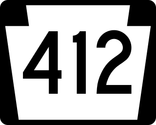
Pennsylvania Route 412 is a 17.75-mile-long (28.57 km) north–south state route located in Northampton and Bucks counties in southeastern Pennsylvania. Its southern terminus is at PA 611 in the Nockamixon Township community of Harrow. Its northern terminus is at PA 378 in Bethlehem.

<span class="mw-page-title-main">Interstate 78 in Pennsylvania</span> Highway in Pennsylvania, US

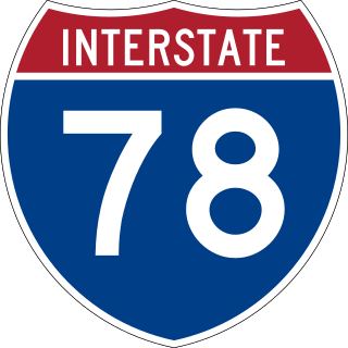
Interstate 78 (I-78) is an east–west Interstate Highway stretching from Union Township, Lebanon County, Pennsylvania, in the west to the Holland Tunnel and New York City in the east. In Pennsylvania, I-78 runs for about 78 miles (126 km) from the western terminus at I-81 in Union Township east to the New Jersey state line near Easton in Northampton County.

References

  1. Deegan, Jim (May 17, 2017). "Northampton County primary election results 2017". lehighvalleylive. Retrieved January 1, 2020.
  2. 1 2 "Census Population API". United States Census Bureau. Retrieved October 12, 2022.
  3. "US Gazetteer files: 2010, 2000, and 1990". United States Census Bureau. February 12, 2011. Retrieved April 23, 2011.
  4. "Hellertown, Pennsylvania". cityinfo.com. Retrieved May 31, 2023.
  5. 1 2 HESS, J. S. "The History of the Borough of Hellertown". www.lehighvalleyhistory.com. Retrieved May 31, 2023.
  6. Popichak, Josh. "Trump Defeats Clinton: How Did Saucon Valley Residents Vote in 2016 Presidential Election?". Saucon Source. Retrieved October 17, 2023.
  7. Popichak, Josh. "Election Update: Hellertown, Lower Saucon Split on Biden, Trump". Saucon Source. Retrieved October 17, 2023.
  8. 1 2 3 4 5 6 7 "STREETS BEAR NAMES OF NOTABLE RESIDENTS". The Morning Call . Retrieved October 18, 2023.
  9. Samuels, Karen (June 12, 2011). "Morris J. Dimmick: A Man Ahead of His Time". Patch Media . Retrieved October 10, 2023.
  10. "HELLERTOWN SOCIETY TO BE GIVEN OLD JAIL HISTORIANS ELECT OFFICERS". The Morning Call . Retrieved October 18, 2023.
  11. 1 2 "HELLERTOWN MAYOR SEEKS RE-ELECTION ELECTION 89". The Morning Call . Retrieved October 17, 2023.
  12. "AN ELECTION PREVIEW". The Morning Call . Retrieved October 17, 2023.
  13. "HELLERTOWN COUNCILMAN: QUIT, MAYOR * BEN MUSCHLITZ'S 'I'M SORRY' WON'T BE ENOUGH, JERRY DONNELLY SAYS". The Morning Call . Retrieved October 17, 2023.
  14. "HELLERTOWN MAYOR WILL INVITE MERGER OPPONENT TO JOIN PANEL * BEN MUSCHLITZ SAID HE'LL ASK LOWER SAUCON TOWNSHIP'S BARRY GEBHART TO BE ON STUDY COMMITTEE". The Morning Call . Retrieved October 17, 2023.
  15. 1 2 Popichak, Josh. "Hellertown Borough Elects First New Mayor in 20 Years". Saucon Source. Retrieved October 17, 2023.
  16. Popichak, Josh. "Long-time Hellertown Mayor Won't Seek Re-Election". Saucon Source. Retrieved October 17, 2023.
  17. Popichak, Josh. "Hellertown Mayor David Heintzelman Announces Re-election Bid". Saucon Source. Retrieved October 17, 2023.
  18. "Census of Population and Housing". U.S. Census Bureau. Retrieved December 11, 2013.
  19. 1 2 "U.S. Census website". United States Census Bureau . Retrieved January 31, 2008.
  20. "Incorporated Places and Minor Civil Divisions Datasets: Subcounty Resident Population Estimates: April 1, 2010 to July 1, 2012". Population Estimates. U.S. Census Bureau. Archived from the original on June 11, 2013. Retrieved December 11, 2013.
  21. "Hellertown Borough map" (PDF). PennDOT. Retrieved March 16, 2023.
  22. Northampton County, Pennsylvania Highway Map (PDF) (Map). PennDOT. 2015. Retrieved January 17, 2016.
  23. System Map (Map). LANTA. Retrieved February 14, 2018.
  24. "Klein Transportation and OurBus announce introductory schedule and rates". Allentown, PA: WFMZ-TV. February 10, 2019. Retrieved February 10, 2019.
  25. "Bieber sets new pick-up, drop-off point in New York City". Allentown, PA: WFMZ-TV. July 27, 2018. Retrieved July 28, 2018.
  26. Dauben, Joseph Warren; Scriba, Christoph J. Writing the history of mathematics: its historical development, Birkhäuser, 2002. Cf. pp.380-381 for the biography of Boyer.