Catasauqua, Pennsylvania

Last updated

Catasauqua, Pennsylvania
Dery Silk Mill Lehigh Co PA.JPG
Dery Silk Mill in the Biery's Port Historic District of Catasauqua in October 2012
Catasauqua Seal.jpg
Lehigh County Pennsylvania Incorporated and Unincorporated areas Catasauqua Highlighted.svg
Location of Catasauqua in Lehigh County, Pennsylvania (left) and of Lehigh County in Pennsylvania (right)
USA Pennsylvania location map.svg
Red pog.svg
Catasauqua
Location of Catasauqua in Pennsylvania
Usa edcp location map.svg
Red pog.svg
Catasauqua
Catasauqua (the United States)
Coordinates: 40°39′11″N75°28′03″W / 40.65306°N 75.46750°W / 40.65306; -75.46750
Country Flag of the United States.svg  United States
State Flag of Pennsylvania.svg  Pennsylvania
County Lehigh
Government
  MayorBarbara Schlegel
Area
[1]
   Borough 1.33 sq mi (3.44 km2)
  Land1.29 sq mi (3.35 km2)
  Water0.04 sq mi (0.10 km2)
Elevation
279 ft (85 m)
Population
 (2020) [2]
   Borough 6,518
  Density5,044.89/sq mi (1,948.11/km2)
   Metro
865,310 (US: 68th)
Time zone UTC-5 (EST)
  Summer (DST) UTC-4 (EDT)
ZIP Code
18032
Area codes 610 and 484
FIPS code 42-11720
Primary airport Lehigh Valley International Airport
Major hospital Lehigh Valley Hospital–Cedar Crest
School district Catasauqua Area
Website www.catasauqua.org

Catasauqua, referred to colloquially as Catty, is a borough in Lehigh County, Pennsylvania, United States. Catasauqua's population was 6,518 at the 2020 census. It is a suburb of Allentown in the Lehigh Valley, which had a population of 861,899 and was the 68th-most populous metropolitan area in the U.S. as of the 2020 census.

Contents

In 1839, Catasauqua was the location of the first manufactured anthracite iron in the nation. The borough was settled in 1805 and chartered in 1853.

Geography

A pre-1923 sketch of Bridge Street Presbyterian Church, founded in 1850 in Catasauqua Catasauqua PA Bridge St Presby PHS0115.jpg
A pre-1923 sketch of Bridge Street Presbyterian Church, founded in 1850 in Catasauqua
The George Taylor House in Catasauqua, home of George Taylor, a Founding Father of the United States who signed the Declaration of Independence George Taylor House.jpg
The George Taylor House in Catasauqua, home of George Taylor, a Founding Father of the United States who signed the Declaration of Independence

Catasauqua is located at 40°39′11″N75°28′3″W / 40.65306°N 75.46750°W / 40.65306; -75.46750 (40.652995, -75.467627). [3] Nearby large communities include Allentown three miles (5 km) to the south and Bethlehem seven miles (11 km) to the east. According to the U.S. Census Bureau, the borough has a total area of 1.3 square miles (3.4 km2), of which 1.3 square miles (3.4 km2) is land and 0.04 square mile (0.10 km2 or 2.31%) is water. Catasauqua Creek flows through the town. Lehigh River runs along the southwestern edge of Catasauqua.

Neighboring municipalities

Demographics

Historical population
CensusPop.Note
1860 1,932
1870 2,85347.7%
1880 3,0657.4%
1890 3,70420.8%
1900 3,9637.0%
1910 5,25032.5%
1920 4,714−10.2%
1930 4,8512.9%
1940 4,764−1.8%
1950 4,9233.3%
1960 5,0622.8%
1970 5,70212.6%
1980 6,71117.7%
1990 6,662−0.7%
2000 6,588−1.1%
2010 6,436−2.3%
2020 6,5181.3%
Sources: [4] [5] [6] [2]

As of the 2000 census, [5] there were 6,588 people, 2,616 households, and 1,750 families residing in the borough. The population density was 5,205.7 inhabitants per square mile (2,009.9/km2). There were 2,747 housing units at an average density of 2,170.6 per square mile (838.1/km2). The racial makeup of the borough was 95.60% White, 1.18% African American, 0.33% Native American, 0.59% Asian, 0.02% Pacific Islander, 1.08% from other races, and 1.20% from two or more races. Hispanic or Latino of any race were 3.54% of the population.

There were 2,616 households, out of which 33.6% had children under the age of 18 living with them, 49.5% were married couples living together, 12.1% had a female householder with no husband present, and 33.1% were non-families. 27.6% of all households were made up of individuals, and 10.8% had someone living alone who was 65 years of age or older. The average household size was 2.50 and the average family size was 3.04.

In the borough, the age distribution of the population shows 25.0% under the age of 18, 7.7% from 18 to 24, 32.1% from 25 to 44, 22.3% from 45 to 64, and 12.9% who were 65 years of age or older. The median age was 36 years. For every 100 females there were 94.1 males. For every 100 females age 18 and over, there were 91.1 males. The median income for a household in the borough was $42,432, and the median income for a family was $48,589. Males had a median income of $32,320 versus $45,730 for females. The per capita income for the borough was $18,906. About 5.4% of families and 8.0% of the population were below the poverty line, including 11.7% of those under age 18 and 11.2% of those age 65 or over.

History

18th century

George Taylor, signer of the Declaration of Independence, built a Georgian stone house in 1768 in what is now Catasauqua. The George Taylor House has been named a National Historic Landmark, a showpiece of the community's rich historical heritage. At the time, the area of present-day Catasaqua was referred to as Biery's Port.

19th century

In 1840, the anthracite iron industry was found in Biery's Port in present-day Catasaqua, making Catasaqua a birthplace of the American Industrial Revolution. [7] Welsh immigrant David Thomas relocated to the area and opened the Crane Iron Works. The Catasauqua and Fogelsville Railroad existed to transport ore from limonite deposits to the plant. Remembered as "the father of Catasauqua," Thomas initially named the community Craneville after his former employer in Wales. The wealthy, generous Thomases were responsible for many sweeping changes to the prosperity of the community. David Thomas founded the Presbyterian Church of Catasauqua, in which residents still worship today, and his wife Elizabeth donated money and land to found the Welsh Congregational Church, which no longer exists. Thomas organized Catasauqua's first fire company, installed its first public water system, and served as its first burgess.

In 1854, the town was formally titled Catasauqua (pronounced "Cat-uh-SAW-kwuh"), derived from the Lenape language, and meaning "dry ground" or "thirsty ground." By 1900, Catasauqua boasted 5,000 residents, and had the highest percentage of self-made millionaires of any town in the United States.

20th century

In 1917, while many of the young men of the town served in World War I, Catasauqua became the first community in the United States to raise $1 million in war bonds, earning it the nickname "The Million Dollar Town".

21st century

Catasauqua observed its 150th anniversary of incorporation in 2004. In July 2014, the town also celebrated its 100th anniversary of the old home week celebration in 1914. The original old home week marked the 75th anniversary of the town's Lehigh Crane Iron Company.

Catasauqua is home to two different neighborhoods listed on the National Register of Historic Places: Biery's Port, located along the Lehigh River and named for an early family of prominence, and a neighborhood known as "the mansion district," which includes Victorian homes once owned by wealthy Catasauqua residents.

Education

Catasauqua is served by the Catasauqua Area School District and maintains three public schools: Sheckler Elementary (grades k-4), Catasauqua Middle School (grades 5-8), and Catasauqua High School (grades 9-12). The district also serves parts of Hanover Township and North Catasauqua.

Transportation

Race Street in Catasauqua 2022-09-26 12 38 18 View northeast along Race Street between Lehigh Street and Front Street in Catasauqua, Lehigh County, Pennsylvania.jpg
Race Street in Catasauqua

As of 2019, there were 20.18 miles (32.48 km) of public roads in Catasauqua, of which 1.66 miles (2.67 km) were maintained by the Pennsylvania Department of Transportation (PennDOT) and 18.52 miles (29.81 km) were maintained by the borough. [8]

The main thoroughfares through the borough are Race Street, Lehigh Street, and Howerton Road.

Notable people

Related Research Articles

<span class="mw-page-title-main">Quakertown, Pennsylvania</span> Borough in Pennsylvania, United States

Quakertown is a borough in Bucks County, Pennsylvania, United States. As of 2020, it had a population of 9,359. The borough is 15 miles (24 km) south of Allentown and Bethlehem and 40 miles (64 km) north of Philadelphia, making Quakertown a border town of both the Delaware Valley and Lehigh Valley metropolitan areas.

<span class="mw-page-title-main">Palmerton, Pennsylvania</span> Borough in Pennsylvania, United States

Palmerton is a borough in Carbon County, Pennsylvania, United States. It is part of Northeastern Pennsylvania. The borough's population was 5,414 at the 2010 census.

<span class="mw-page-title-main">Weissport, Pennsylvania</span> Borough in Pennsylvania, United States

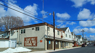
Weissport is a borough in Carbon County, Pennsylvania. It is part of Northeastern Pennsylvania. As of the 2010 census, it had a population of 412.

<span class="mw-page-title-main">Coopersburg, Pennsylvania</span> Borough in Pennsylvania, United States

Coopersburg is a borough in Lehigh County, Pennsylvania, United States. The population of Coopersburg was 2,447 as of the 2020 census. It is a suburb of Allentown and is located 7 miles (11 km) miles southeast of Allentown, 40 miles (64 km) north of Philadelphia, and 76 miles (122 km) west of New York City.

<span class="mw-page-title-main">Coplay, Pennsylvania</span> Borough in Pennsylvania, United States

Coplay is a borough in Lehigh County, Pennsylvania, United States. Coplay's population was 3,348 at the 2020 census. It is located six miles (10 km) northwest of Allentown. The borough is part of the Lehigh Valley metropolitan area, which had a population of 861,899 and was the 68th-most populous metropolitan area in the U.S. as of the 2020 census.

<span class="mw-page-title-main">Emmaus, Pennsylvania</span> Borough in Pennsylvania, United States

Emmaus is a borough in Lehigh County, Pennsylvania, United States. As of the 2020 U.S. census, it had a population of 11,652. Emmaus is located in the Lehigh Valley, the third-largest metropolitan area in Pennsylvania and 68th-largest metropolitan area in the nation.

<span class="mw-page-title-main">Fullerton, Pennsylvania</span> Census-designated place in Pennsylvania, United States

Fullerton is an unincorporated area and census-designated place (CDP) in Whitehall Township in Lehigh County, Pennsylvania. The population of Fullerton was 16,588 as of the 2020 census.

<span class="mw-page-title-main">Hanover Township, Lehigh County, Pennsylvania</span> Township in Pennsylvania, United States

Hanover Township is a township in Lehigh County, Pennsylvania, United States. As of the 2010 census, the township had a population of 1,571. It is a suburb of Allentown and Bethlehem and part of the Lehigh Valley metropolitan area, which had a population of 861,899 and was the 68th-most populous metropolitan area in the U.S. as of the 2020 census.

<span class="mw-page-title-main">Hokendauqua, Pennsylvania</span> Census-designated place in Pennsylvania, United States

Hokendauqua is an unincorporated community and census-designated place (CDP) in Whitehall Township in Lehigh County, Pennsylvania, United States. The population of Hokendauqua was 3,340 as of the 2020 census. Hokendauqua is a suburb of Allentown, Pennsylvania in the Lehigh Valley metropolitan area, which had a population of 861,899 and was the 68th-most populous metropolitan area in the U.S. as of the 2020 census.

<span class="mw-page-title-main">Macungie, Pennsylvania</span> Borough in Pennsylvania, United States

Macungie is borough in Lehigh County, Pennsylvania, United States, its second oldest. As of the 2020 census, Macungie had a population of 3,257.

<span class="mw-page-title-main">Salisbury Township, Lehigh County, Pennsylvania</span> Township in Pennsylvania, United States

Salisbury Township is a township in Lehigh County, Pennsylvania, United States. The township's population was 13,621 at the 2020 census. The township borders Allentown, Pennsylvania's third-largest city, Bethlehem, and Emmaus, in the Lehigh Valley, which had a population of 861,899 and was the 68th-most populous metropolitan area in the U.S. as of the 2020 census.

<span class="mw-page-title-main">Slatington, Pennsylvania</span> Borough in Pennsylvania, United States

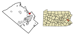
Slatington is a borough in Lehigh County, Pennsylvania, United States. As of the 2010 census, it had a population of 4,232. Slatington is located northwest of Allentown and Bethlehem. Slatington is part of the Lehigh Valley metropolitan area, which had a population of 861,899 and was the 68th-most populous metropolitan area in the U.S. as of the 2020 census.

<span class="mw-page-title-main">Upper Saucon Township, Pennsylvania</span> Township in Pennsylvania, United States

Upper Saucon Township is a township in Lehigh County, Pennsylvania, United States. It is part of the Lehigh Valley metropolitan area, which had a population of 861,899 and was the 68th-most populous metropolitan area in the U.S. as of the 2020 census. The township had a population of 16,973 as of the 2020 census.

<span class="mw-page-title-main">Whitehall Township, Pennsylvania</span> Township in Pennsylvania, United States

Whitehall Township is a township with home rule status in Lehigh County, Pennsylvania, United States. The township's population was 26,738 as of the 2010 census.

<span class="mw-page-title-main">White Haven, Pennsylvania</span> Borough in Pennsylvania, United States

White Haven is a borough in Luzerne County, Pennsylvania, United States. It is located along the Lehigh River. The population was 1,163 at the 2020 census.

<span class="mw-page-title-main">Allen Township, Northampton County, Pennsylvania</span> Township in Pennsylvania, United States

Allen Township is a township in Northampton County, Pennsylvania, United States. The population of Allen Township was 4,269 at the 2010 census. Allen Township is part of the Lehigh Valley metropolitan area, which had a population of 861,899 and was the 68th-most populous metropolitan area in the U.S. as of the 2020 census.

<span class="mw-page-title-main">North Catasauqua, Pennsylvania</span> Place in Pennsylvania, United States

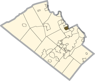
North Catasauqua is a borough in Northampton County, Pennsylvania, United States. The borough was founded in 1907. The population of North Catasauqua was 2,971 at the 2020 census. The borough is part of the Lehigh Valley metropolitan area, which had a population of 861,899 and was the 68th-most populous metropolitan area in the U.S. as of the 2020 census.

<span class="mw-page-title-main">Northampton, Pennsylvania</span> Borough in Pennsylvania, United States

Northampton is a borough in Northampton County, Pennsylvania, United States. Its population was 10,395 as of the 2020 census. Northampton is located 7.8 miles (12.6 km) north of Allentown, 66.7 miles (107.3 km) northwest of Philadelphia, and 93.8 miles (151.0 km) west of New York City.

<span class="mw-page-title-main">Pen Argyl, Pennsylvania</span> Borough in Pennsylvania, United States

Pen Argyl is a borough in Northampton County, Pennsylvania. The borough's population was 3,510 as of the 2020 census.

<span class="mw-page-title-main">Walnutport, Pennsylvania</span> Place in Pennsylvania, United States

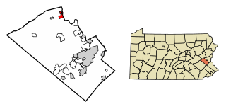
Walnutport is a borough in Northampton County, Pennsylvania. It was first incorporated in 1909. The population of Walnutport was 2,067 at the 2020 census.

References

  1. "ArcGIS REST Services Directory". United States Census Bureau. Retrieved October 12, 2022.
  2. 1 2 "Census Population API". United States Census Bureau. Retrieved October 12, 2022.
  3. "US Gazetteer files: 2010, 2000, and 1990". United States Census Bureau. February 12, 2011. Retrieved April 23, 2011.
  4. "Census of Population and Housing". U.S. Census Bureau. Retrieved December 11, 2013.
  5. 1 2 "U.S. Census website". United States Census Bureau . Retrieved January 31, 2008.
  6. "Incorporated Places and Minor Civil Divisions Datasets: Subcounty Resident Population Estimates: April 1, 2010 to July 1, 2012". Population Estimates. U.S. Census Bureau. Archived from the original on June 11, 2013. Retrieved December 11, 2013.
  7. Savidge, Mariella (April 15, 2002). "Historical group finds new base". The Morning Call. Allentown, Pennsylvania . Retrieved September 15, 2010.
  8. "Catasauqua Borough map" (PDF). PennDOT. Retrieved March 17, 2023.
  9. Reichler, Joseph L., ed. (1979) [1969]. The Baseball Encyclopedia (4th ed.). New York: Macmillan Publishing. ISBN   0-02-578970-8.

Further reading