1834 Java earthquake

Last updated
1834 Java earthquake
De voorzijde van het paleis te Buitenzorg na de aardbeving van 10 oktober 1834 Rijksmuseum SK-A-4025.jpeg
Illustration of damage in Bogor Palace after earthquake
Indonesia Java relief location map.png
Bullseye1.png
Indonesia relief location map.jpg
Bullseye1.png
Local dateOctober 11, 1834 (1834-10-11)
Magnitude Mw 7.0
Depth12 km
Epicenter 6°28′12″S106°57′29″E / 6.470°S 106.958°E / -6.470; 106.958
Java, Dutch East Indies
Fault Baribis Fault
TypeThrust
Areas affected Java
Max. intensity MMI IX (Violent)
LandslidesYes
Casualties5 dead

The 1834 Java earthquake struck the Dutch East Indies (present-day Indonesia) island of Java, in the city of Bogor. The earthquake occurred on the morning of October 11, 1834. It was assigned VIII (Severe) to IX (Violent) on the Modified Mercalli intensity scale. [1]

Contents

Description

It was preceded by a number of strongly felt foreshocks the night before on October 11. When the mainshock struck the next morning, it was violently felt. Vibrations were also detected by people as far as Tegal in Central Java and Lampung on the neighboring island of Sumatra. [2]

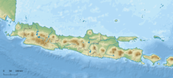
Although the earthquake caused very few deaths and injuries, it severely damaged many and collapsed a few. Damage to roads such as cracks were reported from Bogor to Cianjur, Cianjur Regency. [3] Many warehouses and factories were also badly affected. A postal station in the city was buried under a landslide, killing five people and ten horses. [4] Many homes and stone building in Batavia were damaged. [4] A country warehouse and a number of townhouses were also damaged. The Bogor Palace in the city, which was the residence of Jean Chrétien Baud, [5] Governor-General of the Dutch East Indies, was so severely damaged that Jean Chrétien Baud ordered it be demolished. [6] The palace was rebuilt with a new 19th century European architecture style. [7]

Earthquake

Modeling the earthquake with a moment magnitude (Mw) of 7.0 at a depth of 12 km along a 45-km-long reverse fault known as the Baribis Fault was consistent with the historical descriptions about the earthquake and its effects. In the simulation of ground motions, Batavia, Buitenzorg, Tjanjor, and Tjiandjawar suffered the most intense shaking, at IX on the Mercalli intensity scale. The simulation also predicted severe to violent shaking in Banten, Karawang, and Tegal but no descriptions of extensive damage was reported there, possibly due to historical bias. [4]

Future hazard

A simulation estimates that if an earthquake of the same intensity occurred today it would cause around 40,000 deaths. [8]

See also

Related Research Articles

<span class="mw-page-title-main">Bogor Palace</span> Presidential palace in Indonesia

The Bogor Palace is one of six presidential palaces of Indonesia, it is located in the city of Bogor, West Java. The palace is noted for its distinctive architectural and historical features, as well as the adjoining botanical gardens. Istana Bogor was opened to the public in 1968 to public tour groups, with the permission of the acting president of Indonesia, Suharto. The gardens of the palace covers an area of 284,000 square metres.

<span class="mw-page-title-main">Great Post Road</span> Historical road in Java, Indonesia constructed in the early 19th century

The Great Post Road is the name for the historical road that runs across Java that connects Anyer and Panarukan. It was built during the reign of Herman Willem Daendels (1808–1811), governor-general of the Dutch East Indies, using unpaid forced labor that cost thousands of lives.

<span class="mw-page-title-main">North Coast Road (Java)</span> Road in Indonesia

The North Coast Road is a road 1,430 km in length, that connects Cilegon and Banyuwangi along the northern coast of Java, particularly between Jakarta and Surabaya.

<span class="mw-page-title-main">2009 West Java earthquake</span> Earthquake in Indonesia

An earthquake occurred on September 2, 2009 at 14:55:01 local time in West Java, Indonesia. The magnitude 7.0 earthquake killed at least 81 people, injured over 1,297, and displaced over 210,000. The quake was felt in the capital Jakarta, although damage there was minimal, and it was Indonesia's deadliest earthquake since the 2006 Pangandaran earthquake and tsunami.

The following is a timeline of the history of the city of Jakarta, Indonesia.

The 1917 Bali earthquake occurred at 06:50 local time on 21 January. It had an estimated magnitude of 6.6 on the surface wave magnitude scale and had a maximum perceived intensity of IX (Violent) on the Mercalli intensity scale. It caused widespread damage across Bali, particularly in the south of the island. It triggered many landslides, which caused 80% of the 1,500 casualties.

<span class="mw-page-title-main">2017 Java earthquake</span> 2017 earthquake centered in Tasikmalaya, West Java, Indonesia

The 2017 Java earthquake occurred on 15 December 2017 when a moment magnitude 6.5 earthquake struck the Indonesian island of Java, specifically the city of Tasikmalaya on 23:47:58 West Indonesian Time in West Java, Indonesia. The earthquake struck at a depth of 91 km and was categorized as a strong but deep earthquake. It was initially registered as a 7.3 magnitude earthquake by Indonesian agencies. Widespread damage was reported across Tasikmalaya, the nearest major city to the epicentre. A tsunami warning was immediately issued by the authorities but was subsequently cancelled. Four people have been confirmed dead.

<span class="mw-page-title-main">5 August 2018 Lombok earthquake</span> Earthquake in Indonesia

On 5 August 2018, a destructive and shallow earthquake measuring Mw  6.9 struck the island of Lombok, Indonesia. It was the main shock following its foreshock, a nearby Mw  6.4 earthquake on 29 July. It was followed by a nearby 6.9 earthquake on 19 August 2018.

<span class="mw-page-title-main">2019 Sunda Strait earthquake</span> 2 August 2019, earthquake in Indonesia

The 2019 Sunda Strait earthquake occurred on the night of 2 August 2019, when a magnitude 6.9 earthquake rattled Sunda Strait at a moderate depth of 52.8 kilometres. The epicentre was located 214 km from Bandar Lampung, the capital of Lampung and 147 km west of Sumur, Pandeglang Regency. The earthquake struck with a maximum intensity of VI (Strong). The earthquake prompted a tsunami warning in the area, with authorities urging coastal residents to immediately evacuate to higher grounds.

A moment magnitude 6.2 earthquake struck Majene Regency in West Sulawesi, Indonesia, on 15 January 2021, at 02:28 WITA. The reverse faulting shock initiated at 18.0 km (11.2 mi) depth with an epicenter inland, located 32 km (20 mi) south of Mamuju. It was preceded by a Mw  5.7 foreshock several hours prior. Shaking from the mainshock was assigned a maximum Modified Mercalli intensity of VI (Strong) in Majene and Mamuju. Four of the five regencies in West Sulawesi were affected. More than 6,000 structures were damaged or destroyed; damage was estimated at Rp829.1 billion rupiah. At least 105 people were confirmed dead; more than 3,300 were injured and thousands were displaced.

The western coast of West Sulawesi was struck by a major earthquake on 23 February 1969 at 00:36 UTC. It had a magnitude of 7.0 Mw and a maximum felt intensity of VIII on the Modified Mercalli intensity scale. It triggered a major tsunami that caused significant damage along the coast of the Makassar Strait. At least 64 people were killed, with possibly a further 600 deaths caused by the tsunami.

<span class="mw-page-title-main">2021 East Java earthquake</span> Earthquake in Indonesia

An earthquake occurred on 10 April 2021 at 14:00 local time (UTC+07:00) off the south coast of eastern Java. The epicenter of the earthquake is located 44 km south–southwest of Gondanglegi Kulon in East Java province. Measuring 6.0 or 6.1 on the moment magnitude scale (Mw ) and having a depth of 82.3 km, the earthquake caused moderate shaking measuring V on the Mercalli intensity scale. At least 10 individuals are known to have died from the earthquake and another 104 were seriously injured.

On the morning of January 5, 1699, a violent earthquake rocked the then Dutch East Indies city of Batavia on the island of Java, now known as the Indonesian capital city of Jakarta. Dutch accounts of the event described the earthquake as being "so heavy and strong" and beyond comparable to other known earthquakes. This event was so large that it was felt throughout west Java, and southern Sumatra.

The 1815 Bali earthquake occurred on November 22 between 22:00 and 23:00 local time (WITA), affecting the Bali Kingdom. The estimated moment magnitude 7.0 earthquake struck off the north coast of Bali at a shallow depth. It was assigned a maximum intensity of IX (Violent) on the Mercalli intensity scale, causing severe damage in Buleleng and Tabanan. The earthquake caused a landslide and tsunami that killed 11,453 people.

The 2021 Bali earthquake struck at 04:18 local time (UTC+08:00) when people were still sleeping on 15 October 2021. It resulted in 4 deaths and 73 more injured, despite having a moment magnitude of 4.7.

<span class="mw-page-title-main">1867 Java earthquake</span> Earthquake in the Dutch East Indies (present-day Indonesia)

The 1867 Central Java earthquake occurred on June 10 at between 04:20 and 04:30 local time. It struck off the southern coast of the Indonesian island with an estimated moment magnitude of 7.8 (Mw ). Widespread devastation occurred in Central Java, where as many as 700 people were killed. The intermediate-depth intraslab earthquake did not cause a tsunami.

<span class="mw-page-title-main">Baribis Fault</span>

The Baribis Fault is a geological feature located in the northern part of Java. This fault, estimated to be 100 kilometers long, stretches from Purwakarta to Lebak Regency and is a threat to the Jakarta metropolitan area because the fault is partially located within the metropolitan area itself.

<span class="mw-page-title-main">2022 West Java earthquake</span> Earthquake in Indonesia

On 21 November 2022, at 13:21 WIB (UTC+07:00), a Mww 5.6 earthquake struck near Cianjur in West Java, Indonesia. The strike-slip earthquake occurred with a focal depth of 11 km (6.8 mi). Between 335 and 635 people died, 7,729 were injured and five remain missing. More than 62,628 homes were damaged across 16 districts in Cianjur Regency and the surrounding region. It is the deadliest earthquake to hit Indonesia since the 2018 Sulawesi earthquake. Damage evaluated after the event earned it a maximum Modified Mercalli intensity of VIII (Severe).

An earthquake affected the island of Java, Indonesia on 22 January 1780. The source and magnitude of the earthquake remains debated among seismologists. Proposed origins of the earthquake include shallow inland back-arc thrusting along a fault located within the upper crust on the island or rupture of the subduction zone off the southern coast of Java. The magnitude of the earthquake is estimated to be at least 8.5, while other sources usually refer to it with a range of Mw  8.0 to 8.5 for the megathrust earthquake. For the shallow crustal earthquake source, the magnitude range is Mw  7.0 to 8.0.

<span class="mw-page-title-main">Herman Suherman</span>

Herman Suherman is an Indonesian politician of the Indonesian Democratic Party of Struggle and former bureaucrat who is the regent of Cianjur Regency, West Java. He served as acting regent between 2018 and 2021, replacing his predecessor who was arrested on corruption charges, and he became the official regent in 2021 after winning the 2020 regency election. Prior to entering politics, he worked in the regency's government for nearly 30 years.

References

  1. "Katalog Gempabumi Signifikan dan Dirasakan". BMKG . Retrieved 13 July 2021.
  2. Teddy Tri Setio Berty (3 August 2019). "3 Gempa Dahsyat yang Pernah Mengguncang Jakarta di Masa Lampau" (in Indonesian). Liputan. Retrieved 13 July 2021.
  3. "Significant Earthquake Information". ngdc.noaa.gov. NCEI. Retrieved 13 July 2021.
  4. 1 2 3 Ngoc Nguyen; Jonathan Griffin; Athanasius Cipta; Phil R. Cummins (2015). "Indonesia's Historical Earthquakes: Modelled examples for improving the national hazard map". Record 2015/23. Canberra, Australia: Geoscience Australia. doi:10.11636/Record.2015.023. ISSN   2201-702X . Retrieved 19 June 2021.
  5. "Front View of Buitenzorg Palace during the Earthquake of 10 October 1834, Willem Troost (II), 1834 - 1836". Rijksmuseum . Retrieved 13 July 2021.
  6. Widi Agustian (6 April 2014). "Istana Bogor Sempat Hancur oleh Gempa Bumi Dahsyat". Oke Finance. Retrieved 13 July 2021.
  7. adk, rus (March 1, 2015). "Kisah Jokowi, Istana Bogor, dan Ratu Pantai Selatan". Archived from the original on March 4, 2016. Retrieved March 6, 2015.
  8. Nguyen, Ngoc; Griffin, Jonathan; Cipta, Athanasius; Cummins, Phil R. (January 2015). Indonesia's Historical Earthquakes Modelled examples for improving the national hazard map (Report). 10.11636/Record.2015.023. doi:10.11636/Record.2015.023 . Retrieved 17 June 2022.