
Bristol County is a county in the Commonwealth of Massachusetts. As of the 2020 census, the population was 579,200. The shire town is Taunton. Some governmental functions are performed by the Commonwealth of Massachusetts, others by the county, and others by local towns and cities.

Norfolk County is located in the U.S. state of Massachusetts. At the 2020 census, the population was 725,981. Its county seat is Dedham. It is the fourth most populous county in the United States whose county seat is neither a city nor a borough, and it is the second most populous county that has a county seat at a town. The county was named after the English county of the same name. Two towns, Cohasset and Brookline, are exclaves.

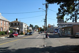
North Attleborough, alternatively spelled North Attleboro, is a town in Bristol County, Massachusetts, United States. The population was 30,834 at the 2020 United States Census.
Plainville is a town in Norfolk County, Massachusetts, United States. The population was 9,945 at the time of the 2020 census. Plainville is part of the Boston and Providence metropolitan areas.

Wrentham is a town in Norfolk County, Massachusetts, United States. The population was 12,178 at the 2020 census.

Cumberland is the northeasternmost town in Providence County, Rhode Island, United States, first settled in 1635 and incorporated in 1746. The population was 36,405 at the 2020 census, making it the seventh-largest municipality and the largest town in the state.

Metacomet, also known as Pometacom, Metacomet, and by his adopted English name King Philip, was sachem to the Wampanoag people and the second son of the sachem Massasoit. Metacom became sachem in 1662 when his brother Wamsutta died shortly after the death of their father. Wamsutta's widow Weetamoo, sachem of the Pocasset, was Metacom's ally and friend for the rest of his life. Metacom married Weetamoo's younger sister Wootonekanuske. It is unclear how many children they had or what happened to them. Wootonekanuske and one of their sons were sold to slavery in the West Indies following the defeat of the Native Americans in what became known as King Philip's War.

Route 1A is a north–south state highway in Massachusetts. It is an alternate route to U.S. 1 with three signed sections and two unsigned sections where the highway is concurrent with its parent. Due to the reconfiguration of tunnel interchanges brought on by the completion of the Big Dig, Route 1A is discontinuous in the downtown Boston area. Vehicles entering Downtown Boston via the Sumner Tunnel must take I-93 north to the exit for Government Center and make a U-turn to access the entrance ramp to I-93 south and vice versa.

Greater Boston is the metropolitan region of New England encompassing the municipality of Boston and its surrounding areas. The region forms the northern arc of the Northeast megalopolis, so Greater Boston means both a metropolitan statistical area (MSA) and a combined statistical area (CSA), which is broader. The MSA consists of most of the eastern third of Massachusetts, excluding the South Coast and Cape Cod; the CSA additionally includes the municipalities of Providence, Manchester, Worcester, the South Coast region, and Cape Cod. While the city of Boston covers 48.4 square miles (125 km2) and has 675,647 residents as of the 2020 census, the urbanization has extended well into surrounding areas and the CSA has a population of more than 8.4 million people, making it one of the most populous such regions in the U.S. The CSA is one of two in Massachusetts, the other being Greater Springfield. Greater Boston is the only CSA in New England that lies in three states ; some definitions extend it into a fourth (Connecticut).
Washington Street is a street originating in downtown Boston, Massachusetts that extends southwestward to the Massachusetts–Rhode Island state line. The majority of its length outside of the city was built as the Norfolk and Bristol Turnpike in the early 19th century. It is the longest street in Boston and remains one of the longest streets in the Commonwealth of Massachusetts.

The Greater Attleboro Taunton Regional Transit Authority (GATRA) oversees and coordinates public and medical transportation in the areas of Attleboro and Taunton, Massachusetts and 24 nearby areas. It operates daily fixed bus routes, commuter shuttle services and Dial-A-Ride services for seniors and persons with disabilities within communities in Bristol, Norfolk, and Plymouth counties. GATRA is based at the Bloom Bus Terminal in Taunton.

Massachusetts's 10th congressional district was a small district that included parts of the South Shore of Massachusetts, and all of Cape Cod and the islands. The district had existed since 1795, but was removed for the 113th Congress in 2013 as district lines were redrawn to accommodate the loss of the seat due to reapportionment as a result of the 2010 census. Effective from the elections of 2012, most of the former district falls into the new Massachusetts 9th congressional district, with some northern portions falling in the new 8th district.

The area that is now Massachusetts was colonized by English settlers in the early 17th century and became the Commonwealth of Massachusetts in the 18th century. Before that, it was inhabited by a variety of Indian tribes. The Pilgrim Fathers who sailed on the Mayflower established the first permanent settlement in 1620 at Plymouth Colony which set precedents but never grew large. A large-scale Puritan migration began in 1630 with the establishment of the Massachusetts Bay Colony, and that spawned the settlement of other New England colonies.

This is a list of properties and districts in Massachusetts listed on the National Register of Historic Places. There are over 4,300 listings in the state, representing about 5% of all NRHP listings nationwide and the second-most of any U.S. state, behind only New York. Listings appear in all 14 Massachusetts counties.

The Ten Mile River is a river within the U.S. states of Massachusetts and Rhode Island. It flows approximately 22 miles (35 km) and drains a watershed of 54 square miles (140 km2).
The Sevenmile River or Seven Mile River is a river which flows through U.S. states of Massachusetts and Rhode Island. It flows approximately 9.8 miles (15.8 km).

Route 152 is a state highway in the U.S. states of Rhode Island and Massachusetts. The highway begins at U.S. Route 1A and Route 114 in East Providence, Rhode Island. After crossing into Massachusetts, Route 152 runs 14.8821 miles (23.9504 km) through Seekonk, Attleboro, and North Attleboro to US 1 in Plainville.
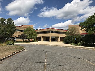
Tri-County Regional Vocational Technical High School, often abbreviated Tri-County or just Tri, is a public vocational high school in Franklin, Massachusetts, United States.

The Roebuck Tavern is a historic tavern at 21 Dedham Street in Wrentham, Massachusetts. The two-story Federal style structure was built in 1795 by David Fisher, whose family was one of the earliest to settle the area in the 17th century. Fisher operated a tavern, which would have been successful, as Wrentham was then a stop on the stagecoach route between Boston and Providence, Rhode Island. The building remained in the Fisher family until 1910.

Major Eleazer Lusher was a politician and military leader from Dedham, Massachusetts.


