Feira da Mata

Last updated
Feira da Mata
Município de Feira da Mata
Municipality
Bahia Municip FeiradaMata.svg
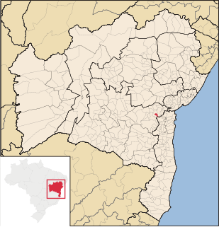
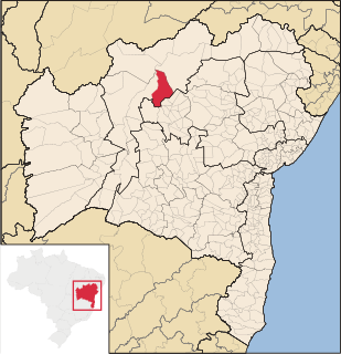
Location of Feira da Mata in Bahia
Brazil location map.svg
Red pog.svg
Feira da Mata
Location of Feira da Mata in Brazil
Coordinates: 14°12′25″S44°16′51″W / 14.20694°S 44.28083°W / -14.20694; -44.28083 Coordinates: 14°12′25″S44°16′51″W / 14.20694°S 44.28083°W / -14.20694; -44.28083
Country Flag of Brazil.svg  Brazil
Region Northeast
State Bandeira da Bahia.svg Bahia
Founded 1989
Government
  Mayor Alex Ronan Viana Mota
Area
  Total 1,176.105 km2 (454.097 sq mi)
Elevation 497 m (1,631 ft)
Population (2014)
  Total 5,911
  Density 5.0/km2 (13/sq mi)
Demonym(s) Matense
Time zone BRT (UTC-3)

Feira da Mata is a municipality in the state of Bahia in the North-East region of Brazil. Feira da Mata covers 1,176.105 km2 (454.097 sq mi), and has a population of 5,911 with a population density of 5 inhabitants per square kilometer. It was originally part of Carinhanha, but became an independent municipality in 1989. [1]

Municipalities of Brazil administrative division of the states in Brazil

The municipalities of Brazil are administrative divisions of the Brazilian states. At present, Brazil has 5,570 municipalities, making the average municipality population 34,361. The average state in Brazil has 214 municipalities. Roraima is the least subdivided state, with 15 municipalities, while Minas Gerais is the most subdivided state, with 853.

States of Brazil administrative entity of Brazil

The Federative Republic of Brazil is a union of 27 federated units : 26 states and one federal district. The states are generally based on historical, conventional borders which have developed over time. The Federal District cannot be divided into municipalities, according to the Brazilian Constitution, the Federal District assumes the same constitutional and legal powers, attributions and obligations of the states and municipalities, instead, it is divided by administrative regions.

Bahia State of Brazil

Bahia is one of the 26 states of Brazil and is located in the northeastern part of the country on the Atlantic coast. It is the 4th-largest Brazilian state by population and the 5th-largest by area. Bahia's capital is the city of Salvador, located on a spit of land separating the Bay of All Saints from the Atlantic. Once a monarchial stronghold dominated by agricultural, slaving, and ranching interests, Bahia is now a major manufacturing center whose last three elections have been dominated by the Workers' Party.

Feira da Mata is located at the junction of BA-601 and BA-594. It is 964 kilometres (599 mi) from the state capital of Bahia, Salvador. The Carinhanha River forms the southern border of the municipality, which is also the border between the states of Bahia and Minas Gerais. [1]

Salvador, Bahia Municipality in Northeast, Brazil

Salvador, also known as São Salvador da Bahia de Todos os Santos is the capital of the Brazilian state of Bahia. With 2.9 million people (2017), it is the largest city proper in the Northeast Region and the 4th largest city proper in the country, after São Paulo, Rio de Janeiro and Brasília.

Carinhanha River river in Brazil

The Carinhanha River is a river of Bahia and Minas Gerais states in eastern Brazil.

Minas Gerais State of Brazil

Minas Gerais is a state in the north of Southeastern Brazil. It ranks as the second most populous, the third by gross domestic product (GDP), and the fourth largest by area in the country. The state's capital and largest city, Belo Horizonte, is a major urban and finance center in Latin America, and the sixth largest municipality in Brazil, after the cities of São Paulo, Rio de Janeiro, Salvador, Brasilia and Fortaleza, but its metropolitan area is the third largest in Brazil with just over 5,500,000 inhabitants, after those of São Paulo and Rio de Janeiro. Nine Brazilian presidents were born in Minas Gerais, the most of any state.

Feira da Mata was originally home to the Kayapo people. Manuel Nunes Viana expelled the Kayapo population in the early 18th century and settled in the area. [1]

See also

Related Research Articles

Santo Amaro, Bahia Municipality in Northeast, Brazil

Santo Amaro, also known as Santo Amaro da Purificação is a municipality in the state of Bahia in Brazil. The population is 61,702 in an area of 492.9 square kilometres (190.3 sq mi). It is located in the metropolitan area of Salvador. Santo Amaro is located approximately 73 kilometres (45 mi) from the city of Salvador. Santo Amaro was home to numerous Amerindian peoples until the arrival of the Portuguese, who developed the region for sugarcane production. Santo Amaro is now noted for its numerous historic structures. The city is also a center of Candomblé, having more than 60 terreiros, or temples of the religion.

Feira de Santana Municipality in Northeast, Brazil

Feira de Santana is a city in Bahia, Brazil. It is the second-most populous city in the state, with a population of 612,000 according to IBGE's estimate. It is located 100 km northwest of Salvador, Bahia's capital city. These cities are connected by BR-324, a four-lane divided highway.

Arapiraca Municipality in Alagoas, Brazil

Arapiraca is a municipality located in the center of the Brazilian state of Alagoas, some 135 km (84 mi) from the state capital, Maceió. It was founded in 1924. As of 2010, it has a population of 214.006, but IBGE estimated 227,640 inhabitants for 2013.

Magé Place in Southeast, Brazil

Magé is a municipality located in the Brazilian state of Rio de Janeiro.

Itabuna Municipality in Bahia, Brazil


Itabuna is a municipality in Bahia, Brazil. It is the 6th largest city in Bahia by population after Salvador, Feira de Santana, Vitória da Conquista, Juazeiro and Ilhéus. It had an estimated 220,386 residents in 2016. Itabuna covers a total area of 401 square kilometres (155 sq mi) and has a population density of 550 residents per square kilometer.

Juvenília municipality of Brazil

Juvenília is a municipality in the north of the state of Minas Gerais in Brazil. As of 2007 the population was 17,626 in an area of 1,252 km².

Barra, Bahia Municipality in Northeast, Brazil

Barra (Bahia) is a municipality in the state of Bahia in the North-East region of Brazil. Barra covers 11,422.537 km2 (4,410.266 sq mi), and has a population of 49,325 with a population density of 4.3 inhabitants per square kilometer.

Conceição da Feira Municipality in Bahia, Brazil

Conceição da Feira is a municipality in the state of Bahia in the North-East region of Brazil.

Umburanas Municipality in Northeast, Brazil

Umburanas is a municipality in the state of Bahia in the North-East region of Brazil. Umburanas covers 1,670.424 km2 (644.954 sq mi), and has a population of 17,000 with a population density of 9.4 inhabitants per square kilometer. The municipality is located within the caatinga ecoregion. Umburanas borders on five municipalities: Ourolândia, Mirangaba, Campo Formoso, Morro do Chapéu, and Sento Sé, all in the state of Bahia.

Cravolândia Municipality in Northeast, Brazil

Cravolândia is a municipality in the state of Bahia in the North-East region of Brazil. Cravolândia covers 162.171 km2 (62.615 sq mi), and has a population of 5042 with a population density of 32 inhabitants per square kilometer. It borders the municipalities of Santa Inês, Itaquara, Ubaíra and Wenceslau Guimarães. Cravolândia is located 317 kilometres (197 mi) from Salvador, the state capital of Bahia, and is connected to Salvador by federal highways BR-116 and BR-101.

São Francisco do Conde Municipality in Northeast, Brazil

São Francisco do Conde is a municipality in the state of Bahia in the North-East region of Brazil. São Francisco do Conde covers 262.856 km2 (101.489 sq mi), and has a population of 38,838 with a population density of 150 inhabitants per square kilometer. It is located 67 kilometres (42 mi) from the state capital of Salvador. According to the Brazilian Institute of Geography and Statistics São Francisco do Conde has the highest concentration of Brazilians of African descent (90%) in Bahia.

Mata de São João Municipality in Northeast, Brazil

Mata de São João is a municipality in the state of Bahia in the North-East region of Brazil. It covers 632.26 km2 (244.12 sq mi) and a population of 46,392. Mata de São João has a population density of 73 inhabitants per square kilometer. It is located 56 km (35 mi) from the state capital of Bahia, Salvador.

Nazaré, Bahia Municipality in Nordeste, Brazil

Nazaré, also known as Nazaré das Farinhas, is a municipality in the state of Bahia in the North-East region of Brazil. The municipality has a population of 29,546 with a population density of 107 inhabitants per square kilometer. It is located 110 km (68 mi) from the state capital of Bahia, Salvador. Nazaré is within the Bahian Recôncavo, an interior region of the state of Bahia. It borders the municipalities of Muniz Ferreira, Aratuípe, Jaguaripe, São Felipe, and Maragogipe. The Jaguaripe River crosses through the middle of the town. It is sits on the intersection of two Bahian state highways, BA-001 and BA-046..

Itaguaçu da Bahia Municipality in Northeast, Brazil

Itaguaçu da Bahia is a municipality in the state of Bahia in the North-East region of Brazil. It covers 4,451.270 km2 (1,718.645 sq mi), and has a population of 14,533 with a population density of 3.3 inhabitants per square kilometer.

Remanso Municipality in Northeast, Brazil

Remanso (backwater) is a municipality in the state of Bahia in the North-East region of Brazil.

Gongogi Municipality in Northeast, Brazil

Gongogi is a municipality in the state of Bahia in the North-East region of Brazil. It covers 195.39 km2 (75.44 sq mi), and has a population of 8,082 with a population density of 41 inhabitants per square kilometer. It was named after the Gongogi River which forms the southern border of the municipality.

Campo Alegre de Lourdes Municipality in Northeast, Brazil

Campo Alegre de Lourdes is a municipality in the state of Bahia in the North-East region of Brazil. Campo Alegre de Lourdes covers 2,781.170 km2 (1,073.816 sq mi), and has a population of 29,877 with a population density of 11 inhabitants per square kilometer. It is located at the north of the state on the border of Bahia and Piauí.

References

  1. 1 2 3 "Feira da Mata" (in Portuguese). Brasília, Brazil: Instituto Brasileiro de Geografia e Estatística. 2015. Retrieved 2015-08-16.