Paulo Afonso

Last updated
Paulo Afonso
Municipality
The Municipality of Paulo Afonso
Bandeira de Paulo Afonso.jpg
Brasao paulo afonso.png
Bahia Municip PauloAfonso.svg
Location in Bahia
Brazil location map.svg
Red pog.svg
Paulo Afonso
Location of Paulo Afonso
Coordinates: 9°24′00″S38°13′30″W / 9.40000°S 38.22500°W / -9.40000; -38.22500
Country Flag of Brazil.svg  Brazil
Region Northeast
State Bandeira da Bahia.svg Bahia
Founded1958
Government
   Mayor Luiz de Deus (PSD)
Area
[1]
  Total1,545.192 km2 (596.602 sq mi)
Elevation
243 m (797 ft)
Population
 (2020 est. [2] )
  Total118,516
  Density77/km2 (200/sq mi)
Time zone UTC−3 (BRT)
HDI (2010)0.674 – medium [3]

Paulo Afonso is a city in Bahia, Brazil. It was founded in 1958.

The city is the seat of the Roman Catholic Diocese of Paulo Afonso. The city is served by Paulo Afonso Airport.

The municipality contains part of the Raso da Catarina ecoregion. [4] The municipality holds part of the 26,736 hectares (66,070 acres) Rio São Francisco Natural Monument, which protects the spectacular canyons of the São Francisco River between the Paulo Afonso Hydroelectric Complex and the Xingó Dam. [5] It contains part of the 104,842 hectares (259,070 acres) Raso da Catarina Ecological Station, created in 2001. [6]

Climate

Climate data for Paulo Afonso (1981–2010)
MonthJanFebMarAprMayJunJulAugSepOctNovDecYear
Mean daily maximum °C (°F)34.4
(93.9)
34.3
(93.7)
33.7
(92.7)
32.5
(90.5)
30.7
(87.3)
28.5
(83.3)
27.9
(82.2)
29.1
(84.4)
31.7
(89.1)
33.8
(92.8)
34.8
(94.6)
34.6
(94.3)
32.2
(90.0)
Daily mean °C (°F)28.0
(82.4)
28.0
(82.4)
27.8
(82.0)
26.9
(80.4)
25.5
(77.9)
23.7
(74.7)
22.9
(73.2)
23.3
(73.9)
25.1
(77.2)
26.8
(80.2)
27.8
(82.0)
28.0
(82.4)
26.2
(79.2)
Mean daily minimum °C (°F)23.1
(73.6)
23.2
(73.8)
23.2
(73.8)
22.8
(73.0)
21.9
(71.4)
20.5
(68.9)
19.5
(67.1)
19.4
(66.9)
20.3
(68.5)
21.6
(70.9)
22.5
(72.5)
22.8
(73.0)
21.7
(71.1)
Average precipitation mm (inches)49.2
(1.94)
38.3
(1.51)
76.8
(3.02)
75.3
(2.96)
54.2
(2.13)
62.6
(2.46)
49.3
(1.94)
29.0
(1.14)
11.7
(0.46)
17.1
(0.67)
19.5
(0.77)
30.0
(1.18)
513.0
(20.20)
Average precipitation days (≥ 1.0 mm)3366911108322366
Average relative humidity (%)58.759.663.267.773.478.777.772.763.658.956.157.165.6
Mean monthly sunshine hours 256.0232.2236.3222.6195.3151.5167.9194.0236.6271.7273.7267.02,704.8
Source: Instituto Nacional de Meteorologia [7]

Related Research Articles

<span class="mw-page-title-main">Bananal, São Paulo</span> Municipality in the state of São Paulo in Brazil

Município da Estância Turística de Bananal is a city in the state of São Paulo in Brazil. It is part of the Metropolitan Region of Vale do Paraíba e Litoral Norte. The population is 10,993 in an area of 616.43 km2 (238.00 sq mi).

<span class="mw-page-title-main">Natividade da Serra</span> Municipality in Southeast, Brazil

Natividade da Serra is a municipality in the state of São Paulo in Brazil. It is part of the Metropolitan Region of Vale do Paraíba e Litoral Norte. The population is 6,642 in an area of 833.37 km2. The elevation is 720 m. The southern part is heavily forested and mountainous and there are few roads and tracks into the mountain. The hills and some mountains with farmlands dominate the rest of the municipality.
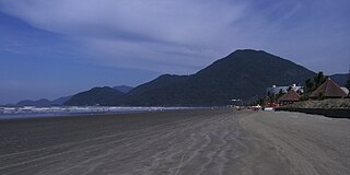
<span class="mw-page-title-main">Peruíbe</span> Municipality in Southeast, Brazil

Peruíbe is a municipality in the state of São Paulo in Brazil. It is part of the Metropolitan Region of Baixada Santista. The population is 69,001 in an area of 324.55 square kilometres (125.31 sq mi). Peruíbe is located to the southwest of the city of São Paulo and west of Santos.
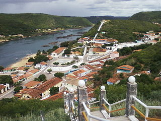
<span class="mw-page-title-main">Piranhas, Alagoas</span> Municipality in Alagoas, Brazil

Piranhas is a historic municipality near the western limit of the State of Alagoas, in the Northeast Region of Brazil.

<span class="mw-page-title-main">Assis Brasil</span> Municipality in Acre, Brazil

Assis Brasil is a municipality located in the south of the Brazilian state of Acre. Its population is 7,534 and its area is 4,974 square kilometres (1,920 sq mi).
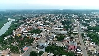
<span class="mw-page-title-main">Sena Madureira</span> Municipality in North, Brazil

Sena Madureira is a municipality located in the center of the Brazilian state of Acre. Its population is 46,511 and its area is 25,278 square kilometres (9,760 sq mi), making it the largest municipality in the state. It has a climate which combines temperatures of 78 °F (26 °C) with humidities in the upper 90s percent, all year round. It is 143 km from Rio Branco. The oldest church in Acre state is located in Sena Madureira, the Nossa Senhora da Imaculada Conceição Church (1910).

<span class="mw-page-title-main">Delmiro Gouveia</span> Municipality in Northeast, Brazil

Delmiro Gouveia is a municipality located in the westernmost point of the Brazilian state of Alagoas. Its population is 52,262 (2020) and its area is 609 km2.

<span class="mw-page-title-main">Olho d'Água do Casado</span> Municipality in Northeast, Brazil

Olho d'Água do Casado is a municipality located in the western of the Brazilian state of Alagoas. Its population is 9,441 (2020) and its area is 323 square kilometres (125 sq mi).

<span class="mw-page-title-main">Canindé de São Francisco</span> Municipality in Northeast, Brazil

Canindé de São Francisco is a municipality located in the Brazilian state of Sergipe. Its population was 30,402 (2020) and its area is 902.2 km2 (348.3 sq mi).

<span class="mw-page-title-main">São Joaquim National Park</span>

São Joaquim National Park is a National park in the state of Santa Catarina, Brazil.

<span class="mw-page-title-main">Nascentes do Rio Parnaíba National Park</span>

Nascentes do Rio Parnaíba National Park is a national park of Brazil.

Raso da Catarina Ecological Station is a strictly protected ecological station in the state of Bahia in Brazil. It lies in the Raso da Catarina ecoregion of the Caatinga biome.
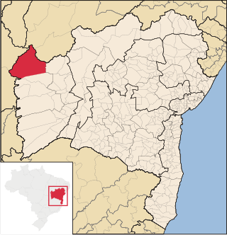
<span class="mw-page-title-main">Formosa do Rio Preto</span> Municipality in Northeast, Brazil

Formosa do Rio Preto is the westernmost and largest city in the Brazilian state of Bahia. It is also the largest in all Northeastern Brazil.
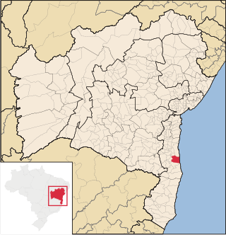
<span class="mw-page-title-main">Una, Bahia</span> Municipality in Northeast, Brazil

Una is a city in Bahia, Brazil. Its population in 2020 was 18,544 inhabitants. It is located about 36 mi (58 km) south from Ilheus.

<span class="mw-page-title-main">Jeremoabo</span> Municipality in Nordeste, Brazil

Jeremoabo is a municipality in the state of Bahia in the North-East region of Brazil.
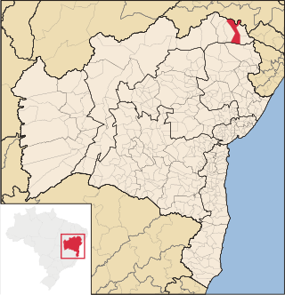
<span class="mw-page-title-main">Rodelas</span> Municipality in Nordeste, Brazil

Rodelas is a municipality in the state of Bahia in the North-East region of Brazil.

<span class="mw-page-title-main">São Félix do Xingu</span> Municipality in Northern, Brazil

São Félix do Xingu is a municipality in the state of Pará in the Northern region of Brazil.

The Rio São Francisco Natural Monument is a natural monument in the states of Alagoas, Bahia and Sergipe, Brazil. It protects a section of dramatic canyons on the São Francisco River and the surrounding caatinga environment, while supporting tourism and ecotourism.

The Una River is a river of Bahia state in eastern Brazil. It discharges into the Atlantic Ocean between Canavieiras to the south and Ilhéus to the north.

The Caatinga Ecological Corridor is an ecological corridor in the caatinga biome of northeast Brazil.

References

  1. "Brazilian Institute of Geography and Statistics". 2017. Retrieved 20 March 2019. 2017 Area Total
  2. IBGE 2020
  3. - UNDP
  4. "Lampião e Conselheiro no Raso da Catarina", Bahia! (in Portuguese), archived from the original on 2016-10-23, retrieved 2016-11-03
  5. Unidade de Conservação: Monumento Natural do Rio São Francisco (in Portuguese), MMA: Ministério do Meio Ambiente, retrieved 2016-05-21
  6. Unidade de Conservação: Estação Ecológica Raso da Catarina (in Portuguese), MMA: Ministério do Meio Ambiente, retrieved 2016-04-19
  7. "Normais Climatológicas Do Brasil 1981–2010" (in Portuguese). Instituto Nacional de Meteorologia. Retrieved 21 May 2024.

...