Rodelas

Last updated
Rodelas
Municipality
Bandeira de Rodelas BA.svg
Flag
Brasao Rodelas.PNG
Seal
Bahia Municip Rodelas.svg
Location in Bahia
CountryFlag of Brazil.svg  Brazil
Region Nordeste
State Bahia
Population
 (2020 [1] )
  Total9,442
Time zone UTC−3 (BRT)

Rodelas is a municipality in the state of Bahia in the North-East region of Brazil. [2] [3] [4] [5]

Contents

Geography

The municipality contains part of the 104,842 hectares (259,070 acres) Raso da Catarina Ecological Station, created in 2001. [6] The municipality was designated a priority area for conservation and sustainable use when the Caatinga Ecological Corridor was created in 2006. [7]

History

The unattested indigenous language Peria (also spelled Poria) was formerly spoken in Rodelas. The extinct Tuxá language was also spoken in Rodelas. [8]

See also

Related Research Articles

Dário Meira Municipality in Nordeste, Brazil

Dário Meira is a municipality in the state of Bahia in the North-East region of Brazil.

Manoel Vitorino Municipality in Nordeste, Brazil

Manoel Vitorino is a municipality in the state of Bahia in the North-East region of Brazil.

Angical Municipality in Nordeste, Brazil

Angical is a municipality in the state of Bahia in the North-East region of Brazil.

Jeremoabo Municipality in Nordeste, Brazil

Jeremoabo is a municipality in the state of Bahia in the North-East region of Brazil.

São José da Vitória is a municipality in the state of Bahia in the North-East region of Brazil.

Macururé is a municipality in the state of Bahia in the North-East region of Brazil.

Governador Celso Ramos Municipality in South, Brazil

Governador Celso Ramos is a municipality in the state of Santa Catarina in the South region of Brazil.

Aiuaba is a municipality in the state of Ceará in the Northeast region of Brazil.

Queimada Nova is a municipality in the state of Piauí in the Northeast region of Brazil.

Alvorada do Gurguéia Municipality in Nordeste, Brazil

Alvorada do Gurguéia is a municipality in the state of Piauí in the Northeast region of Brazil.

Bom Jesus, Piauí Municipality in Nordeste, Brazil

Bom Jesus is a municipality in the state of Piauí in the Northeast region of Brazil.

Cristino Castro Municipality in Nordeste, Brazil

Cristino Castro is a municipality in the state of Piauí in the Northeast region of Brazil. A significant production of cacao, latex and bananas takes place in the region.

Monte Alegre do Piauí is a municipality in the state of Piauí in the Northeast region of Brazil.

Santa Luz, Piauí Municipality in Nordeste, Brazil

Santa Luz is a municipality in the state of Piauí in the Northeast region of Brazil.

Brejo do Piauí Municipality in Nordeste, Brazil

Brejo do Piauí is a municipality in the state of Piauí in the Northeast region of Brazil.

Canto do Buriti Municipality in Nordeste, Brazil

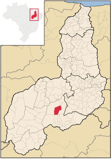
Canto do Buriti is a municipality in the state of Piauí in the Northeast region of Brazil.

Caracol, Piauí Municipality in Nordeste, Brazil

Caracol is a municipality in the state of Piauí in the Northeast region of Brazil.

Guaribas Municipality in Nordeste, Brazil

Guaribas is a municipality in the state of Piauí in the Northeast region of Brazil.

Jurema, Piauí Municipality in Nordeste, Brazil

Jurema, Piauí is a municipality in the state of Piauí in the Northeast region of Brazil.

Tamboril do Piauí Municipality in Nordeste, Brazil

Tamboril do Piauí is a municipality in the state of Piauí in the Northeast region of Brazil.

References

  1. IBGE 2020
  2. "Divisão Territorial do Brasil" (in Portuguese). Divisão Territorial do Brasil e Limites Territoriais, Instituto Brasileiro de Geografia e Estatística (IBGE). July 1, 2008. Retrieved December 17, 2009.
  3. "Estimativas da população para 1º de julho de 2009" (PDF) (in Portuguese). Estimativas de População, Instituto Brasileiro de Geografia e Estatística (IBGE). August 14, 2009. Retrieved December 17, 2009.
  4. "Ranking decrescente do IDH-M dos municípios do Brasil" (in Portuguese). Atlas do Desenvolvimento Humano, Programa das Nações Unidas para o Desenvolvimento (PNUD). 2000. Retrieved December 17, 2009.
  5. "Produto Interno Bruto dos Municípios 2002-2005" (PDF) (in Portuguese). Instituto Brasileiro de Geografia e Estatística (IBGE). December 19, 2007. Retrieved December 17, 2009.
  6. Unidade de Conservação: Estação Ecológica Raso da Catarina (in Portuguese), MMA: Ministério do Meio Ambiente, retrieved 2016-04-19
  7. Mattos, Marluza (2006), Ministério cria Corredor Ecológico da Caatinga (in Portuguese), Ministério do Meio Ambiente, retrieved 2016-11-01
  8. Loukotka, Čestmír (1968). Classification of South American Indian languages . Los Angeles: UCLA Latin American Center.

Coordinates: 8°50′S38°46′W / 8.833°S 38.767°W / -8.833; -38.767