Prado, Bahia

Last updated
Prado
Municipality
Guaratiba morning.jpg
Prado at dawn, on the coast.
Bahia Municip Prado.svg
Location in Bahia
CountryFlag of Brazil.svg  Brazil
Region Nordeste
State Bahia
Population
 (2020 [1] )
  Total28,194
Time zone UTC -3

Prado is a municipality in the state of Bahia in the North-East region of Brazil. [2] [3] [4] [5]

The municipality contains the Descobrimento National Park, a conservation unit of 22,694 hectares (56,080 acres) created in 1999. It also contains part of the Corumbau Marine Extractive Reserve, a protected offshore fishing area of 89,597 hectares (221,400 acres). [6]

See also

Related Research Articles

Jiquiriçá is a municipality in the state of Bahia in the North-East region of Brazil.

Ubaíra Municipality in Nordeste, Brazil

Ubaíra is a municipality in the state of Bahia in the North-East region of Brazil.

Dário Meira Municipality in Nordeste, Brazil

Dário Meira is a municipality in the state of Bahia in the North-East region of Brazil.

Ibicuí is a municipality in the state of Bahia in the North-East region of Brazil.

Sapeaçu is a municipality in the state of Bahia in the North-East region of Brazil.

São Felipe is a municipality in the state of Bahia in the North-East region of Brazil.

Itajuípe Municipality in Nordeste, Brazil

Itajuípe is a municipality in the state of Bahia in the North-East region of Brazil.

São José da Vitória is a municipality in the state of Bahia in the North-East region of Brazil.

Guaratinga Place in Nordeste, Brazil

Guaratinga is a municipality in the state of Bahia in the North-East region of Brazil.

Nilo Peçanha, Bahia Municipality in Nordeste, Brazil

Nilo Peçanha is a municipality in the state of Bahia in the North-East region of Brazil.

Gavião, Bahia Municipality in Nordeste, Brazil

Gavião is a municipality in the state of Bahia in the North-East region of Brazil.

Itapebi is a municipality in the state of Bahia in the North-East region of Brazil.

Ubaitaba Municipality in Nordeste, Brazil

Ubaitaba is a municipality in the state of Bahia in the North-East region of Brazil.

Ubatã Municipality in Nordeste, Brazil

Ubatã is a municipality in the state of Bahia in the North-East region of Brazil.

Mascote is a municipality in the state of Bahia in the North-East region of Brazil.

Santa Cruz da Vitória Municipality in Nordeste, Brazil

Santa Cruz da Vitória is a municipality in the state of Bahia in the North-East region of Brazil.

Uruçuca Municipality in Nordeste, Brazil

Uruçuca is a municipality in the state of Bahia in the North-East region of Brazil.

Wenceslau Guimarães Municipality in Nordeste, Brazil

Wenceslau Guimarães is a municipality in the state of Bahia in the North-East region of Brazil.

Nova Viçosa Municipality in Nordeste, Brazil

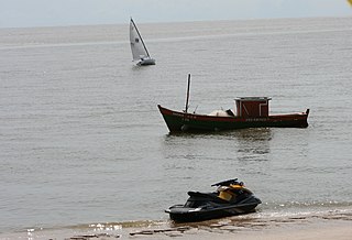
Nova Viçosa is a municipality in the state of Bahia in the North-East region of Brazil. It was "discovered" in 1720 and became a municipality in 1962. The municipality contains part of the Cassurubá Extractive Reserve, a 100,768 hectares sustainable use conservation unit that protects an area of mangroves, river and sea where shellfish are harvested.

Igrapiúna Municipality in Nordeste, Brazil

Igrapiúna is a municipality in the state of Bahia in the North-East region of Brazil.

References

  1. IBGE 2020
  2. "Divisão Territorial do Brasil" (in Portuguese). Divisão Territorial do Brasil e Limites Territoriais, Instituto Brasileiro de Geografia e Estatística (IBGE). July 1, 2008. Retrieved December 17, 2009.
  3. "Estimativas da população para 1º de julho de 2009" (PDF) (in Portuguese). Estimativas de População, Instituto Brasileiro de Geografia e Estatística (IBGE). August 14, 2009. Retrieved December 17, 2009.
  4. "Ranking decrescente do IDH-M dos municípios do Brasil" (in Portuguese). Atlas do Desenvolvimento Humano, Programa das Nações Unidas para o Desenvolvimento (PNUD). 2000. Archived from the original on October 3, 2009. Retrieved December 17, 2009.
  5. "Produto Interno Bruto dos Municípios 2002-2005" (PDF) (in Portuguese). Instituto Brasileiro de Geografia e Estatística (IBGE). December 19, 2007. Retrieved December 17, 2009.
  6. RESEX Marinha do Corumbau (in Portuguese), ISA: Instituto Socioambiental, retrieved 2016-06-06

Coordinates: 17°20′27″S39°13′15″W / 17.34083°S 39.22083°W / -17.34083; -39.22083