Related Research Articles
Ash is an unincorporated community in Douglas County, Oregon, United States, south of Loon Lake in the Southern Oregon Coast Range. The community is also referred to as Ash Valley.
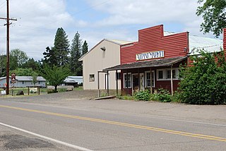
Alpine is an unincorporated rural community and census-designated place in Benton County, Oregon, United States. It is west of Monroe off Oregon Route 99W. As of the 2010 Census, the population was 171.
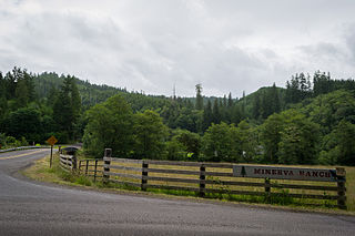
Minerva is an unincorporated community in Lane County, Oregon, United States. It is located about 13 miles (21 km) northeast of Florence near the North Fork Siuslaw River within the Siuslaw National Forest.

Blooming is an unincorporated community in Washington County, Oregon, United States near the Tualatin River, about two miles south of Cornelius. Its elevation is 190 feet. There are several plant nurseries in the area.
Salt Creek is an unincorporated historic community in Polk County, Oregon, United States on Oregon Route 22 about six miles northwest of Dallas. As an early European American settlement of the Oregon Country, the cemetery at Salt Creek has graves dating back to 1847. Salt Creek, a tributary of the South Yamhill River, was named by early settlers for the salt licks found on its banks. The Salt Creek post office, named after the creek, was established in 1852 and closed in 1903. James B. Riggs, who arrived in Oregon via the Oregon Trail and the Meek Cutoff in 1845, was the first postmaster. Riggs previously been the first postmaster of Yoncalla, followed by Jesse Applegate.
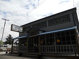
Cushman is an unincorporated community in Lane County, Oregon, United States. It is located on the north bank of the Siuslaw River on Oregon Route 126, between Tiernan and Florence.

Horton is an unincorporated community in Lane County, Oregon, United States. It is about three miles northeast of Blachly, in the Lake Creek valley of the Central Oregon Coast Range.
Denmark is an unincorporated community in Curry County, Oregon, United States, between Bandon and Port Orford where U.S. Route 101 crosses Willow Creek.

Quincy is an unincorporated community in Columbia County, Oregon, United States. It is located about 4.5 miles northeast of Clatskanie and 3.5 miles southwest of Mayger in a drained and diked area of the Columbia River lowlands.

Greenville is an unincorporated historic community in Washington County, Oregon, United States. It is located approximately two miles south of Banks on Oregon Route 47.
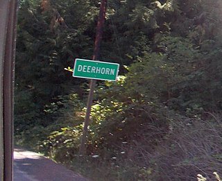
Deerhorn is an unincorporated community in Lane County, Oregon, United States. It is about 4 miles (6 km) west of Leaburg on Oregon Route 126 in the McKenzie River valley.
Carus is an unincorporated community in Clackamas County, Oregon, United States. It is located about seven miles south of Oregon City, on Oregon Route 213.
Bridge is an unincorporated community in Coos County, Oregon, United States. It is about 9 miles (14 km) east of Myrtle Point on Oregon Route 42 near the Middle Fork Coquille River.
Burnt Woods is an unincorporated community in Lincoln County, Oregon, United States. It is located about 16 miles (26 km) west of Philomath on U.S. Route 20 in the Central Oregon Coast Range near the Tumtum River.
Hamlet is an unincorporated community in Clatsop County, Oregon, United States. It is located approximately six miles southeast of Necanicum, in the Northern Oregon Coast Range near the confluence of the North Fork Nehalem River and the Little North Fork Nehalem River. It is surrounded by units of the Clatsop State Forest.
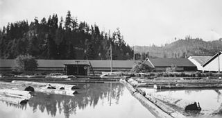
Vaughn is an unincorporated community in Lane County, Oregon, United States. It is located about 4 miles (6.4 km) south of Noti in the foothills of the Central Oregon Coast Range near Noti Creek. Author Ralph Friedman described Vaughn as "a mill in the meadows".
Peel is an unincorporated community in Douglas County, Oregon, United States. It is located about six miles southeast of Glide near the Little River.
Clifton is an unincorporated community in Clatsop County, Oregon, United States. It is located north of U.S. Route 30, about nine miles northwest of Westport on the south bank of the Columbia River. It is on Clifton Channel across from Tenasillahe Island.
Suver is an unincorporated community in Polk County, Oregon, United States. It is located about 10 miles north of Corvallis and about 8 miles south of Monmouth, 1 mile east of Oregon Route 99W.

Suplee is an unincorporated historic community in eastern Crook County, Oregon, United States. It was located about 18 miles (29 km) east of Paulina, near the Crook-Grant county line. The Suplee area was settled by people of French and Métis descent from the French Prairie area in Marion County, including the great-granddaughter of Étienne Lucier.
References
- ↑ "Harlan". Geographic Names Information System . United States Geological Survey, United States Department of the Interior. November 28, 1980. Retrieved December 16, 2010.
- ↑ Oregon Atlas & Gazetteer (7th ed.). Yarmouth, Maine: DeLorme. 2008. p. 32. ISBN 978-0-89933-347-2.
- 1 2 Odegard, Kyle (December 7, 2008). "Home Sweet Childhood Home". Corvallis Gazette-Times . Retrieved December 16, 2010.
- 1 2 Odegard, Kyle (December 7, 2008). "A Changing Landscape". Corvallis Gazette-Times . Retrieved December 16, 2010.
- 1 2 Odegard, Kyle (December 7, 2008). "Harlan Pretty But Isolated, Locals Say". Corvallis Gazette-Times . Retrieved December 16, 2010.
- 1 2 McArthur, Lewis A.; McArthur, Lewis L. (2003) [1928]. Oregon Geographic Names (7th ed.). Portland, Oregon: Oregon Historical Society Press. p. 446. ISBN 978-0875952772.
- 1 2 3 4 5 "Harlan Timeline". Corvallis Gazette-Times . December 7, 2008. Retrieved December 16, 2010.
- 1 2 Friedman, Ralph (1990). In Search of Western Oregon (2nd ed.). Caldwell, Idaho: The Caxton Printers, Ltd. ISBN 0-87004-332-3.
- ↑ Friedman, Ralph (1993) [1972]. Oregon for the Curious (3rd ed.). Portland, Oregon: Pars Publishing Company. p. 42. ISBN 0-87004-222-X.
