Rose Lodge, Oregon

Last updated

Rose Lodge, Oregon
Rose Lodge Oregon Store.jpg
Store in Rose Lodge
Lincoln County Oregon Incorporated and Unincorporated areas Rose Lodge Highlighted.svg
Location of Rose Lodge, Oregon
Coordinates: 45°0′37″N123°52′49″W / 45.01028°N 123.88028°W / 45.01028; -123.88028
Country United States
State Oregon
County Lincoln
Area
[1]
  Total9.59 sq mi (24.83 km2)
  Land9.59 sq mi (24.83 km2)
  Water0.00 sq mi (0.00 km2)
Elevation
180 ft (55 m)
Population
 (2020) [2]
  Total1,933
  Density201.63/sq mi (77.85/km2)
Time zone UTC-8 (Pacific (PST))
  Summer (DST) UTC-7 (PDT)
ZIP code
97372
Area code 541
FIPS code 41-63800 [3]
GNIS feature ID1148732 [4]

Rose Lodge is a census-designated place (CDP) and unincorporated community in Lincoln County, Oregon, United States, [5] along the 45th parallel. The population was 1,894 at the 2010 census. [6]

Contents

Rose Lodge was named for a rose bower over the front gate of the post office established in 1908 by postmaster Julia Dodson. [7]

Geography

Rose Lodge is in northern Lincoln County, with its northern border in part following the Tillamook County line. Oregon Route 18 runs through the community, leading west 4 miles (6 km) to U.S. Route 101 and east 40 miles (64 km) to McMinnville. Lincoln City is 10 miles (16 km) southwest of Rose Lodge via Routes 18 and 101.

According to the United States Census Bureau, the CDP has a total area of 9.6 square miles (24.8 km2), all of it land. [8] The center of town is 180 feet (55 m) above sea level, [5] along the Salmon River, which flows west to the Pacific Ocean at Cascade Head.

Demographics

Historical population
CensusPop.Note
2020 1,933
U.S. Decennial Census [9] [2]

As of the census [3] of 2000, there were 1,708 people, 693 households, and 474 families residing in the CDP. The population density was 178.4 inhabitants per square mile (68.9/km2). There were 826 housing units at an average density of 86.3 per square mile (33.3/km2). The racial makeup of the CDP was 92.45% White, 0.18% African American, 2.81% Native American, 0.29% Asian, 1.35% from other races, and 2.93% from two or more races. Hispanic or Latino of any race were 3.16% of the population.

There were 693 households, out of which 23.5% had children under the age of 18 living with them, 57.6% were married couples living together, 7.6% had a female householder with no husband present, and 31.5% were non-families. 22.9% of all households were made up of individuals, and 11.1% had someone living alone who was 65 years of age or older. The average household size was 2.46 and the average family size was 2.85.

In the CDP, the population was spread out, with 21.0% under the age of 18, 7.9% from 18 to 24, 22.9% from 25 to 44, 29.6% from 45 to 64, and 18.6% who were 65 years of age or older. The median age was 44 years. For every 100 females, there were 97.9 males. For every 100 females age 18 and over, there were 92.9 males.

The median income for a household in the CDP was $39,214, and the median income for a family was $43,250. Males had a median income of $31,759 versus $19,957 for females. The per capita income for the CDP was $18,297. About 8.9% of families and 13.5% of the population were below the poverty line, including 15.2% of those under age 18 and 7.4% of those age 65 or over.

Related Research Articles

<span class="mw-page-title-main">Lincoln County, Oregon</span> County in Oregon, United States

Lincoln County is one of the 36 counties in the U.S. state of Oregon. As of the 2020 census, its population was 50,395. The county seat is Newport. The county is named for Abraham Lincoln, 16th president of the United States.

<span class="mw-page-title-main">Ocean City, Florida</span> CDP in Florida, United States

Ocean City is a census-designated place (CDP) in Okaloosa County, Florida, United States. The population was 5,594 at the 2000 census. It is part of the Fort Walton Beach–Crestview–Destin Metropolitan Statistical Area.

<span class="mw-page-title-main">Gardnerville Ranchos, Nevada</span> Census-designated place in Nevada, United States

Gardnerville Ranchos is a census-designated place in Douglas County, Nevada, United States. As of the 2010 census, the population was 11,312. The area is the namesake for the Gardnerville Ranchos Micropolitan Statistical area which includes other areas of Douglas County.

<span class="mw-page-title-main">Clackamas, Oregon</span> Unincorporated community in the state of Oregon, United States

Clackamas is an unincorporated community and former census-designated place (CDP) in Clackamas County, Oregon, United States, and is a suburb of Portland. The population was approximately 7,000 as of 2010.

<span class="mw-page-title-main">Jennings Lodge, Oregon</span> Unincorporated community in the state of Oregon, United States

Jennings Lodge is a census-designated place and unincorporated community in Clackamas County, Oregon, United States, between Milwaukie and Gladstone. For statistical purposes, the United States Census Bureau has defined Jennings Lodge as a census-designated place (CDP). The census definition of the area may not precisely correspond to local understanding of the area with the same name. As of the United States Census, 2010, it had a total population of 7,315.

<span class="mw-page-title-main">Oak Grove, Oregon</span> Unincorporated community in the state of Oregon, United States

Oak Grove is an unincorporated community in Clackamas County, Oregon, United States, in the Portland metropolitan area. For statistical purposes, the United States Census Bureau has defined Oak Grove as a census-designated place (CDP). The census definition of the area may not precisely correspond to local understanding of the area with the same name. The population was 16,629 at the 2010 census.

<span class="mw-page-title-main">Oatfield, Oregon</span> Unincorporated community in the state of Oregon, United States

Oatfield is an unincorporated community and census-designated place in Clackamas County, Oregon, United States. It is in the Portland metropolitan area. As of the 2010 census, the population of the CDP was 13,415.

<span class="mw-page-title-main">Bunker Hill, Oregon</span> CDP in Oregon, United States

Bunker Hill is a census-designated place (CDP) in Coos County, Oregon, United States. As of the 2010 census the population was 1,444.

<span class="mw-page-title-main">Glide, Oregon</span> Census-designated place in Oregon, United States

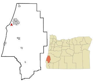
Glide is a census-designated place (CDP) in Douglas County, Oregon, United States. The population was 1,795 at the 2010 census.

<span class="mw-page-title-main">Roseburg North, Oregon</span> CDP in Oregon, United States

Roseburg North is a census-designated place (CDP) in Douglas County, Oregon, United States. The population was 5,912 at the 2010 census. Winchester, Oregon is included as part of Roseburg North.

<span class="mw-page-title-main">Lincoln Beach, Oregon</span> Unincorporated community in the state of Oregon, United States

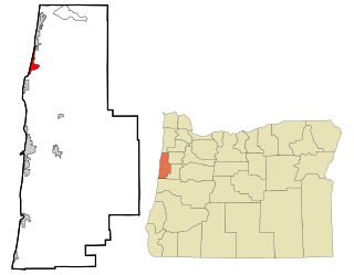
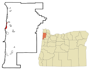
Lincoln Beach is a census-designated place (CDP) in Lincoln County, Oregon, United States. It includes the unincorporated communities of Lincoln Beach and Gleneden Beach. The total population was 2,045 at the 2010 census.

<span class="mw-page-title-main">Butteville, Oregon</span> Unincorporated community in the state of Oregon, United States

Butteville is a census-designated place and unincorporated community in Marion County, Oregon, United States. For statistical purposes, the United States Census Bureau has defined Butteville as a census-designated place (CDP). The census definition of the area may not precisely correspond to local understanding of the area with the same name. As of the 2020 census the population was 273. It is part of the Salem Metropolitan Statistical Area.

<span class="mw-page-title-main">Marion, Oregon</span> Unincorporated community in the state of Oregon, United States

Marion is an unincorporated community in Marion County, Oregon, United States. For statistical purposes, the United States Census Bureau has defined Marion as a census-designated place (CDP). The census definition of the area may not precisely correspond to local understanding of the area with the same name. The population was 307 at the 2020 census. Marion is part of the Salem Metropolitan Statistical Area.

<span class="mw-page-title-main">Mehama, Oregon</span> Unincorporated community in the state of Oregon, United States

Mehama is an unincorporated community in Marion County, Oregon, United States, located on Oregon Route 22 and the North Santiam River. For statistical purposes, the United States Census Bureau has defined Mehama as a census-designated place (CDP). The census definition of the area may not precisely correspond to local understanding of the area with the same name. The population was 317 at the 2020 census. It is part of the Salem Metropolitan Statistical Area.

<span class="mw-page-title-main">Cape Meares, Oregon</span> Unincorporated community in the state of Oregon, United States

Cape Meares is a census-designated place (CDP) and unincorporated community in Tillamook County, Oregon, United States. The population was 110 at the 2000 census.

<span class="mw-page-title-main">Cayuse, Oregon</span> Unincorporated community in the state of Oregon, United States

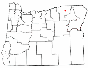
Cayuse is a census-designated place (CDP) and unincorporated community in Umatilla County, Oregon, United States, located 11 miles (18 km) east of Pendleton on the Umatilla Indian Reservation. The population was 59 at the 2000 census. It is part of the Pendleton–Hermiston Micropolitan Statistical Area.

Lawson Heights is a census-designated place (CDP) in Unity Township, Westmoreland County, Pennsylvania, United States. The population was 2,339 at the 2000 census.

<span class="mw-page-title-main">Spring Garden-Terra Verde, Texas</span> Former CDP in Texas, United States

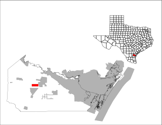
Spring Garden-Terra Verde is a census-designated place (CDP) in Nueces County, Texas, United States. The population was 693 at the 2000 census.

<span class="mw-page-title-main">Barview, Oregon</span> Census-designated place in Oregon, United States

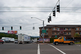
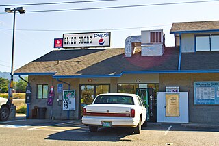
Barview is a census-designated place (CDP) in Coos County, Oregon, United States. The population was 1,844 at the 2010 census.

Lincoln is a census-designated place (CDP) consisting of the primary settlement in the town of Lincoln in Penobscot County, Maine, United States. The population was 2,884 at the 2010 census.

References

  1. "ArcGIS REST Services Directory". United States Census Bureau. Retrieved October 12, 2022.
  2. 1 2 "Census Population API". United States Census Bureau. Retrieved October 12, 2022.
  3. 1 2 "U.S. Census website". United States Census Bureau . Retrieved January 31, 2008.
  4. "US Board on Geographic Names". United States Geological Survey. October 25, 2007. Retrieved January 31, 2008.
  5. 1 2 "Rose Lodge". Geographic Names Information System . United States Geological Survey, United States Department of the Interior. November 28, 1980. Retrieved January 9, 2010.
  6. "Total Population: 2010 Census DEC Summary File 1 (P1), Rose Lodge CDP, Oregon". data.census.gov. U.S. Census Bureau. Retrieved August 21, 2020.
  7. McArthur, Lewis A.; Lewis L. McArthur (2003) [1928]. Oregon Geographic Names (Seventh ed.). Portland, Oregon: Oregon Historical Society Press. p. 825. ISBN   0-87595-277-1.
  8. "2019 U.S. Gazetteer Files: Places: Oregon". United States Census Bureau. Retrieved August 21, 2020.
  9. "Census of Population and Housing". Census.gov. Retrieved June 4, 2016.