| CDP | County | Township | Population | Change (%) | Land area | Population density |
|---|
| 2020 | 2010 |
|---|
| Advance | Charlevoix | Eveline | 340 | 328 | +3.66% | 2.72 sq mi (7.04 km2) | 125.00/sq mi (48.26/km2) |
| Alba | Antrim | Chestonia
Star | 287 | 295 | −2.71% | 2.73 sq mi (7.07 km2) | 105.13/sq mi (40.59/km2) |
| Alden | Antrim | Helena | 123 | 125 | −1.60% | 0.40 sq mi (1.04 km2) | 307.50/sq mi (118.73/km2) |
| Allendale | Ottawa | Allendale | 27,073 | 17,579 | +54.01% | 23.23 sq mi (60.17 km2) | 1,165.43/sq mi (449.98/km2) |
| Amasa | Iron | Hematite | 195 | 283 | −31.10% | 4.04 sq mi (10.46 km2) | 48.27/sq mi (18.64/km2) |
| Arcadia | Manistee | Arcadia | 309 | 291 | +6.19% | 0.60 sq mi (1.55 km2) | 515.00/sq mi (198.84/km2) |
| Argentine | Genesee | Argentine | 2,685 | 2,525 | +6.34% | 2.37 sq mi (6.14 km2) | 1,132.91/sq mi (437.42/km2) |
| Atlanta † | Montmorency | Briley
Avery | 720 | 827 | −12.94% | 3.61 sq mi (9.35 km2) | 199.45/sq mi (77.01/km2) |
| Atlantic Mine | Houghton | Adams | 565 | | | 1.10 sq mi (2.85 km2) | 513.64/sq mi (198.32/km2) |
| Attica | Lapeer | Attica | 962 | 994 | −3.22% | 4.78 sq mi (12.38 km2) | 201.26/sq mi (77.71/km2) |
| Au Sable | Iosco | Au Sable | 1,453 | 1,404 | +3.49% | 2.10 sq mi (5.44 km2) | 691.90/sq mi (267.15/km2) |
| Barnes Lake | Lapeer | Deerfield | 768 | | | 1.55 sq mi (4.01 km2) | 495.48/sq mi (191.31/km2) |
| Bath | Clinton | Bath | 2,841 | 2,083 | +36.39% | 5.86 sq mi (15.18 km2) | 484.81/sq mi (187.19/km2) |
| Bay Port | Huron | Fairhaven
McKinley | 464 | 477 | −2.73% | 3.35 sq mi (8.68 km2) | 138.51/sq mi (53.48/km2) |
| Bay Shore | Charlevoix
Emmet | Hayes
Resort | 687 | 754 | −8.89% | 1.55 sq mi (4.01 km2) | 443.23/sq mi (171.13/km2) |
| Bay View | Emmet | Eveline | 183 | 133 | +37.59% | 0.38 sq mi (0.98 km2) | 481.58/sq mi (185.94/km2) |
| Beal City | Isabella | Nottawa | 332 | 357 | −7.00% | 4.01 sq mi (10.39 km2) | 82.79/sq mi (31.97/km2) |
| Bear Lake | Kalkaska | Bear Lake | 366 | 327 | +11.93% | 5.76 sq mi (14.92 km2) | 63.54/sq mi (24.53/km2) |
| Beecher | Genesee | Mount Morris
Genesee | 8,840 | 10,232 | −13.60% | 5.88 sq mi (15.23 km2) | 1,478.26/sq mi (570.76/km2) |
| Beechwood | Ottawa | Holland
Park | 3,121 | 3,015 | +3.52% | 1.81 sq mi (4.69 km2) | 1,724.31/sq mi (665.76/km2) |
| Bendon | Benzie | Inland | 210 | 208 | +0.96% | 2.00 sq mi (5.18 km2) | 105.00/sq mi (40.54/km2) |
| Benton Heights | Berrien | Benton | 3,652 | 4,084 | −10.58% | 3.86 sq mi (10.00 km2) | 946.11/sq mi (365.30/km2) |
| Bergland | Ontonagon | Bergland | 141 | | | 0.73 sq mi (1.89 km2) | 193.15/sq mi (74.58/km2) |
| Big Bay | Marquette | Powell | 257 | 319 | −19.44% | 3.90 sq mi (10.10 km2) | 65.90/sq mi (25.44/km2) |
| Boon | Wexford | Boon | 90 | 167 | −46.11% | 0.84 sq mi (2.18 km2) | 107.14/sq mi (41.37/km2) |
| Brethren | Manistee | Dickson | 331 | 410 | −19.27% | 1.28 sq mi (3.32 km2) | 258.59/sq mi (99.84/km2) |
| Bridgeport | Saginaw | Bridgeport | 6,571 | 6,950 | −5.45% | 8.40 sq mi (21.76 km2) | 782.26/sq mi (302.03/km2) |
| Brimley | Chippewa | Superior | 504 | | | 1.75 sq mi (4.53 km2) | 288.00/sq mi (111.20/km2) |
| Brownlee Park | Calhoun | Emmett
Pennfield | 2,021 | 2,108 | −4.13% | 2.02 sq mi (5.23 km2) | 1,000.50/sq mi (386.29/km2) |
| Bruce Crossing | Ontonagon | Stannard | 184 | | | 4.51 sq mi (11.68 km2) | 40.80/sq mi (15.75/km2) |
| Brutus | Emmet | Maple River | 202 | 218 | −7.34% | 2.82 sq mi (7.30 km2) | 71.63/sq mi (27.66/km2) |
| Buena Vista | Saginaw | Buena Vista | 5,855 | 6,816 | −14.10% | 4.00 sq mi (10.36 km2) | 1,463.75/sq mi (565.16/km2) |
| Burt | Saginaw | Taymouth | 1,194 | 1,228 | −2.77% | 6.04 sq mi (15.64 km2) | 197.68/sq mi (76.33/km2) |
| Byron Center | Kent | Byron | 7,431 | 5,822 | +27.64% | 5.08 sq mi (13.16 km2) | 1,462.80/sq mi (564.79/km2) |
| Caberfae | Wexford | South Branch
Slagle | 72 | 64 | +12.50% | 0.44 sq mi (1.14 km2) | 163.64/sq mi (63.18/km2) |
| Cambria | Hillsdale | Cambria | 258 | | | 1.24 sq mi (3.21 km2) | 208.06/sq mi (80.33/km2) |
| Canada Creek Ranch | Montmorency | Montmorency | 258 | 304 | −15.13% | 2.23 sq mi (5.78 km2) | 115.70/sq mi (44.67/km2) |
| Canadian Lakes | Mecosta | Morton
Austin | 3,202 | 2,756 | +16.18% | 10.33 sq mi (26.75 km2) | 309.97/sq mi (119.68/km2) |
| Cannonsburg | Kent | Cannon | 203 | | | 0.42 sq mi (1.09 km2) | 483.33/sq mi (186.62/km2) |
| Carp Lake | Emmet | Carp Lake | 356 | 357 | −0.28% | 2.06 sq mi (5.34 km2) | 172.82/sq mi (66.72/km2) |
| Cedar | Leelanau | Solon | 102 | 93 | +9.68% | 0.18 sq mi (0.47 km2) | 566.67/sq mi (218.79/km2) |
| Chassell | Houghton | Chassell | 876 | | | 3.62 sq mi (9.38 km2) | 241.99/sq mi (93.43/km2) |
| Chums Corner | Grand Traverse | Blair | 1,065 | 946 | +12.58% | 2.66 sq mi (6.89 km2) | 400.38/sq mi (154.59/km2) |
| Comstock Northwest | Kalamazoo | Comstock
Kalamazoo | 5,562 | 5,455 | +1.96% | 3.23 sq mi (8.37 km2) | 1,721.98/sq mi (664.86/km2) |
| Comstock Park | Kent | Alpine
Planfield | 10,500 | 10,008 | +4.92% | 3.88 sq mi (10.05 km2) | 2,579.38/sq mi (995.90/km2) |
| Conway | Emmet | Little Traverse
Bear Creek | 338 | 204 | +65.69% | 0.42 sq mi (1.09 km2) | 804.76/sq mi (310.72/km2) |
| Copper Harbor | Keweenaw | Grant | 136 | 108 | +25.93% | 1.51 sq mi (3.91 km2) | 90.07/sq mi (34.77/km2) |
| Covington | Baraga | Covington | 99 | | | 3.54 sq mi (9.17 km2) | 27.97/sq mi (10.80/km2) |
| Cross Village | Emmet | Cross Village | 79 | 93 | −15.05% | 0.76 sq mi (1.97 km2) | 103.95/sq mi (40.13/km2) |
| Crystal | Montcalm | Crystal | 888 | | | 2.76 sq mi (7.15 km2) | 321.74/sq mi (124.22/km2) |
| Crystal Downs Country Club | Benzie | Lake | 55 | 47 | +17.02% | 1.26 sq mi (3.26 km2) | 43.65/sq mi (16.85/km2) |
| Crystal Mountain | Benzie | Weldon | 73 | 54 | +35.19% | 1.78 sq mi (4.61 km2) | 41.01/sq mi (15.83/km2) |
| Cutlerville | Kent | Byron
Gaines | 17,849 | 14,730 | +21.17% | 5.74 sq mi (14.87 km2) | 3,109.58/sq mi (1,200.62/km2) |
| Delton | Barry | Barry | 854 | 872 | −2.06% | 2.21 sq mi (5.72 km2) | 386.43/sq mi (149.20/km2) |
| Detroit Beach | Monroe | Frenchtown | 1,957 | 2,087 | −6.23% | 0.62 sq mi (1.61 km2) | 3,156.45/sq mi (1,218.71/km2) |
| Dodgeville | Houghton | Portage | 391 | | | 0.54 sq mi (1.40 km2) | 724.07/sq mi (279.57/km2) |
| Dollar Bay | Houghton | Osceola
Franklin
Torch Lake | 1,060 | 1,082 | −2.03% | 3.94 sq mi (10.20 km2) | 269.04/sq mi (103.88/km2) |
| Dorr | Allegan | Dorr | 3,520 | | | 3.20 sq mi (8.29 km2) | 1,338.44/sq mi (516.77/km2) |
| Dowling | Barry | Baltimore | 351 | 374 | −6.15% | 6.08 sq mi (15.75 km2) | 57.73/sq mi (22.29/km2) |
| Eagle Harbor | Keweenaw | Eagle Harbor | 69 | 76 | −9.21% | 1.80 sq mi (4.66 km2) | 38.33/sq mi (14.80/km2) |
| Eagle River † | Keweenaw | Houghton
Allouez | 65 | 71 | −8.45% | 6.20 sq mi (16.06 km2) | 10.48/sq mi (4.05/km2) |
| Eastport | Antrim | Torch Lake | 206 | 218 | −5.50% | 1.99 sq mi (5.15 km2) | 103.52/sq mi (39.97/km2) |
| Eastwood | Kalamazoo | Kalamazoo | 6,366 | 6,340 | +0.41% | 1.96 sq mi (5.08 km2) | 3,247.96/sq mi (1,254.04/km2) |
| Edgemont Park | Ingham | Lansing | 2,326 | 2,358 | −1.36% | 0.83 sq mi (2.15 km2) | 2,802.41/sq mi (1,082.02/km2) |
| Elm Hall | Gratiot | Sumner | 279 | | | 1.40 sq mi (3.63 km2) | 199.29/sq mi (76.94/km2) |
| Eureka | Clinton | Greenbush | 233 | | | 1.01 sq mi (2.62 km2) | 230.69/sq mi (89.07/km2) |
| Ewen | Ontonagon | McMillan | 229 | | | 0.84 sq mi (2.18 km2) | 272.62/sq mi (105.26/km2) |
| Fair Plain | Berrien | Benton
St. Joseph | 7,402 | 7,631 | −3.00% | 4.30 sq mi (11.14 km2) | 1,721.40/sq mi (664.63/km2) |
| Falmouth | Missaukee | Clam Union | 183 | | | 0.68 sq mi (1.76 km2) | 269.12/sq mi (103.91/km2) |
| Filer City | Manistee | Filer | 136 | 116 | +17.24% | 0.26 sq mi (0.67 km2) | 523.08/sq mi (201.96/km2) |
| Forest Hills | Kent | Ada
Cascade | 28,573 | 25,867 | +10.46% | 49.30 sq mi (127.69 km2) | 579.57/sq mi (223.77/km2) |
| Fostoria | Tuscola | Watertown | 664 | 694 | −4.32% | 4.01 sq mi (10.39 km2) | 165.59/sq mi (63.93/km2) |
| Freeland | Saginaw | Tittabawassee | 7,630 | 6,969 | +9.48% | 6.59 sq mi (17.07 km2) | 1,157.81/sq mi (447.03/km2) |
| Fulton | Keweenaw | Allouez | 149 | | | 0.48 sq mi (1.24 km2) | 310.42/sq mi (119.85/km2) |
| Glen Arbor | Leelanau | Glen Arbor | 261 | 229 | +13.97% | 1.03 sq mi (2.67 km2) | 253.40/sq mi (97.84/km2) |
| Grand Marais | Alger | Burt | 234 | | | 1.89 sq mi (4.90 km2) | 123.81/sq mi (47.80/km2) |
| Grawn | Grand Traverse | Blair | 816 | 772 | +5.70% | 0.65 sq mi (1.68 km2) | 1,255.38/sq mi (484.71/km2) |
| Greenland | Ontonagon | Greenland | 146 | | | 0.41 sq mi (1.06 km2) | 356.10/sq mi (137.49/km2) |
| Greilickville | Leelanau | Elmwood | 1,634 | 1,530 | +6.80% | 4.59 sq mi (11.89 km2) | 355.99/sq mi (137.45/km2) |
| Gwinn | Marquette | Forsyth | 1,784 | 1,917 | −6.94% | 2.81 sq mi (7.28 km2) | 634.88/sq mi (245.13/km2) |
| Hardwood Acres | Benzie | Almira | 393 | 432 | −9.03% | 0.53 sq mi (1.37 km2) | 741.51/sq mi (286.30/km2) |
| Haring | Wexford | Haring | 335 | 328 | +2.13% | 2.31 sq mi (5.98 km2) | 145.02/sq mi (55.99/km2) |
| Hartland | Livingston | Hartland | 777 | | | 2.28 sq mi (5.91 km2) | 340.79/sq mi (131.58/km2) |
| Harvey | Marquette | Chocolay | 3,244 | 1,393 | +132.88% | 6.74 sq mi (17.46 km2) | 481.31/sq mi (185.83/km2) |
| Haslett | Ingham | Meridian | 19,670 | 18,731 | +5.01% | 15.39 sq mi (39.86 km2) | 1,278.10/sq mi (493.48/km2) |
| Hemlock | Saginaw | Richland | 1,408 | 1,466 | −3.96% | 2.75 sq mi (7.12 km2) | 512.00/sq mi (197.68/km2) |
| Henderson | Shiawassee | Rush | 413 | 399 | +3.51% | 3.60 sq mi (9.32 km2) | 114.72/sq mi (44.29/km2) |
| Hermansville | Menominee | Meyer | 509 | | | 1.27 sq mi (3.29 km2) | 400.79/sq mi (154.74/km2) |
| Hickory Corners | Barry | Barry | 313 | 322 | −2.80% | 2.07 sq mi (5.36 km2) | 151.21/sq mi (58.38/km2) |
| Holt | Ingham | Delhi | 25,625 | 23,973 | +6.89% | 15.66 sq mi (40.56 km2) | 1,636.33/sq mi (631.79/km2) |
| Horton Bay | Charlevoix | Bay | 485 | 512 | −5.27% | 4.82 sq mi (12.48 km2) | 100.62/sq mi (38.85/km2) |
| Houghton Lake | Roscommon | Roscommon
Denton
Lake | 5,294 | 3,427 | +54.48% | 10.75 sq mi (27.84 km2) | 492.47/sq mi (190.14/km2) |
| Hubbard Lake | Alcona | Caledonia
Alcona
Hawes | 857 | 1,002 | −14.47% | 8.74 sq mi (22.64 km2) | 98.05/sq mi (37.86/km2) |
| Hubbell | Houghton | Torch Lake
Osceola | 908 | 946 | −4.02% | 1.87 sq mi (4.84 km2) | 485.56/sq mi (187.48/km2) |
| Hurontown | Houghton | Portage | 244 | | | 0.16 sq mi (0.41 km2) | 1,525.00/sq mi (588.81/km2) |
| Ida | Monroe | Ida
Raisinville | 790 | | | 2.47 sq mi (6.40 km2) | 319.84/sq mi (123.49/km2) |
| Indian River | Cheboygan | Tuscarora | 1,950 | 1,959 | −0.46% | 12.93 sq mi (33.49 km2) | 150.81/sq mi (58.23/km2) |
| Interlochen | Grand Traverse | Green Lake | 694 | 583 | +19.04% | 1.24 sq mi (3.21 km2) | 559.68/sq mi (216.09/km2) |
| Ironton | Charlevoix | Eveline | 148 | 140 | +5.71% | 1.02 sq mi (2.64 km2) | 145.10/sq mi (56.02/km2) |
| Jasper | Lenawee | Fairfield | 371 | 412 | −9.95% | 4.03 sq mi (10.44 km2) | 92.06/sq mi (35.54/km2) |
| Jenison | Ottawa | Georgetown | 16,640 | 16,538 | +0.62% | 5.86 sq mi (15.18 km2) | 2,839.59/sq mi (1,096.37/km2) |
| Jennings | Missaukee | Lake
Caldwell | 229 | 264 | −13.26% | 0.76 sq mi (1.97 km2) | 301.32/sq mi (116.34/km2) |
| Kincheloe | Chippewa | Kinross
Caldwell | 2587 | | | 1.27 sq mi (3.29 km2) | 2,037.01/sq mi (786.49/km2) |
| K. I. Sawyer | Marquette | Forsyth
West Branch | 3,064 | 2,624 | +16.77% | 1.71 sq mi (4.43 km2) | 1,791.81/sq mi (691.82/km2) |
| Lake Fenton | Genesee | Fenton | 5,905 | 5,559 | +6.22% | 5.52 sq mi (14.30 km2) | 1,069.75/sq mi (413.03/km2) |
| Lake Gogebic | Ontonagon | Bergland | 122 | | | 1.08 sq mi (2.80 km2) | 112.96/sq mi (43.62/km2) |
| Lake LeAnn | Hillsdale | Somerset | 1571 | | | 1.66 sq mi (4.30 km2) | 946.39/sq mi (365.40/km2) |
| Lake Leelanau | Leelanau | Leland | 229 | 253 | −9.49% | 0.26 sq mi (0.67 km2) | 880.77/sq mi (340.07/km2) |
| Lake Michigan Beach | Berrien | Hagar | 1,101 | 1,216 | −9.46% | 3.83 sq mi (9.92 km2) | 287.47/sq mi (110.99/km2) |
| Lakeport | St. Clair | Burtchville | 720 | | | 1.00 sq mi (2.59 km2) | 720.00/sq mi (277.99/km2) |
| Lake Victoria | Clinton | Victor | 984 | 930 | +5.81% | 0.82 sq mi (2.12 km2) | 1,200.00/sq mi (463.32/km2) |
| Lakes of the North | Antrim | Mancelona
Star | 1,044 | 925 | +12.86% | 16.58 sq mi (42.94 km2) | 62.97/sq mi (24.31/km2) |
| Lambertville | Monroe | Bedford | 10,433 | 9,953 | +4.82% | 6.74 sq mi (17.46 km2) | 1,547.92/sq mi (597.66/km2) |
| Lamont | Ottawa | Tallmadge | 1094 | | | 2.80 sq mi (7.25 km2) | 390.71/sq mi (150.86/km2) |
| Leland | Leelanau | Leland | 410 | 377 | +8.75% | 0.98 sq mi (2.54 km2) | 418.37/sq mi (161.53/km2) |
| Level Park–Oak Park | Calhoun | Bedford | 3,260 | 3,409 | −4.37% | 5.20 sq mi (13.47 km2) | 626.92/sq mi (242.06/km2) |
| Levering | Emmet | McKinley
Carp Lake | 176 | 215 | −18.14% | 0.44 sq mi (1.14 km2) | 400.00/sq mi (154.44/km2) |
| Lewiston | Montmorency | Albert | 996 | 1,392 | −28.45% | 2.83 sq mi (7.33 km2) | 351.94/sq mi (135.89/km2) |
| Loomis | Isabella | Wise | 194 | 213 | −8.92% | 2.80 sq mi (7.25 km2) | 69.29/sq mi (26.75/km2) |
| Lost Lake Woods | Alcona | Alcona | 367 | 312 | +17.63% | 5.05 sq mi (13.08 km2) | 72.67/sq mi (28.06/km2) |
| Lupton | Ogemaw | Rose | 318 | 348 | −8.62% | 3.23 sq mi (8.37 km2) | 98.45/sq mi (38.01/km2) |
| Manistee Lake | Kalkaska | Coldsprings
Excelsior | 465 | 456 | +1.97% | 3.56 sq mi (9.22 km2) | 130.62/sq mi (50.43/km2) |
| Manitou Beach–Devils Lake | Lenawee | Rollin
Woodstock | 2,032 | 2,019 | +0.64% | 6.08 sq mi (15.75 km2) | 334.21/sq mi (129.04/km2) |
| Maple City | Leelanau | Kasson | 209 | 207 | +0.97% | 0.43 sq mi (1.11 km2) | 486.05/sq mi (187.66/km2) |
| Maple Grove | Benzie | Almira | 139 | 132 | +5.30% | 0.35 sq mi (0.91 km2) | 397.14/sq mi (153.34/km2) |
| Marenisco | Gogebic | Marenisco | 179 | 254 | −29.53% | 3.45 sq mi (8.94 km2) | 51.88/sq mi (20.03/km2) |
| Mass City | Ontonagon | Greenland | 148 | | | 0.54 sq mi (1.40 km2) | 274.07/sq mi (105.82/km2) |
| Mears | Oceana | Golden | 322 | | | 1.14 sq mi (2.95 km2) | 291.23/sq mi (112.44/km2) |
| Michigamme | Marquette | Michigamme | 255 | 271 | −5.90% | 2.38 sq mi (6.16 km2) | 107.14/sq mi (41.37/km2) |
| Michigan Center | Jackson | Leoni | 4,609 | 4,672 | −1.35% | 5.04 sq mi (13.05 km2) | 914.48/sq mi (353.08/km2) |
| Middletown | Shiawassee | Caledonia | 825 | 897 | −8.03% | 0.47 sq mi (1.22 km2) | 1,755.32/sq mi (677.73/km2) |
| Millburg | Berrien | Benton | 578 | | | 1.81 sq mi (4.69 km2) | 319.34/sq mi (123.30/km2) |
| Millers Lake | Lapeer | Deerfield | 311 | | | 1.51 sq mi (3.91 km2) | 205.96/sq mi (79.52/km2) |
| Mio † | Oscoda | Big Creek
Mentor
Elmer | 1,690 | 1,826 | −7.45% | 8.37 sq mi (21.68 km2) | 201.91/sq mi (77.96/km2) |
| Mohawk | Keweenaw | Allouez | 388 | | | 1.23 sq mi (3.19 km2) | 315.45/sq mi (121.79/km2) |
| Napoleon | Jackson | Napoleon | 1,131 | 1,258 | −10.10% | 2.62 sq mi (6.79 km2) | 431.68/sq mi (166.67/km2) |
| Naubinway | Chippewa | Garfield | 147 | | | 0.41 sq mi (1.06 km2) | 358.54/sq mi (138.43/km2) |
| Nessen City | Benzie | Colfax | 81 | 97 | −16.49% | 1.21 sq mi (3.13 km2) | 66.94/sq mi (25.85/km2) |
| New Troy | Berrien | Weesaw | 483 | 497 | −2.82% | 1.32 sq mi (3.42 km2) | 365.91/sq mi (141.28/km2) |
| Northview | Kent | Plainfield
Grand Rapids | 15,301 | 14,541 | +5.23% | 10.30 sq mi (26.68 km2) | 1,485.53/sq mi (573.57/km2) |
| Norwood | Charlevoix | Norwood | 144 | 142 | +1.41% | 2.03 sq mi (5.26 km2) | 70.94/sq mi (27.39/km2) |
| Nunica | Ottawa | Crockery | 351 | | | 1.83 sq mi (4.74 km2) | 191.80/sq mi (74.06/km2) |
| Oak Hill | Manistee | Filer | 545 | 569 | −4.22% | 0.50 sq mi (1.29 km2) | 1,090.00/sq mi (420.85/km2) |
| Oden | Emmet | Littlefield | 358 | 363 | −1.38% | 0.61 sq mi (1.58 km2) | 586.89/sq mi (226.60/km2) |
| Okemos | Ingham | Meridian
Alaiedon
Williamstown | 25,121 | 21,369 | +17.56% | 16.85 sq mi (43.64 km2) | 1,490.86/sq mi (575.62/km2) |
| Omena | Leelanau | Leelanau | 295 | 267 | +10.49% | 4.52 sq mi (11.71 km2) | 65.27/sq mi (25.20/km2) |
| Oscoda | Iosco | Oscoda
Au Sable | 916 | 903 | +1.44% | 0.87 sq mi (2.25 km2) | 1,052.87/sq mi (406.52/km2) |
| Ossineke | Alpena | Sanborn | 932 | 938 | −0.64% | 3.66 sq mi (9.48 km2) | 254.64/sq mi (98.32/km2) |
| Painesdale | Houghton | Adams | 336 | | | 0.40 sq mi (1.04 km2) | 840.00/sq mi (324.33/km2) |
| Palmer | Marquette | Richmond | 378 | 418 | −9.57% | 0.59 sq mi (1.53 km2) | 640.68/sq mi (247.37/km2) |
| Palo | Ionia | Ronald | 236 | | | 0.70 sq mi (1.81 km2) | 337.14/sq mi (130.17/km2) |
| Paris | Mecosta | Green | 271 | | | 0.86 sq mi (2.23 km2) | 315.12/sq mi (121.67/km2) |
| Parkdale | Manistee | Manistee | 607 | 704 | −13.78% | 1.55 sq mi (4.01 km2) | 391.61/sq mi (151.20/km2) |
| Paw Paw Lake | Berrien | Coloma
Watervliet | 3,323 | 3,511 | −5.35% | 5.13 sq mi (13.29 km2) | 647.76/sq mi (250.10/km2) |
| Pearl Beach | St. Clair | Clay | 4,698 | 2,829 | +66.07% | 4.80 sq mi (12.43 km2) | 978.75/sq mi (377.90/km2) |
| Pelkie | Baraga | Baraga | 51 | | | 1.33 sq mi (3.44 km2) | 38.35/sq mi (14.81/km2) |
| Pilgrim | Benzie | Crystal Lake | 44 | 11 | +300.00% | 0.35 sq mi (0.91 km2) | 125.71/sq mi (48.54/km2) |
| Pittsford | Hillsdale | Jefferson
Pittsford | 553 | | | 1.91 sq mi (4.95 km2) | 289.53/sq mi (111.79/km2) |
| Ponshewaing | Emmet | Littlefield | 126 | 69 | +82.61% | 0.09 sq mi (0.23 km2) | 1,400.00/sq mi (540.54/km2) |
| Presque Isle Harbor | Presque Isle | Presque Isle | 643 | 600 | +7.17% | 6.37 sq mi (16.50 km2) | 100.94/sq mi (38.97/km2) |
| Prudenville | Roscommon | Denton | 1,643 | 1,682 | −2.32% | 2.85 sq mi (7.38 km2) | 576.49/sq mi (222.58/km2) |
| Quinnesec | Dickinson | Breitung | 1,083 | 1,191 | −9.07% | 1.51 sq mi (3.91 km2) | 717.22/sq mi (276.92/km2) |
| Ramsay | Gogebic | Bessemer | 278 | | | 0.60 sq mi (1.55 km2) | 463.33/sq mi (178.89/km2) |
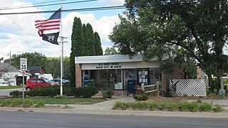
| Rapid City | Kalkaska | Clearwater | 1,357 | 1,352 | +0.37% | 5.41 sq mi (14.01 km2) | 250.83/sq mi (96.85/km2) |
| Rapid River | Delta | Masonville | 335 | | | 1.26 sq mi (3.26 km2) | 265.87/sq mi (102.65/km2) |
| Republic | Marquette | Republic
Humboldt | 470 | 569 | −17.40% | 3.62 sq mi (9.38 km2) | 129.83/sq mi (50.13/km2) |
| Riverdale | Gratiot | Seville | 281 | | | 0.69 sq mi (1.79 km2) | 407.25/sq mi (157.24/km2) |
| Robin Glen–Indiantown | Saginaw | Buena Vista | 674 | 722 | −6.65% | 2.81 sq mi (7.28 km2) | 239.86/sq mi (92.61/km2) |
| Rock | Delta | Maple Ridge | 181 | | | 0.90 sq mi (2.33 km2) | 201.11/sq mi (77.65/km2) |
| Rockland | Ontonagon | Rockland | 173 | | | 0.44 sq mi (1.14 km2) | 393.18/sq mi (151.81/km2) |
| Ruby | St. Clair | Clyde | 852 | | | 3.75 sq mi (9.71 km2) | 227.20/sq mi (87.72/km2) |
| Sand Lake | Iosco | Grant
Plainfield
Wilber | 1,203 | 1,412 | −14.80% | 14.95 sq mi (38.72 km2) | 80.47/sq mi (31.07/km2) |
| Scotts | St. Clair | Climax
Pavilion | 187 | | | 0.24 sq mi (0.62 km2) | 779.17/sq mi (300.84/km2) |
| Shaftsburg | Shiawassee | Woodhull | 450 | | | 1.00 sq mi (2.59 km2) | 450.00/sq mi (173.75/km2) |
| Shields | Saginaw | Thomas
James | 7,035 | 6,587 | +6.80% | 7.88 sq mi (20.41 km2) | 892.77/sq mi (344.70/km2) |
| Shorewood–Tower Hills–Harbert | Berrien | Chikaming | 1,249 | 1,344 | −7.07% | 4.53 sq mi (11.73 km2) | 275.72/sq mi (106.46/km2) |
| Skanee | Baraga | Arvon | 102 | | | 4.73 sq mi (12.25 km2) | 21.56/sq mi (8.33/km2) |
| Skidway Lake | Ogemaw | Mills | 3,082 | 3,392 | −9.14% | 11.29 sq mi (29.24 km2) | 272.98/sq mi (105.40/km2) |
| Snover | Sanilac | Moore | 330 | 448 | −26.34% | 3.42 sq mi (8.86 km2) | 96.49/sq mi (37.26/km2) |
| South Boardman | Kalkaska | Boardman | 509 | 536 | −5.04% | 3.29 sq mi (8.52 km2) | 154.71/sq mi (59.73/km2) |
| South Gull Lake | Kalamazoo | Ross | 1,179 | 1,182 | −0.25% | 1.35 sq mi (3.50 km2) | 873.33/sq mi (337.20/km2) |
| South Monroe | Monroe | Monroe | 6,468 | 6,433 | +0.54% | 2.43 sq mi (6.29 km2) | 2,661.73/sq mi (1,027.70/km2) |
| Spring Arbor | Jackson | Spring Arbor | 2,916 | 2,881 | +1.21% | 2.78 sq mi (7.20 km2) | 1,048.92/sq mi (404.99/km2) |
| St. Helen | Roscommon | Richfield | 2,735 | 2,668 | +2.51% | 5.73 sq mi (14.84 km2) | 477.31/sq mi (184.29/km2) |
| St. James | Charlevoix | St. James | 145 | 205 | −29.27% | 1.03 sq mi (2.67 km2) | 140.78/sq mi (54.35/km2) |
| Stony Point | Monroe | Frenchtown | 1,784 | 1,724 | +3.48% | 1.21 sq mi (3.13 km2) | 1,474.38/sq mi (569.26/km2) |
| Stronach | Manistee | Stronach | 170 | 162 | +4.94% | 0.35 sq mi (0.91 km2) | 485.71/sq mi (187.54/km2) |
| Temperance | Monroe | Bedford | 9,188 | 8,517 | +7.88% | 4.61 sq mi (11.94 km2) | 1,993.06/sq mi (769.52/km2) |
| Three Lakes | Baraga | Spurr | 167 | | | 6.00 sq mi (15.54 km2) | 27.83/sq mi (10.75/km2) |
| Tower | Cheboygan | Forest | 248 | | | 0.54 sq mi (1.40 km2) | 459.26/sq mi (177.32/km2) |
| Trimountain | Houghton | Adams | 212 | | | 0.47 sq mi (1.22 km2) | 451.06/sq mi (174.16/km2) |
| Trowbridge Park | Marquette | Marquette | 2,287 | 2,176 | +5.10% | 1.39 sq mi (3.60 km2) | 1,645.32/sq mi (635.26/km2) |
| Trufant | Montcalm | Maple Valley | 510 | | | 0.96 sq mi (2.49 km2) | 531.25/sq mi (205.12/km2) |
| Twin Lake | Muskegon | Dalton | 2,056 | 1,720 | +19.53% | 2.88 sq mi (7.46 km2) | 713.89/sq mi (275.63/km2) |
| Vandercook Lake | Jackson | Summit | 4,579 | 4,721 | −3.01% | 4.58 sq mi (11.86 km2) | 999.78/sq mi (386.02/km2) |
| Vineyard Lake | Jackson | Columbia
Norvell | 992 | 980 | +1.22% | 2.56 sq mi (6.63 km2) | 387.50/sq mi (149.61/km2) |
| Wacousta | Clinton | Watertown | 1,532 | 1,440 | +6.39% | 8.91 sq mi (23.08 km2) | 171.94/sq mi (66.39/km2) |
| Walloon Lake | Charlevoix | Melrose | 271 | 290 | −6.55% | 1.35 sq mi (3.50 km2) | 200.74/sq mi (77.51/km2) |
| Watersmeet | Gogebic | Watersmeet | 408 | 428 | −4.67% | 9.20 sq mi (23.83 km2) | 44.35/sq mi (17.12/km2) |
| Waverly | Eaton | Delta | 23,812 | 23,925 | −0.47% | 9.10 sq mi (23.57 km2) | 2,616.70/sq mi (1,010.31/km2) |
| Wedgewood | Wexford | Cherry Grove | 227 | 237 | −4.22% | 0.62 sq mi (1.61 km2) | 366.13/sq mi (141.36/km2) |
| Weidman | Isabella | Sherman
Nottawa | 920 | 959 | −4.07% | 5.65 sq mi (14.63 km2) | 162.83/sq mi (62.87/km2) |
| Wellston | Manistee | Norman | 254 | 311 | −18.33% | 0.97 sq mi (2.51 km2) | 261.86/sq mi (101.10/km2) |
| West Ishpeming | Marquette | Ishpeming
Tilden | 2,552 | 2,662 | −4.13% | 2.96 sq mi (7.67 km2) | 862.16/sq mi (332.88/km2) |
| West Monroe | Monroe | Monroe | 3,227 | 3,503 | −7.88% | 1.25 sq mi (3.24 km2) | 2,581.60/sq mi (996.76/km2) |
| Westwood | Kalamazoo | Eveline | 9,621 | 8,653 | +11.19% | 2.85 sq mi (7.38 km2) | 3,375.79/sq mi (1,303.40/km2) |
| White Pine | Ontonagon | Carp Lake | 339 | 474 | −28.48% | 5.00 sq mi (12.95 km2) | 67.80/sq mi (26.18/km2) |
| Whitmore Lake | Washtenaw
Livingston | Northfield
Green Oak | 7,584 | 6,423 | +18.08% | 4.79 sq mi (12.41 km2) | 1,583.30/sq mi (611.31/km2) |
| Winn | Isabella | Fremont | 166 | | | 0.57 sq mi (1.48 km2) | 291.23/sq mi (112.44/km2) |
| Wolf Lake | Muskegon | Egelston | 5,034 | 4,104 | +22.66% | 3.54 sq mi (9.17 km2) | 1,422.03/sq mi (549.05/km2) |
| Woodland Beach | Monroe | Frenchtown | 1,899 | 2,049 | −7.32% | 0.52 sq mi (1.35 km2) | 3,651.92/sq mi (1,410.02/km2) |
| Zeba | Baraga | L'Anse | 397 | 480 | −17.29% | 3.61 sq mi (9.35 km2) | 109.97/sq mi (42.46/km2) |