Mayuge District

Last updated

Mayuge District
Mayuge District in Uganda.svg
District location in Uganda
Coordinates: 00°20′N33°30′E / 0.333°N 33.500°E / 0.333; 33.500
CountryFlag of Uganda.svg  Uganda
Region Eastern Uganda
Sub-region Busoga sub-region
Capital Mayuge
Area
  Land1,082.5 km2 (418.0 sq mi)
Elevation
1,350 m (4,430 ft)
Population
 (2012 Estimate)
  Total461,200
  Density426.1/km2 (1,104/sq mi)
Time zone UTC+3 (EAT)
Website www.mayuge.go.ug

Mayuge District is a district in Eastern Uganda. Like many other Ugandan districts, it is named after its 'chief town', Mayuge, where the district headquarters are located.

Contents

Location

Mayuge District is bordered by Iganga District to the north, Bugiri District to the northeast, Namayingo District to the east, the Republic of Tanzania to the south, and Jinja District to the west. The coordinates of the district are:00 20N, 33 30E. The district headquarters are located at Mayuge, approximately 38 kilometres (24 mi), by road, east of Jinja, Uganda's sixth largest city. [1]

Overview

Prior to 2000, Mayuge District was known as Bunya County and was part of Iganga District. Present-day Mayuge District, Iganga District, Kamuli District, Jinja District, Kaliro District and Bugiri District constitute the Busoga Kingdom. A large proportion of the district's surface area is open water of Lake Victoria. It is estimated that this represents 77% of the total surface area in the district. Another 10% of the district is protected national forest reserve. The district has many Islands which are currently occupied by permanent and migratory fishermen. These include the Islands of Seguti, Dagusi, Vumba, Kaza, Nambuga and Simu. The Islands are all easily accessible by motor boat or canoe.

Population

In 1991, the national population census estimated the district population at about 216,800. The 2002 national census estimated the population of the district to be about 324,700 people, of whom 51.2% were female and 48.8% were male. The district population annual growth rate was calculated at 3.6%. In 2012, it was estimated that the population of Mayuge District was approximately 461,200. [2]

Economic activities

Due to fertile soils and favorable climate, Mayuge District has great agricultural potential. However, the fact that open water and natural forest reserves occupy an estimated 87% of the surface area of the district, significant pressure has been exerted on the natural environment from the increasing population numbers. Most of the agriculture in the district is on the subsistence level. The crops grown include the following:. [3]

Fishing is another high-value activity practiced in the district. This activity is the largest income earner in the district, accounting for 63% and 52% of the district revenue in 2002 and 2003 respectively. In 2004, an estimated 2,600 people were engaged in commercial fishing in Mayuge District. The fish caught from Lake Victoria include: (a) Nile Perch (b) Tilapia (c) Rargentae (Mukene) (d) Clarias (Cat fish) and (e) Protopterus (Lung fish).

In recent times, bee keeping for production of honey, is becoming an accepted and practiced method of earning an income in the district.

See also

Related Research Articles

<span class="mw-page-title-main">Bugiri District</span> District in Eastern Uganda, Uganda

Bugiri District is a district in Eastern Uganda. Like most other Ugandan districts, it is named after its 'chief town', Bugiri, where the district headquarters are located.

<span class="mw-page-title-main">Iganga District</span> District in Eastern Uganda, Uganda

Iganga District is a district in the Eastern Region of Uganda. The town of Iganga is the site of the district headquarters.

<span class="mw-page-title-main">Masindi District</span> District in Western Uganda, Uganda

Masindi District is a district in Western Uganda. Like many other Ugandan districts, it is named after its 'chief town' of Masindi, the location of the district headquarters.

<span class="mw-page-title-main">Busoga</span> Traditional Bantu kingdom in present-day Uganda

Busoga is a kingdom and one of four constitutional monarchies in present-day Uganda. The kingdom is a cultural institution which promotes popular participation and unity among the people of the region through development programs to improve their standard of living.

Bugiri is a town in the Eastern Region of Uganda. It is the chief town of Bugiri District, and the district headquarters are located there. The town was elevated to Municipal Council status in 2019.

<span class="mw-page-title-main">Iganga</span> Ugandan town

Iganga is a town in the Eastern Region of Uganda. It is the main municipal, administrative, and commercial center of Iganga District.

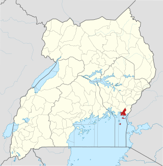
Mayuge is a town in the Eastern Region of Uganda. It is the location of the headquarters of Mayuge District.

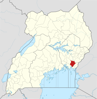
Bugembe is a town in Jinja District in the Eastern Region of Uganda. It is the seat of the Kingdom of Busoga, one of the four constitutional in Uganda, which is coterminous with the Busoga sub-region.

<span class="mw-page-title-main">Namutumba District</span> District in Eastern Uganda, Uganda

Namutumba District, sometimes referred to as Busiki District is a district in Eastern Uganda. It is named after its 'chief town', Namutumba, where the district headquarters are located.

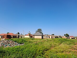
Busembatya, sometimes spelled Busembatia, is a town in the Eastern Region of Uganda.

Busoga University (BU), is a private university in Uganda, affiliated with Central Busoga Diocese of the Church of Uganda.

<span class="mw-page-title-main">Buvuma District</span> District in Central Uganda, Uganda

Buvuma District is a district in the Central Region of Uganda. The district is coterminous with the Buvuma Islands archipelago in Lake Victoria and does not have territory on mainland Uganda.

<span class="mw-page-title-main">Buyende District</span> District in Eastern Uganda, Uganda

Buyende District is a district in Eastern Uganda. It is named after Buyende, the 'chief town' in the district and the location of the district headquarters.

<span class="mw-page-title-main">Namayingo District</span> District in Eastern Uganda, Uganda

Namayingo District is a district in Eastern Uganda. The district is named after its 'chief town', Namayingo, where the district headquarters are located.

<span class="mw-page-title-main">Luuka District</span> District in Eastern Uganda, Uganda

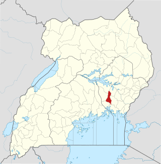
Luuka District is a district in Eastern Uganda.

Busoga sub-region is found in Eastern Uganda occupying an area of over 10,000 square kilometers and according to the 2014 national census about 40 percent of the people in the eastern region live in this sub-region.

<span class="mw-page-title-main">Buluba Hospital</span> Hospital in Eastern Region, Uganda

Buluba Hospital, whose formal name is St. Francis Hospital Buluba, is a community hospital in Uganda. It is owned and operated by the Roman Catholic Diocese of Jinja.

Namayingo is a town in Namayingo District in the Eastern Region of Uganda. It is the site of the district headquarters.

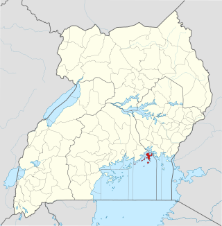
Musita is a town in Mayuge District, in the Eastern Region of Uganda.

The Jinja–Iganga–Bugiri–Tororo Road is a road in the Eastern Region of Uganda, connecting the towns of Jinja and Tororo. Sometimes referred to as Tororo–Jinja Road, it is a busy transport corridor, connecting traffic from neighboring Kenya, and northeastern Uganda to Jinja, a major commercial and industrial center, and ultimately to Kampala, the country's capital, and beyond.

References

  1. "Distance between Jinja and Mayuge with Map". Globefeed.com. Retrieved 19 May 2014.
  2. "Estimated Population of Mayuge District In 1991, 2002 & 2012". Citypopulation.de. Retrieved 19 May 2014.
  3. "The Economic Activities In Mayuge District". Uganda Travel Guide. Retrieved 19 May 2014.[ permanent dead link ]