Apac District

Last updated
Apac District
Apac District in Uganda.svg
District location in Uganda
Coordinates: 01°59′N32°32′E / 1.983°N 32.533°E / 1.983; 32.533
CountryFlag of Uganda.svg  Uganda
Region Northern Region
Sub-region Lango sub-region
Capital Apac
Area
  Total3,255.9 km2 (1,257.1 sq mi)
Population
 (2012 Estimate)
  Total349,000
  Density107.2/km2 (278/sq mi)
Time zone UTC+3 (EAT)
Website www.apac.go.ug

Apac District is a district in the Northern Region of Uganda. The Town of Apac hosts the district headquarters.

Contents

Location

Apac District is bordered by Oyam District to the north-east, Kole District to the north, Lira District to the north-east, Dokolo District to the east, Amolatar District to the south, Nakasongola District to the south-west, and Kiryandongo District to the west. The largest town in the district, Apac, is located approximately 62 kilometres (39 mi), by road, south-west of Lira, the largest city in the Lango sub-region. [1] This location is about 230 kilometres (140 mi), by road, north of Kampala, the capital and largest city of Uganda. [2]

Overview

Sub-counties Ngai, Iceme, Achaba, Minakulu, and Otwal were affected by the Lord's Resistance Army insurgency [3] [4]

In 2006, Apac District was split and part of it became Oyam District. In July 2010, it was further sub-divided to create Kole District. [5]

Population

The 1991 national census estimated the district population at 162,200. The 2002 national census estimated the population at 249,700. The annual population growth rate in the district between 2002 and 2012 was 3.5 percent. It was estimated that the population in 2012 was 349,000. [6]

Economic activities

Paddy fields in Apac District Inspection of rice fields in Apac, Uganda.jpg
Paddy fields in Apac District

Subsistence agriculture is the major economic activity in the district. An estimated 80 percent of the district's population is engaged in subsistence agriculture, although approximately 75 percent of the work is done by women.

Îimop Some fishing is practiced in the south of the district, particularly from Lake Kwania, a component of the Lake Kyoga aquatic system. Fish farming is taking root in the district as well.

Related Research Articles

<span class="mw-page-title-main">Gulu District</span> Neucleated District in Northern Region of Uganda, Uganda

Gulu is a district in the Northern Region of Uganda. The regional headquarters are located in the city of Gulu, which is also the administrative capital of Northern Uganda. the district consists of two main divisions, Gulu West and Gulu East.

<span class="mw-page-title-main">Pader District</span> District in Northern Uganda, Uganda

Pader District is a district in Northern Uganda. It is named after Pader, the chief municipal, administrative and commercial town in the district, where the district headquarters are located.

<span class="mw-page-title-main">Lira District</span> District in Northern Uganda, Uganda

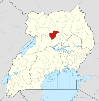
Lira District is a district in Northern Uganda. Like many other Ugandan districts, it is named after its 'chief town', Lira.

<span class="mw-page-title-main">Moyo District</span> District in Northern Uganda, Uganda

Moyo District is a district in Northern Region of Uganda. Like many other Ugandan districts, it is named after its "chief town", Moyo, where the district headquarters are located.

<span class="mw-page-title-main">Apac</span> Ugandan town

Apac is a town in Apac District in the Northern Region of Uganda. It is the 'chief town' of the district and the district headquarters are located there. The district is named after the town.

<span class="mw-page-title-main">Lango sub-region</span>

Lango sub-region is a region in Uganda covering an area of 15,570.7km consisting of the districts of:

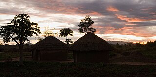
Aboke is a town in the Kole District of the Northern Region of Uganda. It was the location of the Aboke abductions in October 1996.

<span class="mw-page-title-main">Amolatar District</span> District in Northern Uganda, Uganda

Amolatar District is a district in Northern Uganda. Like many other Ugandan districts, it is named after its main municipal and administrative centre, Amolatar Town.

Kiruhura is a town in the Western Region of Uganda. It is the largest town in Kiruhura District and the site of the district headquarters.

<span class="mw-page-title-main">Dokolo District</span> District in Northern Region, Uganda

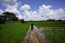
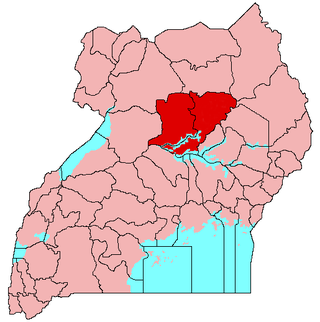
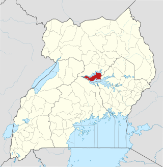
Dokolo District is a district in the Northern Region of Uganda. The town of Dokolo is its main municipal, administrative, and commercial centre.

Oyam is a town in the Northern Region of Uganda. It is the primary municipal, administrative, and commercial centre of Oyam District.

<span class="mw-page-title-main">Oyam District</span> District in Northern Uganda, Uganda

Oyam District is a district in Northern Uganda. Like most Ugandan districts, it is named after its 'chief town', Oyam, where the district headquarters are located.

<span class="mw-page-title-main">Butambala District</span> District in Central Region, Uganda

Butambala District is a district in the Central Region of Uganda.

<span class="mw-page-title-main">Nwoya District</span> District in Northern Uganda, Uganda

Nwoya District is a district in Northern Uganda. Like most districts in Uganda, it is named after its main municipal, administrative and commercial center, Nwoya, the location of the district headquarters.

<span class="mw-page-title-main">Otuke District</span> District in Uganda

Otuke District is a district in Northern Uganda. Like many other Ugandan districts, Otuke district is named after its 'chief town', Otuke, where the district headquarters are located.

<span class="mw-page-title-main">Kole District</span> District in Northern Uganda, Uganda

Kole District is a district in Northern Uganda. Like most other Ugandan districts, it is named after its 'chief town', Kole, where the district headquarters are located.

Kole is a town in Northern Uganda. It is the main municipal, administrative and commercial center of Kole District. The district is named after the town.

<span class="mw-page-title-main">Alebtong District</span> District in Northern Region of Uganda, Uganda

Alebtong District is a district in the Northern Region of Uganda. The town of Alebtong serves as the district headquarters.

<span class="mw-page-title-main">Kiryandongo District</span> District in Western Uganda, Uganda

Kiryandongo District is a district in Western Uganda. Like many other Ugandan districts, it is named after its 'chief town', Kiryandongo, where the district headquarters are located.

Rwekunye is a settlement in Kiryandongo District in the Western Region of Uganda.

References

  1. "Road Distance Between Lira and Apac With Map". Globefeed.com. Retrieved 25 May 2014.
  2. "Map Showing Kampala And Apac With Distance Marker". Globefeed.com. Retrieved 25 May 2014.
  3. "The never-ending pursuit of the Lord's Resistance Army". ACCORD. Retrieved 2022-03-03.
  4. Pham, Phuong; Vinck, Patrick; Stover, Eric (2007). "Abducted: The Lord's Resistance Army and Forced Conscription in Northern Uganda". hhi.harvard.edu. Retrieved 2022-03-03.
  5. Opio, Patrick (4 July 2010). "Museveni Hailed for New District". New Vision. Archived from the original on 16 April 2014. Retrieved 25 May 2014.
  6. "Estimated Population of Apac District In 1991, 2002 & 2012". Citypopulation.de. Retrieved 25 May 2014.