
Westchester County is located in the U.S. state of New York. It is the seventh most populous county in the State of New York and the most populous north of New York City. According to the 2020 United States Census, the county had a population of 1,004,456, its highest decennial count ever and an increase of 55,344 (5.8%) from the 949,113 counted in 2010. Located in the Hudson Valley, Westchester covers an area of 450 square miles (1,200 km2), consisting of six cities, 19 towns, and 23 villages. Established in 1683, Westchester was named after the city of Chester, England. The county seat is the city of White Plains, while the most populous municipality in the county is the city of Yonkers, with 211,569 residents per the 2020 U.S. Census.


Brewster is a village and the principal settlement within the town of Southeast in Putnam County, New York. Brewster’s population was 2,508 at the 2020 census. The village, which is the most densely populated portion of the county, was named for two early farmer landowners, Walter and James Brewster, who donated land for the Brewster railroad station in 1848.

Southeast is a town in Putnam County, New York, United States, so named for its location in the southeastern corner of the county. The population was 18,058 at the 2020 census. The town as a whole is informally referred to as Brewster, the town's principal settlement; the latter is also an incorporated village within the town's borders. Interstate 84, Interstate 684, U.S. Route 202, US Route 6, and NY 22 are the primary routes through the town.

Brewster station is a commuter rail stop on the Metro-North Railroad's Harlem Line, located in Brewster, New York.
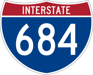
Interstate 684 (I-684) is a 28.47-mile-long (45.82 km) north–south auxiliary Interstate Highway in the state of New York in the United States. There is also a short portion in Connecticut with no junctions. The highway connects I-84 with I-287 and the Hutchinson River Parkway, primarily serving commuter traffic to and from the northern suburbs of the New York metropolitan area. Most of the route is in northern Westchester County. The route of the highway was originally designated as part of I-87 from 1968 to 1970. The first section of the roadway opened to traffic in October 1968, and the final segment was completed in December 1974.

New York State Route 301 (NY 301), also known as the Hudson River Turnpike, is an intra-county state highway stretching across three-quarters of Putnam County, New York, in the United States. The western terminus of NY 301 is at an intersection with NY 9D in Cold Spring. Its eastern terminus is at a junction with NY 52 in Carmel. Along the way, NY 301 meets U.S. Route 9 (US 9) and the Taconic State Parkway and passes through Clarence Fahnestock State Park. The section of the route between NY 9D and US 9 is ceremonially designated as the Sergeant Albert Ireland Memorial Highway.
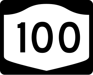
New York State Route 100 (NY 100) is a major north–south state highway in Westchester County, New York, in the United States. It begins parallel to Interstate 87 (I-87) at a junction with the Cross County Parkway in the city of Yonkers and runs through most of the length of the county up to U.S. Route 202 (US 202) in the town of Somers. NY 100 was designated as part of the 1930 renumbering of state highways in New York. Prior to becoming a state road, various sections of NY 100 were part of several important early roads in the county.
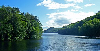
East Branch Reservoir, is a reservoir in the town of Southeast, New York, near the village of Brewster. Part of the New York City water supply system, it was formed by impounding the East Branch of the Croton River. Forming part of the Croton Watershed, it was placed into service in 1891, and lies some 35 miles (56 km) north of the city, in the southeast corner of Putnam County.

The West Branch Reservoir is a reservoir in the New York City water supply system. Formed by impounding the upper reaches of the West Branch of the Croton River, it is located in the Putnam County, New York, towns of Kent, and Carmel, about 50 miles (80 km) north of New York City.
The Boyds Corner Reservoir is a small reservoir in Putnam County, New York. It is in the town of Kent, New York, and is about 50 miles north of New York City. It is the northernmost reservoir in the Croton River watershed, but is not part of the New York City water supply system's Croton Watershed. and was formed by impounding the middle of the West Branch of the Croton River, submerging the village of Boyds Corner.

Middle Branch Reservoir is a reservoir in the New York City water supply system located in the Town of Southeast in Putnam County, 35 miles (65 km) north of the city. Created in 1878 by damming the Middle Branch of the Croton River, it is one of twelve in the Croton Watershed.

The Bog Brook Reservoir is a 379-acre (153 ha) reservoir in the Croton Watershed in southern New York State, part of the New York City water supply system. It is located in the town of Southeast in Putnam County, approximately 38 miles (61 km) north of New York City. It was formed by the damming of Bog Brook, a small tributary of the East Branch of the Croton River. The reservoir was put into service in 1892, making it one of the older in the system.
The Croton Falls Reservoir is a reservoir in the New York City water supply system in the Putnam County, New York townships of Carmel, and Southeast, roughly 50 miles (80 km) north of New York City. Part of the system's Croton Watershed, it was formed by impounding the West Branch and Middle Branch of the Croton River, tributaries of the Croton River, which flows into the Hudson River.

Putnam Transit or Putnam Area Rapid Transit (PART) is the provider of bus transit in Putnam County, New York. An agency of the Putnam County government, Putnam Transit came into service in the mid-1970s as a startup system in the wake of growing suburbanization of Putnam County and rising gas prices.

U.S. Route 202 (US 202) is a part of the U.S. Highway System that runs from New Castle, Delaware, to Bangor, Maine. In the U.S. state of New York, US 202 extends 55.57 miles (89.43 km) from the New Jersey state line near Suffern to the Connecticut state line east of Brewster. While most of US 202 is signed north–south, the portion within New York is signed east–west. It drifts north slowly as it crosses southern New York. US 202 is the only road to cross New York between New Jersey and Connecticut and not pass through New York City on the way.

The East Branch Croton River is a tributary of the Croton River in Dutchess, Putnam, and Westchester counties in the state of New York. It lies within the Croton River watershed and is part of the New York City water supply system's Croton Watershed.
The West Branch Croton River is a tributary of the Croton River in Putnam and Westchester counties in the state of New York. It lies within the Croton River watershed and is part of the New York City water supply system's Croton Watershed.
The Middle Branch Croton River is a tributary of the Croton River in Putnam and Westchester counties in the state of New York. It lies within the Croton River watershed and is part of the New York City water supply system's Croton Watershed.
The Muscoot River is a short tributary of the Croton River in Putnam and Westchester counties in the state of New York. Approximately 6 mi (9.7 km) long and running north-to-south, it lies within the Croton River watershed and is part of the New York City water supply system's Croton Watershed.


