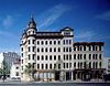
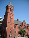
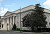
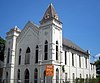
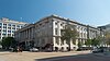
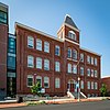
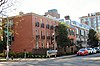
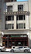
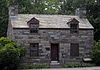
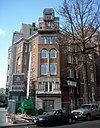
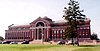
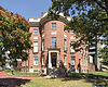
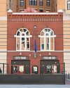
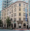
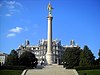
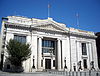
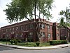
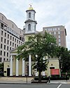
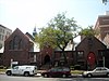
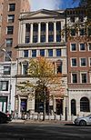
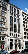
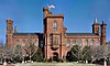
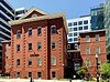
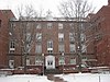
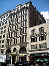
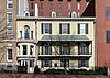
[2] Name on the Register Image Date listed [3] Location Neighborhood Description 1 2nd Baptist Church 2nd Baptist Church June 30, 2004 (# 04000625 816 3rd St. NW 38°54′09″N 77°00′57″W / 38.9025°N 77.015833°W / 38.9025; -77.015833 (2nd Baptist Church ) Mount Vernon Triangle 2 2000 Block of Eye Street, NW 2000 Block of Eye Street, NW August 9, 1977 (# 77001496 South side of 2000 block of Eye St., NW. 38°54′00″N 77°02′46″W / 38.900000°N 77.046111°W / 38.900000; -77.046111 (2000 Block of Eye Street, NW ) George Washington University Currently owned and operated by George Washington University for retail and commercial spaces. 3 Adas Israel Synagogue Adas Israel Synagogue March 24, 1969 (# 69000288 3rd and G Sts., NW. 38°53′52″N 77°01′11″W / 38.897778°N 77.019722°W / 38.897778; -77.019722 (Adas Israel Synagogue ) Downtown East Now The Lillian & Albert Small Capital Jewish Museum 4 Alibi Club Alibi Club October 21, 1994 (# 94001221 1806 Eye St., NW. 38°54′04″N 77°02′32″W / 38.901111°N 77.042222°W / 38.901111; -77.042222 (Alibi Club ) Golden Triangle 5 American Federation of Labor Building American Federation of Labor Building September 13, 1974 (# 74002154 901 Massachusetts Ave., NW. 38°54′12″N 77°01′28″W / 38.903333°N 77.024444°W / 38.903333; -77.024444 (American Federation of Labor Building ) Mount Vernon Square 6 American Institute of Pharmacy Building American Institute of Pharmacy Building August 18, 1977 (# 77001497 2215 Constitution Ave., NW. 38°53′34″N 77°02′59″W / 38.892778°N 77.049722°W / 38.892778; -77.049722 (American Institute of Pharmacy Building ) Monumental Core 7 American Peace Society American Peace Society September 13, 1974 (# 74002155 734 Jackson Pl., NW. 38°53′58″N 77°02′19″W / 38.899444°N 77.038611°W / 38.899444; -77.038611 (American Peace Society ) Monumental Core Headquarters of the American Peace Society from 1911 to 1948; in the Lafayette Square Historic District 8 American Red Cross National Headquarters American Red Cross National Headquarters October 15, 1966 (# 66000853 17th and D Sts., NW 38°53′41″N 77°02′26″W / 38.894722°N 77.040556°W / 38.894722; -77.040556 (American Red Cross National Headquarters ) Monumental Core 9 American Revolution Statuary American Revolution Statuary July 14, 1978 (# 78000256 Public buildings and various parks within DC 38°53′54″N 77°02′16″W / 38.898333°N 77.037778°W / 38.898333; -77.037778 (American Revolution Statuary ) Monumental Core 11 statues in central DC, including G. Washington, B. Franklin, N. Hale, J.P. Jones, J. Barry, E. Burke, C. Pulaski, de Lafayette, T. Kosciuszko, von Steuben, and de Rochambeau and 3 statues in other districts 10 American Security and Trust Company Building American Security and Trust Company Building July 16, 1973 (# 73002070 15th and Pennsylvania Ave., NW. 38°53′56″N 77°02′03″W / 38.898889°N 77.034167°W / 38.898889; -77.034167 (American Security and Trust Company Building ) Golden Triangle 11 Elizabeth Arden Building Elizabeth Arden Building August 18, 2003 (# 03000778 1147 Connecticut Ave. 38°54′18″N 77°02′28″W / 38.905000°N 77.041111°W / 38.905000; -77.041111 (Elizabeth Arden Building ) Golden Triangle 12 Arlington Memorial Bridge Arlington Memorial Bridge April 4, 1980 (# 80000346 Spans the Potomac River 38°53′12″N 77°03′39″W / 38.886667°N 77.060833°W / 38.886667; -77.060833 (Arlington Memorial Bridge ) Monumental Core Extends into Arlington County, Virginia 13 Arts and Industries Building Arts and Industries Building November 11, 1971 (# 71000994 900 Jefferson Dr., SW. 38°53′13″N 77°01′29″W / 38.886944°N 77.024722°W / 38.886944; -77.024722 (Arts and Industries Building ) Southwest Federal Center 14 Arts Club of Washington Arts Club of Washington March 24, 1969 (# 69000289 2017 I St., NW. 38°54′05″N 77°02′46″W / 38.901389°N 77.046111°W / 38.901389; -77.046111 (Arts Club of Washington ) Golden Triangle Cleveland Abbe , a meteorologist who became known as the father of the National Weather Service , lived in this house from 1877 to 1909. Previous occupants in the early decades of the 19th century included James Monroe and the British legation . Built ca. 1802 to 1805, this is a fine example of the Federal style of residential architecture . 15 Asbury United Methodist Church Asbury United Methodist Church November 1, 1986 (# 86003029 Eleventh and K Sts. NW 38°54′08″N 77°01′39″W / 38.902222°N 77.027500°W / 38.902222; -77.027500 (Asbury United Methodist Church ) Downtown 16 Ashburton House Ashburton House November 7, 1973 (# 73002071 1525 H St., NW. 38°54′01″N 77°02′09″W / 38.900278°N 77.035833°W / 38.900278; -77.035833 (Ashburton House ) Golden Triangle 17 Auditor's Building Complex Auditor's Building Complex April 27, 1978 (# 78003051 14th St. and Independence Ave. 38°53′10″N 77°02′01″W / 38.886111°N 77.033611°W / 38.886111; -77.033611 (Auditor's Building Complex ) Southwest Federal Center 18 Augusta Apartment Building Augusta Apartment Building September 9, 1994 (# 94001032 1151 New Jersey Ave. (216 New York Ave.), NW. 38°54′19″N 77°00′52″W / 38.905278°N 77.014444°W / 38.905278; -77.014444 (Augusta Apartment Building ) North Capitol Street 19 Bachelor Apartment House Bachelor Apartment House December 8, 1978 (# 78003052 1737 H St., NW. 38°54′01″N 77°02′30″W / 38.900278°N 77.041667°W / 38.900278; -77.041667 (Bachelor Apartment House ) Golden Triangle 20 Barr Building Barr Building January 14, 2013 (# 12001165 910 17th St., NW 38°54′07″N 77°02′24″W / 38.901913°N 77.039922°W / 38.901913; -77.039922 (Barr Building ) Golden Triangle 21 Blair House Blair House October 15, 1966 (# 66000963 1651 Pennsylvania Ave., NW 38°53′56″N 77°02′19″W / 38.898889°N 77.038617°W / 38.898889; -77.038617 (Blair House ) Monumental Core 22 Bond Building Bond Building September 15, 1983 (# 83001415 1404 New York Ave., NW 38°53′56″N 77°01′57″W / 38.898889°N 77.0325000°W / 38.898889; -77.0325000 (Bond Building ) Downtown 23 Brownley Confectionery Building Brownley Confectionery Building December 1, 1994 (# 94001408 1309 F St., NW. 38°53′51″N 77°01′50″W / 38.897500°N 77.030556°W / 38.897500; -77.030556 (Brownley Confectionery Building ) Downtown 24 Buildings at 1000 Block of Seventh Street, and 649–651 New York Avenue NW Buildings at 1000 Block of Seventh Street, and 649–651 New York Avenue NW February 2, 1984 (# 84000861 1005–1035 7th St., and 649–651 New York Ave. NW 38°54′12″N 77°01′19″W / 38.903333°N 77.021944°W / 38.903333; -77.021944 (Buildings at 1000 Block of Seventh Street, and 649–651 New York Avenue NW ) Mount Vernon Square 649 New York Avenue, NW 25 Bulletin Building Bulletin Building November 12, 2008 (# 07000422 717 6th St., NW 38°53′56″N 77°01′11″W / 38.898889°N 77.019722°W / 38.898889; -77.019722 (Bulletin Building ) Chinatown 26 Capitol Hill Historic District Capitol Hill Historic District August 27, 1976 (# 76002127 Roughly bounded by Virginia Ave., SE., S. Capitol St., F St., NE., and 14th Sts., SE. and NE.; also roughly bounded by 7th St., NE., Interstate 295, M St., SE., and 11th St., SE.; also squares 752, 753, 777, and 788 bounded by 2nd, 4th, and F Sts., NE. 38°53′13″N 76°59′51″W / 38.886944°N 76.997500°W / 38.886944; -76.997500 (Capitol Hill Historic District ) NE, SE and NW Second and third locations represent boundary increases of July 3, 2003 and October 21, 2015 27 Carlton Hotel Carlton Hotel June 28, 1990 (# 90000911 923 16th St., NW. 38°54′07″N 77°02′11″W / 38.901944°N 77.036389°W / 38.901944; -77.036389 (Carlton Hotel ) Golden Triangle 28 Carnegie Endowment for International Peace Carnegie Endowment for International Peace September 13, 1974 (# 74002156 700 Jackson Pl., NW 38°53′56″N 77°02′19″W / 38.898889°N 77.038611°W / 38.898889; -77.038611 (Carnegie Endowment for International Peace ) Monumental Core 29 Central National Bank Central National Bank April 27, 1995 (# 95000526 633 Pennsylvania Ave., NW. 38°53′36″N 77°01′16″W / 38.893333°N 77.021111°W / 38.893333; -77.021111 (Central National Bank ) Penn Quarter 30 Central Heating Plant Central Heating Plant July 6, 2007 (# 07000637 325 13th St., SW. 38°53′08″N 77°01′44″W / 38.885556°N 77.028889°W / 38.885556; -77.028889 (Central Heating Plant ) Southwest Federal Center 31 Central Public Library Central Public Library December 3, 1969 (# 69000290 Mount Vernon Sq., 8th and K Sts., NW. 38°54′08″N 77°01′24″W / 38.902222°N 77.023333°W / 38.902222; -77.023333 (Central Public Library ) Mount Vernon Square 32 Champlain Apartment Building Champlain Apartment Building September 7, 1994 (# 94001042 1424 K St., NW. 38°54′09″N 77°01′58″W / 38.902500°N 77.032778°W / 38.902500; -77.032778 (Champlain Apartment Building ) Downtown 33 Chase's Theater and Riggs Building Chase's Theater and Riggs Building September 7, 1978 (# 78003053 1426 G St. NW. and 615-627 15th St. NW. 38°53′53″N 77°02′01″W / 38.898056°N 77.033611°W / 38.898056; -77.033611 (Chase's Theater and Riggs Building ) Downtown 34 Chesapeake and Potomac Telephone Company Building Chesapeake and Potomac Telephone Company Building August 5, 1988 (# 88001112 730 Twelfth St., NW 38°53′56″N 77°01′42″W / 38.898889°N 77.028333°W / 38.898889; -77.028333 (Chesapeake and Potomac Telephone Company Building ) Downtown 35 Chesapeake and Potomac Telephone Company, Old Main Building Chesapeake and Potomac Telephone Company, Old Main Building June 13, 1988 (# 88000652 722 Twelfth St., NW 38°53′56″N 77°01′42″W / 38.898889°N 77.028333°W / 38.898889; -77.028333 (Chesapeake and Potomac Telephone Company, Old Main Building ) Downtown 36 Church of the Ascension Church of the Ascension January 19, 1984 (# 84000863 1215 Massachusetts Ave. NW 38°54′18″N 77°01′43″W / 38.905000°N 77.028611°W / 38.905000; -77.028611 (Church of the Ascension ) Mount Vernon Square 37 Church of the Epiphany Church of the Epiphany September 10, 1971 (# 71000996 1317 G St., NW. 38°53′55″N 77°01′51″W / 38.898611°N 77.030833°W / 38.898611; -77.030833 (Church of the Epiphany ) Downtown 38 Civil War Fort Sites Civil War Fort Sites July 15, 1974 (# 74000274 Arc of sites surrounding central Washington in Maryland, Virginia, and D.C. 38°49′33″N 77°00′56″W / 38.825778°N 77.0155°W / 38.825778; -77.0155 (Civil War Fort Sites ) All quadrants At the outset of the Civil War in 1861, Washington became a critical target for rebel attacks but was virtually without protection. The Union Army hastily began construction of a fortified defense line around the city, the physical remnants of which encompass these 19 earthwork forts, including Fort Greble . [4] See also National Register listings in western NW D.C. , upper NW D.C. , NE D.C. , SE D.C. , Prince George's County, Maryland , and Fairfax County, Virginia . 39 Civil War Monuments in Washington, DC Civil War Monuments in Washington, DC September 20, 1978 (# 78000257 Various parks within the original boundaries of city 38°54′20″N 77°01′57″W / 38.905667°N 77.032389°W / 38.905667; -77.032389 (Civil War Monuments in Washington, DC ) Various 18 statues about people and topics related to the Civil War, including 11 in central Washington, 6 in the NW quadrant, and 1 in the NE quadrant. 40 Commercial National Bank Commercial National Bank October 11, 1991 (# 91001488 1405 G St., NW. 38°53′54″N 77°01′57″W / 38.898333°N 77.032500°W / 38.898333; -77.032500 (Commercial National Bank ) Downtown 41 Concordia German Evangelical Church and Rectory Concordia German Evangelical Church and Rectory December 14, 1978 (# 78003055 20th and G Sts., NW. 38°53′52″N 77°02′42″W / 38.897778°N 77.045000°W / 38.897778; -77.045000 (Concordia German Evangelical Church and Rectory ) George Washington University Sits directly north of the President's House of George Washington University , also sits right across the street from Oscar W. Underwood House that serves as part of the George Washington University Law School . 42 Constitution Hall Constitution Hall September 16, 1985 (# 85002724 311 Eighteenth St., NW. 38°53′35″N 77°02′30″W / 38.893056°N 77.041667°W / 38.893056; -77.041667 (Constitution Hall ) Monumental Core 43 Corcoran Gallery of Art Corcoran Gallery of Art May 6, 1971 (# 71000997 17th St. at New York Ave., NW. 38°53′44″N 77°02′26″W / 38.895556°N 77.040556°W / 38.895556; -77.040556 (Corcoran Gallery of Art ) George Washington University Home to the Corcoran School of the Arts and Design at George Washington University . 44 Corcoran Hall Corcoran Hall April 12, 1991 (# 90001545 721 21st St., NW. 38°53′57″N 77°02′48″W / 38.899167°N 77.046667°W / 38.899167; -77.046667 (Corcoran Hall ) George Washington University Currently houses faculty offices for the George Washington University physics department 45 Cuban Friendship Urn Cuban Friendship Urn October 11, 2007 (# 07001053 Reservation 332, Ohio Dr., at 14th St. Bridge, SW. 38°52′43″N 77°02′18″W / 38.878611°N 77.038333°W / 38.878611; -77.038333 (Cuban Friendship Urn ) Southwest Waterfront 46 Davidson Building Davidson Building October 4, 2016 (# 16000683 927 15th St., NW. 38°54′08″N 77°02′00″W / 38.902172°N 77.033392°W / 38.902172; -77.033392 (Davidson Building ) Downtown 47 Decatur House Decatur House October 15, 1966 (# 66000858 748 Jackson Pl., NW. 38°53′59″N 77°02′20″W / 38.899722°N 77.038889°W / 38.899722; -77.038889 (Decatur House ) Monumental Core Federal Style house designed by Benjamin Henry Latrobe for naval hero Stephen Decatur across Lafayette Square from the White House . During 1827-1833 was home to successive Secretaries of State Henry Clay , Martin Van Buren , and Judah P. Benjamin . 48 Denrike Building Denrike Building August 22, 2016 (# 16000542 1010 Vermont Ave., NW 38°54′10″N 77°02′01″W / 38.902794°N 77.033674°W / 38.902794; -77.033674 (Denrike Building ) Downtown 49 James C. Dent House James C. Dent House November 2, 2010 (# 10000880 156 Q St., SW. 38°52′14″N 77°00′48″W / 38.870556°N 77.013333°W / 38.870556; -77.013333 (James C. Dent House ) Buzzard Point 50 District Building District Building March 16, 1972 (# 72001422 SE corner of 14th and E Sts., NW. 38°53′41″N 77°01′54″W / 38.894722°N 77.031667°W / 38.894722; -77.031667 (District Building ) Monumental Core 51 District of Columbia City Hall District of Columbia City Hall October 15, 1966 (# 66000857 4th and E Sts., NW 38°53′43″N 77°01′04″W / 38.895278°N 77.017778°W / 38.895278; -77.017778 (District of Columbia City Hall ) Judiciary Square 52 District of Columbia Municipal Center and Plaza District of Columbia Municipal Center and Plaza July 19, 2019 (# 100004189 300 Indiana Ave. NW (301 C St. NW) 38°53′38″N 77°01′03″W / 38.8939°N 77.0176°W / 38.8939; -77.0176 (District of Columbia Municipal Center and Plaza ) Judiciary Square 53 District of Columbia Pound District of Columbia Pound September 30, 2014 (# 14000798 820 S. Capitol St., SW., and 9 I St., SW. 38°52′46″N 77°00′34″W / 38.879306°N 77.009306°W / 38.879306; -77.009306 (District of Columbia Pound ) Southwest Waterfront 54 District of Columbia Recorder of Deeds District of Columbia Recorder of Deeds April 14, 2020 (# 100005181 515 D St. NW 38°53′41″N 77°01′11″W / 38.8948°N 77.0196°W / 38.8948; -77.0196 (District of Columbia Recorder of Deeds ) Judiciary Square 55 District of Columbia War Memorial District of Columbia War Memorial July 11, 2014 (# 14000388 Independence Ave. between 17th and 23rd Sts., SW. 38°53′15″N 77°02′37″W / 38.887500°N 77.043611°W / 38.887500; -77.043611 (District of Columbia War Memorial ) Monumental Core 56 Downtown Historic District Downtown Historic District September 22, 2001 (# 84003901 Roughly, Seventh St. from Pennsylvania Ave. to Mt. Vernon Sq., and F St. between Eleventh and Seventh Sts., NW 38°53′50″N 77°01′29″W / 38.897308°N 77.024781°W / 38.897308; -77.024781 (Downtown Historic District ) Downtown 57 Duncanson-Cranch House Duncanson-Cranch House July 26, 1973 (# 73002081 468-470 N St., SW. 38°52′29″N 77°01′06″W / 38.874722°N 77.018333°W / 38.874722; -77.018333 (Duncanson-Cranch House ) Southwest Waterfront 58 John J. Earley Office and Studio John J. Earley Office and Studio June 18, 2010 (# 10000367 2131 G St., NW 38°53′55″N 77°02′53″W / 38.898608°N 77.048128°W / 38.898608; -77.048128 (John J. Earley Office and Studio ) George Washington University Part of George Washington University 's Columbian College of Arts and Sciences . Currently houses studios for the Theatre and Dance Department. 59 East and West Potomac Parks East and West Potomac Parks November 30, 1973 (# 73000217 Bounded by Constitution Ave., 17th St., Independence Ave., Washington Channel, Potomac River, and Rock Creek Park 38°52′42″N 77°02′08″W / 38.878333°N 77.035556°W / 38.878333; -77.035556 (East and West Potomac Parks ) NW and SW East Potomac Park and West Potomac Park 60 The Editors Building The Editors Building March 17, 2015 (# 15000072 1729 H St., NW 38°54′01″N 77°02′28″W / 38.900278°N 77.041111°W / 38.900278; -77.041111 (The Editors Building ) Downtown 61 Eight Hundred Block of F St. NW Eight Hundred Block of F St. NW April 2, 1974 (# 74002159 800-818 F St. and 527 9th St., NW. 38°53′49″N 77°01′26″W / 38.896944°N 77.023889°W / 38.896944; -77.023889 (Eight Hundred Block of F St. NW ) Penn Quarter 62 Engine Company 16-Truck Company 3 Engine Company 16-Truck Company 3 May 18, 2011 (# 11000281 1018 13th St., NW 38°54′12″N 77°01′47″W / 38.903333°N 77.029722°W / 38.903333; -77.029722 (Engine Company 16-Truck Company 3 ) Downtown 63 Engine Company 23 Engine Company 23 June 6, 2007 (# 07000540 2119 G St., NW 38°53′55″N 77°02′52″W / 38.898555°N 77.047644°W / 38.898555; -77.047644 (Engine Company 23 ) George Washington University 64 Equitable Co-operative Building Association Equitable Co-operative Building Association December 29, 1994 (# 94001515 915 F St., NW. 38°53′50″N 77°01′29″W / 38.897222°N 77.024722°W / 38.897222; -77.024722 (Equitable Co-operative Building Association ) Chinatown 65 The Ethelhurst The Ethelhurst June 26, 2019 (# 100004123 1025 Fifteenth St., NW 38°54′13″N 77°02′04″W / 38.9036°N 77.0345°W / 38.9036; -77.0345 (The Ethelhurst ) 66 The Everglades The Everglades June 18, 2010 (# 10000368 2223 H St., NW 38°53′59″N 77°02′59″W / 38.899628°N 77.049822°W / 38.899628; -77.049822 (The Everglades ) George Washington University Currently Fulbright Hall (residence hall) of George Washington University . 67 Executive Office Building Executive Office Building June 4, 1969 (# 69000293 Pennsylvania Ave. and 17th St., NW 38°53′51″N 77°02′21″W / 38.8975°N 77.039167°W / 38.8975; -77.039167 (Executive Office Building ) Monumental Core 68 Federal Home Loan Bank Board Building Federal Home Loan Bank Board Building July 3, 2007 (# 07000642 320 1st St., NW. 38°53′40″N 77°00′45″W / 38.894444°N 77.012500°W / 38.894444; -77.012500 (Federal Home Loan Bank Board Building ) Downtown East 69 Federal-American National Bank Federal-American National Bank December 29, 1994 (# 94001517 615-621 14th St., NW. 38°53′52″N 77°01′54″W / 38.897778°N 77.031667°W / 38.897778; -77.031667 (Federal-American National Bank ) Downtown 70 Federal Home Loan Bank Board Building (FHLBB) Federal Home Loan Bank Board Building (FHLBB) October 11, 2016 (# 16000701 1700 G St., NW 38°53′53″N 77°02′24″W / 38.898091°N 77.040089°W / 38.898091; -77.040089 (Federal Home Loan Bank Board Building (FHLBB) ) Monumental Core 71 Federal Office Building No. 6 Federal Office Building No. 6 May 8, 2017 (# 100000956 400 Maryland Ave., SW. 38°53′12″N 77°01′08″W / 38.886536°N 77.018948°W / 38.886536; -77.018948 (Federal Office Building No. 6 ) Southwest Federal Center 72 Financial Historic District Financial Historic District October 12, 2006 (# 84003900 15th St. from Pennsylvania Ave. to I St., NW.; also K, 14th, and G Sts., NW. 38°53′55″N 77°02′02″W / 38.898611°N 77.033889°W / 38.898611; -77.033889 (Financial Historic District ) Monumental Core, Downtown Previously known as the Fifteenth Street Financial Historic District. Second set of addresses represents a boundary increase of January 12, 2017 73 The Flagler The Flagler June 18, 2010 (# 10000369 736 22nd St., NW 38°53′58″N 77°02′57″W / 38.899372°N 77.049183°W / 38.899372; -77.049183 (The Flagler ) George Washington University 74 Fletcher Chapel Fletcher Chapel August 14, 1997 (# 97000834 401 New York Ave., NW 38°54′18″N 77°00′59″W / 38.905°N 77.016389°W / 38.905; -77.016389 (Fletcher Chapel ) Mount Vernon Square 75 Foggy Bottom Historic District Foggy Bottom Historic District October 14, 1987 (# 87001269 Bounded by New Hampshire Ave., Twenty-fourth, Twenty-sixth, H, and K Sts., NW 38°54′02″N 77°03′12″W / 38.900556°N 77.053333°W / 38.900556; -77.053333 (Foggy Bottom Historic District ) Foggy Bottom 76 Ford's Theatre National Historic Site Ford's Theatre National Historic Site October 15, 1966 (# 66000034 10th St., NW., between E and F Sts. 38°53′47″N 77°01′34″W / 38.896389°N 77.026111°W / 38.896389; -77.026111 (Ford's Theatre National Historic Site ) Penn Quarter 77 Franklin School Franklin School April 11, 1973 (# 73002085 13th and K Sts., NW. 38°54′08″N 77°01′47″W / 38.902222°N 77.029722°W / 38.902222; -77.029722 (Franklin School ) Downtown A nineteenth-century school, site of Alexander Graham Bell's experiments with the photophone. 78 Freer Gallery of Art Freer Gallery of Art June 23, 1969 (# 69000295 12th St. and Jefferson Dr., SW. 38°53′17″N 77°01′40″W / 38.888056°N 77.027778°W / 38.888056; -77.027778 (Freer Gallery of Art ) Southwest Federal Center 79 Friendship Baptist Church Friendship Baptist Church November 19, 2004 (# 04001236 734 1st St., SW. 38°52′49″N 77°00′43″W / 38.880413°N 77.011846°W / 38.880413; -77.011846 (Friendship Baptist Church ) Southwest Waterfront 80 Garfinckel's Department Store Garfinckel's Department Store April 4, 1995 (# 95000353 1401 F St., NW. 38°53′51″N 77°01′56″W / 38.8975°N 77.032222°W / 38.8975; -77.032222 (Garfinckel's Department Store ) Downtown 81 General Post Office General Post Office March 24, 1969 (# 69000311 E and F Sts. between 7th and 8th Sts., NW 38°53′48″N 77°01′22″W / 38.896667°N 77.022778°W / 38.896667; -77.022778 (General Post Office ) Penn Quarter 82 Germuiller Row Germuiller Row December 1, 1994 (# 94001406 748 3rd St. and 300-302 H St., NW. 38°53′59″N 77°00′56″W / 38.899722°N 77.015556°W / 38.899722; -77.015556 (Germuiller Row ) Chinatown 83 Godey Lime Kilns Godey Lime Kilns November 2, 1973 (# 73000221 Rock Creek and Potomac Parkway at 27th and L Sts., NW. 38°54′12″N 77°03′22″W / 38.903333°N 77.056111°W / 38.903333; -77.056111 (Godey Lime Kilns ) West End 84 Samuel Gompers Memorial Samuel Gompers Memorial October 11, 2007 (# 07001054 Massachusetts Ave. and 10th and L Sts., NW., Reservation 69 38°54′21″N 77°01′36″W / 38.905833°N 77.026667°W / 38.905833; -77.026667 (Samuel Gompers Memorial ) Mount Vernon Square 85 Ulysses S. Grant School Ulysses S. Grant School May 22, 2007 (# 07000447 2130 G St. NW 38°53′59″N 77°02′53″W / 38.899722°N 77.048056°W / 38.899722; -77.048056 (Ulysses S. Grant School ) George Washington University 86 Hamilton Hotel Hamilton Hotel April 17, 2013 (# 12001194 1001 14th St. NW 38°54′10″N 77°01′53″W / 38.902778°N 77.031389°W / 38.902778; -77.031389 (Hamilton Hotel ) Downtown 87 Harbour Square Harbour Square November 28, 2018 (# 100003158 400-560 (even) N St., SW., and 1301-1327 (odd) 4th St., SW. 38°52′26″N 77°01′04″W / 38.8740°N 77.0179°W / 38.8740; -77.0179 (Harbour Square ) Southwest Waterfront 88 Harris & Ewing Photographic Studio Harris & Ewing Photographic Studio December 16, 1994 (# 94001407 1311-1313 F St., NW. 38°53′51″N 77°01′51″W / 38.8975°N 77.030833°W / 38.8975; -77.030833 (Harris & Ewing Photographic Studio ) Downtown 89 Harrison Apartment Building Harrison Apartment Building September 7, 1994 (# 94001036 704 3rd St., NW. 38°53′55″N 77°00′56″W / 38.898611°N 77.015556°W / 38.898611; -77.015556 (Harrison Apartment Building ) Chinatown 90 W. B. Hibbs and Company Building W. B. Hibbs and Company Building March 19, 1991 (# 90002150 725 Fifteenth St., NW. 38°53′57″N 77°02′00″W / 38.899167°N 77.033333°W / 38.899167; -77.033333 (W. B. Hibbs and Company Building ) Downtown 91 Hill Building Hill Building March 17, 2015 (# 15000073 839 17th or 1636 I Sts., NW. 38°54′04″N 77°02′22″W / 38.901111°N 77.039333°W / 38.901111; -77.039333 (Hill Building ) Downtown 92 Hotel Washington Hotel Washington March 30, 1995 (# 95000352 515 15th St., NW. 38°53′49″N 77°02′01″W / 38.896944°N 77.033611°W / 38.896944; -77.033611 (Hotel Washington ) Downtown 93 Interior Department Offices Interior Department Offices November 23, 1986 (# 86003160 Eighteenth and F Sts. NW 38°53′48″N 77°02′35″W / 38.896667°N 77.043056°W / 38.896667; -77.043056 (Interior Department Offices ) Golden Triangle 94 Jefferson Apartment Building Jefferson Apartment Building September 7, 1994 (# 94001046 315 H St., NW. 38°54′01″N 77°00′57″W / 38.900278°N 77.015833°W / 38.900278; -77.015833 (Jefferson Apartment Building ) Mount Vernon Triangle 95 Thomas Jefferson Memorial Thomas Jefferson Memorial October 15, 1966 (# 66000029 S bank of the Tidal Basin 38°52′52″N 77°02′13″W / 38.881111°N 77.036944°W / 38.881111; -77.036944 (Thomas Jefferson Memorial ) Monumental Core 96 Lyndon Baines Johnson Memorial Grove On The Potomac Lyndon Baines Johnson Memorial Grove On The Potomac December 28, 1973 (# 73002097 Lady Byrd Johnson Park, Columbia Island 38°52′42″N 77°03′05″W / 38.878333°N 77.051389°W / 38.878333; -77.051389 (Lyndon Baines Johnson Memorial Grove On The Potomac ) Monumental Core 97 The Keystone The Keystone June 18, 2010 (# 10000370 2150 Pennsylvania Ave., NW 38°54′06″N 77°02′54″W / 38.901672°N 77.0483°W / 38.901672; -77.0483 (The Keystone ) George Washington University Currently the H.B. Burns Memorial Building of George Washington University . 98 Martin Luther King Memorial Library Martin Luther King Memorial Library October 22, 2007 (# 07001102 901 G St. NW. 38°54′02″N 77°01′29″W / 38.900556°N 77.024722°W / 38.900556; -77.024722 (Martin Luther King Memorial Library ) Chinatown 99 Korean War Veterans Memorial Korean War Veterans Memorial July 27, 1995 (# 01000273 Southeast of the Lincoln Memorial, off Independence Ave. 38°53′16″N 77°02′50″W / 38.887858°N 77.047336°W / 38.887858; -77.047336 (Korean War Veterans Memorial ) Monumental Core 100 Lafayette Building Lafayette Building September 1, 2005 (# 05001205 811 Vermont Ave. NW 38°54′03″N 77°02′05″W / 38.900786°N 77.034589°W / 38.900786; -77.034589 (Lafayette Building ) Golden Triangle 101 Lafayette Square Historic District Lafayette Square Historic District August 29, 1970 (# 70000833 Roughly between 15th and 17th Sts. and H St. and State and Treasury Places, exclusive of the White House and its grounds 38°53′55″N 77°02′11″W / 38.898611°N 77.036389°W / 38.898611; -77.036389 (Lafayette Square Historic District ) Monumental Core, Golden Triangle , Downtown 102 Julius Lansburgh Furniture Co., Inc. Julius Lansburgh Furniture Co., Inc. May 8, 1974 (# 74002164 909 F St., NW. 38°53′51″N 77°01′29″W / 38.8975°N 77.024722°W / 38.8975; -77.024722 (Julius Lansburgh Furniture Co., Inc. ) Chinatown Also known as the Old Masonic Temple 103 Thomas Law House Thomas Law House August 14, 1973 (# 73002093 1252 6th St., SW. 38°52′29″N 77°01′09″W / 38.874722°N 77.019167°W / 38.874722; -77.019167 (Thomas Law House ) Southwest Waterfront 104 L'Enfant Plan of the City of Washington, District of Columbia L'Enfant Plan of the City of Washington, District of Columbia April 24, 1997 (# 97000332 Roughly bounded by Florida Ave. from Rock Cr., NW. to 15th St., NE., S to C St., and E to the Anacostia River 38°53′26″N 77°01′13″W / 38.890556°N 77.020278°W / 38.890556; -77.020278 (L'Enfant Plan of the City of Washington, District of Columbia ) All 105 Lenthall Houses Lenthall Houses March 16, 1972 (# 72001425 606–610 21St., NW 38°53′52″N 77°02′49″W / 38.897667°N 77.046936°W / 38.897667; -77.046936 (Lenthall Houses ) George Washington University Two of the oldest known houses built in the District of Columbia. Currently a part of George Washington University . 106 Edward Simon Lewis House Edward Simon Lewis House July 23, 1973 (# 73002094 456 N St., SW. 38°52′28″N 77°01′05″W / 38.87445°N 77.01805°W / 38.87445; -77.01805 (Edward Simon Lewis House ) Southwest Waterfront 107 Lincoln Memorial Lincoln Memorial October 15, 1966 (# 66000030 West Potomac Park 38°53′21″N 77°03′00″W / 38.8893°N 77.050111°W / 38.8893; -77.050111 (Lincoln Memorial ) Monumental Core 108 Lisner Auditorium Lisner Auditorium October 25, 1990 (# 90001548 730 21st St., NW. 38°53′57″N 77°02′50″W / 38.899167°N 77.047222°W / 38.899167; -77.047222 (Lisner Auditorium ) George Washington University Contains multiple auditoriums used by George Washington University . 109 Lockkeeper's House, C & O Canal Extension Lockkeeper's House, C & O Canal Extension November 30, 1973 (# 73000218 SW corner of 17th St. and Constitution Ave., NW. 38°53′31″N 77°02′24″W / 38.891944°N 77.04°W / 38.891944; -77.04 (Lockkeeper's House, C & O Canal Extension ) Monumental Core 110 Luzon Apartment Building Luzon Apartment Building September 7, 1994 (# 94001035 2501 Pennsylvania Ave., NW. 38°54′14″N 77°03′12″W / 38.903889°N 77.053333°W / 38.903889; -77.053333 (Luzon Apartment Building ) West End 111 M Street High School M Street High School October 23, 1986 (# 86002924 128 M St. NW 38°54′19″N 77°00′49″W / 38.905278°N 77.013611°W / 38.905278; -77.013611 (M Street High School ) North Capitol Street 112 Gen. Robert Macfeely House Gen. Robert Macfeely House September 15, 1989 (# 89001214 2015 I St., NW. 38°54′06″N 77°02′44″W / 38.901528°N 77.045556°W / 38.901528; -77.045556 (Gen. Robert Macfeely House ) Golden Triangle 113 Masonic Temple Masonic Temple February 18, 1987 (# 86002920 801 Thirteenth St., NW 38°54′00″N 77°01′46″W / 38.900000°N 77.029444°W / 38.900000; -77.029444 (Masonic Temple ) Downtown 114 Mayflower Hotel Mayflower Hotel November 14, 1983 (# 83003527 1127 Connecticut Ave. NW 38°54′16″N 77°02′23″W / 38.904444°N 77.039722°W / 38.904444; -77.039722 (Mayflower Hotel ) Golden Triangle 115 McLachlen Building McLachlen Building November 6, 1986 (# 86003042 1001 G St. NW 38°53′54″N 77°01′35″W / 38.898333°N 77.026389°W / 38.898333; -77.026389 (McLachlen Building ) Downtown 116 Memorial Continental Hall Memorial Continental Hall November 28, 1972 (# 72001427 17th St., between C and D Sts., NW 38°53′37″N 77°02′25″W / 38.893611°N 77.040278°W / 38.893611; -77.040278 (Memorial Continental Hall ) Monumental Core 117 Metropolitan African Methodist Episcopal Church Metropolitan African Methodist Episcopal Church July 26, 1973 (# 73002102 1518 M St., NW. 38°54′19″N 77°02′09″W / 38.905278°N 77.035833°W / 38.905278; -77.035833 (Metropolitan African Methodist Episcopal Church ) Golden Triangle Gothic -style church dedicated in 1886; held the funerals of Frederick Douglass and Rosa Parks ; on the National Trust for Historic Preservation 2010 list of America's Most Endangered Places [5] 118 Metropolitan Club Metropolitan Club April 28, 1995 (# 95000441 1700 H St., NW. 38°54′00″N 77°02′24″W / 38.900000°N 77.040000°W / 38.900000; -77.040000 (Metropolitan Club ) Golden Triangle 119 Milton Hall Milton Hall June 18, 2010 (# 10000371 2222 I St., NW 38°54′02″N 77°02′59″W / 38.900639°N 77.049817°W / 38.900639; -77.049817 (Milton Hall ) George Washington University Currently is Jacqueline Bouvier Kennedy Onassis Hall at George Washington University . 120 Moran Building Moran Building September 26, 1983 (# 83001413 501-509 G St., NW 38°53′54″N 77°01′10″W / 38.898333°N 77.019444°W / 38.898333; -77.019444 (Moran Building ) Chinatown 121 Morrison and Clark Houses Morrison and Clark Houses March 19, 1991 (# 90002149 1013-1015 L St., NW. 38°54′15″N 77°01′38″W / 38.904167°N 77.027222°W / 38.904167; -77.027222 (Morrison and Clark Houses ) Mount Vernon Square 122 Mount Vernon Memorial Highway Mount Vernon Memorial Highway May 18, 1981 (# 81000079 Washington St. and George Washington Memorial Parkway 38°52′38″N 77°02′56″W / 38.877222°N 77.048861°W / 38.877222; -77.048861 (Mount Vernon Memorial Highway ) SW Extends into Alexandria, Virginia 123 Mount Vernon Square Historic District Mount Vernon Square Historic District September 3, 1999 (# 99001071 Roughly bounded by New York Ave., 7th St., N St., and 1st St., NW. 38°54′19″N 77°01′04″W / 38.905278°N 77.017778°W / 38.905278; -77.017778 (Mount Vernon Square Historic District ) Mount Vernon Square Extends north of M Street 124 Mount Vernon Triangle Historic District Mount Vernon Triangle Historic District September 19, 2006 (# 06000191 Roughly bounded by the 400 blocks of Massachusetts Ave., NW. and K St., NW., Prather's Alley, and 5th St., NW. 38°54′13″N 77°01′06″W / 38.903611°N 77.018333°W / 38.903611; -77.018333 (Mount Vernon Triangle Historic District ) Mount Vernon Triangle 125 Mullett Rowhouses Mullett Rowhouses September 30, 1994 (# 94001149 2517, 2519 and 2525 Pennsylvania Ave., NW. 38°54′15″N 77°03′16″W / 38.904167°N 77.054444°W / 38.904167; -77.054444 (Mullett Rowhouses ) West End 126 Munson Hall Munson Hall June 18, 2010 (# 10000372 2212 H St., NW 38°54′02″N 77°02′58″W / 38.900556°N 77.049444°W / 38.900556; -77.049444 (Munson Hall ) George Washington University Currently Munson Hall of George Washington University . 127 Myrene Apartment Building Myrene Apartment Building September 9, 1994 (# 94001041 703 6th St., NW. 38°53′55″N 77°01′11″W / 38.898611°N 77.019722°W / 38.898611; -77.019722 (Myrene Apartment Building ) Chinatown 128 National Academy of Sciences National Academy of Sciences March 15, 1974 (# 74002168 2101 Constitution Ave., NW. 38°53′34″N 77°02′54″W / 38.892778°N 77.048333°W / 38.892778; -77.048333 (National Academy of Sciences ) Monumental Core 129 National Archives National Archives May 27, 1971 (# 71001004 Constitution Ave. between 7th and 9th Sts., NW. 38°53′33″N 77°01′24″W / 38.8925°N 77.023333°W / 38.8925; -77.023333 (National Archives ) Monumental Core Designated a National Historic Landmark in 2023. 130 National Bank of Washington, Washington Branch National Bank of Washington, Washington Branch May 8, 1974 (# 74002169 301 7th St., NW. 38°53′37″N 77°01′16″W / 38.893611°N 77.021111°W / 38.893611; -77.021111 (National Bank of Washington, Washington Branch ) Penn Quarter 131 National Geographic Society Headquarters National Geographic Society Headquarters June 5, 2023 (# 100009025 1156 16th St., NW and 1145 17th St. NW 38°54′20″N 77°02′12″W / 38.9055°N 77.0367°W / 38.9055; -77.0367 (National Geographic Society Headquarters ) NW 132 National Mall National Mall October 15, 1966 (# 66000031 Between Independence and Constitution Aves. from the U.S. Capitol to the Washington Monument; also bounded by 3rd St., NW.-SW., Independence Ave., SW., Raoul Wallenberg Pl., SW., the CSX rail line, the Potomac River, and Constitution Ave., NW. 38°53′23″N 77°01′20″W / 38.889722°N 77.022222°W / 38.889722; -77.022222 (National Mall ) NW and SW Second set of addresses represents a boundary increase of December 8, 2016 133 National Metropolitan Bank Building National Metropolitan Bank Building September 13, 1978 (# 78003059 613 15th St., NW. 38°53′52″N 77°02′01″W / 38.897778°N 77.033611°W / 38.897778; -77.033611 (National Metropolitan Bank Building ) Downtown 134 National Museum of Natural History National Museum of Natural History March 30, 2023 (# 100008754 10th St. and Constitution Ave. NW 38°53′29″N 77°01′33″W / 38.8913°N 77.0259°W / 38.8913; -77.0259 (National Museum of Natural History ) Monumental Core 135 National Portrait Gallery National Portrait Gallery October 15, 1966 (# 66000902 F and G Sts. between 7th and 9th Sts., NW 38°53′52″N 77°01′23″W / 38.897778°N 77.023056°W / 38.897778; -77.023056 (National Portrait Gallery ) Chinatown 136 National Savings and Trust Company National Savings and Trust Company March 16, 1972 (# 72001428 New York Ave. and 15th St., NW. 38°53′57″N 77°02′01″W / 38.899167°N 77.033611°W / 38.899167; -77.033611 (National Savings and Trust Company ) Downtown 137 National Union Building National Union Building September 21, 1990 (# 90001375 918 F St., NW 38°53′49″N 77°01′29″W / 38.896944°N 77.024722°W / 38.896944; -77.024722 (National Union Building ) Penn Quarter 138 National War College National War College November 28, 1972 (# 72001535 P St., within Fort Lesley J. McNair 38°51′47″N 77°01′01″W / 38.863056°N 77.016944°W / 38.863056; -77.016944 (National War College ) Buzzard Point 139 Observatory Hill Observatory Hill January 12, 2017 (# 100000479 23rd and E Sts., NW. 38°53′41″N 77°03′05″W / 38.894782°N 77.051449°W / 38.894782; -77.051449 (Observatory Hill ) Observatory Circle 140 The Octagon The Octagon October 15, 1966 (# 66000863 1799 New York Ave., NW 38°53′46″N 77°02′30″W / 38.896111°N 77.041667°W / 38.896111; -77.041667 (The Octagon ) Golden Triangle NHL: Served as the temporary Executive Mansion for Pres. James Madison after White House was burned by the British in the War of 1812 141 Old Engine Company No. 6 Old Engine Company No. 6 September 5, 1975 (# 75002052 438 Massachusetts Ave., NW. 38°54′01″N 77°01′03″W / 38.900278°N 77.0175°W / 38.900278; -77.0175 (Old Engine Company No. 6 ) Chinatown 142 Old Naval Observatory Old Naval Observatory October 15, 1966 (# 66000864 23rd and E Sts., NW 38°53′42″N 77°03′07″W / 38.895000°N 77.051944°W / 38.895000; -77.051944 (Old Naval Observatory ) Monumental Core 143 Old Post Office and Clock Tower Old Post Office and Clock Tower April 11, 1973 (# 73002105 Pennsylvania Ave. at 12th St., NW. 38°53′38″N 77°01′41″W / 38.893889°N 77.028056°W / 38.893889; -77.028056 (Old Post Office and Clock Tower ) Monumental Core 144 Oriental Building Association No. 6 Building Oriental Building Association No. 6 Building September 10, 2004 (# 04000956 600 F St. NW 38°53′56″N 77°01′13″W / 38.898889°N 77.020278°W / 38.898889; -77.020278 (Oriental Building Association No. 6 Building ) Penn Quarter 145 Pan American Union Pan American Union June 4, 1969 (# 69000298 17th St. between C St. and Constitution Ave., NW. 38°53′34″N 77°02′27″W / 38.892778°N 77.040833°W / 38.892778; -77.040833 (Pan American Union ) Monumental Core 146 Pennsylvania Avenue National Historic Site Pennsylvania Avenue National Historic Site October 15, 1966 (# 66000865 Roughly bounded by Constitution Ave., F St., 3rd, and 15th Sts. NW 38°53′35″N 77°01′35″W / 38.893056°N 77.026389°W / 38.893056; -77.026389 (Pennsylvania Avenue National Historic Site ) Monumental Core, Downtown East, Downtown , Penn Quarter 147 Pension Building Pension Building March 24, 1969 (# 69000312 4th and 5th Sts. between F and G Sts., NW 38°53′51″N 77°01′05″W / 38.8975°N 77.018056°W / 38.8975; -77.018056 (Pension Building ) Chinatown Now the National Building Museum 148 Peyser Building-Security Savings and Commercial Bank Peyser Building-Security Savings and Commercial Bank September 10, 2012 (# 12000777 1518 K St., NW 38°54′08″N 77°02′08″W / 38.902347°N 77.035448°W / 38.902347; -77.035448 (Peyser Building-Security Savings and Commercial Bank ) Golden Triangle 149 PHILADELPHIA (gundelo) PHILADELPHIA (gundelo) October 15, 1966 (# 66000852 National Museum of American History , 14th St. and Constitution Ave., NW 38°53′29″N 77°01′48″W / 38.891389°N 77.030000°W / 38.891389; -77.030000 (PHILADELPHIA (gundelo) Monumental Core Only surviving American gunboat from the Revolutionary War, fought in Battle of Valcour Island 150 President's Office, George Washington University President's Office, George Washington University September 13, 1991 (# 90001544 2003 G St., NW. and 700 20th St., NW. 38°53′54″N 77°02′43″W / 38.898333°N 77.045278°W / 38.898333; -77.045278 (President's Office, George Washington University ) George Washington University Part of the George Washington University School of Law. Sits on the historic University Yard with Stockton Hall and Corcoran Hall . 151 President's Park South President's Park South May 6, 1980 (# 80000347 Constitution Ave. 38°53′39″N 77°02′13″W / 38.894167°N 77.036944°W / 38.894167; -77.036944 (President's Park South ) Mounmental Core 152 Railroad Retirement Board Building Railroad Retirement Board Building July 6, 2007 (# 07000638 330 C St., SW. 38°53′08″N 77°01′00″W / 38.885556°N 77.016667°W / 38.885556; -77.016667 (Railroad Retirement Board Building ) Southwest Federal Center 153 Randall Junior High School Randall Junior High School December 22, 2008 (# 08001205 65 I St., SW. 38°52′45″N 77°00′39″W / 38.8793°N 77.010883°W / 38.8793; -77.010883 (Randall Junior High School ) Southwest Waterfront 154 Real Estate Trust Building-Continental Trust Building Real Estate Trust Building-Continental Trust Building January 20, 2015 (# 14001166 1343 H St., NW 38°54′01″N 77°01′52″W / 38.900278°N 77.031111°W / 38.900278; -77.031111 (Real Estate Trust Building-Continental Trust Building ) Downtown 155 Renwick Gallery Renwick Gallery March 24, 1969 (# 69000300 Northeast corner of 17th St. and Pennsylvania Ave., NW 38°53′56″N 77°02′22″W / 38.898889°N 77.039444°W / 38.898889; -77.039444 (Renwick Gallery ) Monumental Core 156 Rhodes' Tavern Rhodes' Tavern March 24, 1969 (# 69000301 601-603 15th St. and 1431 F St., NW. 38°53′51″N 77°02′01″W / 38.8975°N 77.033611°W / 38.8975; -77.033611 (Rhodes' Tavern ) Downtown 157 Riggs National Bank Riggs National Bank July 16, 1973 (# 73002113 1503-1505 Pennsylvania Ave., NW. 38°53′56″N 77°02′04″W / 38.898889°N 77.034444°W / 38.898889; -77.034444 (Riggs National Bank ) Golden Triangle 158 Riggs National Bank, Washington Loan and Trust Company Branch Riggs National Bank, Washington Loan and Trust Company Branch May 6, 1971 (# 71001005 SW corner of 9th and F Sts., NW. 38°53′50″N 77°01′29″W / 38.897222°N 77.024722°W / 38.897222; -77.024722 (Riggs National Bank, Washington Loan and Trust Company Branch ) Penn Quarter 159 Ringgold-Carroll House Ringgold-Carroll House July 26, 1973 (# 73002114 1801 F St., NW. 38°53′51″N 77°02′33″W / 38.897500°N 77.042500°W / 38.897500; -77.042500 (Ringgold-Carroll House ) Golden Triangle 160 Franklin Delano Roosevelt Memorial Franklin Delano Roosevelt Memorial May 2, 1997 (# 01000271 Cherry Tree Walk, Tidal Basin 38°53′35″N 77°01′26″W / 38.893056°N 77.023889°W / 38.893056; -77.023889 (Franklin Delano Roosevelt Memorial ) Monumental Core 161 St. Aloysius Catholic Church St. Aloysius Catholic Church July 26, 1973 (# 73002116 N. Capitol and I Sts., NW. 38°54′05″N 77°00′36″W / 38.901389°N 77.010000°W / 38.901389; -77.010000 (St. Aloysius Catholic Church ) North Capitol Street 162 Saint James Mutual Homes Saint James Mutual Homes February 23, 2016 (# 16000027 201-217 P, 1410-1414 3rd, and 220-215-229 O Sts., SW., and 1411-1415 James Creek Parkway, SW. 38°52′21″N 77°00′49″W / 38.872423°N 77.013727°W / 38.872423; -77.013727 (Saint James Mutual Homes ) Southwest Waterfront 163 St. John's Church St. John's Church October 15, 1966 (# 66000868 16th and H Sts., NW 38°54′01″N 77°02′11″W / 38.900278°N 77.036389°W / 38.900278; -77.036389 (St. John's Church ) Golden Triangle 164 St. Mary's Episcopal Church St. Mary's Episcopal Church April 2, 1973 (# 73002118 730 23rd St., NW. 38°53′57″N 77°03′02″W / 38.899167°N 77.050556°W / 38.899167; -77.050556 (St. Mary's Episcopal Church ) George Washington University 165 General Jose de San Martin Memorial General Jose de San Martin Memorial October 12, 2007 (# 07001059 Reservation 106, Virginia Ave. and 20th St., NW. 38°53′48″N 77°02′44″W / 38.896667°N 77.045556°W / 38.896667; -77.045556 (General Jose de San Martin Memorial ) Monumental Core 166 B.F. Saul Building B.F. Saul Building October 4, 2016 (# 16000685 925 15th St., NW. 38°54′07″N 77°02′00″W / 38.902028°N 77.033400°W / 38.902028; -77.033400 (B.F. Saul Building ) Downtown 167 Schneider Triangle Schneider Triangle December 13, 1982 (# 82001031 Bounded by Washington Circle, New Hampshire Ave. NW, K, 22nd, and L Sts. NW 38°54′11″N 77°02′58″W / 38.903056°N 77.049444°W / 38.903056; -77.049444 (Schneider Triangle ) George Washington University 168 Second National Bank Second National Bank December 29, 1994 (# 94001516 1331 G St., NW. 38°53′54″N 77°01′52″W / 38.898333°N 77.031111°W / 38.898333; -77.031111 (Second National Bank ) Downtown 169 Smithsonian Building Smithsonian Building October 15, 1966 (# 66000867 Jefferson Dr. at 10th St., SW. 38°53′19″N 77°01′35″W / 38.888611°N 77.026389°W / 38.888611; -77.026389 (Smithsonian Building ) Southwest Federal Center 170 Social Security Administration Building Social Security Administration Building July 6, 2007 (# 07000639 330 Independence Ave., SW. 38°52′55″N 77°01′01″W / 38.881944°N 77.016944°W / 38.881944; -77.016944 (Social Security Administration Building ) Southwest Federal Center 171 Southeast No. 9 Boundary Marker of the Original District of Columbia Southeast No. 9 Boundary Marker of the Original District of Columbia November 1, 1996 (# 96001242 0.225 mile south of the Oxon Cove Bridge and 420 feet east of Shepherd Parkway 38°48′14″N 77°01′27″W / 38.803889°N 77.024167°W / 38.803889; -77.024167 (Southeast No. 9 Boundary Marker of the Original District of Columbia ) SW 172 Southern Railway Building Southern Railway Building April 26, 2016 (# 16000194 1500 K St., NW 38°54′08″N 77°02′06″W / 38.902215°N 77.034956°W / 38.902215; -77.034956 (Southern Railway Building ) Downtown 173 Steedman-Ray House Steedman-Ray House September 21, 1990 (# 90001376 1925 F St., NW 38°53′50″N 77°02′42″W / 38.897222°N 77.045000°W / 38.897222; -77.045000 (Steedman-Ray House ) George Washington University This houses the President of George Washington University . Previously, it has been used as an alumni space on the campus. 174 Thaddeus Stevens School Thaddeus Stevens School July 12, 2001 (# 01000706 1050 Twenty-First St., NW 38°54′11″N 77°02′49″W / 38.903194°N 77.046944°W / 38.903194; -77.046944 (Thaddeus Stevens School ) Golden Triangle 175 Stockton Hall Stockton Hall September 13, 1991 (# 90001546 720 20th St., NW. 38°53′57″N 77°02′43″W / 38.899167°N 77.045278°W / 38.899167; -77.045278 (Stockton Hall ) George Washington University Currently part of the George Washington University School of Law. Sits on historic University Yard with Maxwell Woodhull House , President's Office, George Washington University , and Corcoran Hall . 176 Hattie M. Strong Residence Hall Hattie M. Strong Residence Hall April 12, 1991 (# 90001547 620 21st St., NW. 38°53′52″N 77°02′50″W / 38.897778°N 77.047222°W / 38.897778; -77.047222 (Hattie M. Strong Residence Hall ) George Washington University Named after a donation for the construction from Hattie Strong, Hattie M. Strong Residence Hall is a women's residence hall at George Washington University . 177 Sun Building Sun Building March 27, 1985 (# 85000650 1317 F St., NW 38°53′48″N 77°01′34″W / 38.896667°N 77.026111°W / 38.896667; -77.026111 (Sun Building ) Downtown 178 Mary E. Surratt House Mary E. Surratt House August 11, 2009 (# 04000118 604 H Street 38°53′58″N 77°01′13″W / 38.899444°N 77.020278°W / 38.899444; -77.020278 (Mary E. Surratt House ) Chinatown 179 William Syphax School William Syphax School July 25, 2003 (# 03000672 1360 Half St., SW. 38°52′33″N 77°00′31″W / 38.875833°N 77.008611°W / 38.875833; -77.008611 (William Syphax School ) Southwest Waterfront 180 Benjamin Ogle Tayloe House Benjamin Ogle Tayloe House November 2, 2023 (# 100009491 723 Madison Place NW (formerly 21 Madison Place NW) 38°53′59″N 77°02′06″W / 38.8997°N 77.0349°W / 38.8997; -77.0349 (Benjamin Ogle Tayloe House ) Lafayette Square 181 Temperance Fountain Temperance Fountain October 12, 2007 (# 07001061 7th St. and Indiana Ave., NW. 38°53′37″N 77°01′19″W / 38.893611°N 77.021944°W / 38.893611; -77.021944 (Temperance Fountain ) Penn Quarter 182 Terminal Refrigerating and Warehouse Company Terminal Refrigerating and Warehouse Company October 15, 2014 (# 14000854 300 D St., SW. 38°53′04″N 77°00′59″W / 38.884444°N 77.016389°W / 38.884444; -77.016389 (Terminal Refrigerating and Warehouse Company ) Southwest Federal Center 183 Tiber Island Tiber Island January 14, 2013 (# 12001166 401-461 N, 430-490 M, 1201-1265 4th, and 1252 6th Sts., SW. 38°52′32″N 77°01′07″W / 38.875524°N 77.01869°W / 38.875524; -77.01869 (Tiber Island ) Southwest Waterfront 184 Titanic Memorial Titanic Memorial October 12, 2007 (# 07001060 Reservation 717, Waterfront Park, and Water and P Sts., SW. 38°52′38″N 77°01′16″W / 38.877222°N 77.021111°W / 38.877222; -77.021111 (Titanic Memorial ) Southwest Waterfront 185 Tower Building Tower Building September 7, 1995 (# 95001084 1401 K St., NW. 38°54′05″N 77°01′57″W / 38.901389°N 77.032500°W / 38.901389; -77.032500 (Tower Building ) Downtown 186 Town Center East Town Center East January 15, 2014 (# 13001071 1001 and 1101 3rd St., SW. 38°52′39″N 77°00′57″W / 38.877449°N 77.015699°W / 38.877449; -77.015699 (Town Center East ) Southwest Waterfront 187 Oscar W. Underwood House Oscar W. Underwood House December 8, 1976 (# 76002132 2000 G St., NW 38°53′53″N 77°02′43″W / 38.898056°N 77.045278°W / 38.898056; -77.045278 (Oscar W. Underwood House ) George Washington University This is the home of the Jacob Burns Law Clinics of the George Washington University Law School. 188 Union Trust Building Union Trust Building January 19, 1984 (# 84000867 740 15th St. NW 38°54′00″N 77°02′02″W / 38.900000°N 77.033889°W / 38.900000; -77.033889 (Union Trust Building ) Golden Triangle 189 United Brotherhood of Carpenters and Joiners-Local 132 United Brotherhood of Carpenters and Joiners-Local 132 September 17, 2003 (# 03000945 1010 10th St. NW, 1001 K St. NW 38°54′09″N 77°01′35″W / 38.9025°N 77.026389°W / 38.9025; -77.026389 (United Brotherhood of Carpenters and Joiners-Local 132 ) Downtown 190 United Mine Workers of America Building United Mine Workers of America Building September 13, 2000 (# 00001032 900 Fifteenth St. NW 38°54′08″N 77°02′13″W / 38.902222°N 77.036944°W / 38.902222; -77.036944 (United Mine Workers of America Building ) Golden Triangle 191 U.S. Capitol Gatehouses and Gateposts U.S. Capitol Gatehouses and Gateposts November 30, 1973 (# 73002120 7th, 15th, and 17th Sts., and Constitution Ave., NW. 38°53′27″N 77°01′56″W / 38.890833°N 77.032222°W / 38.890833; -77.032222 (U.S. Capitol Gatehouses and Gateposts ) Monumental Core 192 US Chamber of Commerce Building US Chamber of Commerce Building May 13, 1992 (# 92000499 1615 H St., NW. 38°54′01″N 77°02′17″W / 38.900278°N 77.038056°W / 38.900278; -77.038056 (US Chamber of Commerce Building ) Golden Triangle 193 U.S. Civil Service Commission Building U.S. Civil Service Commission Building September 18, 2013 (# 13000713 1724 F St., NW 38°53′50″N 77°02′27″W / 38.897104°N 77.040752°W / 38.897104; -77.040752 (U.S. Civil Service Commission Building ) Golden Triangle 194 US Courthouse-District of Columbia US Courthouse-District of Columbia July 5, 2007 (# 07000640 333 Constitution Ave. NW 38°53′22″N 77°01′02″W / 38.889444°N 77.017222°W / 38.889444; -77.017222 (US Courthouse-District of Columbia ) Downtown East 195 U.S. Court Of Military Appeals U.S. Court Of Military Appeals January 21, 1974 (# 74002174 450 E St., NW. 38°53′44″N 77°01′07″W / 38.895556°N 77.018611°W / 38.895556; -77.018611 (U.S. Court Of Military Appeals ) Downtown East 196 U.S. Department of Agriculture Administration Building U.S. Department of Agriculture Administration Building January 24, 1974 (# 74002175 12th St. and Jefferson Dr., SW. 38°53′17″N 77°01′49″W / 38.888056°N 77.030278°W / 38.888056; -77.030278 (U.S. Department of Agriculture Administration Building ) Southwest Federal Center 197 U.S. Department of Agriculture Cotton Annex U.S. Department of Agriculture Cotton Annex October 5, 2015 (# 15000683 300 12th St., SW. 38°53′08″N 77°01′40″W / 38.885556°N 77.027778°W / 38.885556; -77.027778 (U.S. Department of Agriculture Cotton Annex ) Southwest Federal Center 198 U.S. Department of Agriculture South Building U.S. Department of Agriculture South Building July 5, 2007 (# 07000643 14th St. and Independence Ave., SW. 38°53′12″N 77°01′48″W / 38.886667°N 77.030000°W / 38.886667; -77.030000 (U.S. Department of Agriculture South Building ) Southwest Federal Center 199 U.S. Department of Housing and Urban Development U.S. Department of Housing and Urban Development August 26, 2008 (# 08000824 451 7th St., SW. 38°53′02″N 77°01′19″W / 38.884017°N 77.022011°W / 38.884017; -77.022011 (U.S. Department of Housing and Urban Development ) Southwest Federal Center Known as "Robert C. Weaver Federal Building", it was designed by Marcel Breuer 200 US Department of the Interior Building US Department of the Interior Building November 10, 1986 (# 86002898 Eighteenth and C Sts. NW 38°53′41″N 77°01′54″W / 38.894722°N 77.031667°W / 38.894722; -77.031667 (US Department of the Interior Building ) Monumental Core 201 U.S. Department of State Building U.S. Department of State Building August 21, 2017 (# 100001481 2201 C St. NW. 38°53′40″N 77°02′54″W / 38.8944°N 77.0484°W / 38.8944; -77.0484 (U.S. Department of State Building ) Monumental Core Known as the Harry S. Truman Building 202 U.S. Department of the Treasury U.S. Department of the Treasury November 11, 1971 (# 71001007 1500 Pennsylvania Ave., NW 38°53′53″N 77°02′04″W / 38.898056°N 77.034444°W / 38.898056; -77.034444 (U.S. Department of the Treasury ) Monumental Core 203 US General Accounting Office Building US General Accounting Office Building September 21, 1995 (# 95001086 441 G St., NW. 38°53′56″N 77°01′04″W / 38.898788°N 77.017671°W / 38.898788; -77.017671 (US General Accounting Office Building ) Chinatown 204 US Public Health Service Building US Public Health Service Building July 5, 2007 (# 07000641 1951 Constitution Ave. NW 38°53′34″N 77°02′40″W / 38.892778°N 77.044444°W / 38.892778; -77.044444 (US Public Health Service Building ) Monumental Core 205 USS SEQUOIA (yacht) USS SEQUOIA (yacht) December 23, 1987 (# 87002594 Gangplank Marina (as of 2010) [6] 38°52′32″N 77°01′21″W / 38.875556°N 77.0225°W / 38.875556; -77.0225 (USS SEQUOIA (yacht) ) Southwest Waterfront 206 U.S. Tax Court U.S. Tax Court August 26, 2008 (# 08000821 400 2nd St., NW. 38°53′43″N 77°00′52″W / 38.895325°N 77.014547°W / 38.895325; -77.014547 (U.S. Tax Court ) Downtown East 207 University Club of Washington, DC University Club of Washington, DC April 4, 2024 (# 100010128 1135 Sixteenth Street, NW 38°54′18″N 77°02′10″W / 38.9049°N 77.0360°W / 38.9049; -77.0360 (University Club of Washington, DC ) 208 Vietnam Veterans Memorial Vietnam Veterans Memorial November 13, 1982 (# 01000285 West end of Constitution Gardens 38°53′27″N 77°02′50″W / 38.890833°N 77.047222°W / 38.890833; -77.047222 (Vietnam Veterans Memorial ) Monumental Core 209 Virginia Interlocking Control Tower Virginia Interlocking Control Tower April 10, 2017 (# 100000846 Southeastern corner of 2nd St. and Virginia Ave., SW. 38°53′01″N 77°00′49″W / 38.883546°N 77.013512°W / 38.883546; -77.013512 (Virginia Interlocking Control Tower ) Southwest Federal Center 210 Waggaman-Ray Commercial Row Waggaman-Ray Commercial Row February 24, 1995 (# 95000162 1141, 1143, and 1145 Connecticut Ave. 38°54′15″N 77°02′28″W / 38.904167°N 77.041111°W / 38.904167; -77.041111 (Waggaman-Ray Commercial Row ) Golden Triangle 211 George Washington University-Old West End Historic District George Washington University-Old West End Historic District January 27, 2015 (# 14001207 Between F, I, 19th, and 23rd Sts., NW. and Virginia Ave., NW. 38°53′56″N 77°02′51″W / 38.898889°N 77.047500°W / 38.898889; -77.047500 (George Washington University-Old West End Historic District ) George Washington University 212 Washington Monument Washington Monument October 15, 1966 (# 66000035 The Mall, between 14th and 17th Sts., NW. 38°53′23″N 77°02′09″W / 38.889722°N 77.035833°W / 38.889722; -77.035833 (Washington Monument ) Monumental Core 213 Watergate Complex Watergate Complex October 12, 2005 (# 05000540 2500, 2600, 2650, and 2600 Virginia Ave., NW, and 600 and 700 New Hampshire Ave., NW 38°53′56″N 77°03′17″W / 38.898889°N 77.054722°W / 38.898889; -77.054722 (Watergate Complex ) Foggy Bottom 214 Westory Building Westory Building September 10, 2012 (# 12000778 607 14th St., NW 38°53′53″N 77°01′54″W / 38.897964°N 77.031661°W / 38.897964; -77.031661 (Westory Building ) Downtown 215 Margaret Wetzel House Margaret Wetzel House October 25, 1990 (# 90001542 714 21st St., NW. 38°53′56″N 77°02′50″W / 38.898889°N 77.047222°W / 38.898889; -77.047222 (Margaret Wetzel House ) George Washington University Part of George Washington University for various academic programs. 216 Wheat Row Wheat Row July 23, 1973 (# 73002125 1315, 1317, 1319, and 1321 4th St., SW. 38°52′26″N 77°01′05″W / 38.873889°N 77.018056°W / 38.873889; -77.018056 (Wheat Row ) Southwest Waterfront 217 Emily Wiley House Emily Wiley House May 26, 2006 (# 06000192 902 3rd St., NW 38°54′12″N 77°00′56″W / 38.903333°N 77.015556°W / 38.903333; -77.015556 (Emily Wiley House ) Mount Vernon Triangle 218 Willard Hotel Willard Hotel February 15, 1974 (# 74002177 1401-1409 Pennsylvania Ave., NW. 38°53′49″N 77°01′58″W / 38.896944°N 77.032778°W / 38.896944; -77.032778 (Willard Hotel ) Downtown 219 Winder Building Winder Building March 24, 1969 (# 69000303 604 17th St., NW. 38°53′51″N 77°02′25″W / 38.8975°N 77.040278°W / 38.8975; -77.040278 (Winder Building ) Golden Triangle 220 Wire Building Wire Building January 23, 2013 (# 12001195 1000 Vermont Ave., NW 38°54′10″N 77°02′02″W / 38.902778°N 77.033944°W / 38.902778; -77.033944 (Wire Building ) Downtown 221 Maxwell Woodhull House Maxwell Woodhull House April 12, 1991 (# 90001543 2033 G St., NW. 38°53′54″N 77°02′48″W / 38.898333°N 77.046667°W / 38.898333; -77.046667 (Maxwell Woodhull House ) George Washington University Part of George Washington University , houses the Albert Small Washingtonia Collection. 222 Yale Steam Laundry Yale Steam Laundry March 18, 1999 (# 99000332 437-443 New York Ave., NW. 38°54′17″N 77°01′05″W / 38.904722°N 77.018056°W / 38.904722; -77.018056 (Yale Steam Laundry ) Mount Vernon Square