Rooster Rock State Park

Last updated

Rooster Rock State Park
Rooster rock from west on I-84 P2528.jpeg
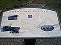
Rooster rock from the west
USA Oregon location map.svg
Red pog.svg
Usa edcp location map.svg
Red pog.svg
TypePublic, state
Location Multnomah County, Oregon
Nearest city Troutdale
Coordinates 45°32′40″N122°14′09″W / 45.5445639°N 122.2359232°W / 45.5445639; -122.2359232 [1]
Operated by Oregon Parks and Recreation Department

Rooster Rock State Park is a state park located east of Corbett, in the U.S. state of Oregon. One of the features of the park is Rooster Rock, a column of basalt forming a natural obelisk, which stands near the south side of the Columbia River Gorge, in the lee of Crown Point. The park is administered by the Oregon Parks and Recreation Department.

Contents

The monolith was mentioned in the journal of the explorers Lewis and Clark as their camping place on November 2, 1805. [2] The name is phallic in origin, [2] specifically, the column's original name was "Cock Rock". The Chinook word for the rock was iwash, referring to penis. [3] The name was later modified to Rooster Rock so as not to offend the public. [3]

The eastern portion of the park is designated as a clothing-optional beach, the first officially designated clothing-optional beach in the U.S. [4] The only other clothing-optional beach in the state, after Glassbar Island's closing, is Collins Beach, on Sauvie Island in the Columbia River, north of Portland.

The area around the parking lot has been a favorite astronomy spot for amateur astronomers in the area, with organizations such as OMSI hosting multiple star parties at the venue. [5]

See also

Related Research Articles

<span class="mw-page-title-main">Multnomah Falls</span> Waterfall in Oregon, U.S.

Multnomah Falls is a waterfall located on Multnomah Creek in the Columbia River Gorge, east of Troutdale, between Corbett and Dodson, Oregon, United States. The waterfall is accessible from the Historic Columbia River Highway and Interstate 84. Spanning two tiers on basalt cliffs, it is the tallest waterfall in the state of Oregon at 620 ft (189 m) in height. The Multnomah Creek Bridge, built in 1914, crosses below the falls, and is listed on the National Register of Historic Places.

<span class="mw-page-title-main">Sauvie Island</span> Island in the state of Oregon

<span class="mw-page-title-main">Lewis and Clark National Historical Park</span> Historic site in Oregon and Washington, United States

The Lewis and Clark National Historical Park, located in the vicinity of the mouth of the Columbia River, commemorates the Lewis and Clark Expedition. Administration of the park, which includes both federal and state lands, is a cooperative effort of the National Park Service and the states of Oregon and Washington. The National Historical Park was dedicated on November 12, 2004.

<span class="mw-page-title-main">Hayden Island, Portland, Oregon</span> Neighborhood in Portland, Oregon, United States

Hayden Island is an island in the Columbia River between Vancouver, Washington, and Portland, Oregon. The wide main channel of the Columbia passes north of the island. To the south, sheltered by the island, is a smaller channel known as North Portland Harbor. Much of Hayden Island is within Portland city limits, and recognized as one of its 95 neighborhoods.

<span class="mw-page-title-main">Shepperd's Dell</span> Small canyon in the Columbia River Gorge in Oregon, in the U.S.

Shepperd's Dell is a small canyon in the Columbia River Gorge in Oregon, located at 45.54833°N 122.195°W which is less than one-third mile southeast of Rooster Rock State Park. The Shepperd's Dell Bridge is listed on the National Register of Historic Places.

<span class="mw-page-title-main">Government Island (Oregon)</span> Island on the Columbia River in Oregon, United States

Government Island is a 1,760-acre (710 ha) island in the Columbia River north of Portland, in Multnomah County, in the U.S. state of Oregon. Though Interstate 205 passes over it on the Glenn L. Jackson Memorial Bridge, access to the island is only by boat. There is a city controlled locked gate in the fence surrounding the freeway.

<span class="mw-page-title-main">Chanticleer Point</span> Geographic feature in the U.S. state of Oregon

Chanticleer Point is a geographical landmark on the Oregon side of the Columbia River Gorge. It is the first notable overlook encountered traveling east on the Historic Columbia River Highway. It is a typical location from which to take photos of the gorge featuring Crown Point prominently. It overlooks Rooster Rock State Park.

<span class="mw-page-title-main">Nude recreation</span> Leisure activity while naked

Nude recreation refers to recreational activities which some people engage in while nude. Historically, the ancient Olympic Games were nude events. There remain some societies in Africa, Oceania, and South America that continue to engage in everyday public activities—including sports—without clothes, while in most of the world nude activities take place in either private spaces or separate clothing optional areas in public spaces. Occasional events, such as nude bike rides, may occur in public areas where nudity is not otherwise allowed.

<span class="mw-page-title-main">Collins Beach (Sauvie Island)</span> Beach in Oregon, United States

Collins Beach is a sandy beach on the Columbia River side of Sauvie Island in Oregon, United States, located north of Portland.

<span class="mw-page-title-main">Lewis and Clark State Recreation Site</span> State park in the U.S. state of Oregon

Lewis and Clark State Recreation Site is a state park in eastern Multnomah County, Oregon, near Troutdale and Corbett, and is administered by the Oregon Parks and Recreation Department. It is located on the Sandy River, near its confluence with the Columbia River. Broughton's Bluff marks the westernmost extent of the Columbia River Gorge at the site.

<span class="mw-page-title-main">Sauvie Island Wildlife Area</span>

The Sauvie Island Wildlife Area is a state game management area on Sauvie Island in the U.S. state of Oregon. It contains more than 12,000 acres (4,856 ha) for mixed use including hunting, fishing, canoeing, kayaking, birdwatching and hiking. Established in 1974, it is located in both Multnomah and Columbia counties.

<span class="mw-page-title-main">Nude beach</span> A beach where public nudity is practiced

A nude beach, sometimes called a clothing-optional or free beach, is a beach where users are at liberty to be nude. Nude beaches usually have mixed bathing. Such beaches are usually on public lands, and any member of the public is allowed to use the facilities without membership in any movement or subscription to any personal belief. The use of the beach facilities is normally anonymous. Unlike a naturist resort or facility, there is normally no membership or vetting requirement for the use of a nude beach. The use of nude beach facilities is usually casual, not requiring pre-booking. Nude beaches may be official, unofficial, or illegal.

<span class="mw-page-title-main">Manhattan Beach State Recreation Site</span>

Manhattan Beach State Recreation Site is a state park in the U.S. state of Oregon. Administered by the Oregon Parks and Recreation Department, the park is open to the public and is fee-free. Amenities at the park, which is 2 miles (3 km) north of Rockaway Beach along U.S. Route 101, include picnicking, fishing, and a Pacific Ocean beach.

McVay Rock State Recreation Site is a state park in the U.S. state of Oregon, administered by the Oregon Parks and Recreation Department.

<span class="mw-page-title-main">Kelley Point Park</span> Public park in Portland, Oregon, U.S.

Kelley Point Park is a city park in north Portland in the U.S. state of Oregon. Bounded by the Columbia Slough on the south, the Willamette River on the west, and the Columbia River on the north, the park forms the tip of the peninsula at the confluence of the rivers. Marine Terminal 6 of the Port of Portland lies immediately east of the park along the Columbia, while Terminal 5 is along the Willamette slightly south of the Columbia Slough. The park is at 45.6498384°N 122.7637106°W and rises to an elevation of 39 feet (12 m) above sea level. Sauvie Island is west of the park across the Willamette River. Hayden Island is slightly upstream of the park on the Columbia River opposite Marine Terminal 6.

Lighthouse Beach is a small section of the Fire Island National Seashore that is adjacent to Robert Moses State Park on New York's Long Island. It was notable for having sections that were officially designated as clothing optional prior to 2013.

<span class="mw-page-title-main">Floras Lake</span> Lake in the U.S. state of Oregon

Floras Lake is a natural 236-acre (96 ha) body of water on the southern Oregon Coast of the United States. Fed by four small tributaries from a basin of about 10 square miles (26 km2) in Curry County, it lies about 10 miles (16 km) north of Port Orford and 2 miles (3 km) west of U.S. Route 101. It was probably named for Fred Flora, a 19th-century settler and miner who lived nearby.

References

  1. "Rooster Rock State Park". Geographic Names Information System . United States Geological Survey, United States Department of the Interior . Retrieved July 1, 2011.
  2. 1 2 McArthur, Lewis A.; Lewis L. McArthur (2003) [1928]. Oregon Geographic Names (7th ed.). Portland, Oregon: Oregon Historical Society Press. ISBN   0-87595-277-1.
  3. 1 2 Gulick, Bill (2006). Sixty-Four Years as a Writer. Caxton Press. pp. 102–103. ISBN   0-87004-453-2.
  4. "10 great places to leave the swimsuit at home". USA Today. June 1, 2007. Retrieved December 27, 2010.
  5. R, Mike (March 17, 2019). "Rooster Rock State Park Astronomy Site". CosmosPNW. Retrieved January 15, 2022.