The Banks–Vernonia State Trail is a paved rail trail and state park in northwest Oregon in the United States. It runs for 21 miles (34 km), primarily north–south, between the towns of Vernonia in Columbia County and Banks in Washington County on an abandoned railroad bed. Banks is about 25 miles (40 km) west of Portland.

The Depoe Bay Whale Watching Center, also known as the Depoe Bay Ocean Wayside, is an Oregon State Parks-staffed visitor center in Depoe Bay, Oregon, U.S. to help visitors observe whale migration and provide information about whales and other marine mammals, including history, economics, and their environmental and ecological influences. The wayside provides a sheltered platform from which to view the ocean. First established as a wayside parking area on the Oregon Coast Highway in 1930, the wayside building was built in 1956 as a restroom facility for the popular spot. It is located just to the north of the Depoe Bay Bridge, also on the National Register.

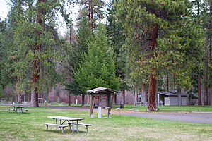
Chandler State Wayside is a state park in south-central Oregon in the United States. It is named in honor of Solomon and Hattie Chandler, who donated the land for the park. The park covers 85 acres (34 ha) of pine forest along a creek. The park provides restrooms and other basic facilities to accommodate the traveling public. Chandler State Wayside is administered by the Oregon Parks and Recreation Department.

Dyer State Wayside, a rest stop with picnic tables and public toilets, lies about 10 miles (16 km) south of Condon, along Oregon Route 19. It occupies 0.6 acres (0.24 ha) in a narrow canyon along a branch of Thirty Mile Creek at the mouth of Ramsey Canyon.

Alderwood State Wayside is a state park on Oregon Route 36 in the U.S. state of Oregon. Administered by the Oregon Parks and Recreation Department, the day-use wayside covers about 76 acres (31 ha). It is open year-round and attracts about 45,000 visitors annually.

Booth State Scenic Corridor is a state park in the U.S. state of Oregon, administered by the Oregon Parks and Recreation Department.

Bradley State Scenic Viewpoint is a state park in the U.S. state of Oregon, administered by the Oregon Parks and Recreation Department. It is located directly north of U.S. Route 30 between Astoria and Portland.
Bullards Beach State Park is a state park in the U.S. state of Oregon, administered by the Oregon Parks and Recreation Department.

Cline Falls State Scenic Viewpoint is a state park near Redmond, Oregon, United States. It is located on the Deschutes River. The park covers 9 acres (36,000 m2). It is administered by the Oregon Parks and Recreation Department.

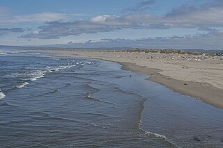
D River State Recreation Site is a state park in the U.S. state of Oregon, administered by the Oregon Parks and Recreation Department. It is a sandy beach of the Pacific Ocean within central Lincoln City along the length of the 120-foot (37 m) long D River, one of the world's shortest rivers.

Ellmaker State Wayside is a state park in the U.S. state of Oregon, administered by the Oregon Parks and Recreation Department. It is located on U.S. Route 20 approximately 1 mile (1.6 km) north of the community of Burnt Woods.

Face Rock State Scenic Viewpoint is a state park in Bandon, Oregon, United States, administered by the Oregon Parks and Recreation Department. The rocks and tidal flats adjacent to the park form part of the Oregon Islands National Wildlife Refuge. More than 300 species of birds frequent the area.

Hat Rock State Park is a state park in the U.S. state of Oregon, administered by the Oregon Parks and Recreation Department. The park is located off the east side of U.S. Highway 730 in Hermiston, on the south shore of Lake Wallula behind McNary Dam on the Columbia River.
Hoffman Memorial State Wayside is a state park in the U.S. state of Oregon, administered by the Oregon Parks and Recreation Department.
Holman State Wayside is a state park in Polk County, Oregon, United States, on Oregon Route 22 at the foot of the Eola Hills near the community of Eola. The wayside is administered by the Oregon Parks and Recreation Department but was closed to vehicular traffic in 2007 because of ongoing problems with criminal activity.

Koberg Beach State Recreation Site is a state park in Hood River County, Oregon United States, administered by the Oregon Parks and Recreation Department. The park offers a wayside rest area for west bound traffic on Interstate 84.

Tub Springs State Wayside is a state park in the U.S. state of Oregon, administered by the Oregon Parks and Recreation Department.

Washburne State Wayside was a state park 4 miles (6 km) northwest of Junction City, in the U.S. state of Oregon. Administered by the Oregon Parks and Recreation Department, the wayside served as a rest stop for travelers on Oregon Route 99W and an interpretive center for the Applegate Trail. The state bought the land for the park in 1926 from William C. and Mae E. Washburne. It was located on the border between Lane and Benton counties.

The Crawfordsville Bridge spans the Calapooia River adjacent to Oregon Route 228 near the community of Crawfordsville in Linn County, Oregon, United States.

Redmond–Bend Juniper State Scenic Corridor is a collection of ten unimproved land parcels administered for the Oregon Parks and Recreation Department. The parcels are located along U.S. Route 97 between Bend and Redmond, Oregon, United States. It is named for the large western juniper trees found on the parcels. The scenic corridor is completely undeveloped with no trails or park facilities of any kind.