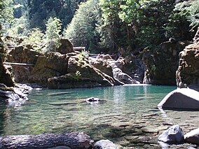
The North Santiam River is a 92-mile (148 km) tributary of the Santiam River in western Oregon in the United States. It drains 766 square miles (1,980 km2) of the Cascade Range on the eastern side of the Willamette Valley east of Salem.

The Three Sisters Wilderness is a wilderness area in the Cascade Range, within the Willamette and Deschutes National Forests in Oregon, United States. It comprises 286,708 acres (1,160.27 km2), making it the second largest wilderness area in Oregon, after the Eagle Cap Wilderness. It was established by the United States Congress in 1964 and is named for the Three Sisters volcanoes. The wilderness boundary encloses the Three Sisters as well as Broken Top, which is southeast of South Sister.
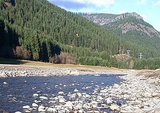
The Willamette National Forest is a National Forest located in the central portion of the Cascade Range of the U.S. state of Oregon. It comprises 1,678,031 acres (6,790.75 km2). Over 380,000 acres are designated wilderness which include seven major mountain peaks. There are also several National Wild and Scenic Rivers within the forest. The forest is named for the Willamette River, which has its headwaters in the forest. The forest headquarters are located in the city of Springfield. There are local ranger district offices in McKenzie Bridge, Detroit, Sweet Home, and Westfir.

The Mount Hood National Forest is 62 miles (100 km) east of the city of Portland, Oregon, and the northern Willamette River valley. The Forest extends south from the Columbia River Gorge across more than 60 miles (97 km) of forested mountains, lakes and streams to the Olallie Scenic Area, a high lake basin under the slopes of Mount Jefferson. The Forest includes and is named after Mount Hood, a stratovolcano. The Forest encompasses some 1,067,043 acres (4,318.17 km2). Forest headquarters are located in Sandy, Oregon. A 1993 Forest Service study estimated that the extent of old growth in the Forest was 345,300 acres (139,700 ha). The Forest is divided into four separate districts - Barlow, Clackamas River (Estacada), Hood River, and Zigzag (Zigzag).
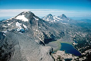
The Three Sisters are closely spaced volcanic peaks in the U.S. state of Oregon. They are part of the Cascade Volcanic Arc, a segment of the Cascade Range in western North America extending from southern British Columbia through Washington and Oregon to Northern California. Each more than 10,000 feet (3,000 m) in elevation, they are the third-, fourth- and fifth-highest peaks in Oregon. Located in the Three Sisters Wilderness at the boundary of Lane and Deschutes counties and the Willamette and Deschutes national forests, they are about 10 miles (16 km) south of the nearest town, Sisters. Diverse species of flora and fauna inhabit the area, which is subject to frequent snowfall, occasional rain, and extreme temperature variation between seasons. The mountains, particularly South Sister, are popular destinations for climbing and scrambling.

The Bull of the Woods Wilderness is a wilderness area located in the Mount Hood National Forest in the northwestern Cascades of Oregon, United States. It was created in 1984 and consists of 37,607 acres (15,219 ha) including prime low-elevation old-growth forest, about a dozen lakes of at least 1-acre (4,000 m2) and many large creeks and streams. Adjacent areas, including Opal Creek Wilderness to the west, create a pristine area of nearly 84 square miles (218 km2). There are at least ten trailheads and 60 miles (97 km) of trail.

The Opal Creek Wilderness is a wilderness area located in the Willamette National Forest in the U.S. state of Oregon, on the border of the Mount Hood National Forest. It has the largest uncut watershed in Oregon.
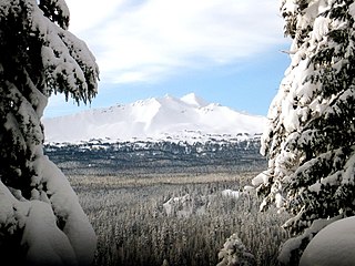
The Diamond Peak Wilderness is a wilderness area straddling the Cascade crest and includes the Diamond Peak volcano. It is located within two National Forests - the Willamette National Forest on the west and the Deschutes National Forest on the east.

Diamond Peak is a volcano in Klamath and Lane counties of central Oregon in the United States. It is a shield volcano, though it might also be considered a modest stratocone. Diamond Peak forms part of the Cascade Volcanic Arc, a segment of the Cascade Range in western North America extending from southern British Columbia through Oregon to Northern California. Reaching an elevation of 8,748 feet (2,666 m), the mountain is located near Willamette Pass in the Diamond Peak Wilderness within the Deschutes and Willamette national forests. Surrounded by coniferous forest and visible in the skyline from foothills near Eugene, Diamond Peak offers a few climbing routes and can be scrambled. Diamond Peak is one of Oregon's Matterhorns.

The Deschutes National Forest is a United States National Forest located in parts of Deschutes, Klamath, Lake, and Jefferson counties in central Oregon. It comprises 1.8 million acres (7,300 km2) along the east side of the Cascade Range. In 1908, the Deschutes National Forest was established from parts of the Blue Mountains, Cascade, and Fremont National Forests. In 1911, parts of the Deschutes National Forest were split off to form the Ochoco and Paulina National Forests, and parts of the Cascade and Oregon National Forests were added to the Deschutes. In 1915, the lands of the Paulina National Forest were rejoined to the Deschutes National Forest. A 1993 Forest Service study estimated that the extent of old growth in the forest was 348,100 acres (140,900 ha). Within the boundaries of the Deschutes National Forest is the Newberry National Volcanic Monument, containing cinder cones, lava flows, and lava tubes. The Deschutes National Forest as a whole contains in excess of 250 known caves. The forest also contains five wilderness areas, six National Wild and Scenic Rivers, the Oregon Cascade Recreation Area, and the Metolius Conservation Area. Forest headquarters are located in Bend, Oregon. There are local ranger district offices in Bend, Crescent, and Sisters.
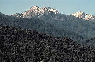
The Red Buttes Wilderness is a wilderness area in the Klamath and Rogue River national forests in the U.S. states of Oregon and California. It comprises 19,940 acres (8,070 ha), approximately 16,190 acres (6,550 ha) of which is located in California, and 3,750 acres (1,520 ha) in Oregon. It was established by the California Wilderness Act of 1984 and the Oregon Wilderness Act of 1984.

The Sky Lakes Wilderness is a wilderness area located in the Rogue River–Siskiyou and Fremont–Winema national forests in the southern Cascade Range of Oregon in the United States. It comprises 116,300 acres (47,100 ha), of which 75,695 acres (30,633 ha) are in the Rogue River–Siskiyou National Forest and 40,605 acres (16,432 ha) are in the Fremont–Winema National Forest. It was established in 1984 under the Wilderness Act of 1964.

The Mount Jefferson Wilderness is a wilderness area located on and around Mount Jefferson in the central Cascade Range of Oregon in the United States. The wilderness lies within the Willamette National Forest and Deschutes National Forest. The wilderness area covers 111,177 acres (449.92 km2), with more than 150 lakes. It also has 190 miles (310 km) of trails, including 40 miles (64 km) of the Pacific Crest National Scenic Trail. Three Fingered Jack and Mount Jefferson are both prominent features of the wilderness area. Mount Jefferson Wilderness is the second most visited Oregon wilderness area after the Three Sisters Wilderness.

The Mark O. Hatfield Wilderness is a wilderness area located on the northern side of Mount Hood in the northwestern Cascades of the U.S. state of Oregon, near the Columbia River Gorge and within Mount Hood National Forest. Prior to Wilderness designation it was known as the Columbia Gorge Recreation Area.
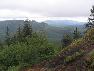
The Oregon Coast Range, often called simply the Coast Range and sometimes the Pacific Coast Range, is a mountain range, in the Pacific Coast Ranges physiographic region, in the U.S. state of Oregon along the Pacific Ocean. This north-south running range extends over 200 miles (320 km) from the Columbia River in the north on the border of Oregon and Washington, south to the middle fork of the Coquille River. It is 30 to 60 miles wide and averages around 1,500 feet (460 m) in elevation above sea level. The coast range has three main sections, a Northern, Central, and Southern.

The Siuslaw National Forest is a national forest in western Oregon in the United States. Established in 1908, the Siuslaw is made up of a wide variety of ecosystems, ranging from coastal forests to sand dunes.

Santiam State Forest is one of six state forests managed by the Oregon Department of Forestry. The forest is located approximately 25 miles (40 km) southeast of Salem, Oregon, and includes 47,871 acres (193.73 km2) on the western slope of the Cascade Mountains in three Oregon counties: Clackamas, Linn, and Marion. It is bounded on the east by the Willamette National Forest and Mount Hood National Forest. Silver Falls State Park is located west of the forest. The rest of the land surrounding the forest belongs to the Bureau of Land Management or is privately owned. The forest is managed as part of the Department of Forestry's North Cascade District. It is the largest single block of state owned forest land in the Cascades.

The Cascades ecoregion is a Level III ecoregion designated by the United States Environmental Protection Agency (EPA) in the U.S. states of Washington, Oregon, and California. Somewhat smaller than the Cascade mountain range for which it is named, the ecoregion extends north to Snoqualmie Pass, near Seattle, and south to Hayden Pass, near the Oregon-California border, including the peaks and western slopes of most of the High Cascades. A discontiguous section is located on Mount Shasta in California.
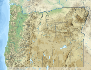
The South Fork Breitenbush River is a 10-mile (16 km) tributary of the Breitenbush River in the U.S. state of Oregon. The river flows generally northwest from Russell Lake in the Mount Jefferson Wilderness of the Cascade Range to near Breitenbush Hot Springs, where it merges with the North Fork Breitenbush River to form the main stem.
