Saddle Mountain State Natural Area is a state park in northwest Oregon. It is located in the Northern Oregon Coast Range in central Clatsop County, about 20 miles (32 km) by road from Seaside. A 2.5-mile (4.0 km) long hiking trail climbs to the top of Saddle Mountain, which is located in the park. On clear days, the Pacific Ocean, Columbia River mouth and several of the Cascade mountains in Washington and Oregon can be seen from the summit.

The Lewis and Clark National Historical Park, located in the vicinity of the mouth of the Columbia River, commemorates the Lewis and Clark Expedition. Administration of the park, which includes both federal and state lands, is a cooperative effort of the National Park Service and the states of Oregon and Washington. The National Historical Park was dedicated on November 12, 2004.

L. L. "Stub" Stewart Memorial State Park is a 1,654-acre (669 ha) Oregon state park in Washington County near the community of Buxton. When the park opened in 2007 it was the first new full-service state park in Oregon since 1972. The park includes hiking trails, mountain bike trails, horseback riding, RV and tent campsites, and cabins among other amenities. Located off Oregon Route 47 in the foothills of the Northern Oregon Coast Range, the park connects to the Banks–Vernonia State Trail.

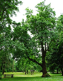
Bald Peak State Scenic Viewpoint is a state park located atop Bald Peak located in Yamhill County, in the United States. The day use only park offers picnic tables and a hiking trail for views of the Willamette Valley and the Cascade Range. The state of Oregon acquired the 26 acres (11 ha) in 1931 after Yamhill and Washington counties requested a park from the state.

Tumalo State Park is a well-developed state park in Deschutes County, Oregon, United States. Established in 1954, the park is located northwest of the city of Bend and along the Deschutes River at a site home to many bird species. The park is popular for picnics, swimming, fishing, hiking, and camping, and is open year-round.

Chandler State Wayside is a state park in south-central Oregon in the United States. It is named in honor of Solomon and Hattie Chandler, who donated the land for the park. The park covers 85 acres (34 ha) of pine forest along a creek. The park provides restrooms and other basic facilities to accommodate the traveling public. Chandler State Wayside is administered by the Oregon Parks and Recreation Department.

Sheridan State Scenic Corridor is a state park in the Columbia River Gorge, west of Cascade Locks, Oregon. The 11-acre (4.5 ha) property, containing an old-growth forest, is located on the south side of Interstate 84 at approximately milepoint 42.5, and was not accessible by motor vehicle since I-84 was built in 1960. However, with the opening of the Eagle Creek-Cascade Locks segment of the Historic Columbia River Highway State Trail in 1998, it has become easily accessible by foot or bicycle. The park is on a triangular lot, surrounded by I-84 and the Mount Hood National Forest.

Jackson F. Kimball State Recreation Site is a state park in southern Oregon. The park is operated and maintained by the Oregon Parks and Recreation Department, and is located approximately 20 miles (32 km) southeast of Crater Lake National Park and 3 miles (4.8 km) north of Fort Klamath. The park was established in 1955, and covers 19 acres (7.7 ha) including the headwaters of the Wood River.

Collier Memorial State Park is a state park in southern Oregon. The park is operated and maintained by the Oregon Parks and Recreation Department. It is located on U.S. Highway 97, approximately 30 miles (48 km) north of Klamath Falls and 105 miles (169 km) south of Bend. The park covers 146 acres (59 ha) along the Williamson River.

Samuel H. Boardman State Scenic Corridor is a linear state park in southwestern Oregon, in the United States. It is 12 miles (19 km) long and thickly forested along steep and rugged coastline with a few small sand beaches. It is named in honor of Samuel H. Boardman, the first Oregon Parks superintendent.

Agate Beach State Recreation Site is a state park between Newport and Agate Beach in Lincoln County in the U.S. state of Oregon. It is administered by the Oregon Parks and Recreation Department.

Booth State Scenic Corridor is a state park in the U.S. state of Oregon, administered by the Oregon Parks and Recreation Department.
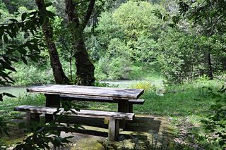
Coquille Myrtle Grove State Natural Site is a state park administered by the Oregon Parks and Recreation Department in the U.S. state of Oregon. The park, bordering the Powers Highway between Myrtle Point and Powers, in Coos County, features a swimming hole and sandy beach along the South Fork Coquille River. Other amenities include parking, picnic tables, restrooms, and access to fishing but no drinking water.

Driftwood Beach State Recreation Site is a state park administered by the Oregon Parks and Recreation Department in the U.S. state of Oregon. Located 3 miles (5 km) north of Waldport along the Pacific Ocean, the park offers beach access, picnicking, and fishing in a setting of shore pines and sand. It is fee-free and open year-round.
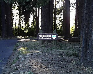
Maud Williamson State Recreation Site is a state park in Yamhill County, Oregon, United States, administered by the Oregon Parks and Recreation Department. The park is located at the intersection of Oregon Route 221 and Oregon Route 153 near Wheatland. The park entrance is across from Wheatland Road, which leads to the Wheatland Ferry.
Rocky Creek State Scenic Viewpoint is a state park in Lincoln County in northwestern Oregon, United States. Administered by the Oregon Parks and Recreation Department, the 59-acre (24 ha) park lies along a bluff between Whale Cove and Rocky Creek. The park extends south along the Otter Crest Loop Road to the Rocky Creek Bridge.

Sunset Bay State Park is a state park in the U.S. state of Oregon. Administered by the Oregon Parks and Recreation Department, it is about 0.4 miles (0.6 km) south of Cape Arago Lighthouse and 2.5 miles (4.0 km) outside the town of Charleston on Coos Bay. The park offers a crescent shaped beach, tide pools, hiking trails and a year-round campground.

Elliott Corbett Memorial State Recreation Site is a state park along the south shore of Blue Lake Crater in Jefferson County, Oregon, United States. The park is named in honor of Elliott R. Corbett II, who was killed while serving in the United States Army during World War II. It includes 63 acres (25 ha) of wilderness land with very few park facilities. Corbett State Park is administered by the Oregon Parks and Recreation Department.

Redmond–Bend Juniper State Scenic Corridor is a collection of ten unimproved land parcels administered for the Oregon Parks and Recreation Department. The parcels are located along U.S. Route 97 between Bend and Redmond, Oregon, United States. It is named for the large western juniper trees found on the parcels. The scenic corridor is completely undeveloped with no trails or park facilities of any kind.

Sisters State Park is a state park located at the southeast side of the town of Sisters in Deschutes County, Oregon, United States. The park property is bisected by U.S. Route 20 and Oregon Route 126, creating three separate parcels. The park covers 28 acres (11 ha) of undeveloped forest land along Whychus Creek. It is adjacent to two developed city parks that were once part of the state park. Sisters State Park is administered by the Oregon Parks and Recreation Department.