Seal Slough

Last updated
Seal Slough
Foster City aerial view, February 2018.JPG
In this aerial view, facing northwest, serpentine Seal Slough separates San Mateo (west of the Slough, bottom 14) and Foster City (east, upper 34; the bridges crossing the Slough carry Fashion Island Blvd and SR 92 at center, and Hillsdale Blvd at right.
Location Map San Francisco Bay Area.png
Red pog.svg
Seal Slough
Location San Mateo County, California
Coordinates 37°34′15″N122°17′39″W / 37.5707687°N 122.2941354°W / 37.5707687; -122.2941354 [1]
Type Slough (hydrology)
Part ofSan Francisco Bay
River sourcesBorel Creek, Leslie Creek, Laurel Creek [1]

Seal Slough, also known as Marina Lagoon, is a narrow winding tidal channel through a tidal marsh in San Mateo [1] and Foster City, California. [2] This slough has been the object of a wetland restoration project in recent years to enhance habitat value. [3] Dredging has been carried out in Seal Slough since at least 1954. [4] When the original sewage treatment plant for the city of San Mateo was constructed in 1935, its discharge was directed to Seal Slough. [5]

Contents

The marshy area through which Seal Slough meanders is a productive brackish wetland whose dominant flora is cordgrass. There are a number of significant wildlife features associated with Seal Slough, including use by the endangered California clapper rail. [6] A tide gate near the mouth of Seal Slough regulates tidal influx from San Francisco Bay to Marina Lagoon; this flushing action is important to prevent population explosion of midges in the local area.

Course

Panorama at the mouth of Seal Slough (2022); road bridges are in the background and construction cranes on the left are being used during the reconstruction of the city wastewater treatment plant. Seal Slough.jpg
Panorama at the mouth of Seal Slough (2022); road bridges are in the background and construction cranes on the left are being used during the reconstruction of the city wastewater treatment plant.

According to the City of San Mateo, Seal Slough properly refers to just the outlet, where it experiences a tidal exchange with San Francisco Bay on the eastern shoreline of the city of San Mateo, approximately midway between Coyote Point and the San Mateo Bridge. [7] The portion upstream from the mouth is known as Marina Lagoon, which is approximately 300 to 400 ft (91 to 122 m) wide over a serpentine course 4.5 mi (7.2 km) long, representing the area that was diked and dredged starting from 1952 to provide a flood control basin and recreational area. The upstream inlets to Marina Lagoon, east of Hillsdale Boulevard, are O'Neill Slough and Belmont Slough. [8] [9] Officially, the entire waterway is still Seal Slough, as an act of Congress would be required to rename it. [10]

The mouth is characterized by a marshy area and an extent of bay mud extending approximately 700 m (2,300 ft) northward into San Francisco Bay. The mouth is crossed by the Seal Slough Bridge carrying East Third Avenue / J Hart Clinton Drive, completed in 1985, [11] and a narrower, older bridge previously used by the road and now part of the San Francisco Bay Trail. Seal Slough is separated from Marina Lagoon by a small earthen dam, which has tidal gates at the south end, and gravity or pumped flow at the north end. [12] :17 Near the downstream / northern end of Marina Lagoon is situated the city of San Mateo Wastewater Treatment Plant, Bayside School, and Bayside/Joinville Park on the western/southern bank; on the northern/eastern bank is the Mariner's Island residential development. In between, a small island near the dam, accessible by boat, is preserved as Lagoon Island Park.

Waterfront homes in Foster City along Seal Slough, from Parkside Aquatic Park in San Mateo (2022) Parkside Aquatic Park, San Mateo - 51793371320.jpg
Waterfront homes in Foster City along Seal Slough, from Parkside Aquatic Park in San Mateo (2022)

The course of the slough is highly tortuous as it winds in a generally south-southeast direction. [13] The channelized Leslie and Borel Creeks drain into Marina Lagoon. Further upstream, single-family residential uses have encroached closely on its southern/western banks; in this middle reach it also passes close to and north of Parkside School and Parkside Aquatic Park, approximately opposite from the Fashion Island shopping area. Further to the east it passes beside Lakeshore School and Lakeshore Park before crossing under Hillsdale Boulevard and entering Foster City. In the uppermost reaches, south of Los Prados Park (in San Mateo) and Boothbay Park (in Foster City), O'Neill and Belmont Sloughs drain into Marina Lagoon; O'Neill is channeled under U.S. 101.

Ecology

Much of the information regarding Seal Slough was developed in a 1980 study, in which Caltrans and the city retained Earth Metrics to analyze impacts of a new bridge across Seal Slough at East Third Avenue. [6] The most significant habitat area along Seal Slough is the tidal mouth, where there are three identified plant community zones. The lowest zone is defined by the presence of mudflats and/or the dominant plant cordgrass, distichlis sp. The middle zone is characterized by the dominant plant pickleweed, Salicornia sp., and the upper zone, which is the most disturbed, is characterized by salt grass, Distichlis spicata, and by peripheral halophytes (salt tolerant plants). The pickleweed community thrives primarily on the north banks of Seal Slough. Cordgrass and pickleweed habitats are among the most productive types in the state of California, in each case producing over five tons of organic material per acre per annum. Further these plants supply the adjacent mudflats with detritus that is the basis of estuarine food chains.

Map of Marina Lagoon at Parkside Aquatic Park (2022) Parkside Aquatic Park, San Mateo - 51792750338.jpg
Map of Marina Lagoon at Parkside Aquatic Park (2022)

Cordgrass is also used for food and cover for a multiplicity of waterfowl, including the endangered California clapper rail, which species occurs in Seal Slough. Other avafauna found in this robust wetland include killdeer, mallards and the snowy egret. The Seal Slough mudflats also provide a feeding area at high tides for a variety of fishes including topsmelt, anchovy, bat ray, leopard shark, spiny dogfish, striped bass and longjaw mudsucker.

Colonies of Australian tubeworms ( ficopomatus enigmaticus ) were discovered on the support columns for SR 92 when the water level was lowered for maintenance. The worms were introduced inadvertently in the 1920s from ship bilge water. [14]

See also

Related Research Articles

<span class="mw-page-title-main">San Francisco Bay</span> Shallow estuary on the coast of California, United States

San Francisco Bay is a large tidal estuary in the U.S. state of California, and gives its name to the San Francisco Bay Area. It is dominated by the cities of San Francisco, San Jose, and Oakland.

<span class="mw-page-title-main">Benicia State Recreation Area</span> State recreation area in California

Benicia State Recreation Area is a state park unit of California, United States, protecting tidal wetland. It is located in the Solano County city of Benicia, 2 miles (3.2 km) west of downtown Benicia and borders Vallejo's Glen Cove neighborhood. The park covers 447 acres (181 ha) of marsh, grassy hillsides and rocky beaches along the narrowest portion of the Carquinez Strait. Southampton Creek and the tidal marsh front Southampton Bay, where the combined waters of the Sacramento and San Joaquin Rivers approach San Pablo Bay, the northern portion of San Francisco Bay.

<span class="mw-page-title-main">Lake Merritt</span> Tidal lagoon in the center of Oakland, California

Lake Merritt is a large tidal lagoon in the center of Oakland, California, just east of Downtown. It is named after Samuel Merritt, Oakland's mayor in 1867–1869, who had the lagoon dammed turning the tidal lagoon into a salt water lake. It is surrounded by parkland and city neighborhoods. It is historically significant as the United States' first official wildlife refuge, designated in 1870, and has been listed as a National Historic Landmark since 1963.

<span class="mw-page-title-main">Coos Bay</span> Estuary in Oregon, United States

Coos Bay is an estuary where the Coos River enters the Pacific Ocean, the estuary is approximately 12 miles long and up to two miles wide. It is the largest estuary completely within Oregon state lines. The Coos Bay watershed covers an area of about 600 square miles and is located in northern Coos County, Oregon, in the United States. The Coos River, which begins in the Oregon Coast Range, enters the bay from the east. From Coos River, the bay forms a sharp loop northward before arching back to the south and out to the Pacific Ocean. Haynes Inlet enters the top of this loop. South Slough branches off from the bay directly before its entrance into the Pacific Ocean. The bay was formed when sea levels rose over 20,000 years ago at the end of the Last Glacial Maximum, flooding the mouth of the Coos River. Coos Bay is Oregon's most important coastal industrial center and international shipping port, with close ties to San Francisco, the Columbia River, Puget Sound and other major ports of the Pacific rim.

<span class="mw-page-title-main">Bair Island</span> Swamp in Redwood City, San Mateo County, United States

Bair Island is a marsh area in Redwood City, California, covering 3,000 acres (1,200 ha), and includes three islands: Inner, Middle and Outer islands. Bair Island is part of the larger Don Edwards San Francisco Bay National Wildlife Refuge. It is surrounded by the Steinberger slough to the northwest and Redwood Creek to the southeast.

<span class="mw-page-title-main">Emeryville Crescent State Marine Reserve</span> Marine reserve of California, United States

Emeryville Crescent State Marine Reserve is a marine reserve of California, United States, preserving marshland on the east shore of San Francisco Bay. It is managed as part of Eastshore State Park by the East Bay Regional Park District. The 103.5-acre (41.9 ha) marsh stretches from the eastern approach of the San Francisco–Oakland Bay Bridge in Oakland to the foot of Powell Street in Emeryville. The reserve encompasses the entire Emeryville Crescent Marsh and is named as such for its crescent shape. It was established in 1985.

<span class="mw-page-title-main">Ridgway's rail</span> Species of bird

Ridgway's rail is a species of bird found principally along the Pacific coast of North America from the San Francisco Bay Area to southern Baja California, as well as in some regions of the Gulf of California. A member of the rail family, Rallidae, it is a chicken-sized bird that lives brackish tidal marshes and rarely flies. Its name commemorates American ornithologist Robert Ridgway.

<span class="mw-page-title-main">Bay mud</span> Type of soil formed by sedimentation in estuaries

Bay mud consists of thick deposits of soft, unconsolidated silty clay, which is saturated with water; these soil layers are situated at the bottom of certain estuaries, which are normally in temperate regions that have experienced cyclical glacial cycles.
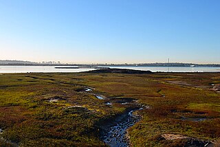
<span class="mw-page-title-main">California coastal salt marsh</span>

California's coastal salt marsh is a wetland plant community that occurs sporadically along the Pacific Coast from Humboldt Bay to San Diego. This salt marsh type is found in bays, harbors, inlets, and other protected areas subject to tidal flooding.

<span class="mw-page-title-main">San Mateo Creek (San Francisco Bay Area)</span> River in California, United States

San Mateo Creek is a perennial stream whose watershed includes Crystal Springs Reservoir, for which it is the only natural outlet after passing Crystal Springs Dam.

<span class="mw-page-title-main">Port of Redwood City</span> Port in the San Francisco Bay

The Port of Redwood City is a marine freight terminal on the western side of the southern San Francisco Bay, on the West Coast of the United States. This marine terminal is situated within the city of Redwood City, California. The port was developed from a natural deepwater channel discovered in the year 1850, at the mouth of Redwood Creek. From the early use as a log float port, commercial use expanded to a variety of industrial commodities; moreover, it is considered the birthplace of shipbuilding on the North American west coast. As of 2004 the annual freight shipments have reached about two million metric tons. The Port of Redwood City provides berths for dry bulk, liquid bulk, and project cargoes, along with certain recreational opportunities and public access to San Francisco Bay.

<span class="mw-page-title-main">Redwood Creek (San Mateo County)</span> River in California, United States

Redwood Creek is a 9.5-mile-long (15.3 km) perennial stream located in San Mateo County, California, United States which discharges into South San Francisco Bay. The Port of Redwood City, the largest deepwater port in South San Francisco Bay, is situated on the east bank of Redwood Creek near its mouth, where the creek becomes a natural deepwater channel.
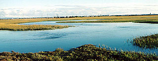
<span class="mw-page-title-main">Seal Beach National Wildlife Refuge</span> Wildlife refuge in California

The Seal Beach National Wildlife Refuge is a wildlife refuge encompassing 965 acres (3.91 km2) located in the California coastal community of Seal Beach. Although it is located in Orange County it is included as part of the San Diego National Wildlife Refuge Complex. It was established in 1972.

<span class="mw-page-title-main">Elkhorn Slough</span> Body of water in Monterey County, California

Elkhorn Slough is a 7-mile-long (11 km) tidal slough and estuary on Monterey Bay in Monterey County, California. It is California's second largest estuary and the United States' first estuarine sanctuary. The community of Moss Landing and the Moss Landing Power Plant are located at the mouth of the slough on the bay.
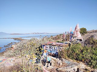
<span class="mw-page-title-main">Albany Bulb</span> Former landfill in Albany, California

The Albany Bulb is a former landfill largely owned by the City of Albany, in California. The Bulb is the west end of a landfill peninsula jutting west from the east shore of San Francisco Bay. The term "Bulb" is often used to refer to the entire peninsula, which includes the Albany Plateau, north of Buchanan Street at its base; the high narrow "Neck," and the round "Bulb." The Bulb is part of the City of Albany, and can be reached via Buchanan Street or the Bay Trail along the east side of San Francisco Bay. Landmarks include, Mary's Mask, Gritchell's Bay, and Mad Marc's Castle. The Geotag for Gritchell's Bay is 37.8908083, -122.3257826.

<span class="mw-page-title-main">Belmont Slough</span> River in California, United States

Belmont Slough is a slough on the western shore of San Francisco Bay separating Redwood Shores and Foster City. It provides estuarine and marine deepwater habitats in its subtidal waters, which are characterized as brackish and saltwater.

The Kendall-Frost Mission Bay Marsh Reserve is a 20-acre University of California Natural Reserve System reserve on the northern shore of Mission Bay in San Diego County, California. Administered by UC San Diego, the site is owned by the University of California and managed for teaching and research.

<span class="mw-page-title-main">Emeryville mudflat sculptures</span> Found object sculptures in California, USA

The Emeryville mudflat sculptures were a series of found object structures along the San Francisco Bay shoreline of Emeryville, California, largely constructed from discarded materials found on-site such as driftwood. The mudflat sculptures were first erected in 1962 and received national attention by 1964; through the 1960s and 70s, anonymous, usually amateur artists would construct sculptures visible to traffic at the eastern end of the Bay Bridge. With the creation of the Emeryville Crescent State Marine Reserve in 1985 and increased attention to ecosystem preservation, the last mudflat sculptures were removed in 1997.

<span class="mw-page-title-main">Brewer Island</span> Island in California

Brewer Island is an island in the San Francisco Bay, in San Mateo County, California. Originally owned by W. P. A. Brewer, for over one hundred years it was used for hay farming. Several attempts to develop the island failed between 1912 and 1959. Ultimately, a venture by Richard Grant and T. Jack Foster succeeded in 1960; Brewer Island's surface was raised by 6 ft (1.8 m), an artificial lake was dug in its center, and it became the location of what is now known as Foster City.

<span class="mw-page-title-main">Ballona Lagoon</span> Tidal wetland in Southern California, US

The Ballona Lagoon is a soft-bottomed channel and 16-acre (65,000 m2) tidal marsh in the Marina Peninsula neighborhood of Los Angeles that feeds the Venice Canals with water from the Pacific Ocean via a tide gate.

References

  1. 1 2 3 "Seal Slough". Geographic Names Information System . United States Geological Survey, United States Department of the Interior. 19 January 1981. Retrieved 1 December 2016.
  2. Satellite Photo of Seal Slough in San Mateo and Foster City, California
  3. "Bay/Delta - Projects: Seal Slough". Ecoatlas. Retrieved 14 November 2016.
  4. Call Bulletin Library (29 January 1954). "Dredge works to protect San Mateo, "Seal Slough Drainage Project" under way". San Francisco Public Library. Retrieved 14 November 2016.
  5. "Wastewater: The Basics" (PDF). Clean Water Program. 3 May 2016. Retrieved 14 November 2016.
  6. 1 2 T.E. Harvey, H.S. Shellhammer, C.M.Hogan, K.Wilson, G.W.Ball, V. Pfeifle et al., Section 7 endangered species biological assessment for the proposed East Third Avenue widening project, city of San Mateo, San Mateo County , prepared by Earth Metrics Inc. for Caltrans and the city of San Mateo, California (1980)
  7. San Mateo Quadrangle Map, 7.5 Minute Series, U.S. Geological Survey, Washington, DC, 1956, photo-revised 1980
  8. "Marina Lagoon". City of San Mateo. Retrieved 8 April 2022.
  9. "Life on the Lagoon: A Neighborhood Update". City of San Mateo. 2021. Retrieved 8 April 2022.
  10. "Marina Lagoon Dredging a 'Necessity'". San Mateo Times. May 10, 1962. Retrieved 3 May 2022.
  11. "Third Avenue over Seal Slough". Bridge Reports. Retrieved 8 April 2022.
  12. Shoreline Park Specific Plan (Report). July 16, 1990. City of San Mateo. May 1971. Retrieved 8 April 2022.
  13. "Seal Slough Watershed". Oakland Museum of California. Retrieved 1 December 2016.
  14. John Muir Laws (April 4, 2017). "Naturalist's Notebook: They Lowered the Level of San Mateo's Marina Lagoon and Found ... These Things". Bay Nature magazine. Retrieved 3 May 2022.