Jefferson County is a county located in the U.S. state of Washington. As of the 2020 census, the population was 32,977. The county seat and only incorporated city is Port Townsend. The county is named for Thomas Jefferson.
Clallam County is a county in the U.S. state of Washington. As of the 2020 census, the population was 77,155, with an estimated population of 77,805 in 2022. The county seat and largest city is Port Angeles; the county as a whole comprises the Port Angeles, WA Micropolitan Statistical Area. The name is a Klallam word for "the strong people". The county was formed on April 26, 1854. Located on the Olympic Peninsula, it is south from the Strait of Juan de Fuca, which forms the Canada–US border, as British Columbia's Vancouver Island is across the strait.

Seward is an incorporated home rule city in Alaska, United States. Located on Resurrection Bay, a fjord of the Gulf of Alaska on the Kenai Peninsula, Seward is situated on Alaska's southern coast, approximately 120 miles (190 km) by road from Alaska's largest city, Anchorage.

Forks, also previously known as the unincorporated town of Quillayute, is a city in southwest Clallam County, Washington, United States. The population was 3,335 at the 2020 census. It is named after the forks in the nearby Bogachiel, Calawah, and Sol Duc rivers which join to form the Quillayute River.

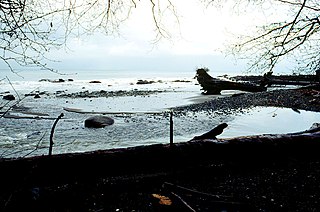
Neah Bay is a census-designated place (CDP) on the Makah Reservation in Clallam County, Washington, United States. The population was 935 at the 2020 census. It is across the Canada–US border from British Columbia. Europeans originally called it "Scarborough Harbour" in honor of Captain James Scarborough of the Hudson's Bay Company. It was changed to Neah in 1847 by Captain Henry Kellett. Kellett spelled it "Neeah Bay". The name "Neah" refers to the Makah Chief Dee-ah, pronounced Neah in the Klallam language. During the summer months, Neah Bay is a popular fishing area for sports fishermen. Another attraction is the Makah Museum, which houses artifacts from a Makah village partly buried by a mudslide around 1750. Many people also visit to hike the Cape Trail or camp at Hobuck Beach. An emergency response tug is stationed at Neah Bay which has saved 41 vessels since its introduction in 1999.
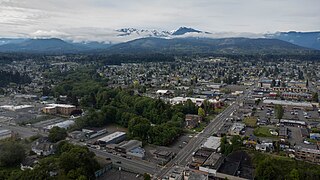
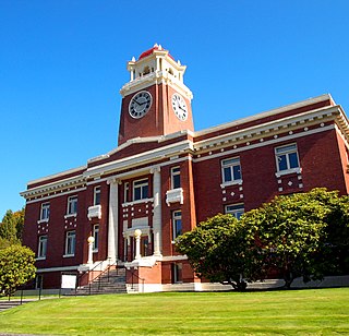
Port Angeles is a city and county seat of Clallam County, Washington, United States. With a population of 19,960 as of the 2020 census, it is the largest city in the county. The population was estimated at 20,134 in 2021.

Port Townsend is a city on the Quimper Peninsula in Jefferson County, Washington, United States. The population was 10,148 at the 2020 United States Census. It is the county seat and only incorporated city of Jefferson County.

Olympic National Park is a United States national park located in the State of Washington, on the Olympic Peninsula. The park has four regions: the Pacific coastline, alpine areas, the west-side temperate rainforest, and the forests of the drier east side. Within the park there are three distinct ecosystems, including subalpine forest and wildflower meadow, temperate forest, and the rugged Pacific coast.

The Olympic Peninsula is a large arm of land in western Washington that lies across Puget Sound from Seattle, and contains Olympic National Park. It is bounded on the west by the Pacific Ocean, the north by the Strait of Juan de Fuca, and the east by Hood Canal. Cape Alava, the westernmost point in the contiguous United States, and Cape Flattery, the northwesternmost point, are on the peninsula. Comprising about 3,600 square miles (9,300 km2), the Olympic Peninsula contained many of the last unexplored places in the contiguous United States. It remained largely unmapped until Arthur Dodwell and Theodore Rixon mapped most of its topography and timber resources between 1898 and 1900.

Western Washington is a region of the United States defined as the area of Washington state west of the Cascade Mountains. This region is home to the state's largest city, Seattle, the state capital, Olympia, and most of the state's residents. The climate is generally far more damp and temperate than that of Eastern Washington.

Ucluelet is a district municipality on the Ucluelet Peninsula, on the west coast of Vancouver Island in British Columbia, Canada. Ucluelet comes from Yuułuʔił which means "people of the safe harbour" in the indigenous Nuu-chah-nulth language and is the homeland of the Yuułuʔiłʔatḥ. As of 2021, its population was 2,066, a 20.3% increase from 1,717 in 2016.
Hurricane Ridge is a mountainous area in Washington's Olympic National Park. Approximately 18 miles (29 km) by road from Port Angeles, the ridge is open to hiking, skiing, and snowboarding and is one of the two most visited sites in the national park.

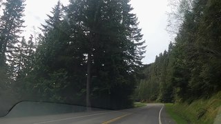
State Route 112 is a state highway and scenic byway in the U.S. state of Washington. It runs east–west for 61 miles (98 km) along the Strait of Juan de Fuca in Clallam County, connecting the Makah Indian Reservation near Neah Bay to U.S. Route 101 (US 101) near Port Angeles.

Tatoosh Island is a small island and small group of islands about 0.5 miles (0.8 km) offshore (northwest) of Cape Flattery, which is on the northwestern tip of the Olympic Peninsula in Washington. Tatoosh is the largest of a small group of islands also often referred to as simply "Tatoosh Island", which are almost as far west as Cape Alava, which is about 15 miles (24 km) to the south and the westernmost point in the contiguous 48 states. The islands are part of the Makah Reservation and a part of Clallam County. The total land area of the island group is 159,807 square metres.
Clallam Bay is an unincorporated community and census-designated place (CDP) in Clallam County, Washington, United States, at the mouth of the Clallam River into Clallam Bay. Known for its natural environment and hunting, Clallam Bay is partially reliant on tourism. Clallam Bay is considered the twin city of nearby Sekiu. As of the 2020 census, the population of Clallam Bay was 386, up from 363 at 2010.
Gardiner is an unincorporated community in Jefferson County, Washington, United States. Additionally, part of Clallam County, located along the Jefferson County line adjacent to Gardiner is often referred to as being part of Gardiner.
Sekiu Airport is a public airport serving the small community of Sekiu, in Clallam County, Washington, United States. It is owned by the Port of Port Angeles.
Clallam Transit System is a public transit operator in Clallam County, Washington, United States. It has 12 routes and also provides paratransit and vanpool services. The agency also coordinates with other transit agencies to provide inter-county connections.

Glines Canyon Dam, also known as Upper Elwha Dam, built in 1927, was a 210-foot (64 m) high concrete arch dam built on the Elwha River within Olympic National Park, Clallam County, Washington.
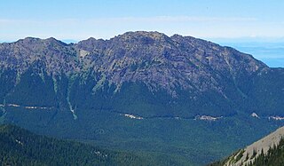
Rocky Peak is a 6,218-foot-elevation (1,895-meter) mountain summit in the Olympic Mountains and is located in Clallam County of Washington state. It is situated eight miles south of Port Angeles, Washington, within Olympic National Park. The nearest higher neighbor is Mount Angeles, 1.87 mi (3.01 km) to the west. Klahhane Ridge connects these two peaks. Travelers on the scenic Hurricane Ridge Road traverse the lower south slope of Rocky Peak en route to the Hurricane Ridge visitor center. The mountain was named Rocky Peak by local people from the time of the earliest settlers in the area. Precipitation runoff from the north side of the peak drains into Rocky Creek, whereas the south slope drains into Morse Creek, thence into the Strait of Juan de Fuca.