Related Research Articles

Flatlands is a neighborhood in the southeast part of the borough of Brooklyn in New York City. The current neighborhood borders are roughly defined by the Bay Ridge Branch to the north, Avenue U to the south, Ralph Avenue to the east, and Flatbush Avenue to the southwest.

Midwood is a neighborhood in the south-central part of the New York City borough of Brooklyn. It is bounded on the north by the Bay Ridge Branch tracks just above Avenue I and by the Brooklyn College campus of the City University of New York, and on the south by Avenue P and Kings Highway. The eastern border consists of parts of Nostrand Avenue, Flatbush Avenue, and Coney Island Avenue; parts of McDonald Avenue and Ocean Parkway mark the western boundary.

Flatbush is a neighborhood in the New York City borough of Brooklyn. The neighborhood consists of several subsections in central Brooklyn and is generally bounded by Prospect Park to the north, East Flatbush to the east, Midwood to the south, and Kensington and Parkville to the west. The modern neighborhood includes or borders several institutions of note, including Brooklyn College.
Kensington is a neighborhood in the central portion of the New York City borough of Brooklyn, located south of Prospect Park and Green-Wood Cemetery. It is bordered by Coney Island Avenue to the east; Fort Hamilton Parkway and Caton Avenue to the north; McDonald Avenue and 36th Street to the west; and Ditmas Avenue or Foster Avenue to the south. Kensington and Parkville are bordered by the Prospect Park South and Ditmas Park subsections of Flatbush to the east; Windsor Terrace to the north; Borough Park to the west; and Midwood to the south.

East Flatbush is a residential neighborhood in the New York City borough of Brooklyn. East Flatbush is bounded by Crown Heights and Empire Boulevard to the north; Brownsville and East 98th Street to the east; Flatlands, Canarsie and the Long Island Rail Road's Bay Ridge Branch to the south; and the neighborhood of Flatbush and New York Avenue to the west. East Flatbush is a predominantly African American neighborhood and has a population of 135,619 as of the 2010 United States census.
Brooklyn Community Board 6 is a New York City community board that encompasses the Brooklyn neighborhoods of Red Hook, Carroll Gardens, Park Slope, Gowanus, Cobble Hill and Columbia Street Waterfront District. It is delimited by Upper New York Bay and East River on the west, Atlantic Avenue, Court Street, Fourth Avenue, Warren and Pacific Streets on the north, Prospect Park on the east, as well as by the 15th Street, Hamilton Avenue and the Gowanus Canal on the south. It approximates the 19th century district of South Brooklyn.
Brooklyn Community Board 7 is a New York City community board that encompasses the Brooklyn neighborhoods of Sunset Park, Windsor Terrace, Greenwood Heights and South Park Slope. It is delimited by Gowanus Bay on the west; by 15th Street and Prospect Park South West on the north; and by Caton Avenue, Fort Hamilton Parkway, 37th Street and 8th Avenue on the east, as well as by the Long Island Rail Road and Bay Ridge R.R. Yards on the south.

Brooklyn Community Board 9 is a New York City community board that encompasses the Brooklyn neighborhoods of Crown Heights, Prospect Lefferts Gardens, and Wingate. It is delimited by Ocean Avenue and Flatbush Avenue on the west, Eastern Parkway on the north, Rochester, East New York and Utica Avenues on the east, as well as by Clarkson Avenue on the south.

Brooklyn Community Board 10 is a New York City community board that encompasses the Brooklyn neighborhoods of Bay Ridge, Dyker Heights, and Fort Hamilton. It is delimited by Upper New York Bay on the west, Bay Ridge R.R. Yards and Long Island Rail Road on the north, 14th Avenue and Bay 8th Street on the east, as well as by Lower New York Bay on the south.
Brooklyn Community Board 11 is New York City community board that encompasses the Brooklyn neighborhoods of Bath Beach, Gravesend, Mapleton, and Bensonhurst. It is delimited by Bay 8th Street and 14th Avenue on the west, 61st Street on the north, McDonald Avenue on the east, as well as by Avenue U and Gravesend Bay on the south.
Brooklyn Community Board 12 is New York City community board that encompasses the Brooklyn neighborhoods of Borough Park, Kensington, Ocean Parkway, and Midwood.
Brooklyn Community Board 13 is a New York City community board that encompasses the Brooklyn neighborhoods of Coney Island, Brighton Beach, Gravesend, and Seagate. It is delimited by Gravesend Bay on the west, 26th Avenue, 86th Street, Avenue Y on the north, Coney Island Avenue and Corbin Place on the east, as well as by Lower New York Bay on the south.

Brooklyn Community Board 14 is a New York City community board that encompasses the Brooklyn neighborhoods of Flatbush, Midwood, Kensington, and Ocean Parkway. It is delimited by Coney Island Avenue, the Long Island Rail Road, McDonald Avenue, Avenue F and 18th Avenue on the west, Parkside Avenue on the north, Bedford Avenue, Foster Avenue and Nostrand Avenue on the east, and Kings Highway and Avenue P on the south.
Brooklyn Community Board 15 is a New York City community board that encompasses the Brooklyn neighborhoods of Gravesend, Sheepshead Bay, Manhattan Beach, Gerritsen Beach, Madison, Homecrest, and Plum Beach. It is delimited by Corbin Place, Coney Island Avenue, Avenue Y, 86th street, Avenue U and McDonald Avenue, Avenue P and Kings Highway on the north, Nostrand avenue and Marine Park on the east, as well as by the Atlantic Ocean on the south.
Brooklyn Community Board 16 is a New York City community board that encompasses the Brooklyn neighborhoods of Brownsville and Ocean Hill. It is delimited by East 98th street, East New York Avenue, Ralph Avenue, Atlantic Avenue and Saratoga Avenue on the west, Broadway on the north, Van Sinderen Avenue on the east, as well as by the Long Island Rail Road on the south.
Brooklyn Community Board 18 is a New York City community board that encompasses the Brooklyn neighborhoods of Canarsie, Bergen Beach, Mill Basin, Flatlands, Marine Park, Georgetown, and Mill Island. It is delimited by Nostrand Avenue on the west, the Long Island Rail Road on the north, Van Sinderen Avenue and Louisiana Avenue on the east, as well as by Shore Parkway on the south.

Community boards of Brooklyn are New York City community boards in the borough of Brooklyn, which are the appointed advisory groups of the community districts that advise on land use and zoning, participate in the city budget process, and address service delivery in their district.
The demographics of Brooklyn reveal a very diverse borough of New York City and a melting pot for many cultures, like the city itself. Since 2010, the population of Brooklyn was estimated by the Census Bureau to have increased 3.5% to 2,592,149 as of 2013, representing 30.8% of New York City's population, 33.5% of Long Island's population, and 13.2% of New York State's population. If the boroughs of New York City were separate cities, Brooklyn would be the third largest city in the United States after Los Angeles and Chicago.

Prospect Lefferts Gardens is a residential neighborhood in the Flatbush area of the New York City borough of Brooklyn. The community is bounded by Empire Boulevard to the north, Clarkson Avenue to the south, New York Avenue to the east, and Ocean Avenue/Prospect Park to the west. Prospect Lefferts Gardens was designated a New York City Landmark area in 1979 and called the Prospect Lefferts Gardens Historic District.
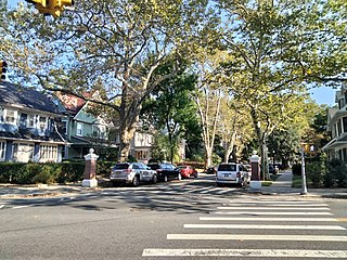
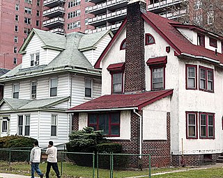
West Midwood is a planned community and historic enclave in the New York City borough of Brooklyn. West Midwood is located in central Brooklyn in the southern edge of the community of Victorian Flatbush, abutting the northern boundary of the community of Midwood. It is bordered by Foster Avenue to the north, the BMT Brighton subway line to the east, Avenue H to the south, and Coney Island Avenue to the west. West Midwood is located south of Prospect Park within what is sometimes referred to as Ditmas Park.
References
- ↑ "Brooklyn Community District 17" (PDF). Retrieved 12 July 2020.
- ↑ "NYC Planning | Community Profiles". communityprofiles.planning.nyc.gov. Retrieved 12 July 2020.
- ↑ Brooklyn Community Boards Archived 2007-12-21 at the Wayback Machine , New York City. Accessed December 31, 2007.

