Hamptons at Boca Raton, Florida

Last updated
Hamptons at Boca Raton, Florida
FLMap-doton-WhisperWalk.PNG
Location of Hamptons at Boca Raton, Florida
Coordinates: 26°23′9″N80°11′4″W / 26.38583°N 80.18444°W / 26.38583; -80.18444 Coordinates: 26°23′9″N80°11′4″W / 26.38583°N 80.18444°W / 26.38583; -80.18444
Country Flag of the United States.svg  United States
State Flag of Florida.svg  Florida
County   Palm Beach
Area
  Total2.7 sq mi (6.9 km2)
  Land2.5 sq mi (6.4 km2)
  Water0.2 sq mi (0.5 km2)
Elevation
16 ft (5 m)
Population
 (2000)
  Total11,306
  Density4,547.2/sq mi (1,755.7/km2)
Time zone UTC-5 (Eastern (EST))
  Summer (DST) UTC-4 (EDT)
FIPS code 12-28592 [1]
GNIS feature ID1867149 [2]

Hamptons at Boca Raton was a census-designated place (CDP) located in an unincorporated area near Boca Raton in Palm Beach County, Florida, United States. The population was 11,306 at the 2000 census. While it is not officially in the City of Boca Raton, the community is frequently classified under its umbrella term.

Contents

Geography

Hamptons at Boca Raton is located at 26°23′9″N80°11′4″W / 26.38583°N 80.18444°W / 26.38583; -80.18444 (26.385704, -80.184400). [3]

According to the United States Census Bureau, the CDP has a total area of 6.9 km2 (2.7 mi2), of which 6.4 km2 (2.5 mi2) is land and 0.5 km2 (0.2 mi2) (6.74%) is water.

Demographics

Historical population
CensusPop.
1990 11,686
2000 11,306−3.3%
source: [4]

As of the census [1] of 2000, there were 11,306 people, 6,336 households, and 3,047 families residing in the CDP. The population density was 1,753.1/km2 (4,547.2/mi2). There were 7,729 housing units at an average density of 1,198.5/km2 (3,108.5/mi2). The racial makeup of the CDP was 94.80% White (91.2% were Non-Hispanic White,) [5] 1.66% African American, 0.04% Native American, 1.47% Asian, 0.01% Pacific Islander, 0.93% from other races, and 1.09% from two or more races. Hispanic or Latino of any race were 4.62% of the population.

There were 6,336 households, out of which 9.9% had children under the age of 18 living with them, 42.6% were married couples living together, 4.2% had a female householder with no husband present, and 51.9% were non-families. 48.3% of all households were made up of individuals, and 43.5% had someone living alone who was 65 years of age or older. The average household size was 1.78 and the average family size was 2.52.

In the CDP, the population was spread out, with 10.6% under the age of 18, 2.7% from 18 to 24, 12.9% from 25 to 44, 13.9% from 45 to 64, and 59.9% who were 65 years of age or older. The median age was 73 years. For every 100 females, there were 70.6 males. For every 100 females age 18 and over, there were 67.4 males.

The median income for a household in the CDP was $30,365, and the median income for a family was $47,798. Males had a median income of $41,173 versus $28,906 for females. The per capita income for the CDP was $24,831. About 3.9% of families and 7.3% of the population were below the poverty line, including 2.4% of those under age 18 and 8.8% of those age 65 or over.

As of 2000, English was the first language for 84.48% of all residents, while Yiddish comprised 6.04%, Spanish made up 5.25%, Polish accounted for 1.31%, German was totaled at 0.98%, French totaled 0.65%, Hebrew was at 0.51%, Arabic at 0.42%, and Portuguese was the mother tongue for 0.32% of the population. [6]

Related Research Articles

Roosevelt Gardens is a census-designated place (CDP) in Broward County, Florida, United States. The population was 2,456 at the 2010 census.

Washington Park, Florida CDP in Florida, United States

Washington Park is a census-designated place (CDP) in Broward County, Florida, United States. The population was 1,672 at the 2010 census.

Warrington, Florida CDP in Florida, United States

Warrington is a census-designated place (CDP) in Escambia County, Florida, United States. Warrington is located between downtown Pensacola and the state line with Alabama; it is 6 miles (10 km) away from both.

North Key Largo, Florida CDP in Florida, United States

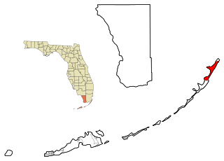
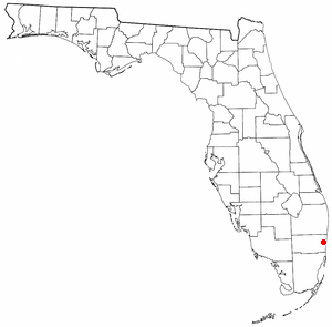
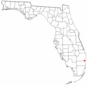
North Key Largo is a census-designated place (CDP) in Monroe County, Florida, United States. The population was 1,244 at the 2010 census. It includes two private clubs, the Ocean Reef Club and the Key Largo Anglers Club and is reached from the mainland via the Card Sound Bridge.

Boca Del Mar, Florida unincorporated place in Florida, United States

Boca Del Mar was a census-designated place (CDP) in an unincorporated area near Boca Raton in Palm Beach County, Florida, United States. The population was 21,832 at the 2000 census. While it is not officially in the City of Boca Raton, the community is often classified under its umbrella term.

Boca Pointe, Florida unincorporated place in Florida, United States

Boca Pointe was a census-designated place (CDP) located in an unincorporated area near Boca Raton in Palm Beach County, Florida, United States. The population was 3,302 at the 2000 census. The CDP was not included in the 2010 census. While it is not officially in the City of Boca Raton, the community is frequently classified under its umbrella term.

High Point was a census-designated place (CDP) in Palm Beach County, Florida, United States. The population was 2,191 at the 2000 census. The CDP was removed from the 2010 census. Although it is still unincorporated, it is within Delray Beach's "future annexation area."

Mission Bay, Florida unincorporated place in Florida, United States

Mission Bay is a census-designated place (CDP) located in an unincorporated area near Boca Raton in Palm Beach County, Florida, United States. The population was 2,926 at the 2000 census. While it is not officially in the City of Boca Raton, the community is frequently classified under its umbrella term.

Plantation Mobile Home Park is a census-designated place (CDP) in Palm Beach County, Florida, United States. The population was 1,218 at the 2000 census.

Sandalfoot Cove, Florida unincorporated place in Florida, United States

Sandalfoot Cove was a census-designated place (CDP) located in an unincorporated area near Boca Raton in Palm Beach County, Florida, United States. The population was 16,582 at the 2000 census. While it is not officially in the City of Boca Raton, the community is frequently classified under its umbrella term.

Seminole Manor is a census-designated place (CDP) in Palm Beach County, Florida, United States. The population was 2,546 at the 2000 census. The neighborhood was developed in the late 1950s, with the majority of houses built in 1958 and 1959.

Whisper Walk, Florida unincorporated place in Florida, United States

Whisper Walk was a census-designated place (CDP) located in an unincorporated area northwest of Boca Raton in Palm Beach County, Florida, United States. The population was 5,135 at the 2000 census. While it is not in the city of Boca Raton, Boca Raton is its postal address, and the community is frequently classified under its umbrella term.

Barnes Lake-Millers Lake, Michigan Census-designated place & unincorporated community in Michigan, United States

Barnes Lake-Millers Lake is a census-designated place (CDP) and Unincorporated community within Deerfield Township, Lapeer County in the U.S. state of Michigan. The CDP is used for statistical purposes and has no legal status as a municipality. The population was 1,187 at the 2000 census.

Hampton Manor, New York CDP in New York, United States

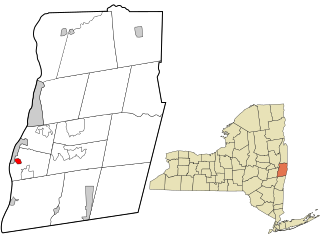
Hampton Manor is a census-designated place in the town of East Greenbush in Rensselaer County, New York, United States. The population was 2,417 at the 2010 census.

East Hampton North, New York Census-designated place in New York, United States

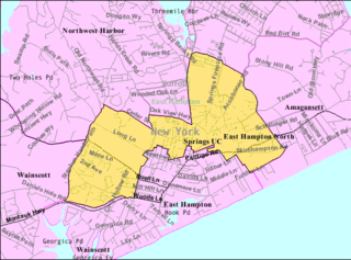
East Hampton North is a census-designated place (CDP) in Suffolk County, New York, United States. At the 2010 census, the population was 4,142.

Elgin, Lancaster County, South Carolina CDP in South Carolina, United States

Elgin is a census-designated place (CDP) in Lancaster County, South Carolina, United States. The population was 2,426 at the 2000 census.

Walterhill, also known as Walter Hill, is a census-designated place (CDP) in Rutherford County, Tennessee. The population was 401 at the 2010 census.

Los Alvarez, Texas CDP in Texas, United States

Los Alvarez is a census-designated place (CDP) in Starr County, Texas, United States. The population was 303 at the 2010 census down from 1,434 at the 2000 census.

Livermore Falls (CDP), Maine Census-designated place in Maine, United States

Livermore Falls is a census-designated place (CDP) in the town of Livermore Falls in Androscoggin County, Maine, United States. The population of the CDP was 1,594 at the 2010 census, out of a population of 3,187 within the full town.

Bar Harbor (CDP), Maine Census-designated place in Maine, United States

Bar Harbor is a census-designated place (CDP) in the town of Bar Harbor in Hancock County, Maine, United States. The CDP population was 2,552 at the 2010 census, out of a population of 5,235 in the town of Bar Harbor as a whole.

References

  1. 1 2 "U.S. Census website". United States Census Bureau . Retrieved 2008-01-31.
  2. "US Board on Geographic Names". United States Geological Survey. 2007-10-25. Retrieved 2008-01-31.
  3. "US Gazetteer files: 2010, 2000, and 1990". United States Census Bureau. 2011-02-12. Retrieved 2011-04-23.
  4. "CENSUS OF POPULATION AND HOUSING (1790-2000)". U.S. Census Bureau . Retrieved 2010-07-17.
  5. "Demographics of Hamptons at Boca Raton, Florida". MuniNetGuide.com. Archived from the original on 2008-05-25. Retrieved 2007-12-12.
  6. "MLA Data Center Results for Hamptons at Boca Raton, Florida". Modern Language Association . Retrieved 2007-12-12.