
The Maryland Transit Administration (MTA) is a state-operated mass transit administration in Maryland, and is part of the Maryland Department of Transportation. The MTA operates a comprehensive transit system throughout the Baltimore-Washington Metropolitan Area. There are 80 bus lines serving Baltimore's public transportation needs, along with other services that include the Light Rail, Metro Subway, and MARC Train. In 2021, the system had a ridership of 44,612,100, or about 124,900 per weekday as of the first quarter of 2022. With nearly half the population of Baltimore residents lacking access to a car, the MTA is an important part of the regional transit picture. The system has many connections to other transit agencies of Central Maryland, Washington, D.C., Northern Virginia, and south-central Pennsylvania : WMATA, Charm City Circulator, Regional Transportation Agency of Central Maryland, Annapolis Transit, Rabbit Transit, Ride-On, and TransIT.
BWI Airport Station is an intermodal passenger station in Linthicum, Maryland near Baltimore–Washington International Airport (BWI). It is served by Amtrak Northeast Corridor intercity trains, MARC Penn Line regional rail trains, and several local bus lines.
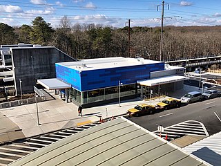
The Purple Line is an under-construction 16.2-mile (26.1 km) light rail line intended to link several Maryland suburbs of Washington, D.C.: Bethesda, Silver Spring, College Park, and New Carrollton. The line will also enable riders to move between the Maryland branches of the Red, Green, Yellow, and Orange lines of the Washington Metro without riding into central Washington, and between all three lines of the MARC commuter rail system. The project is administered by the Maryland Transit Administration (MTA), an agency of the Maryland Department of Transportation (MDOT), and not the Washington Metropolitan Area Transit Authority (WMATA), which operates Metro.

The Metro SubwayLink is a rapid transit line serving the greater area of Baltimore, Maryland, in the United States, and is operated by the Maryland Transit Administration. The segment in Downtown Baltimore is underground, and most of the line outside the central city is elevated or at surface grade. In 2021, the line had a ridership of 1,667,400, or about 4,700 per weekday as of the first quarter of 2022.

The DC Circulator is a bus system in Washington, D.C. The District of Columbia Department of Transportation operates the service in a public–private partnership with RATP Dev.

Maryland Route 384 is a state highway in the U.S. state of Maryland. The highway runs 0.53 miles (0.85 km) from MD 390 east to U.S. Route 29 and MD 97 within Silver Spring. MD 384 is a six-lane divided highway that forms the southernmost portion of Colesville Road, a major commuting route and one of the two main streets, with Georgia Avenue, within downtown Silver Spring, the commercial hub of southeastern Montgomery County. The state highway also provides access to the Silver Spring station of the Washington Metro, which serves as a transit hub for commuter rail and bus service for the surrounding area. MD 384 and its railroad underpass were constructed in the late 1920s. The highway was expanded to a divided highway in the mid-1970s.

Washington, D.C. has a number of different modes of transportation available for use. Commuters have a major influence on travel patterns, with only 28% of people employed in Washington, D.C. commuting from within the city, whereas 33.5% commute from the nearby Maryland suburbs, 22.7% from Northern Virginia, and the rest from Washington, D.C.'s outlying suburbs.
Allegany County Transit (ACT) is a publicly funded, general-public bus system serving Allegany County, Maryland, providing Public Transportation. Allegany County has two types of services, a Fixed Route and a Demand Response Service. Allegany County Transit is a division of Allegany County Government.

LocalLink 75 is a bus route operated by the Maryland Transit Administration in Baltimore and its suburbs. The line currently runs from the Patapsco Light Rail Stop to Parkway Center in Anne Arundel County, via BWI Airport and Arundel Mills. Weekend trips and some weekday trips on this line terminate at Arundel Mills. The line operates between BWI Airport and downtown Baltimore during hours when the light rail is not operating.

The Maryland Transit Administration was originally known as the Baltimore Metropolitan Transit Authority, then the Maryland Mass Transit Administration before it changed to its current name in October 2001. The MTA took over the operations of the old Baltimore Transit Company on April 30, 1970.

LocalLink 62 is a bus route in the suburbs of Baltimore. The line currently runs from the Essex campus of the Community College of Baltimore County to Turner's Station in Dundalk. The current route serves the Rosedale, Middle River, and Essex areas and the CCBC Essex and Dundalk campuses. The line was previously known as Route 4 prior to the launch of BalitmoreLink. LocalLink Route 62 replaced the entirety of Route 4 on June 18, 2017.

Route 57 is a bus route operated by the Maryland Transit Administration in Baltimore and its suburbs. The line currently runs from the Rogers Avenue Metro Subway Station in Northwest Baltimore to Security Square Mall, with selected trips to the Social Security Administration headquarters in Woodlawn. The line serves the corridor of Gwynn Oak Avenue and the communities of Howard Park, Gwynn Oak, and Windsor Mill.
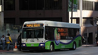
The Charm City Circulator is a privately funded, public transit downtown circulator shuttle service giving riders connection to historic sites, parking, and businesses throughout downtown Baltimore for free. The newest transit system in Maryland was established in 2008, but did not begin inaugural service until January 11, 2010 because of funding issues. The system operates four routes on major streets throughout downtown. The system also connects to the city's water taxi and MTA Maryland.

Regional Transportation Agency of Central Maryland, locally referred to as the RTA, is a transit organization developed to establish a more effective and efficient public transportation system across Central Maryland. The RTA is made up of multiple jurisdictions including Anne Arundel County, Howard County, City of Laurel and Northern Prince George's County. The RTA combined the management and administrative functions of multiple transit operations, reducing operating costs by over 10%, and provided a better customer service experience by improving connections across Central Maryland. The Commission allows all of the participating jurisdictions the ability to oversee transit management operations.
Kevin B. Quinn is the chief executive officer of TransLink. Prior to his current role, he served as CEO and administrator of the Maryland Transit Administration from 2017 to 2021.
Flash BRT is a bus rapid transit network in Montgomery County, Maryland with one operational line and two more under development. When complete, the network will run along U.S. 29 from Silver Spring to Burtonsville, Maryland Route 355 from Bethesda to Clarksburg, and Maryland Route 586 from Wheaton to Rockville.

The College Park–Bethesda Line, designated Route J4, is a rush hour-only MetroExtra bus route operated by the Washington Metropolitan Area Transit Authority between the College Park–University of Maryland station of the Green and Yellow Lines of the Washington Metro and Bethesda station of the Red Line of the Washington Metro. The J4 operates throughout the neighborhoods in Prince George's and Montgomery counties in Maryland. This line currently runs along construction of the upcoming Purple Line between College Park and Bethesda.
The College Park–North Bethesda Line, designated Route C8, is a bus route that operates Monday to Saturday that is operated by the Washington Metropolitan Area Transit Authority, United States, between College Park–University of Maryland station of the Green and Yellow Lines and North Bethesda station of the Red Line of the Washington Metro. The line operates every 30 minutes at all times. Trips are roughly 60 - 80 minutes long.
The Silver Spring–Fairland Line designated Route Z6 or Z8 are daily bus routes operated by the Washington Metropolitan Area Transit Authority between Burtonsville Crossing Park & Ride lot (Z6) and Greencastle Park & Ride Lot (Z8), and Silver Spring station of the Red Line of the Washington Metro. The line operates every 20–30 minutes at all times. Both trips are roughly 60 minutes long.
