Natural Bridge is a geological formation in Rockbridge County, Virginia, comprising a 215-foot-high (66 m) natural arch with a span of 90 feet (27 m). It is situated within a gorge carved from the surrounding mountainous limestone terrain by Cedar Creek, a small tributary of the James River. Consisting of horizontal limestone strata, Natural Bridge is the remains of the roof of a cave or tunnel through which the Cedar Creek once flowed.

First Landing State Park offers recreational opportunities at Cape Henry in the independent city of Virginia Beach, Virginia. As the first planned state park of Virginia, First Landing is listed on the National Register of Historic Places as Seashore State Park Historic District. A portion of the park is listed as a National Natural Landmark as part of the Seashore Natural Area.

This is a list of properties and historic districts in West Virginia that are listed on the National Register of Historic Places. There are listings in every one of West Virginia's 55 counties.

Buildings, sites, districts, and objects in Virginia listed on the National Register of Historic Places:
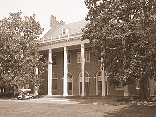
St. Catherine's School is an independent Episcopal diocesan school in Richmond, Virginia, USA. It is the oldest private, all-girls school in Richmond and the only independent all-girls school in Virginia for age 3 - grade 12. St. Catherine's is the sister school to St. Christopher's. The two schools have a Coordinate Program which includes joint events for the lower and middle Schools and shared classes in the upper school. St. Catherine's competes in 15 different sports as a member of the Virginia League of Independent Schools. The school holds a fund raising event on campus each spring called "Daisy Days". The event is open to the Richmond community. The school was listed on the National Register of Historic Places and the Virginia Landmarks Register in 2008.

Sky Meadows State Park is a 1,862-acre (754 ha) park in the Virginia state park system. It is located in extreme northwest Fauquier County, Virginia in the Blue Ridge Mountains, near Paris, Virginia. It is about an hour outside of the Washington, D.C. metro region.

Cedar Creek and Belle Grove National Historical Park became the 388th unit of the United States National Park Service when it was authorized on December 19, 2002. The National Historical Park was created to protect several historically significant locations in the Shenandoah Valley of Northern Virginia, notably the site of the American Civil War Battle of Cedar Creek and the Belle Grove Plantation.

Leesylvania State Park is located in the southeastern part of Prince William County, Virginia. The land was donated in 1978 by philanthropist Daniel K. Ludwig, and the park was dedicated in 1985 and opened full-time in 1992.

Kenmore, also known as Kenmore Plantation, is a plantation house at 1201 Washington Avenue in Fredericksburg, Virginia. Built in the 1770s, it was the home of Fielding and Betty Washington Lewis and is the only surviving structure from the 1,300-acre (530 ha) Kenmore plantation.

The Virginia Landmarks Register (VLR) is a list of historic properties in the Commonwealth of Virginia. The state's official list of important historic sites, it was created in 1966. The Register serves the same purpose as the National Register of Historic Places. The nomination form for any Virginia site listed on the VLR is sent forward to the National Park Service for consideration for listing on the National Register.
The Recreational Demonstration Area program was a National Park Service program during the 1930s and early 1940s that built forty-six public parks in twenty-four states on 397,000 acres (1,606.6 km2), chiefly near urban areas in the United States. The NPS used labor from a variety of Great Depression federal relief programs, chiefly the Civilian Conservation Corps and Works Progress Administration, to build recreational demonstration areas. By the end of World War II, the recreational demonstration areas had all either become National Park Service units or been given to their states for use as state parks.

Town Creek Indian Mound is a prehistoric Native American archaeological site located near present-day Mount Gilead, Montgomery County, North Carolina, in the United States. The site, whose main features are a platform mound with a surrounding village and wooden defensive palisade, was built by the Pee Dee, a South Appalachian Mississippian culture people that developed in the region as early as 980 CE. They thrived in the Pee Dee River region of North and South Carolina during the Pre-Columbian era. The Town Creek site was an important ceremonial site occupied from about 1150—1400 CE. It was abandoned for unknown reasons. It is the only ceremonial mound and village center of the Pee Dee located within North Carolina.

Westmoreland State Park lies within Westmoreland County, Virginia. The park extends about one and a half miles along the Potomac River and covers 1,321 acres. The Horsehead Cliffs provide visitors with a panoramic view of the Potomac River, and lower levels feature fossils and beach access. The park offers hiking, camping, cabins, fishing, boating and swimming, although mechanical issues in 2021 kept the swimming facility closed. Located on the Northern Neck Peninsula, the park is close to historical sites featuring earlier eras: George Washington's birthplace and Stratford Hall, the birthplace of Robert E. Lee.

Sayler's Creek Battlefield, near Farmville, Virginia, was the site of the Battle of Sayler's Creek of the American Civil War. Confederate general Robert E. Lee's army was retreating from the Richmond to the Petersburg line. Here, on April 6, 1865, Union general Philip Sheridan cut off and beat back about a quarter of Lee's depleted army. Eight Confederate generals surrendered, and 7,700 men were lost. Confederate Major General George Washington Custis Lee, eldest son of Robert E. Lee, was forcibly captured on the battlefield by Private David Dunnels White of the 37th Massachusetts Regiment. The battle was the last major engagement of the war in Virginia; Lee's surrender at Appomattox occurred three days later. A portion of the landmarked battlefield area is included in Sailor's Creek Battlefield Historical State Park. The Civil War Trust and its partners have acquired and preserved 885 acres (3.58 km2) of the battlefield in five transactions since 1996.

This is a list of the National Register of Historic Places listings in Chesterfield County, Virginia.

This is a list of the National Register of Historic Places listings in Frederick County, Virginia.

This is a list of the National Register of Historic Places listings in Halifax County, Virginia.
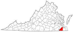
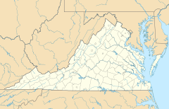
This is a list of the National Register of Historic Places listings in Suffolk, Virginia.

Markham Historic District is a national historic district located at Markham, Fauquier County, Virginia. It encompasses 44 contributing buildings and 4 contributing sites in the rural villages of Farrowsville and Markham. The majority of resources in the district were constructed in the mid- and late 19th century and include multiple dwellings, a hotel, as well as commercial buildings, and a train station. The district also contains early-20th-century dwellings. Notable buildings include Mountain View, Wolfs Crag, Rosebank, Markham School (1918), the 1819 stone Upper Goose Creek Church, and the former Markham Freight Station.