This article lists census-designated places (CDPs) in the U.S. state of Utah . At the 2010 census, there were 81 CDPs in Utah. [1] That number dropped to 79 in 2016 when first Dutch John then Millcreek incorporated, [2] and to 74 when five in Salt Lake County became metro townships.

Yah-ta-hey is a census-designated place (CDP) in McKinley County, New Mexico, United States. As of the 2000 census, the CDP population was 580. The English name for this place is an approximation of a Navajo greeting, though the actual Navajo name means "like a devil", in reference to J.B. Tanner, who operated the trading post located here; the same name is used for Aneth, Utah, where Tanner also worked.

Bountiful is a city in Davis County, Utah, United States. As of the 2010 census, the city population was 42,552, a three percent increase over the 2000 figure of 41,301. The city grew rapidly during the suburb growth of the late 1940s, 1950s, and 1960s and was Davis County's largest city until 1985 when it was surpassed by Layton. Bountiful is Utah's 15th largest city.
Canyon Rim was a census-designated place (CDP) in Salt Lake County, Utah, United States, that was consolidated with neighboring Millcreek CDP in 2010. The consolidated CDP was incorporated in 2016. The population was 10,428 at the 2000 census, a minuscule decrease from the 1990 figure of 10,527. The area formerly in Canyon Rim CDP is located just south of Interstate 80 and the Sugar House neighborhood of Salt Lake City near the mouth of Parley's Canyon.

Cottonwood Heights is a city located in Salt Lake County, Utah, United States, along the east bench of the Salt Lake Valley. It lies south of the cities of Holladay and Murray, east of Midvale, and north of Sandy within the Salt Lake City, Utah Metropolitan Statistical Area. Following a successful incorporation referendum in May 2004, the city was incorporated on January 14, 2005. Cottonwood Heights had been a Census-designated place (CDP) before incorporation. The population as of the 2010 census was 33,433. This is a significant increase over the CDP's 2000 census count of 27,569.
Cottonwood West was a census-designated place (CDP) in Salt Lake County, Utah, United States. The CDP was situated between the cities of Holladay and Murray, which by the mid-2000s had annexed virtually all of the area between them.

East Millcreek was a census-designated place (CDP) in Salt Lake County, Utah, United States, that was consolidated with neighboring Millcreek in 2010. The consolidated CDP was incorporated in 2016. The population was 21,385 at the 2000 census, a minute increase over the 1990 figure of 21,184. It was originally proposed to be included in the corporate limits of the city of Holladay, which was incorporated on November 29, 1999. However, inclusion of East Millcreek was rejected by voters in 2008. East Millcreek was then incorporated with the former Millcreek CDP as the city of Millcreek on December 28, 2016.

Holladay is a city in central Salt Lake County, Utah, United States. It is part of the Salt Lake City, Utah Metropolitan Statistical Area. The population was 26,472 at the 2010 census, a significant increase from 14,561 in 2000. The city was incorporated on November 29, 1999, as Holladay-Cottonwood, and the name was shortened to Holladay on December 14 of that year. It was reported in the 1990 census as the Holladay-Cottonwood CDP.

Millcreek is a city in Salt Lake County, Utah, United States, and is part of the Salt Lake City Metropolitan Statistical Area. The population as of the 2020 Census was 63,380. Prior to its incorporation on December 28, 2016, Millcreek was a census-designated place (CDP) and township.
Mount Olympus or Olympus Cove is a neighborhood in Millcreek, Utah built on the northwestern slopes of Mount Olympus of the Wasatch Range. It was formerly a census-designated place (CDP), but was consolidated into the Millcreek CDP for census purposes in 2010. Millcreek incorporated as a city in 2016. The commercial center of the neighborhood is the relatively flat area south of the crossing of Mill Creek by Interstate 215, which includes the Olympus Hills Shopping Center, Skyline High School, a trailhead for non-motorized access to Mill Creek Canyon, and a Utah Transit Authority park and ride lot. As of the 2000 census, the CDP population was 7,103, a slight decrease from the 1990 figure of 7,413.

South Salt Lake is a city in Salt Lake County, Utah, United States and is part of the Salt Lake City Metropolitan Statistical Area. The population was 23,617 at the 2010 census.

Aneth is a census-designated place (CDP) in San Juan County, Utah, United States. The population was 598 at the 2000 census. The origin of the name Aneth is obscure.

Elberta is a census-designated place (CDP) in Utah County, Utah, United States. It is part of the Provo–Orem Metropolitan Statistical Area. The population was 256 at the 2010 census. It was founded as Mt. Nebo. After the water failed in 1901, most of the early settlers moved away. It was purchased by Matthew B. Whitney, a native of New York, on November 7, 1907, and he renamed it "Elberta" after the peach cultivar.

Spring Lake is a census-designated place (CDP) in southern Utah County, Utah, United States. It is part of the Provo–Orem Metropolitan Statistical Area. The population was 458 at the 2010 census. It is an unincorporated part of Utah County, located just south of Payson and north of Santaquin.

Copperton is a metro township in Salt Lake County, Utah, United States, located at the mouth of Bingham Canyon, approximately 17 miles (27 km) southwest of Salt Lake City. The metro township boundaries include a smaller area than that of both the former CDP and the former township. Much of the town is included in the Copperton Historic District, which is listed on the National Register of Historic Places.

Thatcher is a census-designated place in Box Elder County, Utah, United States. It is a small farming community, located 3 miles (5 km) southwest of Bothwell and 7 miles (11 km) west of Tremonton. The population was 789 at the 2010 census.

Deseret is a census-designated place in Millard County, Utah, United States. The population was 353 at the 2010 census. Deseret is located approximately 10 miles (16 km) southwest of Delta, and about 150 miles (240 km) southwest of Salt Lake City. The name Deseret comes from the Book of Mormon.

Fremont is a census-designated place in northwestern Wayne County, Utah, United States. It lies along State Route 72 just northeast of the town of Loa, the county seat of Wayne County. To the north is Fishlake National Forest. Fremont's elevation is 7,218 feet (2,200 m). The population was 145 at the 2010 census.
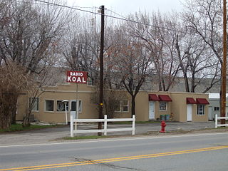
Carbonville is a census-designated place in Carbon County, Utah, United States. The population was 1,567 at the 2010 census.

Marion is a census-designated place in Summit County, Utah, United States. The population was 685, according to the 2010 census.
East Basin is an unincorporated area and census-designated place (CDP) in Summit County, Utah, United States. It was first listed as a CDP prior to the 2020 census.